Why The Chronometer Solved Longitude

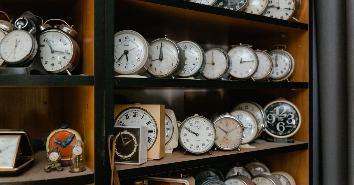
Photo: lil artsy / Pexels
A ship's navigator in 1700 could tell you fairly precisely how far north or south of the equator the vessel sat. Ask the same navigator how far east or west the ship had traveled from home port, and the honest answer was a guess built on dead reckoning, compass headings, and hope. The gap between those two abilities was not a minor inconvenience. It sent ships onto rocks, stranded fleets hundreds of kilometers from where captains believed they stood, and eventually forced the British Parliament to put a price on the problem: a reward that, in 2026 terms, would run into the millions. The instrument that finally closed the gap was not a telescope or a new astronomical table. It was a clock, small enough to hold in two hands, that could keep time at sea as reliably as a church clock kept time on land.
The disaster that turned longitude into a national emergency
The event most often cited as the trigger for Britain's formal push to solve longitude is the Scilly naval disaster of October 1707, when a Royal Navy fleet returning from Gibraltar under Admiral Sir Cloudesley Shovell misjudged its position in poor weather and ran onto the rocks of the Isles of Scilly off the southwest coast of England. Multiple ships were lost, and the death toll is generally cited in the range of roughly 1,400 to 2,000 sailors, making it one of the worst peacetime disasters in Royal Navy history (Royal Museums Greenwich, "Harrison's clocks and the longitude problem"). The fleet's navigators had used the best dead-reckoning methods available at the time, and they were still catastrophically wrong about where they were.
Disasters like Scilly were not isolated. Merchant ships regularly missed islands, overshot destinations by days, or wrecked on coastlines their navigators believed were still far away. The economic cost, in lost cargo, delayed trade, and destroyed ships, compounded the human cost, and by the early 1700s pressure had built for Parliament to act rather than leave the problem to individual captains and private inventors working in isolation.
Parliament responded with the Longitude Act of 1714, which established a Board of Longitude and offered a tiered prize, up to £20,000, for any method that could determine a ship's longitude at sea to within specified margins of accuracy, with the largest reward reserved for the tightest tolerance of half a degree (roughly 30 nautical miles at the equator). Twenty thousand pounds in 1714 was an extraordinary sum, several times what a skilled tradesman might earn across an entire lifetime, and the size of the reward signaled how seriously Parliament, the Royal Navy, and Britain's merchant class took the problem. It was not framed as an academic puzzle. It was framed as an economic and military necessity for a nation whose power depended on reliable ocean-going trade and naval reach.
Why latitude was solvable and longitude was not
Latitude, a ship's position north or south of the equator, could be determined with tools and methods that had existed since antiquity. Sailors measured the angle of the sun above the horizon at local noon, or the height of the North Star above the horizon at night, and compared that angle against known reference tables. Because the stars and the sun's noon position are fixed relative to a given latitude regardless of the date or the ship's speed, this measurement required no knowledge of elapsed time and no comparison to a distant reference point. A sextant, a table, and a clear sky were enough.
Longitude, a ship's position east or west, had no equivalent natural signal. There is no star that sits directly overhead at a specific longitude the way the North Star's altitude reveals latitude. The only way to determine how far east or west a ship had traveled was to compare something happening locally, right now, to the same thing happening at a known reference location at the same instant. That comparison is fundamentally a timekeeping problem, and until the mid-1700s, no clock existed that could make the comparison reliably over a multi-week ocean voyage.
Dead reckoning, the fallback method, estimated position by tracking a ship's speed (measured crudely with a knotted rope and sandglass), heading (from a compass), and elapsed time, then extrapolating a course from the last known position. Errors in speed estimation, undetected ocean currents, and small compass inaccuracies all compounded over a long voyage. A ship might believe itself in one location while sitting, in reality, hundreds of kilometers away, which is precisely the kind of error that ran Shovell's fleet onto the Scilly rocks.
The math behind comparing two clocks
Earth completes one full rotation, 360 degrees, in approximately 24 hours, which means every 15 degrees of longitude corresponds to exactly 1 hour of difference in local time. This relationship is the entire mathematical foundation of time-based longitude determination, and astronomers had understood it more than a century before Harrison began his work. The practical problem was never the math. It was building an instrument precise enough to make the math usable.
Here is how a navigator actually used the relationship. Before departure, the ship's clock was set to the exact local time at a fixed reference point, in Harrison's era typically the Royal Observatory in Greenwich, England. That clock then ran continuously throughout the voyage, without being reset, no matter how many weeks or months passed. At sea, the navigator determined local time independently each day by observing the sun's position, most simply by noting the moment the sun reached its highest point in the sky (local noon). Comparing the ship's local noon to what the reference clock displayed for Greenwich time at that same instant revealed the time difference between the two locations, and that time difference converted directly into a longitude figure using the 15-degrees-per-hour relationship.
| Time difference from reference meridian | Longitude equivalent | Approximate distance at equator |
|---|---|---|
| 1 hour | 15 degrees | ~1,667 km (1,036 mi) |
| 4 minutes | 1 degree | ~111 km (69 mi) |
| 1 minute | 15 arcminutes | ~28 km (17 mi) |
| 4 seconds | 1 arcminute | ~1.85 km (1.15 mi) |
Every 4 minutes of clock error corresponds to roughly 1 degree of longitude error, which is why a clock's drift over a long voyage mattered so much to a navigator's accuracy.
The arithmetic is genuinely simple, something a ship's navigator could work out by hand in minutes. What made it useless for two centuries was the clock. A timepiece that drifted by even a few minutes over a six-week voyage would translate that drift into a positional error of dozens or hundreds of kilometers, which defeated the entire purpose.
Why every existing clock design failed at sea
The most accurate clocks available in the early 1700s used pendulums, a design refined by the Dutch astronomer and physicist Christiaan Huygens in the 1650s. A pendulum clock keeps time by relying on the extremely consistent period of a swinging weight under gravity, and on land, in a stable, temperature-controlled room, pendulum clocks of the period could be remarkably accurate. At sea, that consistency collapsed for several compounding reasons.
A ship rolls, pitches, and yaws constantly, even in moderate weather, and a pendulum's swing depends on gravity acting in a predictable, vertical direction. Every lurch of the hull disturbed the pendulum's motion in ways that accumulated timing errors far beyond what the mechanism could tolerate. Temperature swings between a ship's hold, open deck, and different climate zones on a long voyage caused metal components to expand and contract, altering the effective length of pendulum rods and the tension of springs, which shifted the clock's rate in ways no fixed correction could anticipate. Humidity and salt air caused corrosion and friction in moving parts that land-based clocks, kept indoors, never had to contend with. Lubricating oils of the era also thickened or thinned unpredictably across temperature ranges, adding yet another source of drift.
Astronomers had proposed an alternative that sidestepped the clock problem entirely: the lunar distance method, which used the moon's measured angular position relative to specific stars, compared against pre-calculated astronomical tables, to derive Greenwich time without needing a mechanical clock at all. The method worked in principle, and the Board of Longitude, whose membership leaned heavily toward astronomers, favored it for years. In practice, lunar distance calculations required extensive training, clear skies, cumbersome tables, and roughly four hours of calculation per position fix, making it slow, error-prone in inexperienced hands, and dependent on weather in a way a self-contained mechanical clock was not. The rivalry between the lunar distance camp and the mechanical-clock camp shaped the entire multi-decade politics of the Longitude Act.
Could astronomers have solved longitude without a clock at all?
In theory, yes, and lunar distance tables did eventually see real use alongside chronometers well into the 1800s. In practice, the method was slow, required a trained navigator and clear skies, and never matched the simplicity of reading a chronometer's face and comparing it to a noon sun sight, which is why chronometers displaced it as the primary method once they became affordable and widely manufactured.
Harrison's four decades of mechanical problem-solving
John Harrison was a self-taught carpenter and clockmaker from Lincolnshire with no formal scientific training, which made him an outsider to the astronomer-dominated Board of Longitude from the start. He began working on marine timekeeping in the 1720s and did not stop refining his designs until his death in 1776, a span of roughly five decades devoted to a single engineering problem.
His first machine, H1, was completed and brought to London in 1735. Rather than a conventional pendulum, H1 used two large interconnected balances, essentially counterweighted beams, connected by springs so that the motion of one canceled out disturbances in the other, making the mechanism far less sensitive to a ship's rocking than a hanging pendulum. H1 was tested at sea aboard HMS Centurion in May 1736 on a voyage to Lisbon and back, and it performed well enough, correctly helping identify the ship's position near the Lizard headland on the return leg, that the Board of Longitude's commissioners agreed in 1737 to fund further development, an initial payment of £500 with an additional £250 to build an improved version (Royal Museums Greenwich).
Harrison was not satisfied with H1, believing he could do better, and he set the machine aside to build H2, a heavier and more refined version of the same basic dual-balance approach. H2 never went to sea. Harrison discovered a fundamental design flaw in its balance mechanism during development and abandoned formal trials rather than present a machine he knew was compromised, an early sign of the perfectionism that would repeatedly delay him.
H3, begun around 1740, consumed roughly nineteen years of continuous refinement. It introduced innovations that would prove important even though the machine itself was eventually superseded, including an early bimetallic strip mechanism to compensate for temperature-driven changes in metal dimensions, a problem that had plagued every prior clock at sea. H3 never achieved the accuracy Harrison wanted, and by the early 1750s he had begun to suspect that the entire large-scale, weighted-balance approach he had pursued for three decades was the wrong path.
The H4 breakthrough and the Jamaica trial
Around 1751 to 1752, Harrison began a radically different design that he designated H4. Instead of the large mechanisms of H1 through H3, H4 was built at the scale of an oversized pocket watch, roughly 12 centimeters (about 5 inches) in diameter, and it abandoned counterweighted balances entirely in favor of a balance wheel and hairspring, a small oscillating wheel whose timing is governed by spring tension rather than gravity or momentum. Because a balance wheel's oscillation does not depend on a fixed gravitational reference the way a pendulum does, it was far less disturbed by a ship's rolling motion, and its compact size made it much easier to insulate against temperature swings than the room-sized mechanisms Harrison had spent thirty years perfecting.
H4 went to sea in 1761. Harrison's son William carried the watch aboard the ship Deptford, departing England on November 18, 1761, and arriving in Jamaica on January 19, 1762 (Royal Museums Greenwich). On arrival, H4 was found to be running only about 5.1 seconds slow, an error so small that, calculated across the full length of the voyage, it corresponded to roughly 39.2 seconds of accumulated error over 47 days at sea, a result cited as roughly three times better than the accuracy the Longitude Act's top prize required.
The result should have settled the matter. It did not. The Board of Longitude, whose membership included prominent astronomers invested in the lunar distance method, argued that a single successful voyage could have been a fluke, and it declined to award the full prize outright. The Board demanded further proof, additional sea trials, and eventually insisted that Harrison hand over the mechanism's design so that other clockmakers could demonstrate they could replicate its accuracy, a demand that struck Harrison, who had spent decades perfecting techniques he considered proprietary, as both insulting and financially ruinous.
Why the Board of Longitude resisted paying Harrison
A second trial sent H4 to Barbados aboard the ship Tartar, departing in March 1764, this time under scrutiny from the astronomer Nevil Maskelyne, who was appointed to oversee the test and who was himself a leading advocate of the competing lunar distance method. H4 again performed within the Act's tolerances. Even so, the Board structured its eventual payment in installments tied to conditions Harrison found onerous: an initial £10,000 contingent on Harrison disclosing the watch's inner workings to the Astronomer Royal, with the remaining £10,000 withheld until other makers proved they could build equally accurate duplicates.
Harrison, by then in his seventies, spent years contesting these conditions, building additional watches to prove the design could be replicated, and lobbying anyone in government who would listen. The dispute dragged on for more than a decade after H4's successful trial. It was ultimately resolved not through the Board's formal prize process but through direct intervention by King George III, who in the early 1770s personally tested one of Harrison's watches and pressed Parliament to compensate Harrison outside the Board's original prize structure. Harrison received a substantial monetary award through this route in 1773, three years before his death, though historians examining the full record still debate whether the total sum he ultimately received matched the £20,000 figure originally promised in the 1714 Act, since much of what he was paid came as separate parliamentary grants rather than a single, formally declared prize. The distinction is a genuine research question in horological history, not a settled fact, and it's worth flagging that the round-number "Harrison finally won the £20,000 prize" framing common in popular retellings oversimplifies a payment history that stretched across multiple separate awards.
Why a clock, and not a telescope, solved the problem
It's worth being precise about what Harrison actually invented, because the popular version of the story sometimes overstates it. Harrison did not discover the mathematical relationship between time and longitude; astronomers had understood that a 1-hour time difference equals 15 degrees of longitude for well over a century before Harrison was born. What Harrison invented was an instrument, a self-contained mechanical clock immune enough to a ship's motion, temperature swings, and humidity that it could carry accurate reference time across an ocean without needing clear skies, trained astronomical observers, or hours of tabular calculation.
This distinction matters because it explains why the chronometer displaced lunar distance tables even though both methods were mathematically valid. Lunar distance required a skilled navigator, a clear sky, and roughly four hours of calculation to produce a single position fix. A chronometer required only a glance at its face and a noon sun sight, a process any competent navigator could complete in minutes regardless of cloud cover during the calculation itself (though the noon sight itself still needed the sun visible). As chronometers became more affordable and mass-produced through the late 1700s and early 1800s, largely through the work of makers who followed Harrison, like Thomas Earnshaw and John Arnold, who simplified and standardized production, the chronometer method won out on practicality even in cases where lunar distance remained a useful backup for navigators without a working chronometer aboard.
Why longitude accuracy mattered far beyond naval disasters
Reliable longitude determination reshaped far more than naval safety. It let merchant fleets chart more direct ocean routes with confidence instead of hugging coastlines out of caution, cutting voyage times and insurance losses. It gave naval commanders the confidence to maneuver fleets in open water and rendezvous at precise coordinates rather than relying on prearranged landmarks. It also accelerated the mapping of coastlines, islands, and trade routes across the Pacific and Indian Oceans during the exploration voyages of the late 1700s, including those of Captain James Cook, who carried a chronometer based on Harrison's design (built by Larcum Kendall) on his second voyage and reported it transformed the confidence of his navigational fixes.
The chronometer's reliance on a fixed reference meridian also had a lasting institutional consequence: because so many navigators and chronometer-makers had standardized on Greenwich as their reference point through the 1700s and 1800s, Greenwich became the practical default for international timekeeping. That informal convention was formalized at the International Meridian Conference in Washington, D.C., in 1884, when delegates from more than twenty nations voted to adopt the Greenwich meridian as the prime meridian for global longitude and international timekeeping, which is why longitude is still measured east and west from Greenwich, England, today.
Common misconceptions about the chronometer's solution
A frequent misunderstanding is that the chronometer solved longitude through some clever astronomical insight unique to Harrison. It didn't. The insight, that comparing local time to reference time reveals longitude through simple arithmetic, was old news to astronomers by the time Harrison was a teenager. Harrison's real contribution was purely mechanical: building a clock robust enough to survive the conditions that had defeated every earlier design.
A second misconception treats "chronometer" and "clock" as interchangeable in this story, when the distinguishing feature was specifically ruggedness under motion, temperature change, and humidity, not raw precision in isolation. Plenty of clocks in the 1700s were, on a stationary table in a controlled room, as accurate as Harrison's H4. None of them could survive six weeks belowdecks on a rolling ship without drifting far outside a usable margin. The marine chronometer's achievement was maintaining precision under conditions specifically engineered to defeat every clock that came before it.
A third misconception, understandable given how often the story gets compressed into a single dramatic paragraph, is that Harrison "won the prize" in a single clean moment after the Jamaica trial. The real history involves multiple trials, a Board that shifted its demands repeatedly, a rival scientific faction with genuine institutional power, and a resolution that ultimately bypassed the Board's formal process altogether in favor of direct royal and parliamentary intervention nearly a decade after H4 had already proven itself at sea.
Table: methods attempted to solve the longitude problem
| Method | Core principle | Main weakness | Practical outcome |
|---|---|---|---|
| Dead reckoning | Estimate position from speed, heading, and elapsed time | Errors compound over weeks at sea | Routinely off by dozens to hundreds of kilometers |
| Magnetic variation | Infer longitude from local compass deviation from true north | Variation patterns were inconsistent and poorly mapped | Never reliable enough for general use |
| Lunar distance method | Measure moon's angle to stars, compare to precomputed tables | Required skilled navigator, clear skies, hours of calculation | Used as a backup method into the 1800s, but slow |
| Marine chronometer | Compare local sun-based noon time to reference clock time | Required decades of engineering to build a clock that survived shipboard conditions | Became the dominant method after Harrison's H4 |
Of the four serious approaches attempted, only the marine chronometer combined the necessary accuracy with the speed and simplicity a working ship's navigator actually needed.
The takeaway
The longitude problem was never a mystery of navigational theory. Mariners and astronomers understood the calculation, comparing local time to a fixed reference time, more than a century before anyone solved it in practice. What was missing was an instrument: a clock small enough to carry, accurate enough to trust, and rugged enough to survive months of rolling seas, salt air, and swinging temperatures without drifting into uselessness. John Harrison spent roughly fifty years, across four major redesigns, closing that engineering gap, and the fight over whether he deserved full credit and full payment for it outlasted the technical problem itself by more than a decade.
Read next:
- Why the gyroscope became a navigation tool
- How GPS corrects for relativity
- How the seismograph made earthquakes measurable
FAQ
Q: Who invented the marine chronometer?
John Harrison, a self-taught English carpenter and clockmaker from Lincolnshire, developed the marine chronometer across roughly five decades, from the 1720s until his death in 1776. His fourth design, H4, completed around 1759 and first tested at sea in 1761, proved accurate enough to solve the longitude problem in practice.
Q: Why couldn't pendulum clocks be used to find longitude at sea?
Pendulum clocks depend on a steady, gravity-driven swing, which a ship's rolling and pitching disrupts. Temperature swings and humid, salty air also caused metal components to expand, contract, and corrode in ways land-based clocks never had to withstand, making pendulum designs unreliable for the multi-week voyages longitude calculation required.
Q: How does comparing time actually reveal longitude?
Earth rotates 360 degrees every 24 hours, so each 15 degrees of longitude corresponds to a 1-hour difference in local time. A navigator compares local noon, measured from the sun's position, against the time a reference clock (set to a fixed location like Greenwich before departure) still shows, and that time difference converts directly into a longitude figure.
Q: How accurate was Harrison's H4 chronometer on its sea trial?
On its 1761–62 voyage to Jamaica, H4 accumulated an error of roughly 39.2 seconds over 47 days at sea, about three times better than the accuracy the 1714 Longitude Act required for its top prize tier (Royal Museums Greenwich).
Q: Did John Harrison receive the full £20,000 longitude prize?
He received substantial payments, including a parliamentary grant tied to direct intervention from King George III around 1773, but the Board of Longitude, whose members favored a competing lunar distance method, delayed and attached conditions to payment for more than a decade after H4's successful trials. Historians still debate whether the total Harrison ultimately received matches the full amount the 1714 Act originally promised.
Q: What was the lunar distance method, and why didn't it win out?
Lunar distance measured the moon's angular position relative to specific stars and compared it against precomputed astronomical tables to derive Greenwich time without a mechanical clock. It worked, and remained in backup use into the 1800s, but it required a trained navigator, clear skies, and roughly four hours of calculation per position fix, which made it slower and less practical than reading a chronometer's face once chronometers became reliable and affordable.
Follow new articles
Add SciHub101 to your feed reader to see new science and technology stories.
About the Author
SciHub101 is an independent science and technology publication founded and edited by Buğra Sözeri, a software engineer and app developer based in Türkiye. AI tools assist with drafting and research. Source documentation in the existing archive is uneven, and articles are being reviewed and corrected. The Editorial Team byline identifies editorial responsibility; it does not certify specialist or independent human review. Where we compare products, anything built by our own team is labelled as such — see the editorial guidelines and About page for how corrections and disclosures work.
Related Articles

The Mechanical Clock: How Humanity Learned to Slice Time
From the verge escapement of 1275 to atomic clocks accurate to one second in 300 million years — the 750-year story of how timekeeping reshaped civilization.
The Atomic Clock: The Device That Defines Time Itself — SciHub101
Louis Essen's 1955 cesium clock at NPL redefined the second and made GPS possible. Now optical clocks are 1,000 times more precise — and the second will be redefined again by 2030.