The Largest Rivers on Earth

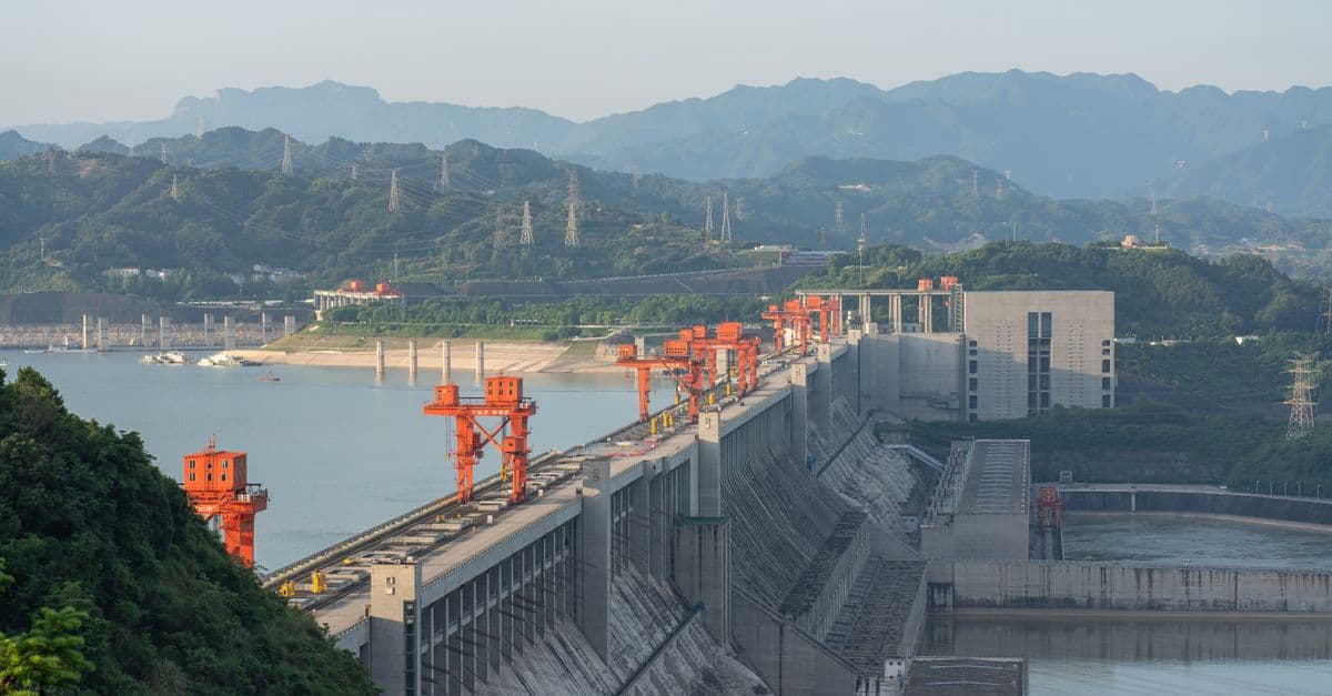
Photo: Jonathan Cooper / Pexels
The Amazon River discharges roughly 209,000 cubic meters of water per second into the Atlantic Ocean — more than the next seven largest rivers combined (USGS; Aguas Amazonicas hydrological monitoring network). That single number settles the "biggest river" question by volume. But length is a separate contest entirely, and the Nile-versus-Amazon debate over which river is longer has never been fully resolved, because the two rivers are measured by different rules. This guide explains why "largest" splits into at least three distinct records, how each is measured, and why river size matters far beyond bragging rights.
Why "largest river" is not one record
Ask a hydrologist which river is the largest and the honest answer is "largest by what?" Rivers get ranked by at least three independent metrics, and a river can dominate one while losing another badly.
Discharge — the volume of water flowing past a fixed point per unit time, usually measured in cubic meters per second (m³/s). This is the metric that best captures a river's raw hydrological power, because it accounts for how much water actually moves, not just how far it travels.
Length — the total distance from a river's most distant headwater to its mouth, typically measured in kilometers. Length sounds simple until you have to define where a river "starts," which turns out to be one of the most contested questions in physical geography.
Drainage basin area — the total land area (in square kilometers) from which a river system collects runoff, rainfall, and tributary flow. A basin is like a funnel: every drop of rain that falls inside its boundary eventually finds its way, directly or indirectly, into the main channel.
The Amazon wins two of the three outright. It has the largest discharge by a wide margin and the largest drainage basin on the planet, covering more than 7 million square kilometers, an area that drains roughly 40% of South America (USGS). Length is where the real argument lives, and it is worth understanding why a question that sounds like simple measurement turns out to be a matter of definition.
How discharge is measured, and why the Amazon wins so decisively
Discharge is calculated by multiplying a river's cross-sectional area (width times average depth at a given point) by its average flow velocity. Hydrologists take these measurements at gauging stations, often using acoustic Doppler current profilers that bounce sound waves off suspended particles in the water to calculate how fast the river is actually moving at different depths.
Think of discharge like the difference between a garden hose and a fire hydrant. Both can push water a long distance, but the fire hydrant moves an enormous volume through a wide opening in a short time. Length tells you how far the water travels; discharge tells you how much power is behind it. The Amazon is the fire hydrant of the planet's freshwater system.
The reason the Amazon dominates discharge so completely comes down to geography, not just size. Its drainage basin sits almost entirely within the wettest region of the tropics, where the Intertropical Convergence Zone delivers heavy, near-constant rainfall across the basin for most of the year. Add snowmelt and glacial runoff from the Andes at the basin's western edge, and the result is a watershed that collects water from an unusually reliable, high-volume combination of tropical rain and mountain runoff.
Downstream near the city of Óbidos in Brazil, where most published discharge estimates are gauged, the river is already so massive that its plume of fresh water is detectable from satellite dozens of kilometers out into the Atlantic Ocean, discoloring the salt water long before the coastline disappears from view. More recent remote-sensing-assisted estimates have pushed the average discharge figure higher, into the 215,000–230,000 m³/s range, reflecting both improved measurement techniques and the difficulty of pinning an exact number on a river whose flow varies seasonally by a factor of two or more between wet and dry months.
Which river has the highest discharge on Earth?
Q: Which river has the highest discharge on Earth? The Amazon River has the highest discharge of any river, averaging roughly 209,000 cubic meters per second and, by some more recent estimates, over 215,000 m³/s (USGS; Aguas Amazonicas). No other river comes close; the Congo, ranked second, discharges about one-fifth as much water.
The Nile-versus-Amazon length debate
This is where "largest river" stops being a settled fact and becomes a genuine scientific dispute. Guinness World Records and most traditional atlases list the Nile as the longest river on Earth, at roughly 6,650 kilometers (4,132 miles), narrowly ahead of the Amazon's traditionally cited length of about 6,400 kilometers (3,977 miles), according to figures compiled by Encyclopaedia Britannica.
The problem is that both numbers depend entirely on where you decide a river "begins," and that decision is not obvious for either system.
The Nile is conventionally traced to Lake Victoria and its feeder streams in Rwanda and Burundi, but different expeditions have identified different specific tributaries and springs as the "true" source over the past 150 years, each shifting the total length calculation by tens of kilometers.
The Amazon's source is even more contested. The traditional measurement starts at the headwaters of the Apurímac River in southern Peru. In 2014, American neuroscientist and explorer James "Rocky" Contos proposed an alternative source at the Mantaro River, also in Peru, farther from the Amazon's mouth. If that source is accepted as the "true" beginning, the Amazon becomes roughly 77 kilometers longer than the traditional figure, which would be enough to push it ahead of the Nile.
This is not a fringe argument. In 2023, an international team of scientists and explorers launched a solar- and pedal-powered expedition specifically to remeasure the Amazon from source to mouth, aiming to produce updated satellite and GPS-based length data and settle the question with modern instrumentation (VOA News; France 24; Phys.org). As of the most recent published reporting, no single measurement has been universally adopted as the definitive answer, and both rivers remain plausible claimants to the "longest river" title depending on which source point you accept.
Why can't scientists just agree on where a river starts?
Q: Why can't scientists just agree on where a river starts? A river's headwaters branch into many smaller tributaries, each fed by even smaller streams, springs, or seasonal snowmelt. There is no universal rule for which branch counts as the "main" source, so different teams choosing different starting tributaries can each defend geographically reasonable but mathematically different total lengths.
The world's largest rivers, side by side
| River | Average discharge (m³/s) | Approximate length (km) | Drainage basin (million km²) | Continent |
|---|---|---|---|---|
| Amazon | ~209,000 (up to ~230,000 in newer estimates) | ~6,400 (traditional) | ~7.0 | South America |
| Congo | ~41,200 | ~4,700 | ~4.0 | Africa |
| Orinoco | ~33,000 | ~2,140 | ~1.0 | South America |
| Ganges–Brahmaputra | ~19,800–38,000 (combined, seasonal) | ~2,900 (Ganges) | ~1.6 (combined) | Asia |
| Yangtze | ~30,000 | ~6,300 | ~1.8 | Asia |
| Mississippi–Missouri | ~16,800 | ~6,275 | ~3.2 | North America |
| Nile | ~2,800–3,100 | ~6,650 (traditional) | ~3.4 | Africa |
By discharge, the Amazon towers over every other river system on the planet. By length, the Nile has held the traditional title, though the ongoing measurement dispute means the Amazon is a live challenger. Figures compiled from USGS reconnaissance data and standard hydrological references; discharge figures vary seasonally and by measurement year, so treat them as representative averages rather than fixed constants.
Notice something the table makes obvious: the Nile, despite its length record, has a strikingly modest discharge, only about 1.5% of the Amazon's flow. That gap exists because most of the Nile's basin crosses the Sahara and the East African drylands, where evaporation, human water extraction for agriculture, and low regional rainfall all cut heavily into the volume that survives the trip downstream. Length and discharge measure genuinely different things, and a river can be a giant on one axis while being modest on the other.
Why drainage basin size matters as much as length or flow
Drainage basin area, sometimes called a watershed or catchment area, describes the entire land surface that funnels water into a river system. It is arguably the most ecologically important of the three metrics, because it determines how much of a continent's biodiversity, climate regulation, and freshwater supply depends on a single river's health.
The Amazon basin is the clearest example of why this matters. Spanning roughly 7 million square kilometers, about 40% of the South American landmass, the Amazon basin also contains the largest tropical rainforest on Earth. The relationship runs in both directions: the rainforest depends on the river system for its extraordinary rainfall recycling, and the river's discharge depends on the forest's role in generating that rainfall. Trees across the basin release water vapor through transpiration, which condenses into rain clouds that fall again farther inland, a self-sustaining cycle sometimes called the basin's "flying rivers." Disrupt the forest cover significantly, and both the rainfall pattern and the river's discharge are put at risk, which is one reason Amazon deforestation is treated as a hydrological problem, not just a biodiversity one.
Basin size also explains why some rivers punch below their length in terms of ecological and economic importance. A long river draining a narrow, arid corridor, the Nile is again the textbook case, supports far fewer people and less biodiversity per kilometer of length than a shorter river draining a wide, wet basin. Nearly all of Egypt's population and agriculture depends on a strip of land within a few kilometers of the Nile's banks precisely because the surrounding basin outside that narrow floodplain is desert.
How much of South America does the Amazon basin cover?
Q: How much of South America does the Amazon basin cover? The Amazon River's drainage basin covers approximately 7 million square kilometers, or roughly 40% of the South American continent, spanning parts of Brazil, Peru, Colombia, Bolivia, Ecuador, Venezuela, Guyana, Suriname, and French Guiana (USGS).
What large rivers reveal about the planet's water cycle
Rivers are the visible bottleneck of a much larger, mostly invisible system: the global water cycle. Roughly speaking, water that evaporates from oceans falls as precipitation over land, and whatever isn't absorbed by soil, plants, or groundwater eventually finds a channel and flows back toward the sea. Rivers are that channel, the drainage system for the entire planet's rainfall.
This is why comparing rivers is not just a geography trivia exercise. A river's discharge is essentially a running measurement of how much fresh water a particular slice of the continent is returning to the ocean at any given moment, which makes major rivers useful indicators for tracking regional climate shifts, drought severity, and long-term rainfall trends. A sustained drop in the Amazon's dry-season discharge, for instance, is one of the signals researchers monitor for evidence of broader shifts in tropical rainfall patterns, alongside satellite rainfall data and soil moisture measurements.
Large rivers also function as the planet's primary long-distance transport system for sediment, nutrients, and dissolved minerals. The Amazon alone carries an enormous sediment load stripped from the Andes, depositing much of it in the river's floodplain and estuary, where it builds and rebuilds land, fertilizes forest soils during seasonal floods, and feeds nutrient-dependent ecosystems far downstream from where the sediment originated. This is comparable to the way glacial rivers reshape terrain, discussed in the context of how the tallest mountains on Earth are worn down over geological time by exactly this kind of water-driven erosion.
How river size shapes the ecosystems built around it
Freshwater ecosystems scale roughly with the volume and stability of the river that sustains them, which is why the Amazon basin also holds the record for freshwater biodiversity. Researchers have documented more than 2,300 fish species in the Amazon basin alone, more than in the entire Atlantic Ocean, a number tied directly to the sheer variety of habitats a river of that scale can support: flooded forest, clearwater tributaries, blackwater tributaries stained by tannins from decaying vegetation, and slow oxbow lakes cut off from the main channel.
Basin-scale rivers also create seasonal flood pulses that many ecosystems depend on rather than merely survive. Along the Amazon's floodplain, water levels can rise ten meters or more between dry and wet season, temporarily submerging tens of thousands of square kilometers of forest in what is known as várzea, flooded forest that fish, dolphins, and other aquatic species move into to feed and breed before the water recedes again. This flood pulse functions like a slow-motion tide, except instead of hours, the cycle plays out over months, and instead of a coastline, it reshapes an entire interior forest.
Smaller river systems can support locally rich ecosystems too, but they lack the scale to sustain the same degree of specialization. A narrow, arid-basin river like the Nile supports a comparatively limited set of freshwater species along its main channel precisely because the surrounding land offers so little additional habitat variety beyond the river itself. Basin size, in other words, is not just a hydrology statistic. It is a rough proxy for how much ecological complexity a river system can carry.
Do bigger rivers always support more biodiversity?
Q: Do bigger rivers always support more biodiversity? Generally yes, but with important exceptions. Basin size and discharge correlate strongly with habitat diversity and species counts, which is why the Amazon leads global freshwater biodiversity rankings. However, factors like water chemistry, isolation, and evolutionary history also matter — some smaller, ancient lake and river systems, such as Africa's Lake Malawi, host extraordinary endemic diversity despite modest size.
How humans measure and monitor the largest rivers today
Modern hydrology no longer relies solely on a technician wading into a river with a measuring rod. Gauging stations along major rivers use acoustic Doppler current profilers, sonar-based instruments anchored to boats or bridges that measure water velocity at multiple depths simultaneously, combined with pressure sensors that track water level continuously. The U.S. Geological Survey and equivalent agencies in other countries maintain networks of these stations on the world's largest rivers, feeding data into long-term hydrological records that researchers use to detect trends.
Satellite remote sensing has added an entirely new layer of measurement over the past two decades. Missions like the Surface Water and Ocean Topography (SWOT) satellite, a joint NASA-CNES mission, measure river surface elevation and width from orbit, allowing scientists to estimate discharge for river stretches that have no ground-based gauge at all, which is especially valuable for tracking remote sections of the Amazon and Congo basins where physical monitoring stations are sparse or difficult to maintain.
This is also why river length figures keep shifting even for well-studied rivers. GPS-based mapping and higher-resolution satellite imagery let researchers retrace a river's actual path with far more precision than the hand-drawn survey maps used a century ago, and those retracements sometimes reveal that a river's true channel is longer or shorter than long-assumed, simply because earlier maps smoothed out meanders or missed a headwater tributary entirely.
Common mistakes people make comparing rivers
People conflate the three river metrics constantly, and it produces genuinely wrong claims that circulate as trivia. A few of the most persistent:
- Assuming "longest" automatically means "biggest." The Nile's length record says nothing about its discharge, which is a small fraction of the Amazon's. "Biggest" needs a metric attached before it means anything.
- Treating length figures as fixed constants. Published river lengths change as measurement techniques improve and as source points are redefined; a figure from a 1990s atlas can be meaningfully out of date.
- Ignoring seasonal variation in discharge. Rivers with strong monsoon-driven flow, like the Ganges-Brahmaputra system, can vary in discharge by a factor of ten or more between dry and wet season, so a single "average discharge" number can mask enormous swings.
- Confusing basin area with river length. A short river can still drain an enormous basin if its tributary network is wide and dense, just as a long, narrow river can drain a comparatively small basin.
The honest takeaway is that "world's largest river" is not a single crown. It is at least three separate competitions, and the most scientifically interesting one, the Nile-versus-Amazon length dispute, is still technically unresolved pending better source-point consensus and updated satellite measurement, much like ongoing efforts to pin down exact figures for the largest deserts on Earth, where boundary definitions create similar measurement disputes.
The takeaway
The Amazon is, without serious argument, the largest river on Earth by discharge and by drainage basin, moving more water than the next several largest rivers combined and draining nearly 40% of an entire continent. The Nile holds the traditional length record, but that title rests on a source-point definition that remains genuinely contested, and an active 2023 remeasurement expedition means the ranking could shift with better data. The real lesson is that "largest" is never a single fact about a river. It is a set of independent measurements, discharge, length, and basin area, each revealing a different dimension of how that river shapes the land and life around it.
Read next:
Follow new articles
Add SciHub101 to your feed reader to see new science and technology stories.
About the Author
SciHub101 is an independent science and technology publication founded and edited by Buğra Sözeri, a software engineer and app developer based in Türkiye. AI tools assist with drafting and research. Source documentation in the existing archive is uneven, and articles are being reviewed and corrected. The Editorial Team byline identifies editorial responsibility; it does not certify specialist or independent human review. Where we compare products, anything built by our own team is labelled as such — see the editorial guidelines and About page for how corrections and disclosures work.
Related Articles


The Longest Rivers in the World: The Nile, the Amazon, and a Measurement Fight
For over a century, the Nile has been called the longest river on Earth at about 6,650 kilometres. But a stubborn group of scientists argues the Amazon is actually longer — and the disagreement isn't sloppiness. It comes down to a genuinely hard question: where does a river begin, and where does it end? The answer changes the ranking, and reveals why even something as basic as 'how long is this river' has no single correct number.

The Largest Structures Ever Built: Towers, Bridges, Dams, and Walls
The Burj Khalifa in Dubai stands 828 meters tall — for context, you could stack almost two Empire State Buildings on top of each other and still not reach its antenna. But height is only one dimension of 'largest.' The world's longest bridge stretches 164.8 km across China. The Great Wall of China, including all branches, runs over 21,000 km. The largest building by floor area is a Boeing factory in Washington State that covers 398,000 square meters under a single roof. What engineering limits the next record depends on which dimension you're measuring and why physics makes every additional meter harder than the last.