Marie Tharp: The Woman Who Mapped the Ocean Floor and Proved Plate Tectonics Was Real
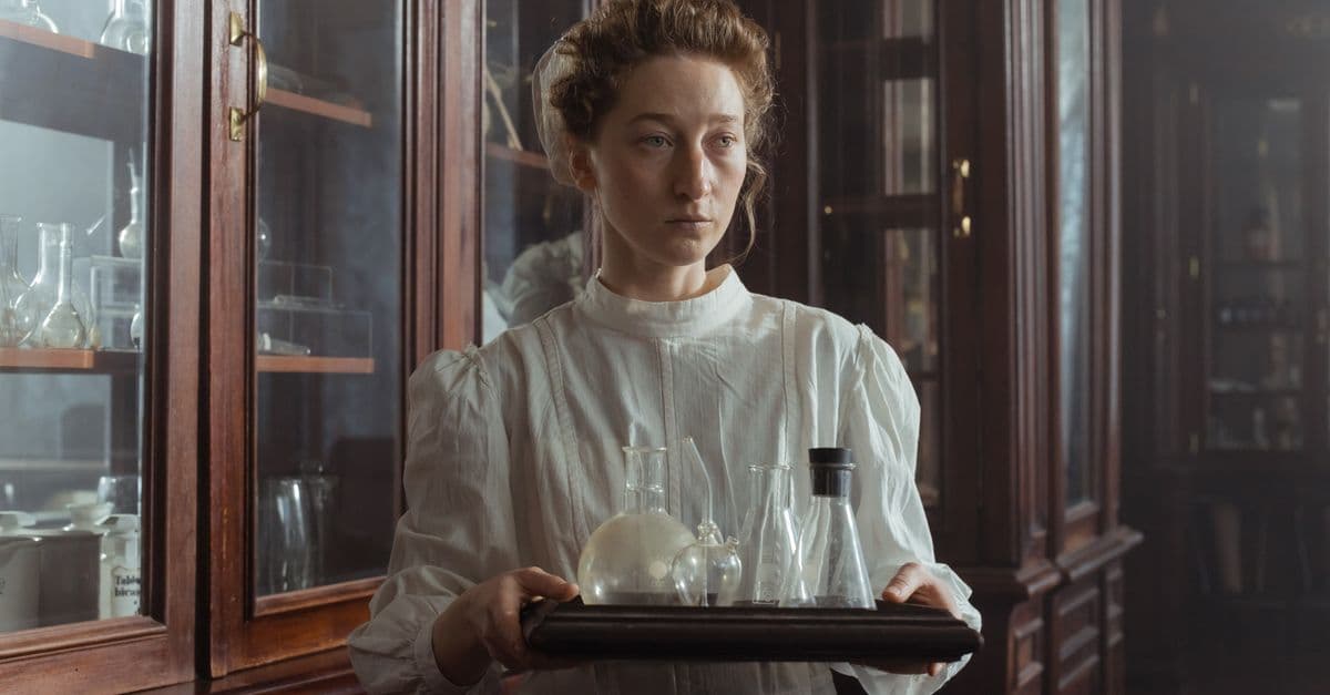
Photo: ThisIsEngineering / Pexels
Marie Tharp (1920–2006) drew the first scientifically accurate maps of the ocean floor at a moment when most of the seafloor was as unknown as the surface of another planet. Working from echo-sounding data collected by male colleagues on research vessels she was not permitted to board, she identified a continuous rift valley running along the center of the Mid-Atlantic Ridge — a canyon-like formation whose existence implied that the seafloor was spreading apart, which in turn implied that the continents were moving. This was, in 1952, heretical. Her colleague and collaborator Bruce Heezen dismissed her interpretation as "girl talk." The evidence accumulated. Within two decades, plate tectonics had become the organizing framework of all earth sciences. Tharp's maps were the evidence that made the theory visible. She spent much of her career credited insufficiently or not at all. Library of Congress named her one of the greatest cartographers of the twentieth century in 1997, forty-five years after the discovery.
Quick Biography
Marie Tharp was born on July 30, 1920, in Ypsilanti, Michigan, the daughter of William Edgar Tharp, a soil surveyor for the U.S. Department of Agriculture. Her father's work took the family to nineteen different towns during her childhood — she attended roughly as many schools. She later described this itinerant education as good preparation for work that required synthesizing information from many incomplete sources. She studied English and music as an undergraduate at Ohio University (1943), then added geology at the University of Michigan during the Second World War, when the university admitted women to the geology program specifically to fill the gap left by men in military service. She graduated with a degree in geology in 1944 and added a master's degree in mathematics from the University of Tulsa in 1948.
She arrived at Columbia University's Lamont Geological Observatory in November 1948, hired by the oceanographer Maurice Ewing to process and plot data. Lamont was one of the few places doing systematic oceanographic research. The research vessel Vema and its predecessors went to sea carrying sonar equipment that measured ocean depth by echo; Tharp stayed in the laboratory on the Palisades, above the Hudson, and turned those measurements into maps.
Her collaboration with Bruce Heezen — who gathered data at sea, she turned it into maps — was professional and eventually personal (they were partners for the last decades of her career) and was also profoundly asymmetric in terms of institutional credit. Their joint work on the ocean floor maps became the basis for Tharp's major discovery, but the published work was often credited primarily or exclusively to Heezen in the scientific literature of the 1950s and early 1960s.
Heezen died of a heart attack in 1977 while aboard a submarine near Iceland, conducting research. Tharp continued working at Lamont until 1983, when she left following a conflict with the institution over the disposition of Heezen's papers and their joint archives. She spent her later years at her home in South Nyack, New York, working on mapping projects. She died on August 23, 2006, at eighty-six.
Personal Life and the Heezen Partnership
The professional relationship between Marie Tharp and Bruce Heezen was one of the most consequential scientific partnerships of the twentieth century, and also one of its least symmetrically credited. They met at Lamont in the early 1950s; he was the oceanographer who went to sea and gathered data, she was the mapper who stayed ashore and turned that data into visual representations of the seafloor. Over time, the relationship became personal as well as professional — they were partners in the fuller sense of the word, though neither spoke about it extensively in public, and the details of their private life were not a subject Tharp foregrounded in her scientific writings.
The partnership lasted until Heezen's death in 1977 aboard a submarine near Iceland — he was conducting research on the mid-ocean ridge system that Tharp had identified from her drawing tables two decades earlier. His death was, by any measure, abrupt and total. He was sixty-two. Tharp continued working at Lamont for six more years after his death, but the institution's handling of Heezen's papers and their shared archives became a source of conflict, and she eventually left in 1983.
What she left with was the archive of their joint scientific work and the maps she had spent three decades making. She continued working on those maps at South Nyack, collaborating with cartographers and institutions that were, in the post-1970s period, far more willing to credit her contribution than Lamont had been during the critical decades of her most important work.
The asymmetry in how the partnership was credited publicly is documented and acknowledged. Heezen was not, by available accounts, deliberately suppressing Tharp's contribution so much as occupying a position — the sea-going scientist who talked to editors and conference audiences — that made his name the one that appeared on papers and press accounts. Tharp drew the maps; Heezen described them in print. The result was that people who heard about the work heard Heezen's name. People who saw the maps — once Tharp's visual style became identified as hers — understood differently.
Major Scientific Contributions
Mapping the Ocean Floor
The seafloor mapping project that Tharp carried out at Lamont through the 1950s, 1960s, and 1970s — in collaboration with Heezen and eventually with the painter and cartographer Heinrich Berann — produced the first comprehensive scientific maps of the ocean floor at a scale and resolution that revealed its major features. The most important of these was the 1977 World Ocean Floor Panorama, drawn by Berann from Tharp and Heezen's scientific data, which gave the public and the scientific community their first accurate visual representation of the entirety of the seafloor. The map showed the continuous mid-ocean ridge system — a globe-spanning mountain range on the seafloor, 65,000 kilometers long — as a single connected feature.
Prior to this work, knowledge of the ocean floor was minimal. Depth soundings existed along some shipping lanes and cable routes, but no systematic survey had established what the overall topography looked like. The introduction of echo-sounding equipment on oceanographic vessels through the 1940s and 1950s generated a new kind of data: continuous depth profiles along tracks the ships traveled. Tharp's role was to take those profiles and construct from them a coherent picture of the three-dimensional relief of the ocean floor.
This required inferring the shape of a surface from tracks of data that were widely spaced, inconsistent in quality, and sometimes contradictory. She developed methods for reconciling and interpolating the profiles, drawing physiographic diagrams (relief maps that showed the three-dimensional shape of the seafloor without numerical contours) that were both scientifically grounded and visually intelligible. The technique was part cartography, part data synthesis, part artistic interpretation, and required a sustained and detailed understanding of underwater geology.
Discovery of the Mid-Atlantic Ridge Rift Valley
In 1952, plotting the echo-sounding profiles from the Atlantic, Tharp noticed a consistent feature in the data from the Mid-Atlantic Ridge: a V-shaped notch running along the center of the ridge, visible in profile after profile when the tracks were brought into alignment. She identified this as a rift valley — a valley formed by the pulling apart of the crust, analogous to the rift valleys of East Africa. If the seafloor was rifting — cracking apart and spreading — then new crust was forming at the center of the Atlantic and the ocean was widening. This was the seafloor spreading hypothesis, and in 1952 it was not the hypothesis; it was regarded as a fringe idea connected to the discredited notion of continental drift.
Heezen's initial response, in a word-for-word account Tharp provided in a 2001 article for Natural History magazine, was to call her conclusion "girl talk." He did not dispute the data; he disputed the interpretation, on the grounds that the seafloor spreading model was not credible. Tharp continued to work through the data and the argument. Her geological reasoning was supported by additional evidence: the locations of earthquake epicenters, when mapped by Columbia seismologist Jack Lamont Oliver and others in the late 1950s, aligned closely with the rift valley she had identified. Heezen came to accept the interpretation. The two eventually published the hypothesis together.
By the early 1960s, the seafloor spreading hypothesis had been connected to a broader plate tectonic framework by Harry Hess, J. Tuzo Wilson, and others. By the mid-1960s, measurements of magnetic striping on the seafloor on either side of the ridges confirmed that new ocean floor was indeed forming at the ridges and spreading outward. The rift valley that Tharp identified in 1952 is the surface expression of this process.
The World Ocean Floor Panorama: A Map That Changed How People Think
The 1977 World Ocean Floor Panorama deserves separate attention from the scientific work that preceded it, because its influence operated through a different channel. The earlier physiographic diagrams — technically rigorous, professionally oriented — were used by geologists and oceanographers. The 1977 panorama, painted by Austrian landscape artist Heinrich Berann from Tharp and Heezen's scientific specifications, was made for everyone else.
Berann was known for his panoramic mountain illustrations. Tharp and Heezen worked with him through the 1960s and 1970s on a series of ocean basin maps before the complete world map; the collaboration combined Tharp's scientific accuracy with Berann's ability to render three-dimensional terrain in a way that non-specialists could read intuitively. The 1977 map showed the entire seafloor — all ocean basins, all mid-ocean ridges, all deep trenches — in a single coherent image that had never existed before.
National Geographic distributed the map as an insert, reaching millions of readers. The map appeared on classroom walls, in textbooks, and in the offices of people who had no professional connection to oceanography but came away with a mental image of the planet's hidden surface that had simply not been available before. Tharp's scientific discoveries were, through Berann's visual language and National Geographic's distribution network, turned into public knowledge. It is one of the more effective examples of scientific visualization in the twentieth century.
Quirks
Banned from Research Ships
Tharp was unable to board Columbia University's research vessels during the early decades of her career because women were considered bad luck on ships — a superstition that had the practical force of institutional policy. This was not specific to Lamont; it was general across American research oceanography through the 1950s and much of the 1960s. The rule was not written law but enforced custom, and it applied to women regardless of their scientific credentials.
The consequence for Tharp's career was structural: she could not gather primary data. All of her observational raw material came through male colleagues who went to sea while she remained ashore. Bruce Heezen collected data on the Atlantic crossing profiles; he was the field scientist, she was the analyst and mapper. This division was not a choice she made; it was the only arrangement available to her.
She wrote about this constraint without theatrical bitterness in her 2001 Natural History article — "I was practically the only one in the building who wasn't going to sea" — but the practical implications were significant. Being absent from the ships meant being absent from the primary data collection, which meant being absent from the published accounts of the voyages, which affected how her contributions were credited in the scientific record.
She was eventually permitted on a research vessel in the 1960s. When she finally went to sea, she described seeing the Mid-Atlantic Ridge from the surface — the chain of volcanic islands that represent the above-water portions of the ridge she had been mapping for years — as an emotional experience.
"Girl Talk"
Tharp described Heezen's initial reaction to her rift valley discovery in a 2001 article in Natural History, the museum magazine, written in her own voice: "I thought I had discovered something important," she wrote, describing the moment she showed Heezen her plotted profiles with the rift valley visible in the data. "Bruce's reaction was to tell me that I was creating something from nothing — what he called 'girl talk.'" The phrase appears in the article, published in the magazine's October 2001 issue, and has been cited by multiple biographers and science historians since.
The phrase is notable because it characterizes the dismissal specifically: not "the data are noisy" or "the interpretation is uncertain" but "girl talk" — a gendered dismissal of the source rather than an engagement with the evidence. Heezen did not contest her data plots; he dismissed the inference on grounds that had nothing to do with the data. He changed his view. The earthquake epicenter alignments that began to emerge in the late 1950s were independently supportive of the rift valley interpretation, and Heezen became a proponent of the seafloor spreading model he had initially dismissed.
Uncredited in the Published Work
The pattern of attribution in the scientific literature from the 1950s and 1960s reflects the institutional arrangement at Lamont: papers on the ocean floor and the Atlantic Ridge were typically published under Heezen's name, sometimes with coauthors from the research cruises, with Tharp's contributions subsumed into the data reduction and mapping work that was not always acknowledged separately. She was in the acknowledgments of many papers; she was not consistently listed as an author.
This was not unique to her situation — women at research institutions in this period were frequently hired as "computers" or data analysts and their contributions to published work were attributed to the supervising male scientist. Rosalind Franklin encountered a version of the same asymmetry in crystallography during the same decade. Tharp's case is somewhat unusual in that her specific interpretive contribution — identifying the rift valley as a rift valley — was the interpretive step that connected the data to the plate tectonics revolution, not just a technical data-processing role.
The institutional recognition came late. The Library of Congress named her one of the four greatest cartographers of the twentieth century in 1997, when she was seventy-seven. Like Vera Rubin, who was dismissed with "that's just a small perturbation" when she first presented evidence for flat galaxy rotation curves, Tharp worked in an era when the institutional structure of science made it possible to do the foundational work and receive insufficient credit for it.
The Music and Art Background That Shaped the Maps
Tharp's undergraduate degree was in English and music, not science. She came to geology through the wartime opening of Michigan's geology program to women, and her visual approach to the data — the physiographic diagrams that made the seafloor legible to non-specialists — reflects a sensibility that was not purely geological. She thought of the seafloor maps partly as illustrations: documents that needed to communicate shape and texture to someone who couldn't calculate the numbers behind them.
This is not a trivial observation. The physiographic diagram technique she and Heezen developed was not standard scientific illustration; it was a choice to represent data in a way that sacrificed some numerical precision for visual comprehensibility. The decision to work with Berann on the 1977 panorama was a further step in the same direction: deploying a landscape painter's skills in the service of scientific communication. The outcome was that Tharp's maps reached audiences that contour plots and depth profiles never would have. Her humanities training was arguably part of what made the science visible.
Famous Quotes
"I had a blank canvas to fill with extraordinary possibilities, a fascinating jigsaw puzzle to piece together: mapping the floor of the oceans." (Marie Tharp, Natural History, October 2001)
"The whole world was spread out before me — or rather, under the ocean. I thought I had found the key to explaining so many things." (From a 2001 Woods Hole Oceanographic Institution interview)
"I was so busy making maps I let Bruce [Heezen] do most of the talking." (Natural History, 2001)
"It's a once-in-a-lifetime — a once-in-the-history-of-the-world — kind of task." (On the ocean floor mapping project, from a 1999 interview published in the Earth Institute archives)
Legacy
The 1977 World Ocean Floor map, drawn by Berann from Tharp and Heezen's scientific specifications, remains one of the most reproduced scientific illustrations in history. It appeared in textbooks, atlases, and science magazines through the late twentieth century and gave the public its first accurate mental image of the seafloor. Millions of people's understanding of what the ocean bottom looks like derives ultimately from Tharp's decades of data synthesis and interpretation.
More significant scientifically is the rift valley identification of 1952 and its role in the plate tectonics revolution. The evidence that the seafloor was rifting — that new crust was forming at mid-ocean ridges and spreading outward — was the physical mechanism that made plate tectonics not just geometrically possible but dynamically real. Wegener had proposed continental drift in 1912 on geometric grounds and been dismissed; the mechanism was missing. Tharp's observation, combined with Hess's 1962 seafloor spreading hypothesis and the magnetic striping measurements of the mid-1960s, supplied the mechanism. The earth sciences were reorganized around it.
Q: How did Marie Tharp discover the Mid-Atlantic Ridge rift valley?
A: By plotting echo-sounding depth profiles from multiple Atlantic crossings onto aligned cross-sections, Tharp noticed a consistent V-shaped notch in the center of the Mid-Atlantic Ridge in 1952. She identified this as a rift valley — a structure formed by the pulling apart of the crust — which implied seafloor spreading and supported continental drift theory. The identification was initially dismissed by colleague Bruce Heezen as "girl talk" but was confirmed by earthquake epicenter data in the late 1950s.
Q: Why was Marie Tharp banned from research ships?
A: Women were excluded from American oceanographic research vessels through the 1950s and much of the 1960s by institutional custom, which held that women were bad luck at sea. This was not written law but enforced policy at Columbia and other institutions. As a result, Tharp worked ashore processing data gathered by male colleagues, which also meant she was absent from the primary publications of the voyages and her contributions were less visible in the scientific record.
Q: Did Marie Tharp get credit for her work?
A: Not consistently during her active career. Papers in the 1950s and early 1960s on the ocean floor topography were primarily published under Bruce Heezen's name; Tharp's contributions were often in the acknowledgments rather than the author list. The Library of Congress recognized her as one of the four greatest cartographers of the twentieth century in 1997, and her foundational role in the plate tectonics revolution was more fully acknowledged in obituaries and historical accounts written after her death in 2006.
Q: What is the significance of the World Ocean Floor map?
A: The 1977 World Ocean Floor Panorama, drawn by Heinrich Berann from Tharp and Heezen's scientific data, was the first accurate comprehensive visual representation of the entire seafloor. It showed the global mid-ocean ridge system, including the rift valleys, as a single connected feature and gave the public and the scientific community a visual framework for understanding plate tectonics. Distributed by National Geographic, it became one of the most widely reproduced scientific maps in history and reached millions of readers who had never engaged with oceanographic data directly.
Q: How did Marie Tharp's work prove plate tectonics?
A: Tharp's identification of a continuous rift valley along the Mid-Atlantic Ridge was the observational evidence that the seafloor was pulling apart — i.e., that new crust was forming at mid-ocean ridges. This seafloor spreading mechanism was what made plate tectonics physically coherent, supplying the dynamic process that had been missing from Wegener's original continental drift hypothesis. Combined with Harry Hess's spreading hypothesis and paleomagnetic stripe measurements, the mid-ocean ridge rift valleys Tharp identified were the key piece of evidence that convinced the geological community.
Q: What was Marie Tharp's relationship with Bruce Heezen?
A: Tharp and Heezen began as professional collaborators at Lamont Geological Observatory in the early 1950s — he gathered sonar data at sea, she mapped it ashore — and their relationship became personal as well over time. They were partners in the fuller sense for the last decades of her career. Heezen died suddenly in 1977 while aboard a submarine near Iceland. After his death, a conflict with Lamont over the disposition of their shared archives eventually led Tharp to leave the institution in 1983. She continued working on the maps independently afterward.
Q: What background did Marie Tharp have before becoming a scientist?
A: Tharp's undergraduate degree was in English and music at Ohio University; she did not study science until the University of Michigan opened its geology program to women during World War II as a wartime measure. She later added a mathematics master's degree from the University of Tulsa. Her humanities training shaped her visual approach to scientific data — the physiographic diagram style she and Heezen developed was partly indebted to an illustrator's sense of how to make complex three-dimensional information legible to a non-specialist audience.
Sources
- Tharp, Marie. "Connect the Dots: Mapping the Seafloor and Discovering the Mid-Ocean Ridge." Natural History magazine (October 2001). (First-person account, primary source for "girl talk" quote.)
- Heezen, Bruce C., Marie Tharp, and Maurice Ewing. "The Floors of the Oceans: I. The North Atlantic." Geological Society of America Special Papers 65 (1959).
- Lawrence, David M. Upheaval from the Abyss: Ocean Floor Mapping and the Earth Science Revolution. Rutgers University Press, 2002.
- Barton, Cheryl. "Marie Tharp, Oceanographic Cartographer, and Her Contributions to the Revolution in the Earth Sciences." Geological Society of London Special Publications 287 (2008): 215–228.
- Felt, Hali. Soundings: The Story of the Remarkable Woman Who Mapped the Ocean Floor. Henry Holt, 2012.
- Sullivan, Walter. "Marie Tharp, Oceanographer." New York Times, August 26, 2006.
Follow new articles
Add SciHub101 to your feed reader to see new science and technology stories.
About the Author
SciHub101 is an independent science and technology publication founded and edited by Buğra Sözeri, a software engineer and app developer based in Türkiye. AI tools assist with drafting and research. Source documentation in the existing archive is uneven, and articles are being reviewed and corrected. The Editorial Team byline identifies editorial responsibility; it does not certify specialist or independent human review. Where we compare products, anything built by our own team is labelled as such — see the editorial guidelines and About page for how corrections and disclosures work.
Related Articles

Robert Boyle: The Father of Chemistry Who Wrote Science Fiction and Refused to Be President
Robert Boyle established Boyle's Law, defined the chemical element, and wrote a remarkable wishlist of future inventions in 1662 that reads like a science fiction catalogue. A verified biography.
Donna Strickland: Third Woman to Win Physics Nobel, Still an Associate Professor When She Won
Donna Strickland's chirped pulse amplification technique is the laser physics behind LASIK eye surgery. Wikipedia rejected her as 'not notable' five months before her 2018 Nobel Prize.

Chien-Shiung Wu: The Physicist Who Proved the Universe Is Not Left-Right Symmetric
Chien-Shiung Wu proved parity violation in 1956, overturning a 30-year assumption in physics. Lee and Yang got the Nobel. She didn't. She worked on the Manhattan Project and always wore a qipao.
Emmy Noether: The Mathematician Who Unified Symmetry and Physics
Emmy Noether proved that every symmetry in nature corresponds to a conservation law. Einstein called her the most significant creative mathematical genius ever produced.
Vera Rubin: The Astronomer Who Found the Dark Matter Hiding in Plain Sight
Vera Rubin confirmed dark matter by measuring galaxy rotation curves that defied Newtonian gravity. Turned away from Princeton. Made her own restroom sign at Palomar. Never got the Nobel.
Lise Meitner: The Physicist Who Explained Fission and Refused the Bomb
Lise Meitner co-explained nuclear fission while her collaborator got the Nobel. She fled Nazi Germany with 10 marks and refused to work on the Manhattan Project. Her biography.