How GPS Works — Satellites, Signals, and Relativity
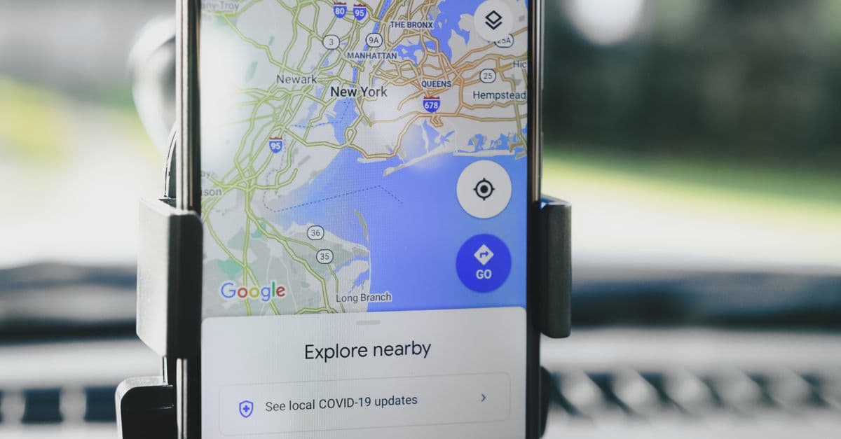
Photo: AS Photography / Pexels
When you tap "Navigate," your phone does something that sounds impossible on paper. It listens to faint radio signals from satellites roughly 20,200 kilometers overhead, measures how long each one took to arrive, and converts those delays into a position good to a few meters. The Global Positioning System (GPS) manages this with no transmission from your phone at all. It works only because the satellites carry atomic clocks, because the ground keeps those clocks honest, and because engineers corrected for Einstein's relativity before launch.
What GPS is made of: three segments, one job
GPS is operated by the United States and is usually described as three cooperating parts. The space segment is the constellation of satellites. The control segment is a network of ground stations that tracks the satellites and uploads fresh data to them. The user segment is every receiver, from a phone to a surveyor's antenna to the timing box in a cellular tower. GPS.gov describes the satellites as transmitting one-way signals that carry the satellite's current position and the current time.
That one-way design matters. Your receiver never talks back, so the system can serve an unlimited number of users at once. It also means GPS cannot, by itself, tell anyone where you are. If an app shares your location, the app is doing the sharing, not the satellites.
The word "GPS" also gets used loosely for any satellite navigation. Strictly, GPS is the American system. The general term is GNSS (Global Navigation Satellite System), which covers GPS, Russia's GLONASS, Europe's Galileo, and China's BeiDou. Most modern phones read several of these at once, a point we return to below.
The constellation: how many satellites, and where
According to GPS.gov's space segment page, the United States commits to keeping at least 24 satellites operational 95 percent of the time. In practice it has flown more: 31 operational satellites, excluding decommissioned spares still in orbit, as of July 3, 2023. The satellites sit in medium Earth orbit (MEO) at about 20,200 kilometers (12,550 miles) altitude.
The baseline design uses six equally spaced orbital planes with four slots in each, for 24 slots. Since June 2011 the "Expandable 24" arrangement has effectively operated as a 27-slot constellation, which spreads the extra satellites to improve coverage in awkward places. Each satellite circles Earth about twice a day, which gives an orbital period of roughly 12 hours.
You can check that period yourself. Orbital speed at radius r from Earth's center is the square root of (GM / r), where GM is Earth's gravitational parameter, about 3.986 × 10¹⁴ m³/s². With Earth's radius of about 6,371 km plus 20,200 km of altitude, r is about 26,570 km, and the speed works out to roughly 3.87 kilometers per second. One lap is then about 43,000 seconds, or just under 12 hours. That is half a sidereal day (the time Earth takes to rotate once relative to the stars), so each satellite retraces nearly the same ground track every day. Engineers chose that on purpose, because it makes the geometry predictable.
A constellation built in generations
The satellites are not identical. GPS.gov lists several generations still in service:
| Block | Launch window | Status per GPS.gov | Notes |
|---|---|---|---|
| IIA | Earlier generation | None operational; last decommissioned in 2019 | Retired |
| IIR | 1997 to 2004 | 6 operational | Onboard clock monitoring |
| IIR-M | 2005 to 2009 | Count not listed | Modernized signals |
| IIF | 2010 to 2016 | 12 operational | Advanced atomic clocks; 12-year design life |
| GPS III / IIIF | First launch 2018 | 6 operational | 15-year design life |
Source: GPS.gov, Space Segment. The page's per-block counts do not add up to the 31 total, and it does not give the IIR-M count, so treat the table as a snapshot of generations rather than an exact inventory.
The takeaway is that GPS is a rolling replacement program. Old satellites age out, newer ones add better signals, and receivers must stay compatible with all of them.
Trilateration: turning delays into a position
A common misconception is that GPS uses triangulation, which measures angles. GPS uses trilateration, which measures distances. Think of the old way of estimating how far away a storm is: count the seconds between lightning and thunder, then multiply by the speed of sound. GPS does the same thing with radio waves, which travel at the speed of light, about 299,792 kilometers per second.
Each satellite broadcasts its own position and the time of transmission. Your receiver notes when the signal arrived. The travel time multiplied by the speed of light gives a distance:
Distance = speed of light × travel time
For a satellite directly overhead, that travel time is about 0.067 seconds (20,200 km divided by 299,792 km/s). For one near the horizon, it is longer, because the slant path is longer.
What one, two, and three distances give you
A single distance places you somewhere on a sphere centered on that satellite. Two spheres intersect in a circle. Three spheres intersect in two points, and one of those is usually absurd, such as a spot far out in space or deep underground, so the receiver discards it. In principle, three satellites fix a position in three dimensions.
Why a fourth satellite is needed
In practice a receiver needs four. The reason is the receiver's clock. Satellites carry atomic clocks that cost a fortune. Your phone has a cheap quartz oscillator that may be off by milliseconds, and that matters enormously, because light covers about 300 kilometers in a millisecond.
So the receiver treats its own clock error as a fourth unknown, alongside latitude, longitude, and altitude. Four satellites give four equations, which can be solved for all four unknowns at once. The measured "distances" before this correction are called pseudoranges, because they include the clock error and are not true ranges.
An analogy helps here. Imagine four friends who each tell you how long ago they started their timers, but your own watch is secretly wrong by an unknown amount. One report cannot reveal the error. Several reports that must all agree on a single moment can. The receiver finds the one clock offset that makes all the spheres meet at a single point, and in doing so it corrects its own clock to something close to atomic accuracy as a free by-product. This is why a GPS receiver is also a precision time source, a role that matters for cellular networks and power grids.
In real conditions receivers track more than four satellites, because extra measurements let the software average out noise and detect a bad one. Satellite geometry matters too. Four satellites bunched together in one patch of sky give poor intersections, much as two nearly parallel lines meet at a badly defined point. GPS.gov lists satellite geometry among the factors that affect user accuracy.
What a GPS signal actually contains
GPS satellites transmit on several frequencies, all derived from a single atomic clock base frequency of 10.23 MHz. Multiplying that base by whole numbers gives the familiar carrier frequencies: 154 times 10.23 MHz is 1,575.42 MHz (called L1), 120 times is 1,227.60 MHz (L2), and 115 times is 1,176.45 MHz (L5). Locking everything to one clock is what lets the system keep its signals coherent.
On top of each carrier rides a spreading code, a long pseudo-random pattern of ones and zeros unique to each satellite. The receiver generates the same pattern and slides it in time until it lines up with the incoming signal. The amount of slide is the travel time. The codes also let all satellites share the same frequency without drowning each other out, since each code looks like noise to every other code. GPS signals arrive weaker than the background radio noise, and this correlation process is how the receiver pulls them out of it.
A slow stream of data is layered on the code as well. This navigation message carries the satellite's orbital parameters (its ephemeris, meaning the table of where it will be), its clock corrections, and a coarse almanac for the rest of the constellation. It moves at only 50 bits per second, which is why a receiver starting from nothing can take minutes to download everything it needs.
Atomic clocks and the arithmetic of nanoseconds
Everything in GPS rests on timekeeping. Because radio waves travel about 30 centimeters per nanosecond, a timing error of one nanosecond is a position error of roughly 30 centimeters.
| Timing error | Distance error (light travel) |
|---|---|
| 1 nanosecond | about 0.3 m |
| 100 nanoseconds | about 30 m |
| 1 microsecond | about 300 m |
| 38 microseconds | about 11 km |
The last row is not an accident. It matches the relativistic drift discussed next. These figures come straight from multiplying time by the speed of light.
Satellites therefore carry atomic clocks, which count the vibrations of atoms (rubidium or cesium in GPS) rather than the swings of a crystal. GPS.gov says Block IIF satellites carry advanced atomic clocks. For the story of how such clocks work in general, see our piece on the atomic clock and the survey of the most precise clocks ever built.
The clocks are not perfect, and no clock stays perfect over long periods. That is why the control segment exists.
Relativity: why GPS needs Einstein
Two relativistic effects act on a satellite clock, and they pull in opposite directions. Together they would ruin the system within minutes if nobody corrected them.
Special relativity: moving clocks run slow
Special relativity says a moving clock ticks slower than a stationary one. GPS satellites move at about 3.87 km/s relative to Earth's center. The fractional slowdown is approximately v² / (2c²), where c is the speed of light. Plugging in the numbers gives about 8.3 × 10⁻¹¹, which over a day of 86,400 seconds adds up to roughly 7 microseconds of lag.
General relativity: clocks in weaker gravity run fast
General relativity says clocks run faster the higher they sit in a gravitational field. A satellite at 20,200 km altitude feels weaker gravity than a clock on the ground. The fractional speed-up is approximately GM / c² × (1 / R − 1 / r), where R is Earth's radius and r is the orbit radius. That comes to about 5.3 × 10⁻¹⁰, or around 45 microseconds per day.
The net effect and the fix
The two numbers combine into a net gain:
| Effect | Direction | Size per day |
|---|---|---|
| Velocity (special relativity) | Satellite clock runs slow | about 7 microseconds |
| Weaker gravity (general relativity) | Satellite clock runs fast | about 45 microseconds |
| Net | Satellite clock runs fast | about 38 microseconds |
Richard Pogge of Ohio State University's astronomy department gives the same figures in his real-world relativity notes: about 7 microseconds lost and 45 gained, for a net gain of 38 microseconds a day. He adds that uncorrected, a navigational fix would go false in about two minutes, and position errors would accumulate at about 10 kilometers per day. More precise treatments, such as the error analysis summarized on the Wikipedia page for GPS error analysis, put the components at about 7.2 and 45.8 microseconds, for a net of 38.6.
The fix is elegant and happens before launch. Rather than correct every signal afterward, engineers tune each satellite clock to tick slightly slow on the ground. The nominal frequency of 10.23 MHz becomes 10.22999999543 MHz, a fractional offset of about 4.5 × 10⁻¹⁰. Once the satellite is in orbit, relativity speeds it up by exactly that amount, and it ticks at the correct rate as seen from Earth.
A useful comparison is a runner who knows a treadmill will run a touch fast. You set it a touch slow before starting, so the result at the finish line is right. The effect is not subtle to the system. It is a built-in calibration, and it is one of the most direct everyday confirmations that relativity is a working part of engineering. Our deeper pieces on how GPS uses Einstein's relativity and how GPS corrects for relativity go further into the physics, and why time moves slower near gravity covers the gravitational half of the story. For a related ground test with real clocks, see the Hafele-Keating experiment.
Smaller relativistic and geometric corrections
The big offset is not the whole story. Satellite orbits are slightly elliptical, so the velocity and the altitude change through each orbit, which makes the relativistic effect wobble by a small amount that receivers must correct. Earth also rotates while the signal is in flight, so receivers apply a correction for that motion (called the Sagnac effect) when working in an Earth-fixed frame. These are small compared with the 38-microsecond offset, but at nanosecond precision they cannot be ignored.
The control segment: keeping the clocks honest
No satellite clock stays accurate on its own, and orbits drift under the tug of the Moon, the Sun, and Earth's lumpy gravity. The control segment fixes this. GPS.gov's control segment page describes a global network of monitoring sites (the page gives both 16 and 17 for the count, made up of Air Force and National Geospatial-Intelligence Agency sites) and 11 command and control antennas. The monitor stations record the signals, the master control station uses their data to compute each satellite's position, and ground antennas upload navigation data back to the satellites.
The cycle matters for users. The ephemeris and clock corrections your receiver downloads are predictions made by the ground, so their quality depends on how recently they were uploaded. Think of it as a ship's navigator who reports positions from a chart updated every few hours: good, but only as fresh as the last update.
How accurate is GPS, really?
Accuracy is quoted in several different ways, and the differences confuse people. GPS.gov's accuracy page separates three ideas.
- Smartphones reach about 4.9 meters (16 feet) in radius under open sky.
- The signal in space is a different measure: the error in the satellites' own broadcast, before the user's receiver adds its own errors. The government commits to 2.0 meters or better, 95 percent of the time, as a daily global average. On April 20, 2021, the measured average was 0.643 meters.
- Timing is committed to 30 nanoseconds or better relative to UTC(USNO), 95 percent of the time, for a specialized receiver at a fixed location.
Notice the gap between 0.643 meters in the satellite signal and 4.9 meters at your phone. The rest of the error is added on the way down and inside the device.
What degrades a fix
GPS.gov lists the common causes: blockage from buildings, bridges, and trees; indoor or underground use; and reflections off buildings or walls, called multipath, where a signal bounces and arrives late by a longer route. Less common causes include radio interference or jamming, major solar storms, and satellite maintenance. User accuracy also depends on satellite geometry, atmospheric conditions, receiver design and quality, and mapping software errors that can mislead you even when the hardware is working.
| Error source | What happens | Why it matters |
|---|---|---|
| Atmosphere (ionosphere, troposphere) | Signal slows slightly as it passes through charged and wet layers | Adds range error that varies through the day |
| Multipath | Signal reflects before arriving | Common in "urban canyons" between tall buildings |
| Satellite geometry | Satellites bunched in one area of sky | Poor intersection angles magnify other errors |
| Receiver quality | Noise and processing differences | Why survey antennas beat phone chips |
| Blockage | Fewer than four satellites visible | No fix at all, or a poor one |
The ionosphere deserves a comment, because it explains why modern phones read two frequencies. The delay the ionosphere causes depends on frequency. A receiver listening on two bands can compare the delays and calculate and remove most of the effect. That is part of why dual-frequency receivers outperform older single-frequency chips.
The day accuracy improved tenfold
For years the United States deliberately degraded civilian GPS. This policy, Selective Availability, added intentional error so adversaries could not use the full accuracy. Per GPS.gov's modernization page, civil readings could be off by as much as 100 meters. In May 2000, President Bill Clinton directed the Department of Defense to turn it off, and accuracy improved tenfold on the day it was deactivated. In 2007 the government announced that GPS III would be built without the feature. If you ever wonder why older receivers from the 1990s quote worse accuracy, this is the reason.
Pushing past a few meters: augmentation
For aviation, surveying, and precision agriculture, a few meters is not enough. The answer is augmentation, which GPS.gov defines as any system that aids GPS by providing accuracy, integrity, availability, or other improvements. The main families are:
- Satellite-based augmentation systems (SBAS) broadcast corrections and warnings from geostationary satellites. GPS.gov's augmentation page describes WAAS (United States, run by the FAA) and says it interoperates with EGNOS (Europe), MSAS (Japan), and GAGAN (India). They also provide integrity monitoring, meaning a warning when a satellite signal cannot be trusted, which pilots need.
- Differential and real-time kinematic (RTK) methods use a reference station at a known location. The station sees the same errors as nearby receivers and broadcasts the difference. Surveyors can reach centimeter-level results with carrier-phase techniques of this kind. GPS.gov notes that one older ground-based network, NDGPS, was discontinued on June 30, 2020.
- Post-processing networks such as CORS provide data for precise positioning tied to the National Spatial Reference System. NOAA's CORS network archives data from almost 2,000 stations, and GPS.gov says its free OPUS service can post-process a user's data to the centimeter level.
An analogy: two people stand a few hundred meters apart on the same hillside, both reading the same slightly faulty tape measure. Because the fault is common to both, one person who knows exactly where they stand can tell the other precisely how wrong the tape is. That shared-error idea is the whole basis of differential GPS.
GPS and the rest of the world's satellites
GPS is one of several global systems, and it is not always the one doing the work in your pocket.
| System | Operator | Orbit and design | Notes |
|---|---|---|---|
| GPS | United States | MEO at about 20,200 km, six planes, 24 baseline slots | 31 operational as of July 2023, per GPS.gov |
| GLONASS | Russia | About 19,100 km, three planes, 8 satellites per plane (24 total) | Per the GLONASS IAC |
| Galileo | European Union | Global constellation | Status page lists 32 satellites, 28 usable, per the European GNSS Service Centre (as of October 2026) |
| BeiDou | China | Global, mixed orbit types | Third-generation constellation completed June 2020 (per Wikipedia) |
| NavIC, QZSS | India, Japan | Regional systems | Cover South Asia and the Asia-Pacific respectively |
Combining systems helps for a simple reason. More satellites in view means better geometry and a better chance of finding four good signals between tall buildings. A phone that can see satellites from several constellations is less likely to lose its fix in a street canyon. It also gives a receiver more chances to throw out a bad signal.
GLONASS orbits are inclined 64.8 degrees to the equator, according to its operator, a steeper tilt than GPS uses, which changes how satellites are distributed over polar regions. Combining the two can therefore help in northern countries.
How your phone gets a quick fix
A receiver that has not been used for days is in a cold start. It knows neither where it is, nor what time it is, nor which satellites to expect. It must search for signals and then download the navigation message at 50 bits per second, which can take minutes.
Phones avoid that wait with assisted GPS (A-GPS). The phone fetches ephemeris and approximate time and location over the cellular or Wi-Fi network, so it knows which satellites to look for and roughly where to find them. That cuts the search from minutes to seconds. It also helps to know your approximate position, because the receiver then only needs to search a narrow range of timing offsets.
Phones then blend GPS with other sensors, a technique called sensor fusion:
- Wi-Fi and cell positioning match nearby access points and towers against databases of known locations, providing a rough fix indoors.
- Barometers sense air pressure to refine altitude, since pressure falls with height.
- Accelerometers and gyroscopes track motion, allowing dead reckoning (estimating where you are by adding up movement from your last known position). This is what keeps the blue dot moving smoothly when you drive through a tunnel.
For the engineering behind spinning sensors, see why the gyroscope became a navigation tool. For the history of the system itself, our article on the GPS invention tells the origin story.
Common misconceptions
"GPS uses cell towers and the internet." The positioning itself does not. Satellite signals alone are enough. The network only helps a phone start up faster and fill gaps indoors.
"GPS knows where I am." The satellites do not. Your receiver computes its own position from signals it receives. Anything that reveals your position to others is software on the phone sending it.
"The satellites are geostationary." They are not. A geostationary satellite sits about 35,786 km up and hovers over one spot; GPS satellites orbit much lower and move across the sky, which is why your phone needs to track several at once. Satellite orbits are a topic of their own, covered in how satellites orbit Earth and in how GPS satellites know your location.
"GPS works the same everywhere." Open sky gives the best results. Dense cities, forests, canyons, and buildings degrade it, and jamming or interference can knock it out locally.
"Relativity is a tiny correction nobody needs." Left uncorrected, the clock drift alone would push position errors toward 10 kilometers per day. It is one of the largest single terms in the system's error budget, and the one engineers handle before launch.
The takeaway
GPS is not a map or a tracker. It is a clock-distribution system that happens to produce positions. Every fix is a solution to four unknowns drawn from four or more delayed signals, and every delay is only meaningful because the satellite clocks are tuned to tick at a deliberately wrong rate on the ground so that relativity makes them right in orbit. The next time a blue dot slides along a street, it is the result of nanosecond arithmetic, a ground network that keeps updating the predictions, and physics that Einstein worked out decades before anyone could build the system. If you want a companion on a related timing idea in the sky, look at how pulsars keep such accurate time.
Frequently Asked Questions
Q: Why does GPS need 4 satellites instead of 3? A: Three distances would fix a position only if the receiver's clock were perfect. Phones use inexpensive quartz oscillators that drift, and a millisecond of error equals about 300 kilometers of range. The fourth satellite gives a fourth equation, so the receiver can solve for x, y, z, and its own clock error at the same time.
Q: How accurate is GPS on a smartphone? A: GPS.gov reports about 4.9 meters (16 feet) in radius under open sky for smartphones. Buildings, trees, reflections, and indoor use make it worse. Survey-grade equipment using differential methods can do much better, and the signal in space itself measured 0.643 meters on April 20, 2021.
Q: Does GPS work underground or underwater? A: Not reliably. The signals are weak radio waves that do not pass well through rock, soil, or water, and GPS.gov lists indoor and underground use among the causes of degraded accuracy. Phones fall back on Wi-Fi, cell signals, and motion sensors, and submarines use other navigation methods.
Q: How big is the relativity correction? A: Satellite clocks lose about 7 microseconds a day from their speed and gain about 45 from weaker gravity, for a net gain of about 38 microseconds a day. Uncorrected, that would add roughly 10 kilometers of position error per day. Engineers offset it by setting the clocks' frequency to 10.22999999543 MHz before launch.
Q: Can GPS track me without my phone sending data? A: The satellites only transmit, and a GPS receiver only listens, so GPS itself does not reveal your location. Apps, cell networks, and devices that send your computed position to a server can. Turning off location services stops apps from reading the fix, but does not change how the satellites behave.
Q: What was Selective Availability? A: It was an intentional degradation of civilian GPS accuracy, with errors of up to about 100 meters. President Bill Clinton directed it be turned off in May 2000, and accuracy improved tenfold on the day it was deactivated. GPS III satellites are being built without the feature.
Q: Is GPS the same as GNSS? A: No. GPS is the American system. GNSS is the general term covering GPS, GLONASS (Russia), Galileo (European Union), and BeiDou (China), plus regional systems. Modern phones commonly use several at once to improve availability.
Sources
- GPS.gov, "Space Segment": https://www.gps.gov/space-segment
- GPS.gov, "GPS Accuracy": https://www.gps.gov/gps-accuracy
- GPS.gov, "GPS Modernization" (Selective Availability): https://www.gps.gov/gps-modernization
- GPS.gov, "Control Segment": https://www.gps.gov/control-segment
- GPS.gov, "GPS Augmentation Systems": https://www.gps.gov/augmentation-systems
- Pogge, R. W., "Real-World Relativity: The GPS Navigation System," Ohio State University: http://www.astronomy.ohio-state.edu/~pogge/Ast162/Unit5/gps.html
- Glonass IAC, "GLONASS": https://www.glonass-iac.ru/en/GLONASS/
- European GNSS Service Centre, "Constellation Information": https://www.gsc-europa.eu/system-service-status/constellation-information
- Wikipedia, "Error analysis for the Global Positioning System" (relativity section figures): https://en.wikipedia.org/wiki/Error_analysis_for_the_Global_Positioning_System
Read next:
Follow new articles
Add SciHub101 to your feed reader to see new science and technology stories.
About the Author
SciHub101 is an independent science and technology publication founded and edited by Buğra Sözeri, a software engineer and app developer based in Türkiye. AI tools assist with drafting and research. Source documentation in the existing archive is uneven, and articles are being reviewed and corrected. The Editorial Team byline identifies editorial responsibility; it does not certify specialist or independent human review. Where we compare products, anything built by our own team is labelled as such — see the editorial guidelines and About page for how corrections and disclosures work.
Related Articles

Countries with the Most Internet Users (2026 Ranked)
China has 1.09 billion internet users — the largest national online population on Earth. India is close behind at 920 million, with the fastest growth. The US (315M), Indonesia (220M), and Brazil (190M) round out the top 5. By 2026, 5.5 billion people — 67% of humanity — are online. Here's the full ranking and what it means.
How Encryption Works — Keeping Data Secret
How encryption works: AES and RSA, key exchange, the TLS 1.3 handshake, digital signatures, end-to-end messaging and NIST's 2024 post-quantum standards.

The Invention of GPS — SciHub101
How Bradford Parkinson, Ivan Getting, and Roger Easton built a satellite navigation system for nuclear bombers that became the infrastructure of everyday life.
How GPS Satellites Know Your Location
GPS uses clocks accurate to a billionth of a second and Einstein's relativity to pinpoint you anywhere on Earth within meters.

GPS Invention: Satellites, Atomic Clocks, and Relativity
GPS was not one person's invention. It came from satellites, atomic clocks, relativity, military navigation, and decades of engineering.

How GPS Uses Einstein's Relativity Every Single Day
Your phone's navigation relies on corrections from both special and general relativity. Without Einstein, GPS would be off by kilometers within hours.