Countries That Border the Most Other Countries (2025)
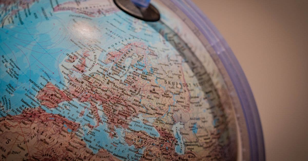
Photo: Nejc Soklič / Pexels
Having many neighbours is both an opportunity and a burden, and few facts about a country predict its foreign policy complexity more reliably than the number of its land borders. A country with one or two neighbours faces a manageable diplomatic portfolio; a country with 14 faces a permanent balancing act across relationships that run the full spectrum from treaty allies to active adversaries. China's 14 borders span relationships with formal partners, active territorial disputes, strategic buffer states, and former Soviet republics whose alignments are in flux. Russia's 14 borders — dramatically altered in perception since February 2022 — include two countries it has invaded in the past 17 years and a NATO frontier that has now expanded by over 1,300 kilometres.
This ranking examines the top 15 countries by number of land borders, maps each country's complete list of neighbours, and analyses what those borders mean for security, trade, and diplomatic influence in the 2020s.
Methodology
Border counts are drawn from CIA World Factbook land boundary data (2024 edition) and cross-referenced with UN Geospatial Division boundary datasets. "Land border" means a formally recognised (or de facto) terrestrial boundary between sovereign states. Disputed borders and territories are noted. Coastlines and maritime boundaries are excluded. The ranking uses the most current internationally recognised border configurations as of 2025, noting significant disputes and de facto situations where they affect the count.
Source: CIA World Factbook, Land Boundaries Field Listing, 2024
Top 15 Countries by Number of Land Borders (2025)
| Rank | Country | Neighbours | Complete List |
|---|---|---|---|
| 1 | China | 14 | Russia, Mongolia, Kazakhstan, Kyrgyzstan, Tajikistan, Afghanistan, Pakistan, India, Nepal, Bhutan, Myanmar, Laos, Vietnam, North Korea |
| 2 | Russia | 14 | Norway, Finland, Estonia, Latvia, Lithuania, Poland (Kaliningrad exclave), Belarus, Ukraine, Georgia, Azerbaijan, Kazakhstan, Mongolia, China, North Korea |
| 3 | Brazil | 10 | Venezuela, Guyana, Suriname, France (French Guiana), Uruguay, Argentina, Bolivia, Peru, Colombia, Paraguay |
| 4 | DR Congo | 9 | Central African Republic, South Sudan, Uganda, Rwanda, Burundi, Tanzania, Zambia, Angola, Republic of Congo |
| 5 | Germany | 9 | Denmark, Netherlands, Belgium, Luxembourg, France, Switzerland, Austria, Czech Republic, Poland |
| 6 | Austria | 8 | Germany, Czech Republic, Slovakia, Hungary, Slovenia, Italy, Switzerland, Liechtenstein |
| 7 | France | 8 | Belgium, Luxembourg, Germany, Switzerland, Italy, Monaco, Spain, Andorra |
| 8 | Serbia | 8 | Hungary, Romania, Bulgaria, North Macedonia, Kosovo, Albania, Montenegro, Bosnia and Herzegovina |
| 9 | Turkey | 8 | Bulgaria, Greece, Georgia, Armenia, Azerbaijan (exclave Nakhchivan), Iran, Iraq, Syria |
| 10 | Tanzania | 8 | Kenya, Uganda, Rwanda, Burundi, DRC, Zambia, Malawi, Mozambique |
| 11 | Zambia | 8 | DRC, Tanzania, Malawi, Mozambique, Zimbabwe, Botswana, Namibia, Angola |
| 12 | Sudan | 7 | Egypt, Libya, Chad, Central African Republic, South Sudan, Ethiopia, Eritrea |
| 13 | Niger | 7 | Algeria, Libya, Chad, Nigeria, Benin, Burkina Faso, Mali |
| 14 | India | 6 | Pakistan, China, Nepal, Bhutan, Bangladesh, Myanmar |
| 15 | Kazakhstan | 5 | Russia, China, Kyrgyzstan, Uzbekistan, Turkmenistan |
Where This Data Comes From
Border counts are sourced from the CIA World Factbook (2024 edition) and cross-referenced against UN Geospatial Division data and bilateral treaty documentation. The figures reflect land boundaries only — maritime/coastal boundaries are excluded. Disputed territories and de facto borders are noted where they affect the ranking; for example, Russia's claimed annexation of Ukrainian territory increases its neighbour count depending on how that claim is recognised. China's 14-neighbour count includes its de facto border with the disputed Hong Kong, which China administers. The ranking methodology treats borders as formally or de facto recognised boundaries between recognised states as of 2025.
The count reveals a critical limitation: it treats all neighbours equally regardless of relationship quality or border stability. China's 14 neighbours include formal allies (Pakistan), active adversaries (India), and strategic buffer states (North Korea) — all weighted the same. Germany's nine neighbours are all EU members or close partners; this is dramatically different from the DRC's nine neighbours, which include zones of active conflict and porous frontiers. The raw number obscures whether a country manages its borders as cooperative or contentious relationships.
Historical Context: How Borders Were Made
The distribution of borders in the world today is not the result of natural geography or cultural grouping — it is overwhelmingly the product of conquest, colonialism, and diplomatic negotiation conducted primarily between the 17th and 20th centuries.
Europe's borders: Centuries of war and settlement. European borders were drawn through the Treaties of Westphalia (1648), the Congress of Vienna (1815), and the Paris Peace Conferences after the First and Second World Wars. Germany's current nine-neighbour configuration is a product of its 1945 defeat and subsequent territorial amputations (Königsberg to the Soviet Union, Silesia and Pomerania to Poland) combined with its 1990 reunification. The fact that all nine of Germany's current neighbours are fellow EU members and NATO allies represents an extraordinary historical transformation from a continent whose borders were drawn in blood as recently as 80 years ago.
Africa's borders: The Berlin Conference legacy. Sub-Saharan Africa's many small and medium-sized states — and the resulting high neighbour counts for countries like the DRC, Tanzania, Zambia, Sudan, and Niger — are largely products of the 1884 to 1885 Berlin Conference, where European colonial powers divided the African continent into spheres of influence with near-total disregard for existing ethnic, linguistic, religious, or geographic boundaries. The result was borders that cut through tribal territories, split ethnic groups between multiple countries, and assigned peoples with no historical connection to the same states. These arbitrarily drawn borders remain the primary source of Africa's cross-border ethnic conflicts, refugee flows, and the phenomenon of rebel groups using the territory of one state to conduct operations against another.
Source: Jeffrey Herbst, "States and Power in Africa," Princeton University Press, 2000
Asia's borders: Imperial collapse and Cold War partition. Many of China's and Russia's neighbours are products of the collapse of two great empires: the Qing Dynasty (which ceded Central Asian territory and lost influence over Korea and Indochina) and the Soviet Union (which dissolved in 1991 into 15 independent states, creating five of Russia's current neighbours and five of China's). The partition of Korea (1945) and the establishment of North Korea as a buffer state gives both China and Russia a shared border with the world's most opaque state.
China's 14 Borders: The World's Most Complex Neighbourhood
China's land boundaries total approximately 22,147 km — the longest total land border of any country in the world, slightly exceeding Russia's approximately 20,241 km.
These 14 borders encompass an extraordinary range of relationships, roughly organised into four categories:
Strategic partners and allies.
Russia (4,209 km border): The Sino-Russian frontier, the world's sixth-longest bilateral border, has transformed from a potential flashpoint (the 1969 Sino-Soviet border conflict involved military clashes with hundreds of casualties) into the foundation of what both governments describe as a "no limits partnership." Russia's dependence on Chinese trade and energy exports following Western sanctions post-2022 has accelerated the relationship's depth. China is now Russia's largest trade partner; Russian energy (oil, gas, coal) increasingly flows east toward Chinese markets rather than west toward Europe.
Pakistan (523 km border): China's "iron brotherhood" relationship with Pakistan involves the $62 billion China-Pakistan Economic Corridor (CPEC), a network of road, rail, and energy infrastructure connecting Gwadar Port on the Arabian Sea to Xinjiang province in western China. The corridor crosses some of the world's most challenging terrain, including the Karakoram Highway through the Karakoram mountain range. CPEC gives China strategic access to the Indian Ocean that bypasses the Strait of Malacca, which Beijing considers a vulnerability.
Disputed and contested borders.
India (3,488 km border): The Line of Actual Control (LAC) — the de facto boundary between China and India — is one of the world's most disputed borders. It was never formally delimited after the 1962 Sino-Indian War, and both countries patrol overlapping claims in multiple sectors. The Galwan Valley confrontation in June 2020 resulted in the deaths of 20 Indian and at least 4 Chinese soldiers in hand-to-hand combat (no firearms were used under an existing local agreement) — the most serious military confrontation between the two countries in over 50 years. Disengagement agreements have been reached at specific friction points, but the underlying territorial disputes remain unresolved.
Bhutan (477 km border): China and Bhutan have no formal diplomatic relations, and their border remains undelimited. China claims portions of Bhutanese territory, including the strategically significant Doklam plateau — which India also disputes. The 2017 Doklam standoff, in which Indian troops physically blocked Chinese road construction in territory claimed by Bhutan, escalated to a 73-day military confrontation before both sides withdrew.
Buffer states and strategic dependencies.
North Korea (1,416 km border): China's border with North Korea is among the most tightly controlled bilateral borders in the world, yet also the primary route for North Korea's informal economy. Approximately 70 to 80% of North Korea's total trade passes through China. The border also sees the flow of North Korean defectors attempting to reach China as a transit point to South Korea or other destinations — a flow China actively suppresses by repatriating defectors. China views North Korea as a strategic buffer: a collapse of the Kim regime would bring a US-allied unified Korea to China's northeastern border, an outcome Beijing consistently works to prevent.
Mongolia (4,677 km border): The Mongolian border connects China's largest neighbour that is neither ally nor adversary. Mongolia pursues a "third neighbour" policy, cultivating relationships with the US, Japan, South Korea, and the EU to balance its geographic dependence on Russia and China. China is Mongolia's dominant trade partner (over 80% of Mongolian exports — primarily copper and coal — go to China), while Russia supplies approximately 90% of Mongolia's fuel. Mongolia's room for genuine strategic independence is extremely limited.
Economic integration partners.
Vietnam (1,297 km), Laos (475 km), and Myanmar (2,129 km) are deeply integrated into Chinese supply chains and infrastructure networks. Vietnam's relationship with China is historically complex — the two countries fought a brief but intense border war in 1979 — but economically intensive. Vietnam has absorbed significant manufacturing investment redirected from China by US-China trade tensions, yet remains dependent on Chinese intermediate goods for its export industries. The China-Laos Railway, completed in December 2021, connects Kunming in Yunnan province to Vientiane in a 1,035 km line that has become the flagship infrastructure project of the Belt and Road Initiative.
Kazakhstan (1,765 km), Kyrgyzstan (1,063 km), and Tajikistan (477 km) are former Soviet republics with deep Russian historical influence but increasing Chinese economic penetration. Chinese investment through the BRI has built roads, ports, and industrial parks; Chinese firms employ local workers; and Chinese goods dominate consumer markets. Whether this economic penetration translates to political alignment remains contested — all three countries maintain membership in the Russia-led Collective Security Treaty Organisation while receiving Chinese investment.
Russia's 14 Borders: Redefined by Conflict
Russia's borders have always been a defining feature of its security concept. Russian strategic culture, shaped by centuries of invasion from multiple directions — the Mongols from the east, Napoleon from the west, Hitler from the west and south — has produced a persistent drive for "strategic depth": buffer territory between the Russian heartland and potential adversaries. This drive has been a recurring source of conflict with Russia's neighbours, most dramatically in the 2022 invasion of Ukraine.
The NATO expansion.
Finland's NATO membership, formalised in April 2023, added approximately 1,340 km to NATO's direct border with Russia — nearly doubling the length of Russia's frontier with NATO member states. Sweden's NATO accession in March 2024 completed the encirclement of the Baltic Sea by NATO members. Russia had explicitly cited preventing Ukraine's NATO membership as a principal justification for the February 2022 invasion; the invasion instead produced exactly what it claimed to prevent, expanding NATO's border with Russia rather than contracting it.
Russia now borders eight NATO members: Norway (196 km), Finland (1,340 km), Estonia (294 km), Latvia (332 km), Lithuania (261 km via the Kaliningrad exclave), Poland (210 km via the Kaliningrad exclave), and — given Russia's claim to control portions of Ukrainian territory — Ukraine's border configuration has become contested.
The Kazakhstan relationship.
The Russia-Kazakhstan border at 7,644 km is the world's longest bilateral land border between any two countries. Kazakhstan's relationship with Russia is among the most strategically significant in Eurasia. Kazakhstan is home to approximately 3.5 million ethnic Russians (roughly 20% of its population), creating an internal political dynamic that Russia has historically used as leverage — the same ethnic Russian presence argument used to justify interventions in Georgia and Ukraine. Kazakhstan's leadership has carefully managed its posture: it has not condemned Russia's Ukraine invasion, maintained the CSTO alliance structure, and continued energy partnerships with Russia, while simultaneously deepening ties with China, the EU, and the US, and emphasising its sovereignty.
Russia's occupied territories.
Russia exercises de facto control over approximately 20% of Georgian territory (South Ossetia and Abkhazia, which Russia recognised as independent states following the 2008 war, a recognition shared by only four other countries) and claimed to annex four Ukrainian oblasts (Donetsk, Luhansk, Zaporizhzhia, and Kherson) in September 2022, though actual Russian control of those territories is incomplete and contested. These territorial claims affect how Russia's borders are described, with the Russian government asserting a border configuration not recognised internationally.
The Belarus dependency.
Belarus (1,312 km border) has become Russia's most dependent ally. Following the disputed 2020 presidential election in Belarus and the mass protests that followed, President Alexander Lukashenko secured Russian support against domestic opposition in exchange for deepening integration. Russia has pre-positioned military forces in Belarus, and Russian forces used Belarusian territory for their February 2022 advance on Kyiv. Belarus's sovereignty relative to Russia has diminished substantially; it functions in many respects as an extension of Russian foreign and military policy.
Brazil: The South American Hub
Brazil's ten-neighbour status gives it an unparalleled geographic centrality in South America. It is the only country in the hemisphere that borders ten separate states; the only two South American countries it does not border are Ecuador and Chile, from which it is separated by Peru and Bolivia respectively.
Brazil's total land border measures approximately 16,145 km — third-longest in the world after China and Russia.
The Amazon border challenge. The vast majority of Brazil's northern and western borders traverse the Amazon Basin — one of the most geographically remote and institutionally challenging frontiers in the world. The border with Peru, Colombia, Venezuela, and Guyana runs through hundreds of kilometres of unmonitored rainforest. This creates significant challenges: it is the primary corridor for cocaine production (particularly from Peru and Bolivia, the world's largest coca-producing countries) moving toward Brazilian and international markets; it is the route for illegal gold mining operations employing tens of thousands of informal miners and generating severe environmental damage; and it is the territory of over a hundred indigenous communities, some uncontacted, whose traditional territories straddle national borders drawn without their knowledge or consent.
The Paraguay-Brazil corridor. The border zone between the Brazilian city of Foz do Iguaçu and the Paraguayan city of Ciudad del Este is one of the world's most active informal trade corridors. Paraguay's lower tax rates on electronics, clothing, and consumer goods have created a decades-long cross-border arbitrage that is largely tolerated by both governments. Formal and informal trade flows in this zone run to billions of dollars annually. The area also has a documented history of money laundering, arms trafficking, and fundraising activities by various criminal and extremist organisations, earning it the designation "Tri-Border Area" in security literature.
Mercosur and regional integration. Brazil has leveraged its central geographic position through Mercosur (Mercado Común del Sur), the customs union founded in 1991 with Argentina, Paraguay, and Uruguay. The Southern Common Market has deepened intraregional trade, though political tensions between member states — particularly between left-wing and right-wing governments of different member countries — have periodically disrupted its functioning. Brazil's aspiration to serve as South America's diplomatic hub, and periodically as its military and economic leader, is a direct function of its geographic centrality.
Germany's 9 Neighbours: History's Most Peaceful Transformation
Germany's nine-neighbour situation deserves special attention precisely because of its historical contrast. Germany has been at war with France (1870, 1914, 1940), Belgium (1914, 1940), Poland (1939), the Netherlands (1940), Luxembourg (1940), Denmark (1940), Czechoslovakia/Czech Republic (1938–1939), and Austria (1938 annexation) — essentially every country on its current border — within the past 130 years.
All nine of Germany's current neighbours are members of the EU. All nine except Switzerland are NATO members or close partners. The Rhine and Oder borders, once among Europe's most contested frontiers, are now among its most open — Schengen Area membership means European citizens cross them without documentation. The transformation is so complete that it is easy to forget that as recently as 1945, most of Europe's borders were demarcated by rubble and barbed wire.
This transformation is not accidental. It is the direct product of two deliberate political projects: NATO (which placed the US security guarantee behind European borders, removing the incentive for intra-European territorial competition) and the European Community/EU (which created economic interdependence deep enough that war between member states became economically unthinkable before it became politically unthinkable).
The geographic dividend. Germany's central position among nine EU member and partner states is a direct economic advantage. Goods manufactured in Germany can reach eight other countries without customs barriers, inspections, or currency exchange costs. The time from a German factory to a Belgian distribution centre is measured in hours, not days or weeks. This geographic centrality is one explanation for Germany's status as the world's third-largest goods exporter — a country of 83 million people competing with the US (335 million) and China (1.4 billion) for global export market share.
Africa's Border-Heavy Countries: The Colonial Inheritance
The Democratic Republic of Congo (nine neighbours), Tanzania (eight), Zambia (eight), Sudan (seven), and Niger (seven) collectively represent some of the world's most complex and contested border environments. Understanding why requires understanding the 1884 to 1885 Berlin Conference.
The Berlin Conference, organised by German Chancellor Otto von Bismarck, convened representatives of 14 European powers (and the United States) to regulate the "Scramble for Africa" and avoid European conflict over colonial claims. Over approximately three months, the delegates drew lines across an African continent that most of them had never visited, dividing territories based on bargaining between European powers rather than any understanding of what lay within those borders.
The result was borders that cut through the middle of ethnic homelands, assigned peoples with centuries of shared history to different colonial jurisdictions, and created states in which the governing colonial power's language (French, English, Portuguese, German) had no relationship to any language spoken by the governed population.
The DRC: Nine borders, nine security challenges. The Democratic Republic of Congo's nine borders encompass the world's 11th-largest country by area and one of its most resource-rich — the DRC holds approximately 70% of the world's cobalt, as well as coltan, gold, timber, and hydroelectric potential. It also encompasses one of the world's most persistent conflicts: fighting in eastern DRC, driven by a complex interplay of local militia, external state actors (particularly Rwanda and Uganda, which have repeatedly backed proxy forces within the DRC), and competition over mineral resources, has killed an estimated 6 million people since 1996 in what is sometimes described as Africa's World War.
The DRC's borders with Rwanda and Uganda are particularly porous and contested. Rwanda's military has been documented crossing the border to support the M23 rebel movement on multiple occasions, most recently in 2022 to 2025, in what UN experts have characterised as a violation of DRC sovereignty. The cross-border mineral trade — particularly in coltan, a tantalum ore essential for smartphones and other electronics — funds armed groups and perpetuates the conflict.
Sudan: The border as conflict generator. Sudan's seven borders reflect the African pattern at its most extreme. Sudan lost its southernmost border when South Sudan became independent in 2011 — itself the product of decades of civil war between the Arab-dominated Khartoum government and the predominantly Christian and animist south. The new border between Sudan and South Sudan is itself disputed, particularly in the oil-rich Abyei region. Sudan's border with Chad has been a zone of conflict and refugee flow, particularly during the Darfur crisis (2003–2010), when an estimated 300,000 people died and 2.7 million were displaced. Sudan's ongoing civil war (2023 to present) between the Sudanese Armed Forces and the Rapid Support Forces has generated one of the world's worst current humanitarian emergencies, with significant cross-border refugee flows into Chad, Egypt, Ethiopia, and South Sudan.
Surprising Findings in the Border Rankings
India has only six neighbours, despite being the world's most populous country. India's 6 bordering nations — Pakistan, China, Nepal, Bhutan, Bangladesh, and Myanmar — reflect its geographic position as a subcontinent largely enclosed by the Himalayas, the Indian Ocean, and the Bay of Bengal. Three of those six border relationships involve active territorial disputes (with Pakistan over Kashmir, with China over multiple sectors of the LAC, and with Bangladesh over small enclaves that were exchanged in 2015). India's strategic situation is unusual: it borders the world's two largest countries (China and the other nuclear-armed South Asian state, Pakistan) and has territorial disputes with both.
Kazakhstan's five neighbours give it extraordinary landlocked strategic significance. Kazakhstan, the world's largest landlocked country by area (approximately the size of Western Europe), borders Russia, China, Kyrgyzstan, Uzbekistan, and Turkmenistan. Its geographic position makes it a critical transit corridor for the Middle Corridor (Trans-Caspian International Transport Route) — the alternative to Russia's railway network for trade between China and Europe that has become strategically important since Russia's 2022 invasion of Ukraine disrupted the Northern Corridor. Kazakhstan's Tengiz oil field, operated in partnership with Chevron, and the Kashagan field in the Caspian Sea make it a significant energy producer; getting that energy to market requires navigating its neighbour relationships carefully.
Serbia has eight neighbours, including Kosovo — a relationship unlike any other. Serbia borders Kosovo, which declared independence from Serbia in 2008 following NATO's 1999 intervention in the Kosovo War. Serbia does not recognise Kosovo's independence; approximately half the world's countries do and half don't. This creates a unique border situation: Serbia has a land boundary with a territory it considers part of its own sovereign territory. The Serbia-Kosovo border is the only European border where the two sides disagree on whether a border exists at all.
The Geography-Trade Relationship
Economic research consistently supports the intuition that shared borders boost trade. The "gravity model" of trade — one of the most empirically robust models in economics — predicts bilateral trade based on the economic size of the two countries and the distance between them, with shared borders adding a significant positive multiplier.
Economists estimate that sharing a land border increases bilateral trade by approximately 50 to 100% compared to the baseline prediction for countries at equivalent distance without a common land border. The mechanism: lower transport costs (no need for maritime shipping or long overland distances), similar time zones that facilitate business communication, often shared linguistic communities near borders that facilitate trade, and the ease of small-scale cross-border commerce that never appears in formal trade statistics.
The EU has amplified this effect dramatically for European countries. Before the creation of the European single market, France-Germany border trade was already substantial; after 1993's single market (eliminating customs barriers, divergent standards, and other non-tariff barriers), it grew substantially further. Germany's ability to serve as Europe's export hub is directly tied to its nine-neighbour, all-EU-partner geographic situation.
For African countries with many neighbours, the potential is present but largely unrealised. The African Continental Free Trade Area (AfCFTA), which came into force in January 2021, aims to create a single market across 54 African countries — eliminating tariffs on 90% of goods and harmonising regulations and investment rules. If successful, it would be the world's largest free trade area by number of countries. The high-neighbour African countries — DRC, Tanzania, Zambia, Sudan, Niger — stand to gain the most from regional trade integration, given their geographic connectivity. Achieving that potential requires addressing the infrastructure deficits, border security challenges, and governance failures that currently make cross-border trade costly and unreliable.
Frequently Asked Questions
Q: Which country has the longest total land border? A: China's total land boundary of approximately 22,147 km is the world's longest. Russia's is approximately 20,241 km, and Brazil's approximately 16,145 km. The world's longest single bilateral land border is the Canada-United States border at 8,891 km (including the Alaska-Canada border).
Q: Can a country be completely surrounded by one other country? A: Yes — these are called enclaves. Lesotho is entirely surrounded by South Africa, and its geographic situation creates significant political and economic dependency — South Africa provides the only land access for Lesotho's exports and imports. Vatican City and San Marino are completely surrounded by Italy. These small states have navigated their geographic constraints in different ways: San Marino has used its status to create a distinctive financial services and tourism economy; Vatican City's global religious significance gives it diplomatic reach entirely disproportionate to its 44 hectares of territory.
Q: Which country has no land borders? A: Island nations have no land borders by definition. Australia, New Zealand, Japan, Iceland, the Philippines, Indonesia, Madagascar, Papua New Guinea, and hundreds of smaller island states have no land boundaries. Among large countries, Australia and New Zealand are the most isolated major economies from their natural trading partners, which is reflected in their trade patterns — both trade primarily with each other and with Asian economies across ocean rather than land.
Q: Do countries with more neighbours have more conflicts? A: The empirical relationship between border count and conflict is complex. Countries with more neighbours have more potential bilateral relationships that can become contentious — more possible sources of territorial disputes, ethnic cross-border communities, and resource competition. But the same borders that can be a source of conflict are also channels of trade and cooperation. Europe demonstrates that high-neighbour situations (Germany has nine) are not inherently conflict-prone. Africa demonstrates that poorly drawn borders can generate persistent instability. The key variables are the quality of border delimitation, the presence or absence of cross-border ethnic disputes, and the strength of regional institutions managing border relationships.
Q: Why don't Brazil and Chile share a border? A: Peru and Bolivia separate Brazil from Chile. Brazil and Ecuador are similarly separated by Peru. South America's geography — the Andes running along the continent's western edge and the Amazon Basin covering most of the north and centre — concentrates the smallest and most mountainous countries on the Pacific coast, which lie between Brazil and Chile. Brazil's coastline faces the Atlantic; Chile's faces the Pacific; and the Andean states (Peru, Bolivia) occupy the mountainous barrier between them.
Q: How does the number of neighbours affect a country's foreign policy? A: Countries with many neighbours have inherently more complex foreign policy portfolios than those with few. China's 14-border situation requires maintaining relationships across the full spectrum: near-alliances (Russia, Pakistan), managed competitions (India), buffer state management (North Korea, Mongolia), and economic integration across Central and Southeast Asia. This complexity is manageable for a large state with significant diplomatic resources but would overwhelm a smaller country. Smaller multi-neighbour states — like Serbia, Austria, and Tanzania — typically seek membership in multilateral frameworks (EU, AU, regional security organisations) that help manage border relationship complexity through institutional structures.
The Takeaway
China and Russia's tied status as the world's most neighbour-rich countries reflects their vast territorial scale and their positions at the junction of multiple geographic and cultural zones — Eurasia's dominant land powers, each pressed up against the civilisational borders of Europe, the Middle East, South Asia, East Asia, and the Arctic simultaneously. Germany's peaceful nine-neighbour configuration is the most consequential transformation a historically dangerous neighbourhood has ever undergone, and it is the strongest evidence that borders do not determine destiny — institutions and political choices do. Brazil's ten-neighbour position makes it South America's geographic keystone, a role its Mercosur membership and continental diplomatic ambitions reflect. Africa's multi-neighbour states carry the heaviest legacy of colonial border-drawing, and their path to realising the trade and development potential of geographic connectivity runs through AfCFTA and the regional institutions being built to make those borders connective rather than merely divisive.
Related Reading
Follow new articles
Add SciHub101 to your feed reader to see new science and technology stories.
About the Author
SciHub101 is an independent science and technology publication founded and edited by Buğra Sözeri, a software engineer and app developer based in Türkiye. AI tools assist with drafting and research. Source documentation in the existing archive is uneven, and articles are being reviewed and corrected. The Editorial Team byline identifies editorial responsibility; it does not certify specialist or independent human review. Where we compare products, anything built by our own team is labelled as such — see the editorial guidelines and About page for how corrections and disclosures work.
Related Articles
Countries With the Most Nuclear Weapons (2025 Rankings)
Nine countries possess nuclear weapons in 2025. Russia leads with approximately 5,580 warheads; the United States has 5,044. Together they hold over 87% of all warheads on earth. China is the fastest-growing nuclear power, having added roughly 100 warheads per year since 2023. And the arms control architecture that managed US-Russian competition for five decades has effectively collapsed.
Countries With the Most Military Bases Abroad (2025)
Foreign basing is one of the clearest expressions of a country's global reach, but no two lists count it the same way. Here is what is documented for the United States, United Kingdom, France, Russia, China, Turkey, and others, and why the totals differ so much.

Countries Investing the Most in AI: 2026 Rankings
The US leads global AI investment by a massive margin, but Saudi Arabia and UAE are now committing percentages of GDP that rival Silicon Valley.

Countries Leading AI Research and Development in 2026
The US and China dominate global AI R&D, but Europe and Asia-Pacific are closing the gap fast.
Top Countries That Export the Most Weapons (2025)
The global arms trade reached approximately $134 billion in 2023 and is growing. This ranking of the top 10 countries that export the most weapons covers market share, key systems exported, and the geopolitical alliances that define the global arms market.
Countries With the Biggest Defence Budgets in the World (2025)
Global defence spending hit a record $2.72 trillion in 2024 and continues to climb in 2025. This ranking covers the top 20 biggest military budgets, their share of GDP, and what each country is actually buying with that money.