Countries With the Longest Coastlines, Ranked and Explained
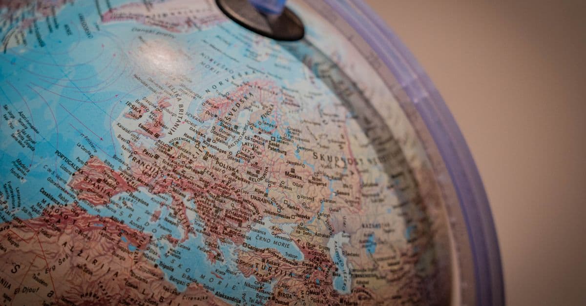
Photo: K / Pexels
Canada has the longest coastline of any country on Earth: about 202,080 km in the CIA World Factbook, and 243,042 km in Statistics Canada's own accounting. Norway is second at 83,281 km, ahead of Russia, a country dozens of times larger. The gap is a fact about shape, not size. Islands, fjords, and bays multiply the shoreline, and the number you get also depends on how closely you measure. This article ranks the leaders, explains why datasets disagree, and shows what coastlines are worth.
Key Takeaways
- Canada's coastline is about 202,080 km in the CIA Factbook series, and 243,042 km in Statistics Canada's figure. Either way it is the world's longest, driven by thousands of Arctic islands.
- Norway ranks second at 83,281 km, but only because the Factbook figure includes its outlying islands. A different dataset lists Norway at 53,199 km.
- Land area barely predicts coastline. Russia has the largest territory and ranks fourth, while Norway, with a tiny fraction of the land, ranks second.
- Coastline is scale-dependent. Measured with 100 km units, Britain's coast is about 2,800 km, and with 50 km units about 3,400 km.
- Coastlines matter because trade, people, and climate risk concentrate there: about 80 percent of international goods trade by volume moves by sea (UNCTAD).
Top 15 countries by coastline length
The table uses the CIA World Factbook series, the most widely quoted source for country-to-country comparisons. It lists sovereign states only. The Factbook also lists the European Union (53,563 km), Greenland (44,087 km, a self-governing territory of Denmark), and Antarctica (17,968 km, disputed), which are left out here. The coast/area ratio is meters of coastline per square kilometer of land, using Factbook land areas.
| Rank | Country | Coastline (km) | Coast/area ratio (m per km²) | Note |
|---|---|---|---|---|
| 1 | Canada | 202,080 | 22.2 | Includes mainland and island coasts |
| 2 | Norway | 83,281 | 274 | Includes outlying islands |
| 3 | Indonesia | 54,716 | 30.2 | Archipelago |
| 4 | Russia | 37,653 | 2.30 | Excludes 850 km on the Caspian Sea |
| 5 | Philippines | 36,289 | 122 | Archipelago |
| 6 | Japan | 29,751 | 81.6 | Archipelago |
| 7 | Australia | 25,760 | 3.35 | Mostly smooth mainland coast |
| 8 | United States | 19,924 | 2.18 | NOAA reports a far larger tidal shoreline |
| 9 | New Zealand | 15,134 | 57.2 | Two main islands plus smaller ones |
| 10 | China | 14,500 | 1.55 | |
| 11 | Greece | 13,676 | 105 | Includes outlying islands |
| 12 | United Kingdom | 12,429 | 51.4 | |
| 13 | India | 11,098 | 2.35 | |
| 14 | Mexico | 9,330 | 4.80 | |
| 15 | Italy | 7,600 | 25.8 |
Source: CIA World Factbook coastline field, as compiled in Wikipedia's "List of countries by length of coastline". The CIA does not state the map scale used for each country, so the figures are not strictly comparable.
Notice how little the ranking follows land area. China and the United States, two of the three largest countries by area, sit at 10th and 8th. Italy, with a boot-shaped peninsula and two big islands, has only 7,600 km. Canada and Norway dominate because their coasts are broken into thousands of pieces.
Why the numbers differ between datasets
A coastline looks like a fixed property of a country, the way a border does. It is not. Two respected datasets can disagree by a factor of two or more, and neither one is wrong. They answer slightly different questions.
The Factbook figure is compiled from national sources, and the methods differ by country. The World Resources Institute (WRI) dataset, by contrast, was built from a single global shoreline layer at a 1:250,000 scale, which means every country was measured the same way. The comparison below shows how much that changes the picture.
| Country | CIA Factbook (km) | WRI global dataset (km) | Ratio of WRI to CIA |
|---|---|---|---|
| Canada | 202,080 | 265,523 | 1.3 |
| United States | 19,924 | 133,312 | 6.7 |
| Russia | 37,653 | 110,310 | 2.9 |
| Indonesia | 54,716 | 95,181 | 1.7 |
| Australia | 25,760 | 66,530 | 2.6 |
| Norway | 83,281 | 53,199 | 0.6 (the reverse; the CIA figure includes outlying islands) |
| China | 14,500 | 30,017 | 2.1 |
| United Kingdom | 12,429 | 19,717 | 1.6 |
| Philippines | 36,289 | 33,900 | 0.9 (close agreement) |
| Japan | 29,751 | 29,020 | 1.0 (close agreement) |
Source: Wikipedia, "List of countries by length of coastline," which reproduces both series. The page notes that WRI excludes disputed areas.
Under the WRI series the top five become Canada (265,523 km), the United States (133,312 km), Russia (110,310 km), Indonesia (95,181 km), and Chile (78,563 km). The United States jumps from eighth to second. That is not a revision of facts about the United States. It is a revision of what counts as the coastline.
The National Oceanic and Atmospheric Administration (NOAA) shows the same effect from inside one country. NOAA's official total for the U.S. shoreline is 153,646 km (95,471 miles), which includes the outer coast, offshore islands, sounds, bays, rivers, and creeks measured inland to the head of tidewater, or to where tidal waters narrow to 30.48 meters (100 feet). NOAA's own page adds that no "legal" shoreline exists, so the length "can vary depending on how the shoreline is defined." The CIA's 19,924 km and NOAA's 153,646 km describe the same country.
The coastline paradox in plain terms
Imagine measuring a jagged coast with a stiff 100 km ruler. You lay it end to end, skip over every bay narrower than the ruler, and cut across every headland. Now switch to a 50 km ruler. It dips into more bays and follows more of the bend, so the total grows. Keep shrinking the ruler and the total keeps growing, because real coastlines have wiggles inside wiggles.
This is the coastline paradox. The English mathematician Lewis Fry Richardson noticed it around 1951, when he saw that Portugal reported its border with Spain as 987 km while Spain reported 1,214 km. Each country had simply used a different ruler. Benoit Mandelbrot made the idea famous in a paper titled "How Long Is the Coast of Britain? Statistical Self-Similarity and Fractional Dimension," published in Science on May 5, 1967. His examples, in rounded terms: Britain measures about 2,800 km with 100 km units and about 3,400 km with 50 km units.
Mandelbrot's key move was to describe coastlines with a fractal dimension, a number between 1 (a perfectly smooth line) and 2 (a line so wiggly it fills a plane). The west coast of Great Britain has a dimension of about 1.25. South Africa's smoother coast is about 1.02. The higher the dimension, the faster measured length grows as the ruler shrinks. That is why a country like Norway, with a rugged, deeply cut shoreline, is far more sensitive to method than one like South Africa. In Mandelbrot's words, coastline length is "an elusive notion that slips between the fingers of those who want to grasp it."
A useful way to read any coastline ranking is to ask three questions:
- What scale was used (1:250,000, 1:50,000, or something finer)?
- Are offshore islands included?
- Does the shoreline follow every bay and river mouth, or cut across them?
If a source does not answer these, treat its number as a rough guide.
Canada: the longest coast by a wide margin
Canada's coastline is the longest in the world under every major dataset. The CIA lists 202,080 km. Statistics Canada, in its yearbook geography chapter, gives a larger figure: 243,042 km, covering the mainland coast and the coasts of offshore islands. The WRI series gives 265,523 km. Three sources, three numbers, one winner.
The reason is the Canadian Arctic Archipelago. According to Wikipedia's count, it holds 94 major islands (over 130 km²) among 36,563 islands in total, spread across roughly 1.4 million km² (a figure The Canadian Encyclopedia also gives). Statistics Canada's table, which credits Natural Resources Canada's Atlas of Canada, lists Baffin Island at 507,451 km², Victoria Island at 217,291 km², and Ellesmere Island at 196,236 km². Baffin is generally ranked the fifth-largest island on Earth, and readers who want the full list can compare it in our guide to the largest islands in the world.
Every one of those islands has its own shoreline, and each shoreline counts toward the total. A map of Canada with the islands removed would have a far shorter coast. A map of Canada drawn at fine scale, with every inlet traced, has far more.
Hudson Bay adds to the total as well. Wikipedia lists the bay at about 1,230,000 km², with a western shore of lowlands, a rocky eastern shore in Quebec, and a northern shore of tundra. Measured by shoreline length, it is the second-largest bay in the world, after the Bay of Bengal. James Bay, its southern arm, extends the coast further inland.
A coast that is mostly empty
Most of Canada's coastline is remote. The shoreline that supports ports, fisheries, and cities is concentrated on the Pacific side around Vancouver, in Atlantic Canada, and along the St. Lawrence River. The Arctic portion, which supplies most of the length, has few residents and is reachable by ship only in the short ice-free season.
That is changing slowly. Warming reduces sea ice, which lengthens the shipping season but also exposes shorelines to waves. The United States Geological Survey (USGS) has documented the effect on the Arctic coast of Alaska, which faces the same sea. Its surveys show the north coast retreating about 1.4 meters per year on average, with some stretches losing up to 20 meters per year. Along one 60 km stretch, average annual erosion roughly doubled between the mid-1950s to late-1970s and 2002 to 2007. USGS researchers link the change to less sea ice, warmer summer sea-surface temperatures, rising sea level, and possibly stronger storms, and say more long-term work is needed to confirm how these factors interact. Canadian Arctic coasts share the same basic physics, although the rates differ from place to place.
Norway: fjords as a coastline multiplier
Norway's 83,281 km is the most striking entry in the table. The country has a land area of roughly 385,000 km², about the size of Japan, and yet its Factbook coast is nearly three times as long as Japan's and more than twice as long as Russia's.
Two things produce this. First, the Factbook figure includes Norway's outlying islands, of which there are a great many. Second, the fjords. Ice-age glaciers carved deep valleys into the Scandinavian mountains, and when the ice retreated and sea level rose, the sea flooded the valleys. The result is a coast cut by long, branching inlets.
The Sognefjord is the standard example. It is the longest and deepest fjord in Norway, extending about 205 km inland to the village of Skjolden, with a maximum depth of 1,308 m and a volume of about 500 km³. Its tributary arms, including the narrow Nærøyfjord (about 300 m across at its narrowest), each add their own shoreline. A fjord is a coastline factory: one entrance, hundreds of kilometers of shore.
Why Norway's rank is soft
The comparison table shows an important caveat. The WRI dataset lists Norway at 53,199 km, far below the Factbook's 83,281 km, and the Wikipedia compilation does not explain the gap. The likely reason is the one given above: the Factbook figure explicitly includes outlying islands, and the other series may treat them differently. Even so, 53,199 km is a very long coast for a country of that size, so the broad point holds. Norway has a coastline wildly out of proportion to its land.
Norway's economy reflects it. Fish farming, offshore oil and gas, and shipping all depend on the sheltered, deep water that fjords provide. The same geography meant that for centuries the sea, not the mountains, was the road between settlements.
Indonesia and the Philippines: coastlines made of islands
Indonesia's 54,716 km (Factbook) is almost certainly an undercount of what a fine-scale survey would show. The WRI series gives 95,181 km. Indonesia's island count has also been revised over time as mapping improves, so any single figure for its shoreline is provisional.
The Philippines presents a different pattern. The Factbook gives 36,289 km and the WRI series gives 33,900 km, close agreement for an archipelago of more than 7,000 islands. The coast/area ratio of 122 m per km² means that for every square kilometer of land, there is more than a hundred meters of shore.
For both countries, the coast is the population center, the food supply, and the transport network. Fish are a major source of protein, ferries connect islands, and the biggest cities sit on the water. Exposure follows. The Philippines lies in a region of frequent typhoons and storm surge, and Indonesia sits on the Pacific Ring of Fire. The December 2004 Indian Ocean earthquake and tsunami devastated Aceh province on Sumatra's northern tip, and the same plate boundaries continue to threaten Indonesian shores. For a ranking of countries by climate and disaster exposure, see our guide to countries most vulnerable to climate change.
Japan, Australia, and the United States: three different shapes
These three countries show how differently a ranking can read depending on what a country's coast looks like.
Japan has a Factbook coastline of 29,751 km, and the WRI figure is 29,020 km. The two sources are within 3 percent, which is unusual. Japan's coast is complex, but its mapping is dense and consistent. The island count tells a similar story of method: Japan's official count of 6,852 islands dated from a 1987 Coast Guard study. A recount using modern mapping, reported in February 2023, was expected to raise that to about 14,125 islands, with the same minimum circumference of 100 meters for both counts. Better maps find more islands without changing the territory.
Australia is the opposite case. The Factbook gives 25,760 km, which is mostly a smooth mainland coast. WRI gives 66,530 km. The gap is large, and the most plausible explanation is that a finer-scale global dataset follows the mainland's many bays and counts offshore islands, though the compilations cited here do not spell out the cause. Australia is a clean example of a country whose rank depends heavily on how the islands are handled. For the related question of ocean territory, see our ranking of the countries with the largest exclusive economic zones.
The United States is the extreme case. The Factbook number, 19,924 km, would put it eighth. WRI's 133,312 km places it second, and NOAA's 153,646 km (95,471 miles) is higher still. The difference between those numbers is the difference between a simplified outline and a survey that follows every tidal river, sound, and bay to the head of tide.
Greece: Europe's most intricate coast
Greece's 13,676 km is long for a country of about 132,000 km², and the Factbook ratio of 105 m per km² is among the highest of any large country. The Factbook figure explicitly includes outlying islands. Greece is commonly described as having roughly 6,000 islands and islets, of which only a small fraction are inhabited. The WRI series gives 15,147 km, a smaller spread than for most countries but the same lesson about method.
The shape of the Aegean, a sea dotted with islands, explains much of Greek history. Ships hopping between visible shores made trade and settlement easier. Today, shipping and coastal tourism remain among the economy's largest sectors. International arrivals and tourist spending follow the coast, a pattern visible in our ranking of countries with the most tourist arrivals.
Russia: huge, but a modest coast for its size
Russia is the largest country by land area, and yet its coastline, 37,653 km in the Factbook, ranks only fourth. The Factbook adds a separate note of 850 km on the Caspian Sea, which is an inland body of water. The ratio is 2.30 m of shore per km² of land, one of the lowest among major coastal countries.
Two reasons stand out. Most of Russia's land is far inland, so its area says little about its edge. And measurement matters: the WRI series, built at a uniform 1:250,000 scale, lists Russia at 110,310 km, third overall, so a good part of the apparent shortfall comes from the Factbook's method rather than from geography alone.
The distribution of the coast matters more than its length. Russia's long Arctic shoreline freezes for much of the year. Murmansk, the largest city north of the Arctic Circle, keeps an ice-free port on the Barents Sea, but the country's historic search for year-round ports on warm water shaped its history for centuries.
The Northern Sea Route question
Warming has made the Arctic coast newly interesting. A 2010 study by Miaojia Liu and Jacob Kronbak in the Journal of Transport Geography estimated that the Northern Sea Route could save about 40 percent of the sailing distance between Yokohama and Rotterdam compared with the Suez Canal route. The same paper warned that "a 40% reduction in distance using the NSR does not mean a corresponding 40% in cost savings," because ice-class ships cost more to build, schedules are irregular, speeds are slower, and icebreaker assistance and transit fees apply. Its authors found the route competitive with Suez only under certain combinations of season length, Russian fees, and fuel prices.
In other words, a longer, colder coast is not automatically an economic asset. It becomes one when the physical, legal, and financial conditions line up.
Coastline relative to land: the island-nation effect
The Factbook ratio tells a different story from the raw ranking. Divide coastline by land area, and the rankings flip. Norway (274 m per km²), the Philippines (122), Greece (105), and Japan (81.6) lead the large-country list. Canada, with 22.2, is only moderate. Russia and China are near the bottom.
Among small states the ratio becomes extreme. The Maldives has about 644 km of coast on roughly 300 km² of land, which works out to more than 2,000 m per km². Monaco's coast is about 4.1 km in the Factbook against a land area of roughly 2 km². Such tiny nations have more shoreline than a typical inland territory of the same size would have meters of road.
That ratio is a rough proxy for how exposed an economy is to the sea. A country with a high ratio tends to depend on ships, ports, and fisheries. A country with a low ratio can run most of its life inland and treat the coast as a gateway.
What a long coast is worth
Coastline length is a geometric fact, but it matters because of what sits along the water.
- Trade. UNCTAD says around 80 percent of the volume of international trade in goods is carried by sea, with a higher share for most developing countries. Ports are the chokepoints.
- People. The UN says most of the world's population lives within about 200 miles (322 km) of a coast.
- Food. Coastal waters support fisheries and aquaculture that supply protein across much of the developing world.
- Risk. Coasts are where sea level rise, storm surge, and erosion hit first. The 2022 U.S. interagency Sea Level Rise Technical Report expects sea level along the U.S. coast to rise 10 to 12 inches over the 30 years following its release, and says that failing to curb emissions could add 1.5 to 5 feet (0.5 to 1.5 meters) by the end of this century.
Length alone does not predict risk. Canada's 202,080 km is mostly remote Arctic shore with very little built value on it. The United Kingdom's 12,429 km, concentrated around dense port cities and estuaries, carries a far larger economic stake per kilometer. The same measure that makes a coastline long, a ragged, island-rich edge, also tends to mean more places for the sea to reach. Rising seas are also tied to wider ocean changes, such as those covered in our explainer on ocean acidification, and to the glacier melt described in how glaciers form and move.
Defense planners care for a different reason. A longer coast is harder to guard, and it makes sea control more expensive. Whether a country can project power over its shoreline is another question, covered in our look at the most powerful navies in the world.
Common misconceptions
"The longest coastline belongs to the biggest country." It does not. Russia is the largest by area and ranks fourth. China is among the largest and ranks tenth. What counts is how broken and island-rich the coast is.
"There is one correct number." There is not. The Factbook, WRI, national agencies, and NOAA each use a different scale and definition. Quote the source and year, and treat the figure as a measurement with an error bar.
"A long coastline means a strong maritime economy." Not automatically. Canada's coast is long and mostly remote. Singapore has a very short coast and is one of the world's busiest port hubs. Ports, depth, and trade connections matter more than length.
"Coastline and maritime boundary are the same thing." They are different. The coastline is the land-sea interface. Maritime zones extend seaward: a territorial sea of up to 12 nautical miles and an exclusive economic zone of up to 200 nautical miles under the UN Convention on the Law of the Sea. A country with a modest coastline but many far-flung islands can control a very large ocean area.
Frequently Asked Questions
Q: Which country has the longest coastline in the world? A: Canada. The CIA World Factbook lists 202,080 km, Statistics Canada reports 243,042 km including mainland and island coasts, and the World Resources Institute dataset gives 265,523 km. Under all three, Canada is first, mainly because of the thousands of islands in the Arctic Archipelago and the long shorelines of Hudson Bay.
Q: Why is Norway's coastline longer than Russia's? A: Fjords and islands. The Factbook counts 83,281 km for Norway, including outlying islands, against 37,653 km for Russia. Norway's glacier-carved fjords, such as the 205 km Sognefjord, add shoreline in a small area, while much of Russia's coast is comparatively straight and ice-bound. The ranking is sensitive to method, though: one alternative dataset lists Norway at 53,199 km.
Q: What is the coastline paradox? A: It is the observation that a coast has no single fixed length, because measured length grows as the measuring unit shrinks. Mandelbrot's 1967 Science paper showed Britain at about 2,800 km with 100 km units and about 3,400 km with 50 km units. Real coasts are fractal, with detail at every scale.
Q: How long is the U.S. coastline? A: It depends on the definition. The CIA Factbook lists 19,924 km, while NOAA's official total shoreline is 153,646 km (95,471 miles), counting bays, sounds, rivers, and creeks to the head of tidewater. NOAA notes there is no single legal definition of shoreline.
Q: Which country has the most coastline relative to its land area? A: Among sizable countries, Norway leads at about 274 m of coast per km² of land in Factbook terms, followed by the Philippines (122), Greece (105), and Japan (81.6). Tiny island states and city-states, such as the Maldives and Monaco, have far higher ratios, above 2,000 m per km².
Q: Is coastline length the same as the length of a maritime border? A: No. Coastline is the land-sea boundary. Maritime borders and zones extend into the sea, including the 12-nautical-mile territorial sea and the 200-nautical-mile exclusive economic zone. A compact island nation can have a short coast and a huge zone, while a country with a long coast on an enclosed sea may have little.
The takeaway
The longest coastlines belong to the countries whose edges are most broken up, not the ones with the most land. Canada wins because the Arctic Archipelago turns one national boundary into tens of thousands of island shores, and Norway ranks second because ice-age glaciers carved a coast that folds back on itself. Every number in this article carries a method, a scale, and a source, and the same country can appear first or eighth depending on which it uses, as the United States does. What survives all the datasets is the pattern: shape beats size, and a coastline is a measurement as much as a place.
Sources
- CIA World Factbook and WRI coastline series, compiled in "List of countries by length of coastline" (Wikipedia)
- Statistics Canada, Canada Yearbook, "International perspective" (geography chapter)
- Statistics Canada, table of major Canadian islands (credit: Atlas of Canada)
- NOAA Ocean Service, "How long is the U.S. shoreline?"
- Wikipedia, "Coastline paradox" (Mandelbrot, Science, 1967)
- Wikipedia, "Sognefjord"
- Wikipedia, "Hudson Bay"
- USGS, climate impacts on Arctic coasts
- Liu and Kronbak (2010), Journal of Transport Geography, on the Northern Sea Route
- UNCTAD, Review of Maritime Transport
- 2022 Sea Level Rise Technical Report (NOAA and partners)
- OPB, "Japan recounted its islands" (February 17, 2023)
Related Reading
Follow new articles
Add SciHub101 to your feed reader to see new science and technology stories.
About the Author
SciHub101 is an independent science and technology publication founded and edited by Buğra Sözeri, a software engineer and app developer based in Türkiye. AI tools assist with drafting and research. Source documentation in the existing archive is uneven, and articles are being reviewed and corrected. The Editorial Team byline identifies editorial responsibility; it does not certify specialist or independent human review. Where we compare products, anything built by our own team is labelled as such — see the editorial guidelines and About page for how corrections and disclosures work.
Related Articles

Most and Least Corrupt Countries in the World (2025)
Transparency International's Corruption Perceptions Index ranks 180 countries on a scale from 0 (highly corrupt) to 100 (very clean). Denmark scores 90 and leads the world's cleanest nations; South Sudan scores 8 at the bottom. This ranking examines what drives corruption, what it costs, and why some nations seem almost immune to it.
Countries With the Most Aircraft Carriers (2025)
Aircraft carriers are the ultimate symbol of naval power projection. In 2025, only a handful of countries operate them, and the United States operates more than the rest of the world combined. This ranking covers every country with aircraft carriers, from American supercarriers to light carriers and helicopter carriers.
Countries With the Largest Coast Guards in the World (2025)
No official global ranking of coast guards exists, because agencies count personnel, ships, and missions differently. This comparison uses published figures for the U.S., China, Japan, India, South Korea, the Philippines, and Indonesia, and explains why size alone misleads.
Countries With the Most Islands (2025)
Sweden counts 267,570 islands, Norway about 239,000, and Finland about 198,000. The tropics barely register. Here is why ice made the difference, and why island counts keep changing.
Countries That Border the Most Other Countries (2025)
China and Russia each share land borders with 14 other countries — more than any other nations on Earth. Brazil borders 10. This ranking examines how shared borders shape geopolitics, trade, conflict, and diplomacy — and what it means to be the world's most neighbour-rich countries.

Countries With the Most Powerful Navies in the World (2025)
Naval power defines a country's ability to control trade routes, project power across oceans, and deny adversaries access to the seas. This ranking of the top 10 most powerful navies in 2025 covers carrier fleets, submarines, surface combatants, and total tonnage.