Countries With the Largest Ocean Territory (EEZ)
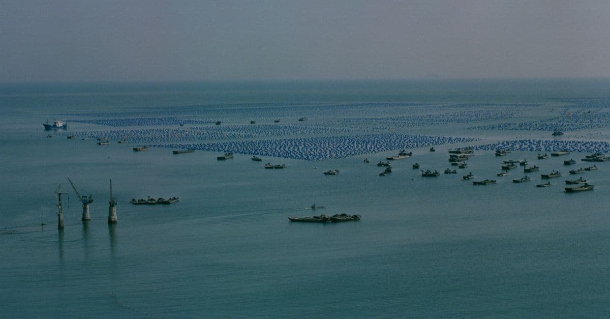
Photo: daydream / Pexels
A country's map does not stop at the beach. Under the law of the sea, a coastal state controls the fish, the seabed minerals, and the offshore energy in a band of ocean that can reach 200 nautical miles (370 km) from its shoreline. That band is the exclusive economic zone, or EEZ. Add up all the zones and a surprising fact appears: France, a mid-sized country on land, ranks first or second in the world by ocean territory, because its scattered overseas territories each carry their own 200-mile circle.
Key Takeaways
- France and the United States are the two largest EEZ holders, each at roughly 11 to 12 million km². Which one ranks first depends on the dataset and on which territories are counted.
- Australia, Russia, the United Kingdom, Indonesia, Canada, Japan, New Zealand, and Chile complete the top ten in the dataset used here.
- Small Pacific states such as Kiribati, the Federated States of Micronesia, the Marshall Islands, and the Cook Islands control ocean thousands of times larger than their land.
- An EEZ gives a state sovereign rights over resources, not ownership of the water. Foreign ships and aircraft keep freedom of navigation and overflight.
- Disputed claims, the legal status of tiny islands, and rising seas make several of the figures below less settled than they look.
Top 20 countries by EEZ area
The table uses version 11 of the Maritime Boundaries Geodatabase, compiled by the Flanders Marine Institute (VLIZ) in Belgium and reproduced in the Atlasocio ranking. Areas are in square kilometers. A country's total includes the zones of its overseas territories and, in some cases, its Antarctic claims, as explained in the next section.
| Rank | Country | EEZ area (km²) | EEZ area (million km²) |
|---|---|---|---|
| 1 | France | 11,691,000 | 11.69 |
| 2 | United States | 11,351,000 | 11.35 |
| 3 | Australia | 8,505,348 | 8.51 |
| 4 | Russia | 7,566,673 | 7.57 |
| 5 | United Kingdom | 6,805,586 | 6.81 |
| 6 | Indonesia | 6,159,032 | 6.16 |
| 7 | Canada | 5,599,077 | 5.60 |
| 8 | Japan | 4,479,388 | 4.48 |
| 9 | New Zealand | 4,420,565 | 4.42 |
| 10 | Chile | 3,681,989 | 3.68 |
| 11 | Brazil | 3,664,673 | 3.66 |
| 12 | Kiribati | 3,441,810 | 3.44 |
| 13 | Mexico | 3,269,386 | 3.27 |
| 14 | Micronesia (Federated States of) | 2,996,419 | 3.00 |
| 15 | Denmark | 2,551,238 | 2.55 |
| 16 | Papua New Guinea | 2,402,288 | 2.40 |
| 17 | Norway | 2,385,178 | 2.39 |
| 18 | India | 2,305,143 | 2.31 |
| 19 | Marshall Islands | 1,990,530 | 1.99 |
| 20 | Cook Islands | 1,960,027 | 1.96 |
Source: VLIZ Maritime Boundaries Geodatabase, version 11, as reproduced by Atlasocio. Atlasocio notes that values differ between sources because of methodological choices, such as how disputed zones are handled.
For scale, the top two zones together exceed 23 million km². The next three, Australia, Russia, and the United Kingdom, add another 22.9 million km², so five countries account for roughly 46 million km² of claimed ocean.
Why do published EEZ rankings disagree?
Search for the largest EEZ and you will find at least three different answers. A 2018 WorldAtlas ranking lists the same figures as the table above for most of the top ten, with France first and the United States second, though it names no source for its table and differs on a few lower rows (for example New Zealand at 4,083,744 km²). A widely used encyclopedia compilation, the Wikipedia article on the exclusive economic zone, lists France at 10,186,624 km² and Australia at 8,148,250 km², with a note that the Australian figure includes about 2,000,000 km² generated by the Australian Antarctic Territory. NOAA, for its part, says the US zone covers more than 3.4 million square nautical miles, which converts to roughly 11.7 million km² at 3.43 km² per square nautical mile. That would put the United States level with, or slightly ahead of, France in the dataset above.
Three things drive the spread.
Which territories count. The VLIZ geodatabase is organized by territory, not by country. In that list, French Polynesia alone is roughly 4.8 million km², Alaska roughly 3.7 million km², and Hawaii roughly 2.5 million km², as reported in the VLIZ infographic. Anyone who ranks "France" has to decide how many of these pieces to add together, and the answer moves the total by millions of square kilometers.
Antarctic claims. Several states claim sectors of Antarctica. Those claims are frozen under the Antarctic Treaty system, and not all countries recognize them. A ranking that includes the Australian Antarctic Territory will place Australia much higher than one that does not. This is why the Wikipedia figure for Australia (8.15 million km²) and the VLIZ-derived figure (8.51 million km²) cannot be compared without checking what each one includes.
Disputes and overlaps. Where two states claim the same water, a geodatabase can exclude the overlap, split it, or assign it to one side. Compilers also differ on how areas are computed and which overlaps are excluded, so even datasets built on the same underlying boundaries can produce different totals for the same country.
The practical lesson: treat any EEZ figure as accurate to roughly a few percent, and treat the order of closely spaced countries as soft. France versus the United States is the clearest example. The gap between them in the table is about 340,000 km², which is small next to the millions of square kilometers that a single territorial-counting decision can move.
How the 200-mile zone came to exist
For most of the age of sail, the sea beyond a narrow coastal strip belonged to no one. Everything past the territorial sea was the high seas, open to any fleet.
That changed in the middle of the twentieth century, and oil and fish drove it. On September 28, 1945, President Harry Truman issued Proclamation 2667, claiming US jurisdiction over the natural resources of the continental shelf, the shallow seabed that extends from the coast. The proclamation left the water above the shelf as high seas, with freedom of navigation intact. Think of it as claiming the basement without claiming the air above the house.
Two years later, Latin American states went further. Chile's president Gabriel González Videla signed a declaration on June 23, 1947 claiming maritime zones out to 200 nautical miles, and Peru followed on August 1, 1947 with Presidential Decree No. 781, according to the Wikipedia summary of the EEZ's history. Other states copied the 200-mile idea over the following decades, and the United Nations Convention on the Law of the Sea (UNCLOS) wrote it into treaty form.
UNCLOS was opened for signature on December 10, 1982 in Montego Bay, Jamaica, and entered into force on November 16, 1994, twelve months after the sixtieth state deposited its instrument of ratification. The UN Treaty Collection's participant table lists 172 parties at the time of writing. The EEZ is defined in Part V of the treaty, and the numbers that matter are all in four short articles.
What a country can and cannot do inside its EEZ
Articles 55 to 58 of UNCLOS set the rules. Article 57 says the zone cannot extend beyond 200 nautical miles from the baselines used to measure the territorial sea. A nautical mile is 1,852 meters, so 200 nautical miles is 370.4 km.
Article 56 gives the coastal state sovereign rights to explore, exploit, conserve, and manage both living and non-living resources in the water column, on the seabed, and in the subsoil. The same article extends those rights to producing energy from water, currents, and winds, which is why offshore wind farms need the consent of the coastal state. The state also has jurisdiction over artificial islands and installations, marine scientific research, and protection of the marine environment, and it must act with due regard to the rights of other states.
Article 58 protects everyone else. All states, coastal or landlocked, keep the freedoms of navigation and overflight and of laying submarine cables and pipelines. A Chinese tanker, a Brazilian warship, and a Kenyan airliner can pass through another country's EEZ without asking permission, though they must respect the coastal state's laws on resources.
The distinction between sovereign rights and sovereignty is easy to miss. A useful comparison is a landlord who controls what is mined or farmed on a property but cannot stop neighbors from using the road that runs through it. The coastal state holds the commercial rights to the zone; it does not hold the zone in the way it holds its own land or its territorial sea.
| Zone | Distance from baseline | Coastal state's authority | Other states' rights |
|---|---|---|---|
| Territorial sea | Up to 12 nautical miles | Full sovereignty over water, seabed, and airspace | Right of innocent passage for ships |
| Exclusive economic zone | Up to 200 nautical miles | Sovereign rights over living and non-living resources, energy production, and some jurisdiction | Navigation, overflight, cables, and pipelines |
| Continental shelf | At least 200 nautical miles; more where the geology allows | Sovereign rights over seabed and subsoil resources | Water above remains EEZ or high seas |
| High seas and the Area | Beyond national jurisdiction | None; the seabed "Area" is managed by the International Seabed Authority | Freedoms of the high seas |
Sources: UNCLOS Parts II, V, VI, and XI, via the UN Division for Ocean Affairs and the Law of the Sea. The 12-nautical-mile figure is the maximum breadth of the territorial sea.
Where small islands become huge ocean powers
The ranking's most striking feature is not the top, where large countries claim large oceans. It is the middle, where tiny nations show up next to giants. Kiribati ranks twelfth in the world, ahead of Mexico. The Federated States of Micronesia ranks fourteenth, ahead of Norway and India.
| Country | Land area (km²) | EEZ area (km²) | EEZ-to-land ratio |
|---|---|---|---|
| Kiribati | 811 | 3,441,810 | about 4,200 to 1 |
| Micronesia (Federated States of) | 702 | 2,996,419 | about 4,300 to 1 |
| Cook Islands | 237 | 1,960,027 | about 8,300 to 1 |
| Marshall Islands | 181 | 1,990,530 | about 11,000 to 1 |
Sources: EEZ areas from VLIZ v11 via Atlasocio. Land areas from the country entries in Wikipedia (Kiribati, Marshall Islands, Cook Islands, Micronesia). Ratios are calculated and rounded.
Imagine a coin on a basketball court. The Marshall Islands' dry land is the coin; the court is the zone it controls. The country's roughly 181 km² of land is smaller than many cities, yet the 200-mile circle drawn around each atoll and island stacks into nearly two million square kilometers of Pacific.
For these states, the zone is the main economic asset. Fishing access fees paid by foreign fleets, licensing of tuna fishing, and in some cases proposals for seabed mining are the sources of revenue that land alone cannot provide. The Cook Islands, for instance, established its Marae Moana marine park in 2017, using its ocean as a conservation and management project rather than only a fishing ground.
Why Pacific states care so much about sea level
A zone built from atolls depends on the atolls staying above water. Under UNCLOS, the baseline from which the 200 miles are measured follows the coast, and the treaty does not say what happens if the coast retreats. Pacific Islands Forum leaders addressed the gap on August 6, 2021 with the Declaration on Preserving Maritime Zones in the Face of Climate Change-related Sea-level Rise. It states their view that maritime zones, once established and notified to the United Nations, should continue to apply without reduction despite sea-level rise.
An American Society of International Law analysis describes the declaration as the first regional statement devoted entirely to this issue, and suggests it could contribute to a customary rule, though it is not enough evidence of one on its own. Whether a global rule emerges is unsettled. The Australia-Tuvalu Falepili Union Treaty, which recognizes Tuvalu's continuing statehood despite sea-level rise, is one example of states writing the principle into bilateral agreements. For the wider picture of who faces the greatest exposure, see our ranking of countries most vulnerable to climate change.
How overseas territories inflate the top of the table
France is the clearest example. Its mainland coastline on the Atlantic and Mediterranean produces a modest zone. The rest comes from territories in every ocean basin, and the biggest single piece is French Polynesia in the South Pacific, listed at roughly 4.8 million km² in the VLIZ data. Territories in the Indian Ocean, the Caribbean, the southern ocean, and the western Pacific add the remainder of the total.
The United Kingdom works the same way. It ranks fifth at 6.81 million km², far more than its home islands alone could generate. The zone comes largely from overseas territories, among them the Falkland Islands, South Georgia and the South Sandwich Islands, Pitcairn, and the British Indian Ocean Territory, which contains the Chagos Archipelago.
That last piece is moving. The UK and Mauritius signed a treaty on May 22, 2025 transferring sovereignty over the Chagos Islands to Mauritius, with a 99-year lease allowing the UK-US military base on Diego Garcia to continue, at £101 million a year. The article reporting the signing does not say whether the treaty has been ratified, so check current status before relying on any figure for the UK. If the transfer completes, the maritime zone around Chagos would shift to Mauritius, and the UK's total would fall.
The same logic applies to the United States. The figure for the US includes not only the 50 states but also territories such as Guam, the Northern Mariana Islands, American Samoa, Puerto Rico, the US Virgin Islands, and a set of remote Pacific islands and atolls. Alaska alone accounts for roughly 3.7 million km² in the VLIZ list, and Hawaii for roughly 2.5 million km². Remote, nearly uninhabited atolls can generate disproportionately large circles, which is the same arithmetic that favors the Pacific island states.
Does the United States have an EEZ if it never joined UNCLOS?
Yes, and the history is more specific than the usual shorthand. The Reagan administration chose not to participate in the Convention in the early 1980s because of its deep-seabed provisions, according to a Congressional Research Service report. Even so, on March 10, 1983, President Reagan issued Proclamation 5030, claiming a 200-nautical-mile EEZ. The CRS notes that the proclamation claimed the zone "in accordance with" UNCLOS.
In 1994, after the objections to the seabed provisions were addressed, the US signed the Agreement amending Part XI of the Convention on July 29, 1994, and President Clinton sent the Convention and the Agreement to the Senate that year. The Senate has not given its advice and consent, so the United States is not a party. In practice the US enforces and defends its EEZ as a matter of national law and customary practice, and NOAA states that the zone is larger than the combined land area of the 50 states.
Non-membership has costs. The CRS report notes that for the US to participate as a member of the International Seabed Authority, or to have standing in some Convention bodies, it would need to accede. That matters more as deep-sea mining and Arctic seabed claims become live issues, discussed below.
What a big EEZ is worth: fish, fuel, wind, and minerals
Fisheries. Fishing is the oldest and still the largest commercial use. The Food and Agriculture Organization's 2026 State of World Fisheries and Aquaculture report, as summarized by Feed & Additive Magazine, reported total fisheries and aquaculture production of 235 million tonnes in 2024, of which about 92 million tonnes of aquatic animals came from capture fisheries. Aquatic animal products worth a record $184 billion were traded internationally. In 2023, 72.6% of all landings came from biologically sustainable stocks. A coastal state with a large zone can sell access to foreign fleets, restrict it, or protect it; a state with no capacity to patrol its zone may see fish taken illegally.
Oil and gas. Offshore petroleum is mostly produced within EEZs, because the continental shelf lies under them. For the countries that sit on the largest reserves, see our ranking of countries with the most oil reserves.
Wind and wave energy. Article 56 explicitly lists energy from water, currents, and winds among the coastal state's sovereign rights. Offshore wind farms in the North Sea sit in the zones of the UK, Norway, Denmark, the Netherlands, Belgium, and Germany. To see which countries lead on clean power generally, see countries that run on the most renewable electricity.
Seabed minerals. Polymetallic nodules (potato-sized lumps rich in manganese, nickel, cobalt, and copper), cobalt-rich crusts, and seafloor sulfides lie on parts of the deep seabed. Some of that seabed lies inside national zones; much of it lies outside, in what UNCLOS calls the Area, where, under Article 137, no state may claim sovereignty or sovereign rights.
Beyond 200 miles: the extended continental shelf and the deep seabed
The EEZ is not the outer limit of everything a coastal state can claim. Under Article 76, the continental shelf runs to the outer edge of the continental margin or to 200 nautical miles, whichever is greater. Where the margin extends farther, the limit may not exceed 350 nautical miles from the baselines or 100 nautical miles from the 2,500-meter isobath (the line connecting points 2,500 meters deep). A state submits its data to the Commission on the Limits of the Continental Shelf, which makes recommendations, and a limit set on that basis "shall be final and binding." Article 82 requires payments or contributions in kind for exploiting non-living resources beyond 200 nautical miles, channeled through the International Seabed Authority.
The shelf grants rights to the seabed and subsoil only. The water above it beyond 200 miles remains high seas. That is why Arctic claims by coastal states revolve around seabed ridges rather than around the water or the ice.
Further out, the seabed becomes the Area. The International Seabed Authority (ISA), created under UNCLOS, regulates mineral-related activities there. According to a CRS report on seabed mining, the ISA had issued 31 exploration contracts as of January 31, 2026, including 17 for polymetallic nodules in the Clarion-Clipperton Zone in the Pacific. As of March 19, 2026, it had not adopted regulations for exploitation, so no commercial mining contracts exist under the international system.
The United States has taken a different route. Executive Order 14285, issued on April 24, 2025 and titled "Unleashing America's Offshore Critical Minerals and Resources," directed NOAA to speed up licenses and permits for seabed mineral activity in areas beyond national jurisdiction under a 1980 US law. On January 21, 2026, NOAA issued a final rule creating a consolidated application process. Whether other states accept licenses issued outside the ISA is a live legal dispute. For readers who want the geography of the deep, see the deepest places in the ocean and why the ocean is still mostly unexplored.
How the line is measured, and why islands matter
The 200 miles are not measured from an imaginary smooth coast. They run from baselines drawn along the coast. UNCLOS allows qualifying states to use straight baselines in some circumstances, and it gives archipelagic states a special system. Under Articles 46 and 47, an archipelagic state may draw baselines around the outermost islands of its archipelago, provided the enclosed area contains a ratio of water to land between 1 to 1 and 9 to 1. The baselines generally cannot exceed 100 nautical miles, though up to 3 percent of them can run to a maximum of 125.
Think of tracing a rubber band around a scattered handful of coins on a table. Everything inside the band counts as part of the archipelagic state's waters, and the 200-mile zone grows outward from the band. For a country like Indonesia, ranked sixth, this system changes the map; the sea between the islands becomes part of the state rather than a patchwork of separate coastlines.
The rock problem
Article 121 sets the rules for islands, and its third paragraph is the source of some of the most heated disputes in ocean law. An island is "a naturally formed area of land, surrounded by water, which is above water at high tide," and gets the full set of maritime zones. But "rocks which cannot sustain human habitation or economic life of their own shall have no exclusive economic zone or continental shelf." A rock still gets a territorial sea and a contiguous zone, but not the 200-mile circle, which could otherwise be worth hundreds of thousands of square kilometers.
The text does not define what sustains habitation or economic life, so states argue about it. A tiny outcrop that qualifies as an island can generate more ocean than a mid-sized country on land. That incentive explains why some governments reinforce, build up, or station people on remote features.
Where overlapping claims turn into disputes
When two coasts are less than 400 nautical miles apart, their 200-mile circles overlap, and the states must agree on a dividing line. UNCLOS provides for dispute settlement through the International Tribunal for the Law of the Sea, the International Court of Justice, or arbitration, and under Article 287 a state may choose among those forums by written declaration. Many overlaps are settled by treaty. Others sit unresolved for decades.
The best-known test of the system is the South China Sea. In a case brought by the Philippines against China, an arbitral tribunal administered by the Permanent Court of Arbitration issued a unanimous award on July 12, 2016. As summarized in the PCA's press release, the tribunal found that China had no legal basis to claim historic rights to resources within the sea areas inside its nine-dash line, to the extent those claims were incompatible with the EEZ provisions of the Convention. China declined to take part in the case and has said it does not accept the ruling. The award is binding on the parties in law, but there is no enforcement mechanism, which is why the dispute continues.
The lesson for EEZ rankings is straightforward. Zones are legal constructs, and a number printed in a table represents a state's claim as modeled by a mapping institute, not a settled physical fact. Where claims overlap or where the status of a feature is contested, no published area is neutral. This is also why the ranking above should not be read as a ranking of strength. A navy decides how much of a zone can actually be policed; see our ranking of countries with the most powerful navies for that side of the question.
Frequently Asked Questions
Q: What is the difference between the territorial sea and the EEZ? A: The territorial sea extends up to 12 nautical miles from the baseline and is under the coastal state's full sovereignty, with a right of innocent passage for foreign ships. The EEZ reaches up to 200 nautical miles and gives the coastal state sovereign rights over resources and some jurisdiction, while all states keep navigation and overflight freedoms. The EEZ includes the area beyond the territorial sea out to its outer limit.
Q: Which country has the largest EEZ? A: In the VLIZ version 11 data reproduced here, France is first at 11.69 million km² and the United States second at 11.35 million km². Other compilations reverse the order, and NOAA's own figure of more than 3.4 million square nautical miles for the US converts to roughly 11.7 million km². The honest answer is that the two are close enough that the result depends on which territories and claims are included.
Q: Can a country lose its EEZ if its islands are submerged? A: UNCLOS does not give a clear answer, and no case has yet tested it. Pacific Islands Forum leaders declared on August 6, 2021 that established maritime zones should continue without reduction despite sea-level rise, and legal scholars describe the declaration as a contribution toward a customary rule rather than settled law.
Q: Can countries extend their rights beyond 200 nautical miles? A: Only over the seabed and subsoil. Under Article 76, a state can claim an extended continental shelf up to 350 nautical miles from the baselines, or 100 nautical miles from the 2,500-meter isobath, if its geology supports it and the Commission on the Limits of the Continental Shelf makes a recommendation. The water above remains high seas, and the state must make payments or contributions in kind for exploiting non-living resources beyond 200 miles.
Q: Why hasn't the United States joined UNCLOS? A: The Reagan administration declined to take part in the early 1980s because of its objections to the deep-seabed provisions. The 1994 Agreement amended many of those provisions, the US signed it on July 29, 1994, and the Convention was sent to the Senate that year. The Senate has not given its advice and consent, so the United States remains outside the treaty while claiming a 200-mile EEZ under Proclamation 5030 of March 10, 1983.
Q: Do rocks and tiny islands get a full EEZ? A: Islands do; rocks do not. Under Article 121, a naturally formed area of land above water at high tide is an island and generates the full set of zones. Rocks that cannot sustain human habitation or economic life of their own get a territorial sea and contiguous zone but no EEZ or continental shelf. The treaty does not define the test precisely, which is why it is contested.
The takeaway
The EEZ ranking is a map of history as much as geography. France and the United Kingdom hold ocean territories many times their size because their overseas possessions each carry a 200-mile circle, while states like Kiribati and the Marshall Islands turn a few hundred square kilometers of land into millions of square kilometers of ocean. The legal machinery behind it, from Truman's 1945 proclamation to the 1994 entry into force of UNCLOS, is recent enough that its edges are still being argued over: islands versus rocks, extended shelves, seabed mining, and what happens to a zone when its baseline goes under water. Read every EEZ number as a claim modeled by a particular dataset on a particular date, and the differences between sources stop looking like errors and start telling you where the open questions are.
Sources
- UN Convention on the Law of the Sea, Part V (Exclusive Economic Zone), UN Division for Ocean Affairs and the Law of the Sea
- UNCLOS Part VI (Continental Shelf), Part IV (Archipelagic States), and Part VIII (Regime of Islands)
- Atlasocio ranking of EEZ areas, based on the VLIZ Maritime Boundaries Geodatabase version 11
- NOAA Ocean Explorer: US Exclusive Economic Zone
- Congressional Research Service, R47744 on UNCLOS and R47324 on seabed mining beyond national jurisdiction
- Permanent Court of Arbitration press release, South China Sea Arbitration, July 12, 2016
Related Reading
- Countries With the Largest Fresh Water Reserves (2025)
- Countries Contributing the Most to Ocean Plastic Pollution (2025)
- Countries With the Most Oil Reserves in the World (2025)
- Countries With the Cleanest Air in the World (2025)
- Countries That Run on the Most Renewable Energy (2025)
- Ocean Acidification Explained: What Lower pH Changes
Follow new articles
Add SciHub101 to your feed reader to see new science and technology stories.
About the Author
SciHub101 is an independent science and technology publication founded and edited by Buğra Sözeri, a software engineer and app developer based in Türkiye. AI tools assist with drafting and research. Source documentation in the existing archive is uneven, and articles are being reviewed and corrected. The Editorial Team byline identifies editorial responsibility; it does not certify specialist or independent human review. Where we compare products, anything built by our own team is labelled as such — see the editorial guidelines and About page for how corrections and disclosures work.
Related Articles
Countries With the Most Active Volcanoes (2025)
Which countries host the most active volcanoes depends on how you define active. This ranking compares the Smithsonian's Holocene counts with recent-eruption counts, and explains why the United States, Japan, Indonesia, Russia, and Chile keep swapping places.
Countries With the Highest CO₂ Emissions: Territorial, Per Capita and Historical
Which countries emit the most carbon dioxide depends on how you count. This ranking uses Global Carbon Project data for 2024 and compares annual territorial emissions, per-person emissions, emissions embedded in trade, and cumulative emissions since the industrial revolution.
Countries with the Most Coral Reefs (2025 Ranked)
Australia's Great Barrier Reef is the world's largest coral structure at 348,000 km². Indonesia has the most coral biodiversity. But 50% of the world's coral reefs have died since 1950 — bleaching events driven by ocean warming are accelerating. Here's the full coral reef ranking and the scale of the crisis.
Countries That Produce the Most Food (Ranked, 2026 Update)
China leads almost every broad measure of food output, but the ranking changes with the metric. Here is who leads by value added, by staple crop tonnage, and by meat and milk, with sources and caveats.

Top Wheat Producing Countries in the World (2026)
Wheat feeds more people than any other cereal crop and underpins global food security. This ranking uses USDA and FAO data to show which countries grow the most wheat, which ones export it, and why the two lists look so different.
Countries With the Cleanest Air in the World (2025)
Air quality is one of the most direct indicators of environmental health. This ranking shows which countries and territories breathe the cleanest air, which suffer the worst pollution, and why small islands keep beating industrial giants on the numbers.