Countries With the Most Active Volcanoes (2025)
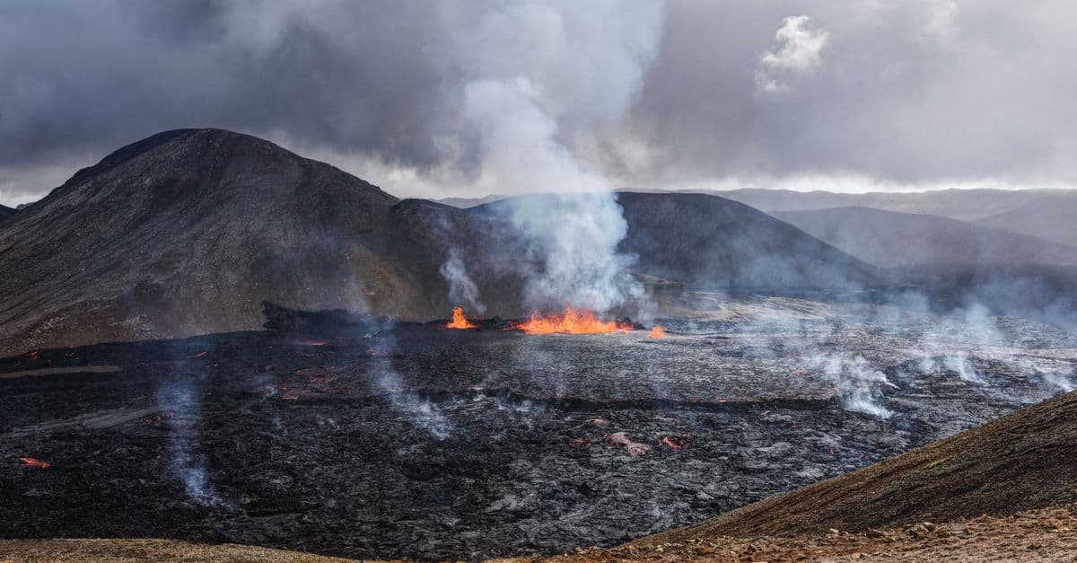
Photo: Rino Adamo / Pexels
Ask which country has the most active volcanoes and you will get three different answers depending on who you ask and how they count. The Smithsonian Institution's Global Volcanism Program (GVP), which keeps the standard catalog, puts the United States first, with roughly 160 volcanoes that have erupted since the last ice age. Count only volcanoes that have actually erupted since 1960 and Indonesia moves to the top. The gap between those two lists says a lot about geology, monitoring, and what the word "active" is really hiding.
Key Takeaways
- The United States leads the GVP's count of Holocene volcanoes (about 162 to 165, depending on the snapshot), mostly because of Alaska's Aleutian arc
- Japan, Russia, and Indonesia sit close together in second to fourth place, and their order changes between data snapshots
- Count only volcanoes with eruptions since 1960 and Indonesia is first, ahead of Japan and the United States
- Roughly 75% of the world's active volcanoes lie along the Pacific Ring of Fire, according to National Geographic
- Eruption risk and eruption count are different things: the deadliest events in the record came from a handful of volcanoes near dense populations
What "active" means, and why it changes the ranking
A volcano is not active the way a lightbulb is on. Volcanologists use at least three overlapping definitions, and which one you pick decides the leaderboard.
The broadest is the one the Smithsonian GVP uses: a volcano counts if it has erupted during the Holocene, the geological epoch that began about 11,700 years ago, or shows credible evidence of eruption in that window. That includes volcanoes that have not erupted in recorded history and that no one is watching. The tightest definition counts only volcanoes with eruptions in historical time, or in recent decades. The USGS describes about 1,350 potentially active volcanoes on land worldwide, of which about 500 have erupted in historical time (USGS). Wikipedia's summary of the field, which cites a later USGS update, gives a higher figure of 1,650 potentially active volcanoes (Wikipedia). The USGS counts exclude the volcanic ridges on the ocean floor, which hide most of Earth's volcanism.
Think of it like counting restaurants. You could count every building that has ever served food in the past 12,000 years, every restaurant with a license, or only the places that served a meal last night. All three are defensible, and all three produce a different top-five city.
The GVP also tracks eruptions as events. Its figures, as summarized in its public FAQ, run to roughly 40 to 50 volcanoes erupting at any given moment, a number that has stayed roughly flat rather than rising. That matters because it deflates the periodic claim that volcanic activity is increasing: more reports can simply mean better satellites and more observers.
Countries by Holocene volcano count
The table below shows the ten countries with the most Holocene volcanoes in one widely reproduced GVP-based snapshot, with data as of December 2022. Iceland, Argentina, and Ecuador are tied at 35 for tenth place.
| Rank | Country | Holocene volcanoes | Main setting |
|---|---|---|---|
| 1 | United States | 162 | Aleutian arc and Alaska, Cascades, Hawaii |
| 2 | Japan | 122 | Subduction zones around the archipelago |
| 3 | Indonesia | 120 | Sunda arc, Banda arc, Sulawesi |
| 4 | Russia | 117 | Kamchatka and the Kuril Islands |
| 5 | Chile | 91 | Southern Andes |
| 6 | Ethiopia | 53 | East African Rift |
| 7 | Papua New Guinea | 46 | New Guinea island arcs |
| 8 | Philippines | 38 | Luzon and Visayan arcs |
| 9 | Mexico | 37 | Trans-Mexican Volcanic Belt |
| 10 (tie) | Iceland, Argentina, Ecuador | 35 each | Mid-Atlantic Ridge and hotspot; Andes |
Source: Gulf News, "Top 10 countries with most active volcanoes" (page updated November 25, 2025; ranking reflects data as of December 2022, based on Smithsonian GVP volcano data) (Gulf News).
Notice that the counts differ slightly from other snapshots. Wikipedia's tabulation of GVP data as of 2023 lists the United States at 165, Japan at 122, Russia and Indonesia tied at 117, and Chile at 91 (Wikipedia). The catalog is revised constantly as researchers date older deposits, merge or split volcanic fields, and reclassify vents. A change of three or four in a national count usually reflects bookkeeping, not geology.
The ranking flips when you count recent eruptions
Holocene counts reward countries with large, old volcanic provinces, including remote ones. A different question gives a more practical answer: which countries have volcanoes that have really been erupting lately?
| Rank | Country | Volcanoes with eruptions since 1960 |
|---|---|---|
| 1 | Indonesia | 55 |
| 2 | Japan | 40 |
| 3 | United States | 39 |
| 4 | Russia | 27 |
| 5 | Chile | 19 |
| 6 | Papua New Guinea | 13 |
| 7 | Ecuador | 12 |
Source: Statista figures as of 2023, reproduced in the Wikipedia article "Active volcano" (Wikipedia).
The United States drops from first to third, because many of its Holocene volcanoes in Alaska have been quiet for centuries or have no recorded eruptions at all. Indonesia climbs to the top because so many of its volcanoes are persistently restless. Neither list is wrong. One asks how much volcanic real estate a country has, and the other asks how often the ground actually moves.
Why these countries? Plate tectonics sets the leaderboard
Volcanoes are not scattered at random. Almost all of them sit where the planet's rigid outer shell, broken into tectonic plates, is being pulled apart, pushed under another plate, or punctured from below. The countries at the top of the table are the ones that happen to straddle one or more of these settings.
Subduction zones, the conveyor belt. Where an oceanic plate dives beneath another plate, it carries water-soaked rock down into the hot mantle. The water lowers the melting point of the rock above it, so magma forms and rises, like adding salt to ice. The rising magma builds a curved chain of volcanoes parallel to the trench: the Aleutians, Kamchatka, Japan, Sumatra and Java, the Andes. National Geographic describes the Pacific's Ring of Fire as a 40,000-kilometer (25,000-mile) horseshoe containing a string of 452 volcanoes and about 75% of all active volcanoes on Earth (National Geographic Education). The same source says roughly 90% of earthquakes occur there too, which is why volcano and earthquake maps look so alike.
Rifts, the zipper. In places where continental crust is stretching, like the East African Rift, the crust thins and magma reaches the surface along a long line of fissures and cones. Ethiopia's high count comes from this. The same process, in progress for tens of millions of years, will eventually split a piece of Africa off from the rest.
Hotspots, the blowtorch. Some volcanism has nothing to do with plate edges. A column of unusually hot rock rising from deep in the mantle can punch through a plate that slides overhead, leaving a trail of volcanoes. Hawaii is the classic example. Iceland is both: it sits on the Mid-Atlantic Ridge, where two plates are separating, and above a mantle plume that boosts the output.
Underneath all of this is the structure of Earth itself, a cool brittle crust over a slowly churning mantle. The geologist who first argued that continents drift is profiled in Alfred Wegener: The Man Who Said the Continents Move.
The United States: most volcanoes, mostly far away
The United States tops the Holocene list largely because of geography rather than because it is a hotbed of danger. Most of its volcanoes lie along the Aleutian arc and in mainland Alaska, a thinly populated region where a volcano may erupt without any person nearby. The impact of those eruptions still reaches a long way, because the plume drifts into the busy air corridors between North America and Asia. Aviation authorities track Alaskan eruptions closely for that reason.
The Cascade Range, which runs from northern California to British Columbia, is the part Americans think of first. Eruptions there are rare on human timescales, averaging about two per century according to the USGS (USGS), but they can be enormous. When Mount St. Helens erupted on May 18, 1980, 57 people died, most of them by asphyxiation from inhaling hot volcanic ash. More than 200 houses and cabins were destroyed, along with more than 185 miles of highways and roads, and trees containing over 4 billion board feet of salable timber were damaged or destroyed, mainly by the lateral blast. The USGS reports that Interstate 90 between Seattle and Spokane was closed for a week and that over 1,000 commercial flights were canceled (USGS).
Hawaii is a different kind of volcanic country. Its basaltic magma is runny, so eruptions tend to flow rather than explode. That does not make them harmless. In the 2018 eruption of Kilauea's lower East Rift Zone, lava covered about 35.5 square kilometers (13.7 square miles) and destroyed 716 dwellings, according to a USGS preliminary summary (USGS). Nobody died from lava in that event, because the flows were slow enough to evacuate ahead of them. That is the whole logic of Hawaiian hazard: you can often outwalk the lava, but you cannot move a house.
The scale of the American monitoring system is worth knowing. The USGS runs five regional volcano observatories (Alaska, Cascades, Hawaiian, Yellowstone, and California) that watch seismicity, ground deformation, and gas emissions. A well-monitored volcano usually announces itself in advance, which is why St. Helens' 1980 eruption, a huge event, killed 57 people rather than thousands.
Indonesia: fewer volcanoes than the US, far more eruptions
Indonesia lies where the Indo-Australian Plate slides under the Eurasian Plate and the smaller plates around Sulawesi and the Banda Sea. The result is a continuous arc from Sumatra through Java to the Lesser Sunda Islands and onward, with hundreds of cones. By the GVP's catalog it has between 117 and 120 Holocene volcanoes, a count that has been revised downward and upward in different releases, but by recent activity it is the clear leader.
Three eruptions explain why Indonesia sits at the center of volcano history.
Tambora, 1815. The eruption of Mount Tambora on Sumbawa island began around April 5, 1815 and peaked on April 10. NOAA rates it a Volcanic Explosivity Index (VEI) 7, on a logarithmic scale where each step up represents roughly ten times more erupted material. The mountain's summit dropped from about 14,100 feet to just under 10,000 feet. NOAA reports about 11,000 deaths from pyroclastic flows (fast-moving avalanches of hot gas and rock), and says more than 100,000 people may have died from food shortages in the following decade (NOAA NESDIS). Other estimates are lower, often 10,000 to 12,000 direct deaths and a total near 71,000 once famine and disease are included, so treat any single figure as an approximation.
Krakatoa, 1883. The Krakatoa eruption and the tsunamis it generated killed more than 36,000 people, according to the British Geological Survey (BGS). The volcano's offspring, Anak Krakatau ("Child of Krakatoa"), grew from the sea in the 20th century. On December 22, 2018, part of its southwestern flank collapsed into the sea. Modeling estimates the landslide at 0.2 to 0.4 cubic kilometers, and it generated a tsunami that killed hundreds of people. A volcano does not have to erupt big to be lethal; it just has to drop the wrong piece of itself into the water.
Merapi, 2010. Merapi, in central Java, is one of the country's most frequently erupting volcanoes and sits north of the city of Yogyakarta. Its 2010 eruption is generally reported to have killed more than 300 people and displaced hundreds of thousands; exact figures vary by source. Merapi illustrates a pattern common in Indonesia: the volcanoes are the reason the land is so fertile, and so the land is densely farmed.
Our companion ranking, The Largest Volcanic Eruptions in History, covers the biggest events, and The Largest Volcanoes in the World compares them by size rather than toll.
Japan: dense population on a restless arc
Japan lies where several tectonic plates meet, and it hosts 122 Holocene volcanoes by the GVP count. Unlike Indonesia, Japan combines frequent eruptions with one of the world's most developed monitoring systems, and that combination changes what happens when a volcano erupts without warning.
The cautionary example is Mount Ontake in September 2014. The eruption, which started around midday on a clear autumn weekend, caught hikers on the summit. Wikipedia's account lists 63 dead, including five bodies never recovered, making it the deadliest volcanic eruption in Japan since the 1902 Torishima event; police said nearly all of the victims had been struck by volcanic rocks (Wikipedia). It was a steam-driven (phreatic) eruption, in which groundwater flashes to steam with little magma involved, and that type gives very few warning signs.
Mount Fuji sits at the center of Japan's long-term planning. Its last eruption, the Hoei eruption, began on December 16, 1707 and ran into early 1708, dropping ash on Edo (modern Tokyo) about 100 kilometers away. Japanese authorities have published simulations of a repeat eruption showing that ashfall could cut power, water, and rail service across the Tokyo region. In August 2025, the Cabinet Office and Tokyo Metropolitan Government released computer- and AI-generated videos for Volcanic Disaster Preparedness Day, and the Tokyo government said there were no signs of Fuji erupting (PBS NewsHour).
Japan also illustrates the benefit side of volcanic geology. The hot spring culture (onsen) that runs through the country exists because the same magma that threatens cities heats the groundwater beneath them.
Russia and Chile: the quiet giants of the Pacific rim
Russia's 117 Holocene volcanoes are concentrated on the Kamchatka Peninsula and the Kuril Islands, some of the most remote terrain on Earth. Few people live nearby, so Russia ranks low on any fatality list despite ranking high on counts. The consequences are mostly aviation: ash from Kamchatka crosses the North Pacific routes.
Chile's 91 volcanoes run along the spine of the Andes, where the Nazca Plate subducts beneath South America. The southern Andes have some of the world's most explosive volcanoes, but much of the range is sparsely populated, and the country runs a national volcano monitoring program, which limits exposure.
Iceland, Ethiopia, Papua New Guinea, and the Philippines
The rest of the top ten shows the variety of volcanic settings.
Iceland (35 Holocene volcanoes by this snapshot). The island's volcanism is produced by the combination of a spreading plate boundary and a hotspot. Its most famous recent disruption was Eyjafjallajokull in 2010. Eurocontrol estimates about 104,000 flights were cancelled, almost 8 million passengers were stranded, and the aviation sector lost EUR 2.7 billion (Eurocontrol). The eruption itself was modest. It mattered because fine ash from a vent under a glacier drifted into one of the world's busiest airspaces.
Since December 2023, a series of fissure eruptions on the Sundhnukur crater row on the Reykjanes Peninsula has repeatedly threatened the town of Grindavik. Wikipedia's tally lists nine eruptions in the series, the most recent in August 2025 (Wikipedia). Icelandic communities have learned to live with this, building lava barriers and evacuating at short notice.
Iceland also draws heavily on the same heat. A 2018 country update by Iceland GeoSurvey puts geothermal energy at about 61% of the country's primary energy supply and reports that it covers about 90% of home heating, though that figure varies by year and by source.
Ethiopia (53). Ethiopia's volcanoes lie along the Afar triangle, where three rifts meet. Many are poorly studied, which makes the national count more uncertain than most.
Papua New Guinea (46) and the Philippines (38). Both lie on the Pacific arcs and sit among the countries most exposed to the combination of eruptions, earthquakes, and tropical storms. The Philippines' Mount Pinatubo erupted in June 1991 in one of the largest eruptions of the 20th century, and it is the standard case study for how a good forecast saves lives. Evacuations before the climactic eruption kept the toll far below what the blast might have caused.
Italy: small count, big exposure
Italy does not make the top ten, but it belongs in any discussion of volcanic risk. Vesuvius, which buried Pompeii and Herculaneum in 79 CE, sits beside the Bay of Naples. Civil protection planning around Vesuvius treats a "red zone" for evacuation that has been enlarged over the years; reporting on the expert recommendations describes an area expanding from 18 towns and about 550,000 residents to 25 towns and about 672,000 residents, though figures vary by source and date. Vesuvius last erupted in 1944.
West of Naples, the Campi Flegrei caldera has shown repeated ground uplift and earthquake swarms in recent years, which prompted the government to commission a dedicated emergency plan in 2023. Etna in Sicily, by contrast, erupts several times a year, mostly with lava fountains and ash rather than city-threatening flows. Etna's frequent activity is exactly why it is closely watched.
Eruptions that changed the record
The table puts several of the events mentioned in this article side by side. Casualty figures for older eruptions are estimates, and sources disagree.
| Event | Date | Country | Reported impact | Source |
|---|---|---|---|---|
| Mount Tambora | April 1815 | Indonesia | VEI 7; about 11,000 killed directly, 100,000+ in later famine (NOAA); other estimates lower | NOAA NESDIS |
| Krakatoa | 1883 | Indonesia | More than 36,000 dead, mostly by tsunami | BGS |
| Mount St. Helens | May 18, 1980 | United States | 57 dead; 185+ miles of roads destroyed | USGS |
| Mount Pinatubo | June 1991 | Philippines | Global cooling of about 0.7 °C at peak | USGS |
| Eyjafjallajokull | April 2010 | Iceland | About 104,000 flights cancelled; EUR 2.7 billion aviation loss | Eurocontrol |
| Mount Ontake | September 2014 | Japan | 63 dead including missing | Wikipedia |
| Kilauea lower East Rift | 2018 | United States | 716 dwellings destroyed; 35.5 km2 of lava | USGS |
Pay attention to what the list has in common. Only one of these eruptions, Tambora, was among the largest of its century. The rest were modest or mid-sized events that happened to strike aircraft, hikers, or towns. Tonnage of ash matters less than where the people are.
How volcanoes change the climate
Large eruptions are one of the few natural events that can change global temperature on a timescale of months. The key ingredient is not ash, which falls out within days or weeks, but sulfur dioxide. When an eruption is powerful enough to inject that gas into the stratosphere, it converts to tiny sulfuric acid droplets that reflect some sunlight back to space. The droplets linger for a year or two, which is why the cooling is temporary.
Tambora's aftermath is the best-known example. NOAA reports that average Northern Hemisphere temperatures fell by about one degree Fahrenheit the next year, which it ties to crop failures, food shortages, and flooding across North America, Western Europe, and parts of Asia, and to snow in New England in July 1816 (NOAA NESDIS). The year became known as the Year Without a Summer.
Pinatubo gave scientists the first modern, instrumented measurement. The USGS says its 1991 eruption cooled Earth's surface for three years, with a peak drop in global temperature of 1.3 degrees Fahrenheit (0.7 degrees Celsius), and that it was about 1,000 times smaller than Yellowstone's largest known eruption (USGS). Other summaries quote about 0.5 °C, depending on the dataset and the period averaged.
None of this means volcanoes can offset human-caused warming. Their effect is a short pulse of cooling that fades as the aerosols settle, while carbon dioxide from burning fossil fuels lingers for centuries. For the opposite scenario, a super-eruption in a country on this list, see What If Yellowstone Erupted Tomorrow?.
What volcanoes give back
Living next to a volcano is not irrational. The hazard is real, but so are the returns.
Fertile soil. Volcanic ash and lava weather into soils rich in minerals and with good water-holding structure. Java, one of the world's most intensively farmed islands, owes much of its agricultural productivity to repeated ashfall, and coffee regions in Colombia, Guatemala, Ethiopia, and Hawaii also grow on volcanic ground. The cost of that fertility is that the farmland sits within reach of the next eruption.
Heat and power. Geothermal systems tap hot rock and water near the surface. Iceland is the most visible example, but Indonesia, the Philippines, New Zealand, Kenya, and Japan also generate power or direct heat from volcanic regions. It is a firm source of clean energy where the geology allows, and it connects to the broader shift in countries that run on the most renewable electricity.
Ores and minerals. Hot fluids circulating around volcanic systems concentrate metals such as copper, gold, and silver, and many of the world's mines sit on ancient volcanic structures.
Tourism and identity. Volcanic landscapes (calderas, lava fields, crater lakes) draw visitors and shape local culture. Eruptions can also create tourism overnight, as the 2021 Fagradalsfjall eruption in Iceland did when thousands hiked to watch a lava field grow.
How eruptions are monitored, and what still surprises scientists
Most large eruptions are preceded by detectable changes, often weeks or months ahead. A rising magma body fractures rock and produces swarms of small earthquakes. It swells the ground, which satellites and GPS stations can measure to the centimeter. It releases more sulfur dioxide and changes the chemistry of gases at fumaroles. Observatories combine these signals with the volcano's own past behavior to set an alert level.
The weak spot is forecasting the timing and size. A volcano can show unrest for years and subside, or give only hours of warning. The steam-driven eruption at Ontake showed how little signal some events produce. Our explainer on how volcanoes work covers the physics of why magma rises and why gas content decides whether an eruption flows or explodes.
Monitoring is also unevenly funded. Countries with high eruption frequency and few resources may have only a handful of instrumented volcanoes, which is a good reason to treat national totals as a floor, not a ceiling.
What people often get wrong about these rankings
More volcanoes does not mean more danger. Danger depends on population nearby, eruption style, warning time, and building quality. Russia has more Holocene volcanoes than Chile but few people near most of them.
The count is not a measure of current activity. A Holocene volcano may not have erupted in 8,000 years. GVP includes it because it is geologically capable of erupting again.
Rankings are not stable. A new radiometric date, a reclassified volcanic field, or a newly discovered submarine volcano can shift a national count. Different snapshots of the same catalog disagree by several volcanoes for the same country.
Volcanoes are not rising in number. The GVP states that volcanic activity has not been increasing. More reports reflect more observers and better remote sensing.
Extinct is a judgment, not a measurement. Volcanoes once classed as extinct have returned to activity, which is why many agencies avoid the label and use "dormant" or give an eruption-free interval instead.
Frequently Asked Questions
Q: Which country has the most active volcanoes? A: By the Smithsonian GVP's count of volcanoes that erupted during the Holocene, the United States is first, with about 162 to 165 depending on the snapshot. By volcanoes with eruptions since 1960, Indonesia is first with 55. The answer depends on which definition you use.
Q: How many active volcanoes are there in the world? A: The USGS describes about 1,350 potentially active volcanoes on land, with about 500 having erupted in historical time. Other summaries cite higher figures, such as 1,650. The totals differ by definition and by catalog version. At any given time, roughly 40 to 50 volcanoes are erupting, according to the GVP.
Q: What is the Ring of Fire? A: It is a 40,000-kilometer (25,000-mile) horseshoe of subduction zones around the Pacific Ocean. National Geographic says it holds about 75% of the world's active volcanoes and roughly 90% of its earthquakes. The United States, Japan, Indonesia, Russia, and Chile all lie along it.
Q: Is Iceland on the Ring of Fire? A: No. Iceland sits on the Mid-Atlantic Ridge, where two plates are pulling apart, and over a mantle hotspot. Ethiopia's volcanoes, similarly, belong to a continental rift. Neither is part of the Pacific subduction belt.
Q: Can a volcanic eruption change the weather worldwide? A: Yes, if it injects enough sulfur dioxide into the stratosphere. After Tambora in 1815, NOAA reports Northern Hemisphere temperatures fell by about one degree Fahrenheit the following year. Pinatubo's 1991 eruption cooled the globe by about 0.7 °C at its peak, according to the USGS. The effect lasts a few years at most.
Q: Which volcano is the most dangerous? A: There is no single answer, because danger combines eruption style, the size of the population nearby, and warning time. Volcanoes close to dense settlement, such as Merapi in Indonesia, Vesuvius in Italy, and Fuji in Japan, get the most attention from emergency planners.
The takeaway
The ranking of volcano countries is less a list of danger than a map of where the planet's plates collide, split, and are punctured. The United States leads the catalog because of the Aleutians, Indonesia leads recent activity, and Japan, Russia, and Chile fill out the top tier because they sit on subduction zones. For anyone reading a number like "162 active volcanoes," the honest follow-up is: active by which definition, as of which year, and watched by whom? The lives lost in the eruptions above came mostly from a few volcanoes in the wrong place with too little warning, which is why monitoring and evacuation planning matter more than the count.
Sources
- Smithsonian Institution Global Volcanism Program, summarized in the Wikipedia article "Active volcano": https://en.wikipedia.org/wiki/Active_volcano
- USGS, "How many active volcanoes are there on Earth?": https://www.usgs.gov/faqs/how-many-active-volcanoes-are-there-earth
- Gulf News, "Top 10 countries with most active volcanoes": https://gulfnews.com/world/list-top-10-countries-with-most-active-volcanoes-1.500358730
- National Geographic Education, "Plate Tectonics and the Ring of Fire": https://education.nationalgeographic.org/resource/plate-tectonics-ring-fire/
- USGS, "Impact of the 1980 Mount St. Helens eruption": https://pubs.usgs.gov/gip/msh/impact.html
- NOAA NESDIS, "Mount Tambora explosively erupts, 1815": https://www.nesdis.noaa.gov/news/day-history-mount-tambora-explosively-erupts-1815
- Eurocontrol, "11 years after the eruption of Icelandic volcano Eyjafjallajokull": https://www.eurocontrol.int/news/11-years-after-eruption-icelandic-volcano-eyjafjallajokull
Related Reading
Follow new articles
Add SciHub101 to your feed reader to see new science and technology stories.
About the Author
SciHub101 is an independent science and technology publication founded and edited by Buğra Sözeri, a software engineer and app developer based in Türkiye. AI tools assist with drafting and research. Source documentation in the existing archive is uneven, and articles are being reviewed and corrected. The Editorial Team byline identifies editorial responsibility; it does not certify specialist or independent human review. Where we compare products, anything built by our own team is labelled as such — see the editorial guidelines and About page for how corrections and disclosures work.
Related Articles
Countries With the Most Biodiversity (2025)
Biodiversity is not evenly spread across the planet. Seventeen 'megadiverse' countries, most of them tropical, hold a large share of Earth's known species. This ranking uses IUCN Red List endemism data and explains why counting species country by country is so hard.
Countries With the Largest Ocean Territory (EEZ)
The ocean covers 71% of Earth's surface, and a coastal state controls the resources in the first 200 nautical miles off its shores. This ranking shows which nations hold the most maritime territory, why published figures disagree, and what an exclusive economic zone does and does not allow.
How Volcanoes Work: The Science of Earth's Most Powerful Force
A single eruption can cool the entire planet for years. Here's the science behind what makes volcanoes tick — from deep magma to explosive blasts.
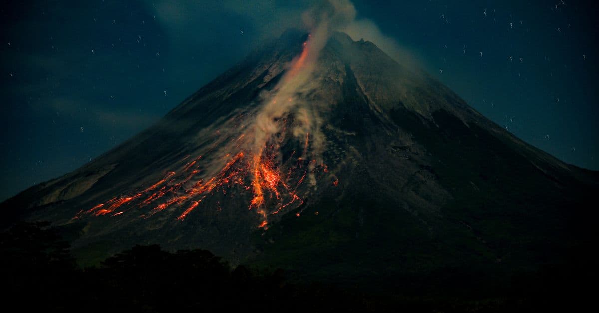
Plate Tectonics Explained — How and Why Earth's Crust Moves
Plate tectonics explained: how Earth's rigid plates move, what drives them, what happens at their boundaries, and the evidence that settled the debate.
How Volcanoes Work — Magma to Eruption
Where magma comes from, why volcanoes form at plate boundaries and hotspots, eruption types, the VEI scale, and how scientists monitor them.