Plate Tectonics Explained — How and Why Earth's Crust Moves
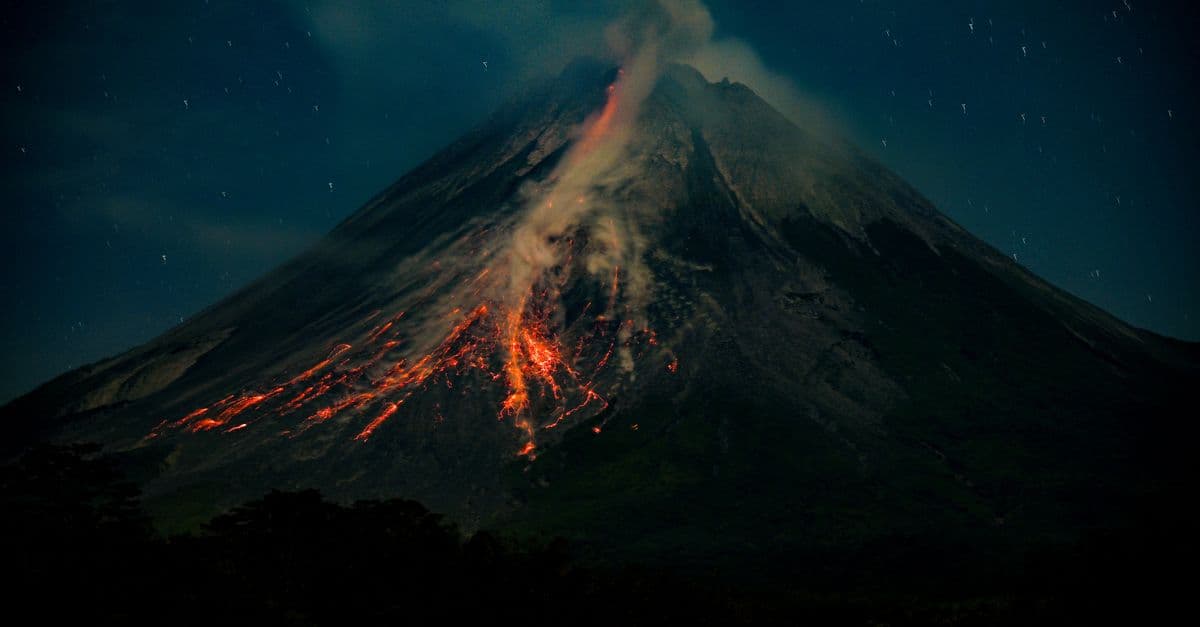
Photo: kevin yung / Pexels
The ground under your feet feels fixed, but it is on the move at roughly the rate your fingernails grow, according to the U.S. Geological Survey. Over tens of millions of years, that slow drift has opened oceans, raised the Himalaya, and rearranged every continent. Plate tectonics is the theory that ties these events together. It explains why earthquakes and volcanoes cluster in narrow belts, why the Atlantic keeps widening, and why matching fossils turn up on coastlines now separated by thousands of kilometers of water.
This article covers what the plates are, what pushes and pulls them, what happens where they meet, and how scientists went from laughing at the idea to measuring it with satellites.
What is a tectonic plate?
Earth's outermost shell, the lithosphere, is the crust plus the rigid uppermost part of the mantle beneath it. It is broken into pieces. Depending on how you count, there are seven or eight major plates and many smaller ones, often called microplates or platelets (Wikipedia, Plate tectonics). A widely used map shows 16 principal plates, which is one reason you will see different totals in different textbooks.
The lithosphere rides on the asthenosphere, a hot, weak layer of the mantle. It is not a liquid ocean of magma, which is a common misunderstanding. It is solid rock that is hot enough to creep, the way cold tar or glacier ice does if you give it enough time. Think of a cracked sheet of pack ice drifting on a slow river: the ice is rigid, the water beneath it flows, and the cracks are where the interesting things happen.
Oceanic and continental lithosphere
Not all plates are built alike. Oceanic crust is mostly dark, iron-rich basalt and gabbro. It is generally under 10 km thick, most of it about 7 km, and it has an average density of about 3.0 g/cm³. Continental crust is lighter, averaging about 2.7 g/cm³, and it is much thicker (Wikipedia, Oceanic crust). Including the rigid mantle layer attached to the crust, oceanic lithosphere is typically about 100 km thick and continental lithosphere about 200 km, though both vary widely from place to place.
That density gap matters more than any other single property. Dense oceanic lithosphere sinks into the mantle when it gets the chance. Buoyant continental lithosphere mostly refuses to, which is why continents are old and the ocean floor is young.
| Property | Oceanic lithosphere | Continental lithosphere |
|---|---|---|
| Typical crust composition | Basalt and gabbro (mafic) | Granite-like and varied (felsic) |
| Crust thickness | Mostly about 7 km | Much thicker, varies by region |
| Average crust density | About 3.0 g/cm³ | About 2.7 g/cm³ |
| Typical lithosphere thickness | About 100 km | About 200 km |
| Oldest large-scale age | About 180 to 200 million years | Billions of years |
| Fate at a collision | Sinks (subducts) | Resists subduction, crumples |
Sources: Wikipedia, Oceanic crust; Wikipedia, Plate tectonics.
How fast do plates move?
Speeds are slow by human standards and varied by plate. Relative motion between plates typically ranges from zero to about 10 cm per year. The Nazca Plate, off South America, is near the fast end at roughly 160 mm per year, while spreading along the Mid-Atlantic Ridge runs at 10 to 40 mm per year (both from the Wikipedia plate tectonics article, which cites the original measurements).
The USGS gives some useful reference points for ridges. The Mid-Atlantic Ridge opens at an average of about 2.5 cm per year, or 25 km per million years. The Arctic Ridge is slower, under 2.5 cm per year, and the East Pacific Rise near Easter Island is the fastest, at more than 15 cm per year (USGS, This Dynamic Earth). Those are spreading rates, meaning the combined motion of the two plates moving apart, not the speed of a single plate.
Here is a way to feel the numbers. At 2.5 cm per year, the Atlantic gains 25 km of width in a million years. Run that for the 100 to 200 million years the USGS says the Atlantic has been opening and you get an ocean thousands of kilometers wide. Nothing about the process is fast. Everything about it is persistent.
What drives plate movement?
The short answer is heat. Earth's interior is hot, partly from heat left over from planetary formation roughly 4.6 billion years ago and partly from radioactive decay. That heat has to escape, and in the mantle it escapes mostly by slow convection, with hot rock rising and cooler rock sinking over timescales of tens of millions of years.
The longer answer is that scientists still argue about exactly how this convection couples to the plates. The USGS is candid about it: no proposed mechanism explains every aspect of plate movement, and none can be tested directly (USGS, Unanswered questions). Still, a consensus has emerged on the main forces.
Slab pull
Slab pull is the dominant force in most modern models. As oceanic lithosphere ages, it cools, thickens, and becomes denser than the mantle beneath it. At a subduction zone, where one plate dives under another, that cold, heavy slab sinks and drags the rest of the plate behind it. The USGS notes that most scientists now regard slab pull as the main driving force (USGS, Unanswered questions), and a widely cited modeling study by Conrad and Lithgow-Bertelloni (2002) reached the same conclusion.
The analogy is a tablecloth sliding off a table. Once enough cloth hangs over the edge, its weight pulls the rest along. The cloth does not need anyone pushing it from behind.
That matches a pattern in the data. Plates attached to long, steep subducting slabs, such as the Pacific and the Nazca, tend to move fast. Plates with little or no subduction along their edges tend to crawl.
Gravitational sliding, often called ridge push
New oceanic lithosphere forms hot and buoyant at mid-ocean ridges, so ridges sit higher than the surrounding seafloor. As the plate cools and thickens moving away from the ridge, it slides slowly downhill on the asthenosphere. This force is usually called "ridge push," though the Wikipedia article points out the name is a misnomer, since nothing is really pushing at the ridge and "gravitational sliding" describes the physics better. It is a real contribution but a smaller one than slab pull.
Mantle convection and basal drag
Hot mantle rises under ridges and cold mantle sinks at trenches, and flow in the mantle can drag on the base of a plate. Whether that drag helps drive a plate or resists its motion depends on the plate and the flow pattern. The USGS lists the number, origin, and structure of convection cells as an open question, and says the origin of heat concentrations that form them "remains a mystery."
The theory has been settled for roughly half a century. The engine underneath it is still being worked out.
The three types of plate boundaries
Nearly all of the planet's dramatic geology happens along plate edges. There are three basic kinds, defined by how the neighboring plates move relative to each other.
Divergent boundaries: plates pulling apart
At divergent boundaries, plates move apart and hot mantle rock rises to fill the gap. As it rises, pressure drops and part of it melts, producing magma that cools into new oceanic crust. The result is a mid-ocean ridge, a long underwater mountain chain with a rift valley down its center.
The Mid-Atlantic Ridge is the best-known case. Iceland sits on top of it, where the ridge rises above sea level, which makes it a rare place to watch spreading happen on land. At Krafla volcano in northern Iceland, a rifting episode from 1975 to 1984 produced a total displacement of about 7 m, with the ground rising 1 to 2 m before some eruptions (USGS, Understanding plate motions).
Divergent boundaries can also form inside continents. A continental rift is a place where the lithosphere is being stretched and thinned. If the stretching continues long enough, a continent splits and a new ocean basin opens between the pieces. The East African Rift is the usual example of this process underway, though how far it will go is a matter of ongoing research.
Convergent boundaries: plates colliding
Convergent boundaries are where plates move toward each other. What happens next depends on what is colliding.
Ocean meets continent. The dense oceanic plate dives beneath the continent. As the slab sinks, it carries water-rich minerals down with it. At depth, those fluids are released into the hot mantle above the slab, lowering its melting point and generating magma. The magma rises and builds a chain of volcanoes on the overriding plate. The Andes are the textbook example. The Cascade Range in the Pacific Northwest is another, built above the small Juan de Fuca Plate sliding under North America.
Ocean meets ocean. One oceanic plate, usually the older and denser one, subducts under the other. The result is a deep trench and an arc of volcanic islands. Japan, the Aleutians, and the Philippines are island arcs. Ocean trenches are typically 8 to 10 km deep, and the deepest of them, Challenger Deep in the Mariana Trench, reaches nearly 11,000 m (USGS, Understanding plate motions). For more extreme depths and locations, see our piece on the deepest places in the ocean.
Continent meets continent. Neither plate is dense enough to sink easily, so the crust crumples, stacks, and thickens. This is how the highest mountains on Earth form. The USGS dates the collision of India with Eurasia to about 40 to 50 million years ago. Before the collision, India was moving north at roughly 9 cm per year; afterward its advance slowed, but the push has continued to raise the Himalaya and the Tibetan Plateau, which has an average elevation above 4,500 m (Wikipedia, Tibetan Plateau). Tibet itself has shifted nearly 2,000 km northward over roughly the past 100 million years, according to the USGS (The Himalaya). Because no subduction volcanoes form in a pure continent-continent collision, the Himalaya are not volcanic. For a ranking of the results, see the tallest mountains on Earth.
Transform boundaries: plates sliding past
At transform boundaries, two plates slide horizontally past each other. Crust is neither made nor destroyed, but the plates do not slide smoothly. They lock, stress builds, and the release comes as an earthquake. The geophysicist J. Tuzo Wilson identified transform faults in the 1960s, according to the USGS.
The San Andreas Fault in California is the famous example. The USGS reports that the Pacific Plate has moved past the North American Plate at an average of about 5 cm per year for the last 10 million years, along a fault zone about 1,300 km long (USGS, Understanding plate motions). That is a long-term average. On any particular segment, the motion can stall for a century and then lurch several meters in seconds.
Why subduction zones produce the biggest earthquakes
Earthquakes occur at all three boundary types, but subduction zones are special for two reasons. First, they are enormous, since the interface between a sinking slab and the overriding plate can extend for hundreds of kilometers along the trench and tens of kilometers down-dip. Second, that interface can stay locked for centuries while the plates keep converging, storing elastic energy like a bent spring.
When it finally ruptures, a very large area slips at once. Megathrust earthquakes of this kind have produced the largest quakes ever recorded, several of them above magnitude 9, including the 2004 Indian Ocean and 2011 Tohoku events. Because the seafloor moves vertically in such a rupture, it displaces a huge volume of water, which is why these quakes are tsunami generators. Our list of the strongest earthquakes ever recorded walks through the biggest cases, and how earthquakes work explains the seismic waves and the limits of prediction.
Subduction also produces earthquakes far below the surface. The USGS describes a magnitude 8.3 earthquake in Bolivia in 1994 that struck at a depth of 636 km. Quakes that deep cannot happen in the shallow crust, and they trace out the path of cold slabs sinking into the mantle. Seismologists had already noticed this pattern by the late 1920s, when Kiyoo Wadati in Japan and later Hugo Benioff in the United States mapped zones of earthquakes dipping beneath trenches. Those zones now carry their names (USGS, Developing the theory).
How scientists proved plates move
The idea of drifting continents is older than the evidence for it, and for decades that mismatch stalled the field.
Wegener and the rejected hypothesis
In 1912, Alfred Wegener, a 32-year-old German meteorologist, published his proposal that the continents were once joined in a single landmass he later called Pangaea and had since drifted apart. He pointed to the jigsaw fit of the coastlines and to matching fossils, including the fern Glossopteris, found on landmasses now far apart and in now-polar regions (USGS, Historical perspective). You can read more about his life in our profile of Alfred Wegener.
The problem was mechanism. Wegener suggested that continents plowed through the ocean floor, and the geophysicist Harold Jeffreys argued that rock that strong could not be pushed through rock without breaking up. The USGS calls this a "fatal weakness" of the theory. Wegener died in 1930 on an expedition across the Greenland ice cap, still a minority voice. The British geologist Arthur Holmes proposed mantle convection as a possible engine around then, but the idea did not win converts.
Seafloor spreading
The break came from the ocean floor, which scientists had barely mapped before World War II. Sonar and magnetometers, some of them adapted from wartime submarine detection, revealed a global system of mid-ocean ridges and deep trenches. The USGS credits Harry Hess of Princeton with proposing that new oceanic crust forms at ridges and then moves away like a conveyor belt, sinking at trenches, so that ocean basins are continually recycled. Robert Dietz coined the term "seafloor spreading." By 1961, the idea was circulating widely (USGS, Developing the theory).
Hess's model neatly explained three puzzles at once: why Earth does not grow as new crust is made, why seafloor sediment is thin, and why oceanic rock is so much younger than continental rock.
Magnetic stripes: a tape recording of Earth's history
The most striking evidence is magnetic. As lava cools at a ridge, iron-bearing minerals lock in the direction of Earth's magnetic field at that moment. The field has flipped polarity many times, so the seafloor carries alternating stripes of normal and reversed magnetization. In 1963, Fred Vine and Drummond Matthews published the explanation in the journal Nature, and Lawrence Morley reached a similar conclusion independently.
The USGS describes the stripes as running in parallel, mirror-image bands on either side of a ridge, with the youngest rock at the crest and progressively older rock farther out. This works like a tape recorder: the ridge is the recording head, and the plate is the tape moving past it. Matching the stripes to the independently dated record of magnetic reversals gave scientists a way to calculate spreading rates across the globe.
Drilling, seismology, and GPS
Three more lines of evidence closed the case.
- Ocean drilling. In 1968 the drilling ship Glomar Challenger began a year-long expedition boring cores along the Mid-Atlantic Ridge between South America and Africa. Fossil and isotopic dating showed the sediment and rock got older with distance from the ridge, as spreading predicted (USGS, Developing the theory).
- Seismology. In the 1960s, the Worldwide Standardized Seismograph Network, set up to monitor the 1963 ban on above-ground nuclear tests, produced a global dataset that mapped earthquake belts precisely. Plot the epicenters and the plate boundaries appear as lines.
- Satellite geodesy. Modern GPS measures the motion of ground stations to a fraction of a millimeter per year, which means plate velocities that were once inferred from rocks can now be watched directly. Our explainer on how GPS works covers the technology behind those measurements.
The age of the seafloor is a quiet but powerful check. The oldest large-scale oceanic crust is only about 180 to 200 million years old, according to the Wikipedia summary of global crustal-age mapping. Continents contain rocks several billion years old. That mismatch only makes sense if ocean floor is continually created and destroyed. For a closely related story about how a single scientist's maps made this case visually, see Marie Tharp.
Hot spots: volcanoes that ignore the boundaries
Not every volcano sits on a plate edge. The Hawaiian Islands are in the middle of the Pacific Plate. In 1963, Wilson proposed that a plate moving over a fixed source of magma deep in the mantle would leave a line of volcanoes behind it, like a sheet of paper dragged over a candle flame (USGS, Hotspots).
The Hawaiian chain fits the pattern. The oldest rocks on Kauai are about 5.5 million years old and heavily eroded, while the oldest exposed rocks on the Big Island are less than 0.7 million years old, and new rock is still forming there. Islands get older and more eroded the farther they have traveled from the hotspot. Yellowstone is the continental version, with three enormous eruptions in the past two million years, the most recent about 600,000 years ago, per the same USGS source. Our scenario piece on what would happen if Yellowstone erupted tomorrow looks at that hazard in detail.
The USGS adds a caution that is easy to miss: newer studies suggest that hotspots may be neither as deep nor as fixed as the classic plume model assumed, so this is an area of active debate. It is a good reminder that plate tectonics is a framework, not a closed book.
Pangaea, supercontinents, and deep time
Run the plate motions backward and the continents converge. The USGS places the breakup of Pangaea at about 200 million years ago, with the supercontinent first splitting into a northern part, Laurasia, and a southern part, Gondwana, a division later proposed by Alexander Du Toit (USGS, Historical perspective). India then raced north for roughly 150 million years before it struck Asia.
Pangaea was not the first supercontinent. Geologists identify earlier assemblies, among them Columbia (roughly 1.8 to 1.5 billion years ago) and Rodinia (roughly 1.25 billion to 750 million years ago), and describe a supercontinent cycle of about 300 to 500 million years (Wikipedia, Supercontinent cycle). Dates for the oldest assemblies are less certain than those for Pangaea, since the rock record is sparse and heavily altered.
When did plate tectonics itself begin? That is an open question. Some studies argue it has operated for 3 to 4 billion years, while others place the start much later, closer to the Neoproterozoic. Because the oldest oceanic crust is long gone, the evidence has to come from continental rocks and chemistry, and interpretations differ.
Two scenario pieces explore what-ifs related to this history: what if Pangaea never broke up and what if continents collided differently. Both are thought experiments, but they lean on the same rules described here.
What plate tectonics does to climate and life
Tectonics is not only about rocks. It reshapes the conditions living things face.
Mountain building and climate. Uplift changes atmospheric circulation and exposes fresh rock to weathering. Chemical weathering of silicate rock draws carbon dioxide out of the air over long timescales, which is one proposed link between the rise of the Himalaya and global cooling. The size of that effect is debated, and scientists have proposed several competing explanations for the long cooling trend that preceded the ice ages.
Ocean gateways. The position of continents decides where ocean currents can flow. Opening or closing a seaway can redirect heat around the globe. Researchers have linked the rise of the Isthmus of Panama to changes in Atlantic circulation, though the timing of closure and the strength of its climate effects are still disputed.
Volcanism and mass extinction. Enormous outpourings of lava, called large igneous provinces, can alter the atmosphere on a global scale. The eruption of the Siberian Traps coincides with the end-Permian extinction about 251.9 million years ago, the most severe in the fossil record. Current estimates put marine species losses at about 81 percent, and a high-precision dating study found that the main extinction pulse lasted only about 60,000 years, give or take 48,000 (Wikipedia, Permian-Triassic extinction event, summarizing Burgess and colleagues, 2014). Older sources quote a figure near 96 percent, which was an earlier estimate that has since been revised.
Fossils and deep time. Tectonics also shapes the fossil record, since seafloor is recycled but continental interiors preserve sediment. If you want the other side of that coin, our explainer on how fossils form shows how rock becomes a record of ancient life.
How we know what is inside Earth
Everything above depends on a picture of Earth's interior that no one has seen directly. Geophysicists build it from earthquake waves, which bend and reflect as they pass through layers with different properties. The speed and path of those waves reveal the crust, the mantle, the liquid outer core, and the solid inner core. If you want the full logic, read how scientists know what is inside Earth alongside how scientists measure the age of Earth, which explains why we can say the planet is about 4.6 billion years old.
Common misconceptions
"The plates float on a sea of magma." They do not. The asthenosphere is mostly solid rock that deforms slowly. Magma forms only in specific places, such as beneath ridges and above subducting slabs, where conditions favor partial melting.
"The continents move through the ocean floor." That was Wegener's picture, and it was the flaw that killed his proposal. In the modern theory, continents are carried within plates, like logs frozen into river ice. Plates include oceanic and continental parts together.
"The ground is sliding under California and will drop the state into the sea." California's faults are transform faults, so crust slides sideways rather than sinking. The popular image of the state falling off is a movie idea, not a geological one.
"Plate tectonics explains everything about Earth's surface." It explains a great deal, but not all of it. Intraplate earthquakes occur far from plate edges. Hotspot volcanism does not fit the three-boundary scheme neatly. And the forces behind the whole system are still debated.
"Earth is expanding." Hess's model explained why it is not: new crust made at ridges is balanced by old crust consumed at trenches. Measurements of plate motion by satellite geodesy are consistent with a planet of constant size.
Plate tectonics compared: boundary types
| Boundary type | Plate motion | Typical features | Example |
|---|---|---|---|
| Divergent | Apart | Mid-ocean ridge, rift valley, new crust | Mid-Atlantic Ridge, East African Rift |
| Convergent, ocean-continent | Together | Trench, volcanic arc, mountains | Andes, Cascades |
| Convergent, ocean-ocean | Together | Trench, volcanic island arc | Japan, Aleutians, Philippines |
| Convergent, continent-continent | Together | Thick mountain belt, few or no volcanoes | Himalaya, Alps |
| Transform | Sideways | Strike-slip fault, shallow earthquakes | San Andreas Fault |
What other planets tell us
Earth is the only planet in our solar system known to have active plate tectonics. Venus is close to Earth in size but shows no sign of global plates, and its surface appears to behave more like a single rigid shell, with volcanism of a different kind. Our article on Venus's volcanoes lays out what we know. Researchers have proposed several reasons, including the lack of surface water to weaken rock and the planet's hotter surface, but none is settled. Mars and the Moon also lack active plates.
That matters beyond curiosity. Some scientists suggest that plate tectonics helps keep climate stable over geologic time by recycling carbon between the interior and the atmosphere. Whether this process is necessary for complex life, or simply helpful, is unresolved, and it feeds into the question of what makes a planet habitable.
Frequently asked questions
Q: How many tectonic plates are there? A: It depends on how you count. Most sources describe seven or eight major plates and many smaller ones, and a common map shows 16 principal plates. The answer changes with how small a fragment you are willing to call a plate.
Q: How fast do tectonic plates move? A: Relative plate motion typically ranges from zero to about 10 cm per year. The Mid-Atlantic Ridge opens at an average of about 2.5 cm per year, while the fastest ridge, the East Pacific Rise, spreads at more than 15 cm per year. GPS now measures these rates directly.
Q: What is the main force that moves the plates? A: Most scientists consider slab pull, the sinking of cold, dense oceanic slabs at subduction zones, to be the dominant force. Gravitational sliding off ridges and drag from mantle flow also contribute, but the exact balance remains an open research question.
Q: What is the difference between continental drift and plate tectonics? A: Continental drift was Wegener's 1912 idea that continents move, without a workable mechanism. Plate tectonics is the later, broader theory, developed mainly in the 1960s, in which rigid plates made of both continents and ocean floor move, with new crust forming at ridges and old crust sinking at trenches.
Q: Why are there earthquakes and volcanoes mainly around the Pacific? A: Much of the Pacific is ringed by subduction zones, where oceanic plates sink beneath continents and island arcs. Those zones produce both the largest earthquakes and the arcs of volcanoes along the Pacific rim.
Q: Can scientists predict plate-boundary earthquakes? A: No. They can map where faults are, estimate how much strain has built up, and calculate long-term probabilities, but they cannot say when a specific fault will rupture. Plate motion is steady, while fault release is abrupt and hard to time.
Q: Will there be another supercontinent? A: Most models say yes, since the cycle has repeated before, but they disagree on where and how it will assemble. All of them put it hundreds of millions of years in the future, far beyond any human timescale.
The takeaway
Plate tectonics works because a simple physical fact, that oceanic rock cools into something heavier than the mantle below it, keeps repeating over hundreds of millions of years. That one fact gives you ridges where new floor is made, trenches where old floor is consumed, and mountains where continents are too buoyant to sink. The evidence is not a single clinching discovery but several independent measurements, from magnetic stripes to seismic belts to satellite positions, all agreeing. The less comfortable part of the story is that the central engine is still debated, and hotspots hint that the tidy picture has loose ends. A theory that has survived sixty years of satellite-era scrutiny while still leaving open questions is a fair description of good science.
Sources
- USGS, This Dynamic Earth (overview)
- USGS, Historical perspective
- USGS, Developing the theory
- USGS, Understanding plate motions
- USGS, The Himalaya (collision zones)
- USGS, Hotspots: mantle thermal plumes
- USGS, Some unanswered questions
- USGS FAQ, How fast do tectonic plates move?
- Wikipedia, Plate tectonics (cites Conrad and Lithgow-Bertelloni 2002)
- Wikipedia, Oceanic crust
- Wikipedia, Supercontinent cycle
- Wikipedia, Permian-Triassic extinction event
- Vine, F. J., and Matthews, D. H. (1963). Magnetic anomalies over oceanic ridges. Nature, 199, 947-949.
Read next:
Follow new articles
Add SciHub101 to your feed reader to see new science and technology stories.
About the Author
SciHub101 is an independent science and technology publication founded and edited by Buğra Sözeri, a software engineer and app developer based in Türkiye. AI tools assist with drafting and research. Source documentation in the existing archive is uneven, and articles are being reviewed and corrected. The Editorial Team byline identifies editorial responsibility; it does not certify specialist or independent human review. Where we compare products, anything built by our own team is labelled as such — see the editorial guidelines and About page for how corrections and disclosures work.
Related Articles
Radiocarbon Dating: How Carbon-14 Tells Us the Age of Ancient Things
Carbon-14 dating lets scientists calculate the age of once-living organisms with remarkable accuracy. Here is the physics behind how a radioactive isotope became archaeology's most powerful clock.

The Chemistry of Photosynthesis — From Photons to Sugar
How photosynthesis works at the molecular level — the light reactions, Z-scheme, electron transport chain, Calvin cycle, and why quantum coherence may be involved.

How Volcanoes Work — Magma to Eruption
Where magma comes from, why volcanoes form at plate boundaries and hotspots, eruption types, the VEI scale, and how scientists monitor them.
How Earthquakes Work — Plate Tectonics Explained
How shifting tectonic plates cause earthquakes, why we measure them with moment magnitude, and why prediction is still impossible.
How Volcanoes Work: The Science of Earth's Most Powerful Force
A single eruption can cool the entire planet for years. Here's the science behind what makes volcanoes tick — from deep magma to explosive blasts.