How Scientists Know What Is Inside Earth
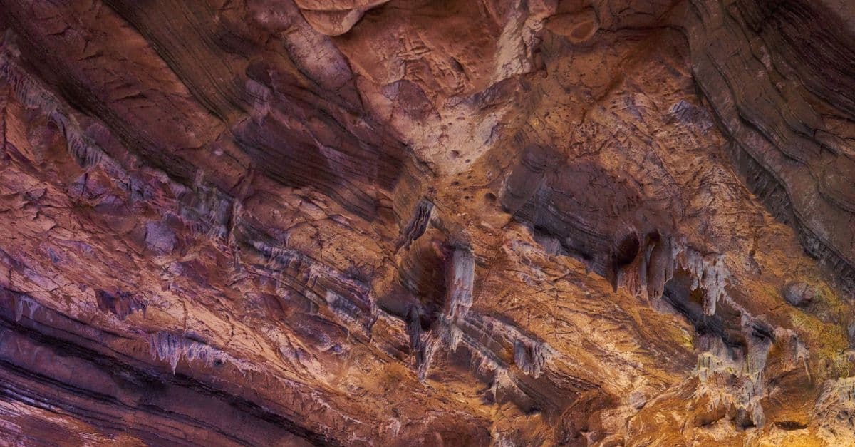
Photo: dayong tien / Pexels
No human has ever seen Earth's interior directly, and no drill has come remotely close to reaching it. The deepest hole ever bored, the Kola Superdeep Borehole in Russia, stopped at 12,262 meters (40,230 feet) after 20 years of drilling — a scratch that barely pierces the crust, which itself is only the outermost of four major layers (Scientific American, 2019). Scientists instead reconstruct the planet's interior the way a doctor reads an X-ray: by sending energy through the body and measuring what comes out the other side. That energy is the shockwave from an earthquake, and the "camera" is a global network of seismometers.
The problem: Earth's interior is permanently out of reach
Earth's radius is about 6,371 kilometers (3,959 miles). The Kola borehole reached roughly 0.2% of that distance before the rock itself defeated the drill. At 12 km down, temperatures climbed to about 180°C (356°F) — nearly double what Soviet geologists had predicted — and the rock began behaving less like stone and more like warm plastic, deforming around the drill bit and pipe (Scientific American, 2019; Interesting Engineering, 2023). Deeper drilling under those conditions is not a matter of better equipment; the rock itself stops holding a hole open.
That thermal wall is the central obstacle to direct exploration. Pressure and temperature both rise steeply with depth: by the time you reach the mantle-core boundary at roughly 2,900 kilometers (1,800 miles) down, pressure exceeds 1.3 million times atmospheric pressure at sea level, and temperatures approach 4,000°C (7,200°F) (USGS, "The Interior of the Earth"). No material yet engineered survives those conditions long enough to drill through it, which is why every major model of Earth's interior is built from indirect evidence rather than a physical sample brought up from the deep.
This is also why the question "how do scientists know" is not rhetorical. It is the actual scientific challenge: build a reliable model of a system you can never physically enter, using only the signals that leak out at the surface. Geophysicists solved this problem by treating the whole planet as a single object that rings like a bell every time a large earthquake strikes it, and then listening carefully to how it rings.
Seismic waves are the primary tool
Seismic waves are the vibrations released by an earthquake, a nuclear test, or a large explosion, and they travel outward through the Earth in several distinct forms. The two types that matter for interior mapping are P-waves and S-waves.
- P-waves (primary waves) — compressional waves that squeeze and stretch rock as they pass, the same way sound moves through air. They can travel through solids, liquids, and gases, and they are the fastest seismic wave, which is why they arrive at a seismometer first.
- S-waves (secondary waves) — shear waves that move rock side to side, perpendicular to the direction of travel. Because liquids cannot support shear (they simply flow instead of springing back), S-waves cannot travel through any liquid layer at all.
That single physical fact — S-waves die in liquid, P-waves do not — turns out to be the key that unlocked the structure of Earth's core.
What is the seismic shadow zone?
The seismic shadow zone is the region on Earth's surface, between about 104 and 140 degrees of angular distance from an earthquake, where seismometers detect no direct S-waves and only weak, refracted P-waves. S-waves stop completely because they cannot cross the liquid outer core; P-waves bend sharply as they pass from mantle rock into liquid metal, leaving a gap where straight-line paths would otherwise land (IRIS, "Seismic Shadow Zones").
Think of it like shining a flashlight through a glass of water sitting inside a block of ice. Light bends where it crosses from ice into water because the two materials refract light differently, so a straight beam ends up landing somewhere other than where you would predict if the whole block were uniform ice. Seismic waves do the same thing when they cross from solid mantle rock into the liquid outer core: the sharp change in material bends their path and leaves a predictable blind spot on the far side of the planet.
How shadow zones revealed the core's structure
Seismologists first noticed the P-wave and S-wave shadow zones in global earthquake records in the early 1900s, and the pattern was too consistent to be noise or measurement error. Every large earthquake, regardless of location, produced the same band of "silence" roughly on the opposite side of the globe. British seismologist Richard Dixon Oldham proposed in 1906 that this pattern indicated a distinct central core with different physical properties than the surrounding mantle, and subsequent work refined that boundary to a depth of about 2,900 kilometers (Croatian seismologist Andrija Mohorovičić had already mapped the shallower crust-mantle boundary — now called the Mohorovičić discontinuity — a few years earlier by studying how seismic waves sped up abruptly at shallow depth).
The complete-shutdown of S-waves beyond 104° told seismologists the outer core had to be liquid, since no known solid-only wave can cross a fluid. But the story did not end there. In 1936, Danish seismologist Inge Lehmann was studying seismograms from a New Zealand earthquake and noticed faint P-waves arriving inside the supposedly "empty" shadow zone — arrivals that should not have existed if the core were uniformly liquid all the way to its center. She proposed that these waves were bouncing off a second boundary deep inside the outer core: a solid inner core roughly 1,250 kilometers (777 miles) in radius, dense enough and rigid enough to reflect and refract P-waves back out through the shadow zone (American Physical Society, 2023; Britannica, "Inge Lehmann").
Lehmann's 1936 paper, titled simply "P′," gave Earth its now-standard four-layer model: crust, mantle, liquid outer core, and solid inner core. Later work explained why the inner core is solid despite being hotter than the outer core: pressure at that depth, more than three million times atmospheric pressure, is high enough to force iron into a solid crystalline state even at temperatures around 5,200°C (9,392°F), which is comparable to the surface temperature of the Sun (Space.com, "Earth's layers"). Pressure, not temperature alone, decides whether the deepest iron is liquid or solid.
How do seismic waves reveal what's inside Earth?
Seismic waves change speed, bend, reflect, or vanish entirely whenever they cross a boundary between materials with different density, rigidity, or physical state. By recording thousands of earthquakes on a global network of seismometers and mapping exactly where each wave type arrives, is delayed, or goes missing, seismologists reconstruct depth, density, and material state without ever physically sampling the rock.
Density, mass, and the "missing" material problem
Seismic waves establish where the layer boundaries sit, but they do not, by themselves, prove what those layers are made of. That answer comes from a much older piece of physics: Earth's total mass and volume.
Earth's average density is about 5,515 kg/m³, calculated from its known mass (measured via gravitational interactions with the Moon and satellites) divided by its known volume. Rocks collected at the surface — granite, basalt, and similar continental and oceanic crust — average only about 2,700 to 3,000 kg/m³. That leaves a substantial density deficit: if the whole planet were made of surface-type rock, Earth would be roughly half as dense as it actually is. Something far denser has to exist deep inside to make up the difference.
Iron and nickel, common in the universe and abundant in meteorites, are dense enough to close that gap. Seismic velocity data reinforces the iron hypothesis independently: P-waves speed up and slow down in ways consistent with a metallic, iron-nickel core rather than a rocky one, and the core's calculated density (roughly 10,000 to 13,000 kg/m³ depending on depth) matches iron-nickel alloys under extreme pressure far better than it matches silicate rock (USGS, "The Interior of the Earth").
Meteorites add a second, independent line of evidence. Many meteorites are leftover material from the same disk of dust and gas that formed the Sun and planets 4.6 billion years ago, and they never underwent the internal differentiation that separated Earth's metal from its rock. Iron meteorites, made almost entirely of iron-nickel alloy, are thought to be fragments of the cores of small differentiated bodies (protoplanets) that broke apart early in solar system history. Their composition closely matches what geophysicists calculate for Earth's core, giving an independent chemical check on a structure inferred purely from wave physics.
Earth's magnetic field confirms a liquid, conductive outer core
A planet does not generate a global magnetic field by accident. Earth's field, which deflects most solar wind and cosmic radiation and makes the planet's surface habitable, requires a very specific set of conditions: a large volume of electrically conductive fluid, rotating, and convecting (churning) inside a rotating planet. That process is called the geodynamo — the self-sustaining electric current generated by convection and rotation in Earth's liquid, iron-rich outer core.
Solid rock does not conduct electricity well enough to sustain this process, and a fully solid planet could not generate a field that persists and slowly shifts over centuries the way Earth's does (magnetic north has measurably drifted over the past 400 years of compass records). A liquid, metallic outer core, however, checks every box: it conducts electricity, it convects because the inner core releases heat as it slowly grows by freezing outward, and Earth's 24-hour rotation twists that convection into organized electric currents.
The geodynamo theory does more than explain magnetism in isolation — it is a second, independent confirmation of a claim seismology already made using an entirely different kind of evidence (elastic wave physics versus electromagnetism). When multiple independent methods converge on the same structure, confidence in that structure goes up sharply, which is exactly what happened with the liquid outer core between the 1900s shadow-zone work and later geodynamo modeling.
High-pressure lab experiments recreate core-like conditions
Seismology tells scientists where the boundaries are and roughly how dense each layer is. It does not, by itself, tell them exactly how iron behaves at 3.6 million atmospheres of pressure. For that, geophysicists turn to a device called a diamond anvil cell, which squeezes microscopic samples between two gem-quality diamond tips to recreate pressures and temperatures close to those found deep inside Earth, while lasers heat the sample and X-rays probe its crystal structure in real time.
These experiments, run at facilities such as the Advanced Photon Source at Argonne National Laboratory and equivalent synchrotron labs in Europe and Japan, let researchers test whether iron under core-like pressure actually produces the seismic wave speeds observed in real earthquake data. When lab measurements of compressed iron match the wave-speed and density profile seismologists calculate for the real core, that agreement is strong evidence the model is correct — not proof beyond all doubt, but a convergence between a planetary-scale observation and a tabletop experiment that would be an extraordinary coincidence if the underlying model were wrong.
This is where the three independent lines of evidence finally lock together: seismic waves define the geometry, density and meteorite chemistry suggest the material, and diamond-anvil experiments confirm that the suggested material actually behaves the way the seismic data says it does at the relevant pressure and temperature. No single method proves the model alone; the convergence across all three is what makes geophysicists confident.
The inner core doesn't just sit there — it moves, and even changes shape
Seismology did not stop at locating the inner core in 1936. Because the inner core is a solid iron-nickel ball floating inside the liquid outer core, decoupled from the rest of the planet by that surrounding fluid, it can rotate at a slightly different rate than the mantle and crust above it. Detecting that difference requires comparing seismic waves from nearly identical earthquakes, recorded decades apart, that happen to pass straight through the inner core along the same path — if the core has rotated in the meantime, the waveform recorded today will look subtly different from the one recorded years earlier, even though the quake and the receiving station are the same.
Using that method on repeating earthquakes near the South Sandwich Islands, seismologists at the University of Southern California reported in 2024 that the inner core's rotation relative to the mantle had not just slowed but reversed direction. The core spun slightly faster than the rest of the planet ("super-rotated") from roughly 2003 to 2008, then reversed and sub-rotated — spinning slightly slower than the mantle — from 2008 into the 2020s, retracing close to the same path it had followed on the way up (Yang and Song, Nature, 2024; ScienceDaily, June 2024). A follow-up study published in Nature Geoscience in February 2025, using an expanded set of earthquake pairs, went further: it found evidence that the shallow surface of the inner core is not just rotating differently but physically deforming over roughly the same 20-year window, in patterns the researchers likened to landslides occurring about 5,000 kilometers (3,100 miles) below the surface (CNN, February 2025).
None of this changes the four-layer structure Lehmann established in 1936 — the inner core is still solid, still iron-nickel, still bounded at roughly 5,150 kilometers depth. What it adds is a picture of that solid ball as dynamic rather than static: gravitationally locked to the mantle by uneven pull from dense mantle rock above, but free to oscillate back and forth over years to decades because the liquid outer core in between offers essentially no friction. The practical stakes are small but real — these oscillations contribute, at the level of milliseconds, to tiny variations in the length of Earth's day, the kind of variation that matters for GPS timing systems but is far too small for a person to notice directly.
Diamonds bring up physical samples from deeper than any drill has gone
Every line of evidence discussed so far — seismic waves, density, magnetism, diamond anvil experiments — is indirect: none of it involves scientists physically holding a piece of the deep Earth in their hands. Diamonds are the one meaningful exception. Formed under extreme pressure at depths ranging from about 150 kilometers (93 miles) in ordinary lithospheric diamonds to over 660 kilometers (410 miles) for a rarer class called "super-deep" diamonds, they occasionally trap tiny specks of the surrounding mantle rock as they crystallize, then get carried to the surface intact inside volcanic eruptions called kimberlites. Because diamond is the hardest natural material known, those trapped specks, called inclusions, survive the trip essentially unaltered — a sealed time capsule from a depth no drill has ever reached.
In 2014, researchers studying a diamond recovered from alluvial deposits near Juína, Brazil described an inclusion of a mineral called ringwoodite, a high-pressure form of the common mantle mineral olivine that theory predicted should exist in the mantle's "transition zone," between about 410 and 660 kilometers (255 and 410 miles) deep, but had never been confirmed in a natural terrestrial sample (Pearson et al., Nature, 2014). The ringwoodite inclusion turned out to contain about 1.5% water by weight, locked into its crystal structure not as liquid but as hydroxide ions bound within the mineral lattice. Because ringwoodite is thought to make up roughly 60% of the transition zone's mineral content, that single grain implied the transition zone as a whole could hold a volume of water rivaling all of Earth's oceans combined (Scientific American, 2014; Live Science).
That finding matters for the same reason the shadow zone mattered in 1906: it is an independent check on a model built mostly from wave physics and laboratory pressure experiments. Geophysicists had inferred the transition zone's likely mineralogy from seismic velocity jumps at those depths and from diamond-anvil experiments squeezing olivine to matching pressures. The Juína inclusion confirmed that inferred mineral — ringwoodite — actually exists at that depth in the real Earth, carrying a physical, chemical property (its water content) that seismic data alone could never have measured directly. Subsequent studies have recovered additional hydrous ringwoodite and other high-pressure mantle minerals in diamonds from other locations, reinforcing rather than overturning the original result (GIA, "Diamonds Help Solve the Enigma of Earth's Deep Water," 2018).
What people get wrong about Earth's interior
A common misconception, reinforced by decades of pop-science illustrations, is that Earth's core is a giant open cavity of molten lava, similar to what erupts from a volcano. It is not. Lava from a volcanic eruption originates in relatively shallow magma chambers in the crust and upper mantle, not from the core 2,900 kilometers down, and the outer core's "liquid" iron is a dense metallic fluid entirely different in composition and behavior from silicate lava.
A second misconception is that the deepest hole ever drilled, the Kola Superdeep Borehole, got anywhere close to the mantle. It did not: at 12.26 kilometers, Kola stayed entirely within continental crust, which is roughly 30 to 70 kilometers thick under continents (USGS, "Inside the Earth"). Reaching the mantle by drilling remains a live scientific goal — projects have targeted thinner oceanic crust, which can be as little as 5 to 10 kilometers thick, specifically because it offers a shorter path down. For more on how close drilling has actually come, see SciHub101's explainer on the deepest scientific drill holes.
A third misconception is that scientists are simply guessing. The layered model of Earth's interior is one of the most heavily cross-checked structures in all of geoscience: it has to satisfy seismic travel-time data from tens of thousands of earthquakes recorded by thousands of global seismometers, Earth's total measured mass and moment of inertia, meteorite chemistry, magnetic field behavior, and laboratory physics under extreme pressure, all simultaneously. A model that failed any one of those checks would have been revised or discarded decades ago.
Earth's layers at a glance
| Layer | Approx. depth range | State | Primary composition | Approx. temperature |
|---|---|---|---|---|
| Crust | 0–70 km | Solid | Silicate rock (granite, basalt) | Surface to ~400°C |
| Mantle | 70–2,900 km | Solid, slowly flowing | Iron-magnesium silicate rock | ~700°C to ~4,000°C |
| Outer core | 2,900–5,150 km | Liquid | Iron-nickel alloy | ~3,000°C to ~4,500°C |
| Inner core | 5,150–6,371 km | Solid | Iron-nickel alloy (compressed) | ~5,200°C |
Depth figures follow the standard PREM (Preliminary Reference Earth Model) boundaries; temperature ranges are estimates from USGS and peer-reviewed geophysics literature and carry meaningful uncertainty, especially at the inner-outer core boundary.
The takeaway
Earth's interior is invisible and unreachable, but it is not a mystery in the way outer space once was: it is a well-tested model built from evidence that converges from four unrelated directions — seismic wave behavior, planetary density, magnetic field physics, and laboratory experiments on compressed iron. No single method proves the four-layer structure on its own, and scientists are candid about what remains uncertain, particularly the exact temperature at the inner-outer core boundary and the fine details of core convection. What makes the model trustworthy is that independent techniques, built on entirely different physics, keep landing on the same answer.
Read next:
- The deepest scientific drill holes
- Quantum mechanics foundations explained
- How climate change is affecting your daily life
Frequently Asked Questions
Q: How do scientists know what is inside Earth if no one has ever drilled there? A: They infer the interior from indirect evidence: how seismic waves from earthquakes bend, slow, and disappear at specific depths, Earth's total measured density compared to surface rock, the behavior of the magnetic field, and lab experiments that recreate core pressure using diamond anvil cells.
Q: What is the seismic shadow zone and why does it matter? A: It is the band between 104° and 140° from an earthquake's epicenter where S-waves never arrive and P-waves arrive weak or delayed. It matters because it is the primary evidence, first mapped in the early 1900s, that Earth's outer core is liquid rather than solid (IRIS).
Q: How deep is the deepest hole ever drilled compared to Earth's radius? A: The Kola Superdeep Borehole reached 12,262 meters (40,230 feet), about 0.2% of Earth's 6,371-kilometer radius. It never left the continental crust, let alone reached the mantle or core (Scientific American, 2019).
Q: Who discovered Earth's solid inner core, and how? A: Danish seismologist Inge Lehmann discovered it in 1936 by noticing faint P-waves arriving inside the supposed shadow zone from a New Zealand earthquake, which she explained as waves reflecting off a solid inner boundary within the liquid outer core (Britannica; APS News, 2023).
Q: Why is Earth's outer core liquid but the inner core solid, even though the inner core is hotter? A: Pressure, not temperature alone, controls the phase of iron at that depth. The inner core sits under more than three million atmospheres of pressure, which forces iron into a solid crystalline state even at roughly 5,200°C, hotter than the liquid outer core above it (Space.com).
Sources
- US Geological Survey, "The Interior of the Earth" and "Inside the Earth" (pubs.usgs.gov)
- IRIS (Incorporated Research Institutions for Seismology), "Seismic Shadow Zones: P Wave" and "S Wave" explainers
- Scientific American, "How Deep Is the Deepest Hole in the World?" (2019)
- American Physical Society, "This Month in Physics History: Seismologist Inge Lehmann Concludes That Earth Has an Inner Core" (2023)
- Britannica, "Inge Lehmann"
- Space.com, "Earth's layers: Exploring our planet inside and out"
- Yang, Y. and Song, X., "Multidecadal variation of the Earth's inner-core rotation," Nature Geoscience (2024); ScienceDaily, "The rotation of Earth's inner core has slowed, new study confirms" (June 2024)
- CNN, "Earth's inner core is changing shape, scientists say" (February 2025), on findings published in Nature Geoscience
- Pearson, D.G. et al., "Hydrous mantle transition zone indicated by ringwoodite included within diamond," Nature (2014)
- GIA (Gemological Institute of America), "Diamonds Help Solve the Enigma of Earth's Deep Water" (2018)
Follow new articles
Add SciHub101 to your feed reader to see new science and technology stories.
About the Author
SciHub101 is an independent science and technology publication founded and edited by Buğra Sözeri, a software engineer and app developer based in Türkiye. AI tools assist with drafting and research. Source documentation in the existing archive is uneven, and articles are being reviewed and corrected. The Editorial Team byline identifies editorial responsibility; it does not certify specialist or independent human review. Where we compare products, anything built by our own team is labelled as such — see the editorial guidelines and About page for how corrections and disclosures work.
Related Articles
How Scientists Measure the Age of Earth
Earth's age is not guessed from one rock. This guide explains radiometric dating, meteorites, zircon crystals, half-lives, and why 4.54 billion years is robust.

Why Is the Ocean Salty? The Science of Sea Salt
Ocean water is salty primarily because rain and rivers slowly weather rocks on land, dissolving ions like sodium and chloride and carrying them to the sea. When seawater evaporates, water leaves but salts remain and accumulate over geological time. Hydrothermal vents and volcanic activity add dissolved minerals. The ocean sits near steady state, with salt being removed about as fast as it arrives.

How Earthquakes Work — Plate Tectonics Explained
How shifting tectonic plates cause earthquakes, why we measure them with moment magnitude, and why prediction is still impossible.

What If Radioactive Decay Stopped?
Radioactive decay provides Earth's internal heat, drives plate tectonics, and powers the magnetic field. If it stopped, Earth would cool, tectonics would cease, the magnetic field would die, and life would face increased radiation. Over billions of years, Earth would become a cold, geologically dead world.

Plate Tectonics Explained — How and Why Earth's Crust Moves
Plate tectonics explained: how Earth's rigid plates move, what drives them, what happens at their boundaries, and the evidence that settled the debate.