The Deepest Scientific Drill Holes
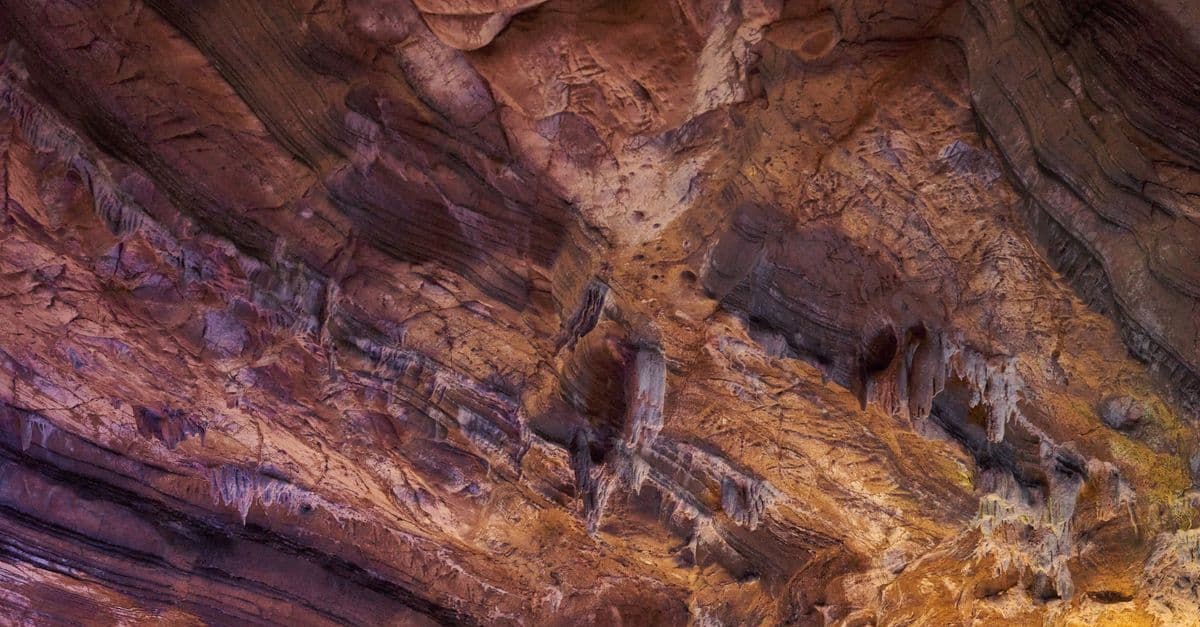
Photo: Diana ✨ / Pexels
The Kola Superdeep Borehole in northwestern Russia reached a true vertical depth of 12,262 meters (about 12.3 kilometers, or 7.6 miles) in 1989, and no scientific hole has gone deeper since. That sounds enormous until you set it beside the planet. Earth's radius is about 6,371 kilometers (3,959 miles), so the deepest hole humans ever drilled for science covers roughly 0.19% of the way to the center. This article explains how Kola was drilled, what it found, why it stopped, and how the deepest holes in the ocean and on land compare.
What the Kola Superdeep Borehole actually was
The Kola Superdeep Borehole, known by its project code SG-3, sits on the Kola Peninsula near the town of Zapolyarny, close to the Norwegian border. Drilling began on May 24, 1970, as a Soviet research program with no commercial goal. Unlike an oil well, SG-3 existed to sample and understand the continental crust, the relatively light outer layer of rock that makes up the landmasses, instead of inferring its structure from surface measurements.
The location was chosen deliberately. The Baltic Shield is one of the oldest pieces of continental crust on Earth, with ancient crystalline rock exposed at the surface. A vertical hole there could sample old rock without first punching through a thick blanket of younger sediment, which makes it an unusually efficient place to read crustal history.
A hole that was really five holes
Kola was not one continuous shaft. A narrow borehole several kilometers deep is prone to drifting off vertical, to unstable walls, and to losing tools when a drill string breaks. Engineers handled this by drilling branches off the main shaft and restarting from a shallower depth when a section failed. A review summarized by ScienceBlog notes that equipment failures, unstable sections, and deviations that required branching were all part of the story.
The timeline below follows the reported depths for the main branches, drawn mainly from the Wikipedia article's chronology, which in turn cites a Russian-language chronology of the project. Where sources disagree, the table says so.
| Date | Milestone |
|---|---|
| May 24, 1970 | Drilling begins |
| June 1979 | Passes the previous world depth record (the 9,583 m Bertha Rogers hole) |
| October 1982 | First branch reaches 11,662 m |
| 1983 | A second branch passes 12,000 m |
| September 1984 | Second branch reaches 12,066 m, then a section of drill string breaks off in the hole |
| 1989 | Third branch reaches 12,262 m, the maximum depth |
| 1991-1992 | Fourth branch, restarted from 9,653 m, stops at 11,882 m |
| 1994 | Fifth branch, restarted from 8,278 m, stops at 8,578 m |
Source: Wikipedia, Kola Superdeep Borehole. Accounts disagree on when the project formally ended: some give 1992, others 1995. That disagreement is a reminder that the story of the project is partly a story of an institution running out of resources.
For scale, if Mount Everest's 8,849-meter (29,032-foot) summit height were measured downward from the surface at Kola, more than 3,400 meters of borehole would still lie below it.
Why 12 kilometers took nineteen years
Deep drilling gets harder faster than it gets deeper. Three physical effects stack up, and a fourth, less physical one decides how long a project survives.
Temperature. Rock heats up with depth, a pattern called the geothermal gradient. Hotter rock is harder on equipment, and drilling fluids, electronics, and seals all degrade as the hole warms.
Pressure. The weight of kilometers of overlying rock compresses everything beneath it. In a deep hole, rock walls can deform inward, so a section that was open when cut may squeeze shut or crumble.
Wear and geometry. Drill bits grind against rock for weeks. Because the drill string, a steel pipe stack, can be many kilometers long, raising it to change a worn bit takes hours, and each trip multiplies the risk of damage.
Money and politics. Kola was a Soviet flagship, and its funding did not survive the end of the Soviet Union. ScienceBlog's summary of the project lists the dissolution of the USSR and funding limits as arriving at the same time as the technical difficulties.
The temperature surprise
Heat is the best-known obstacle at Kola, and the story is more nuanced than the usual retelling. Popular accounts say models predicted about 100 °C (212 °F) at the bottom and the drill found about 180 °C (356 °F). The Wikipedia chronology reports 180 °C at 11,882 meters in 1992, which led the fourth branch to be stopped, and it does not give the predicted figure. The temperature exceeded early expectations either way.
Studies of the borehole's thermal regime, including work by Mottaghy and colleagues, have reported that temperature gradient and heat flow change with depth, which researchers have attributed in part to fluid movement and past climate effects instead of simple steady-state conduction. In plain terms, the deeper crust at Kola was not behaving like a smooth, slowly warming layer cake.
A little arithmetic shows the problem. At 180 °C near 12 kilometers, the average gradient works out to roughly 15 °C per kilometer from the surface, and the real gradient steepened toward the bottom, so the last kilometers were much hotter than the first ones. A drill designed around a gentler curve was suddenly working in a different thermal environment.
Why heat alone is not the whole answer
The temperature story is sometimes told as if one miscalculation ended Kola. The evidence supports something messier. Equipment broke, the hole deviated, rock deformed, and the funding disappeared as the Soviet Union dissolved. Any one of those could have ended a less ambitious project. Together they made restarting at 12 kilometers unrealistic.
What scientists actually learned from Kola
The best argument for deep drilling is that the rock refused to match the predictions. The following table sets expectations against findings.
| Question | Pre-drilling expectation | What the borehole showed |
|---|---|---|
| What changes at the seismic boundary near 7 km? | A transition from granite to basalt | No basalt layer was found; granite-type rock and metamorphic gneiss continued deeper than predicted |
| Is the deep crust dry? | Free water should not exist at great depth | Water was found in fracture zones, and fluids were reported in fractured rock down to about 11 km |
| Is the crust quiet? | Little gas or fluid activity | Drilling mud was described as "boiling" with unexpected hydrogen gas |
| Can life leave traces deep down? | Unclear | Cores from about 6 km down contained fossils of microscopic plankton |
Sources: Wikipedia, Kola Superdeep Borehole and ScienceBlog's summary of the project, which cites Popov et al. (1999) in Tectonophysics, Prokofiev et al. (2020) in Scientific Reports, and a 2026 review in Communications Earth & Environment.
The missing basalt
Before drilling, geophysicists had inferred a boundary between granite-type and basalt-type rock from a change in seismic wave speed, a feature historically called the Conrad discontinuity. Reading rock from seismic data is like guessing what is inside a wrapped parcel by tapping on it and listening: you can tell something changed, but not what.
At Kola, the expected basalt did not appear. The hole passed through about 6,842 meters of Proterozoic volcanic and sedimentary formations before entering Archean gneisses, according to the ScienceBlog summary. Researchers concluded that the seismic contrast reflected changes in how the rock had been altered by heat, pressure, and fracturing, not a switch to a different rock type. That mattered well beyond Russia, because the same assumption had shaped how seismic surveys were interpreted in other old continental shields.
Water, gas, and gold
Water showed up in fracture zones at depths where models had said it should not survive. The ScienceBlog review adds that fluids were found in fracture zones down to roughly 11 kilometers and that gold-bearing mineralization was studied between about 9.5 and 11 kilometers, which suggests deep fluids can move and deposit metals.
The "boiling" mud reported at depth carried large amounts of hydrogen. The source of that hydrogen is debated. The key point for non-specialists is that the deep crust is chemically active. It is not an inert stone slab.
How much of the crust did it cross?
According to the Wikipedia article, the bottom of the hole reached Archean rock and sat about a third of the way through the Baltic Shield's estimated 35-kilometer-thick crust. That puts the achievement in proportion. Kola crossed a respectable fraction of the crust in one place, and still remained far above the boundary with the mantle.
What the hole was like, and what happened to the site
The boreholes were roughly 21 to 23 centimeters (8 to 9 inches) wide, according to accounts of the project, about the width of a dinner plate. That figure surprises people who imagine a tunnel. A hole this narrow and deep is a sampling tool: instruments and cutting tools are lowered on a long string, and cores are brought up in pieces. The ScienceBlog summary reports roughly 4,000 meters of core was recovered, and thermal conductivity was measured on more than 8,000 samples.
Funding ended in the mid-1990s, the operating company was liquidated in 2008, and by August 2012 the borehole was welded shut, according to the Wikipedia article's account of a photograph taken that month. The surface buildings were left to decay.
How Kola compares with other deep holes
"Deepest" is slippery because a hole can be deep in two ways. True vertical depth is the straight-down distance from the surface to the bottom. Measured depth is the length of the path the drill took, including horizontal stretches. Think of a staircase: climbing 10 flights vertically takes you 30 meters up, while walking a long diagonal ramp can cover 100 meters of path and still only gain the same 30.
Oil and gas companies drill deviated wells that run sideways under the sea floor to reach reservoirs from a single platform, so they can set measured-depth records without approaching Kola's vertical depth.
| Hole | Depth | Type of depth | Year | Purpose |
|---|---|---|---|---|
| Kola Superdeep Borehole, Russia | 12,262 m | True vertical depth | 1989 | Science |
| Z-42, Sakhalin-I, Russia | About 12,700 m | Measured depth | 2013 | Oil and gas |
| Z-44 Chayvo, Sakhalin-I, Russia | 12,376 m | Measured depth | 2012 | Oil and gas |
| Odoptu OP-11, Sakhalin-I, Russia | 12,345 m (horizontal reach 11,475 m) | Measured depth | 2011 | Oil and gas |
| BD-04A, Al Shaheen field, Qatar | 12,289 m | Measured depth | 2008 | Oil and gas |
| KTB main hole, Germany | 9,101 m | Depth reached | 1994 | Science |
Sources: Wikipedia, Sakhalin-I, Wikipedia, Al Shaheen Oil Field, Wikipedia, Borehole, and the sources cited above for Kola and KTB. Measured-depth records are marked as such because they are not comparable with a vertical hole.
The German KTB hole
The closest purely scientific comparison is Germany's Continental Deep Drilling Program (KTB, from the German Kontinentales Tiefbohrprogramm), near Windischeschenbach in Bavaria. Its pilot hole reached 4,000 meters in 1989, and the main hole reached 9,101 meters on October 21, 1994. The drill head was designed to withstand 250 to 300 °C, a temperature originally expected at 10 to 14 kilometers depth, and temperatures rose much faster than expected.
KTB's findings echoed Kola's. The rock was not solid and dry; large amounts of fluid and gas entered the borehole, and electrical measurements revealed graphite-rich layers that may let rock slide under pressure. Those results helped lead to the creation of the International Continental Scientific Drilling Program in 1996, according to the Wikipedia article on KTB. Together, the two projects established that the upper crust is far more fluid-filled and active than textbooks of the 1970s assumed.
New deep wells
China began two deep boreholes in July 2023, in the Sichuan and Tarim basins, with planned depths of about 10,520 and 11,100 meters, according to the Wikipedia article on boreholes. Those are targets, not confirmed results, and both are shallower than Kola's depth even if they are completed as planned. They show that the next attempts at ultra-deep vertical drilling are being driven by energy exploration at least as much as by pure science.
The ocean route to the mantle
The mantle is much easier to reach under the sea than under a continent, because oceanic crust is thin. The Mohorovičić discontinuity, usually called the Moho, is the boundary between crust and mantle, identified by an abrupt change in seismic wave speed. Croatian seismologist Andrija Mohorovičić discovered it in 1909. It lies about 5 to 10 kilometers below the ocean floor, and about 20 to 90 kilometers beneath continents, averaging roughly 35 kilometers.
The table below turns those numbers into a rough scoreboard. It divides each hole's depth by the typical thickness of the crust it was drilled through, so it is an illustration, not a measurement of any single site.
| Hole | Depth drilled | Crust thickness used | Share of the way to the Moho |
|---|---|---|---|
| Kola (continental) | 12.3 km | About 35 km (Baltic Shield estimate) | About 35% |
| KTB (continental) | 9.1 km | About 35 km (continental average) | About 26% |
| Deepest JOIDES Resolution hole (oceanic) | 2.1 km | 5 to 10 km below seafloor | About 21% to 42% |
Sources: depths from the sections above; crust thickness from Wikipedia, Mohorovičić discontinuity and the Kola article. The oceanic comparison ignores the several kilometers of water that sit above the seafloor.
Read that way, a two-kilometer hole in the ocean floor has already gone a surprisingly large share of the distance, because oceanic crust is so much thinner than continental crust. That difference explains why the strategy changed after Kola. A hole through 6 kilometers of seafloor rock is a far smaller problem than a hole through 35 kilometers of continent, even though the ocean adds kilometers of water above it. To understand how scientists infer what lies deeper without drilling, see how scientists know what is inside Earth and what is inside Earth.
Project Mohole
The first serious attempt came from the United States. Project Mohole drilled test holes off Guadalupe Island, Mexico, in March and April 1961, in about 3,600 meters of water. The deepest penetration was 183 meters (601 feet) below the seafloor. Congress ended the project in 1966 after cost overruns, management disputes, and the loss of its main political supporter.
The hole was shallow, but the idea survived. Mohole's dynamic positioning method, which kept a ship in place without anchors, made deep-water drilling possible, and the ocean-drilling programs that followed built on it. Using the ship Glomar Challenger from 1968 to 1983, that program produced cores that gave strong evidence for seafloor spreading and supported Alfred Wegener's ideas about moving continents.
From JOIDES Resolution to Chikyu
The successor programs used the drillship JOIDES Resolution, which operated from 1985 until August 2024 under a series of international programs. Its deepest hole penetrated 2,111 meters below the seafloor, a long way short of the Moho. The US National Science Foundation announced in March 2023 that it would stop funding the ship because of rising operating costs, and operations ended in August 2024. Over its career the ship recovered more than 373 kilometers of core in total, according to the Wikipedia article on the vessel.
| Program | Years | Scale |
|---|---|---|
| Deep Sea Drilling Project (Glomar Challenger) | 1968-1983 | 96 expeditions, 624 sites |
| Ocean Drilling Program (JOIDES Resolution) | 1985-2003 | 111 expeditions, 669 sites |
| Integrated Ocean Drilling Program | 2003-2013 | 35 expeditions, 145 sites |
| International Ocean Discovery Program | 2013-2024 | 48 expeditions, 220 sites |
Sources: Wikipedia, Deep Sea Drilling Project and Wikipedia, JOIDES Resolution. The three later programs all used the JOIDES Resolution. The numbers show the other strategy in ocean science: instead of one record-setting hole, hundreds of shallow ones that sample the ocean floor across the globe. For the first program, the Wikipedia article gives 1,741 meters as the deepest penetration beneath the seafloor and 7,044 meters as the deepest water drilled.
The hope of reaching the mantle has shifted toward the Japanese ship Chikyu, which is built for riser drilling, a method that circulates mud up a pipe to the ship and allows deeper holes. Its design goal is roughly 7 kilometers beneath the seabed. On September 21, 2024, during Expedition 405, it set a Guinness record with a drill pipe length of 7,906 meters. That is a pipe length, not a depth below the seafloor, so it is not directly comparable with Kola.
Why deep drilling is still worth the cost
Most of what scientists know about the interior comes from indirect evidence: earthquake waves, gravity, magnetic fields, and laboratory experiments that squeeze rock between diamond anvils. Seismic waves, in particular, travel at speeds that depend on the rock they pass through, which is why how earthquakes work is the foundation for most knowledge of Earth's interior.
Each indirect method is a calculated inference, and an inference needs a ground-truth check. Direct rock samples are that check, in the way a surgeon's look inside confirms what an X-ray suggested. Kola's missing basalt is the best example: the seismic interpretation was reasonable, and it was wrong in an important way.
Drilling also reveals things nobody thought to look for, such as hydrogen-rich fluids and mineralizing waters at 10 kilometers. The same logic applies to ancient rock, because the crust at Kola also holds clues to early history, something geologists address with methods for measuring the age of Earth.
Common misconceptions
"Kola brought us close to the mantle." It did not. The hole stayed inside the crust, about a third of the way through the local crustal thickness. No drilling project has yet reached the mantle.
"Heat was the only reason it stopped." Heat was a major technical wall, but equipment failures, rock deformation, and the end of Soviet funding all contributed.
"Longer oil wells are deeper." Extended-reach wells have greater measured length because they run sideways. Kola remains the deepest vertical hole.
"The hole is a tunnel you could walk down." At roughly 21 to 23 centimeters wide, it was a dinner-plate-sized sampling hole, not a shaft.
"Deeper automatically means more valuable." Kola's payoff came from findings that contradicted models, not from the depth figure itself. A modest hole in the right place can teach more than a record in the wrong one.
Readers curious about other extremes beneath the surface can compare Kola with the deepest caves on Earth, which are natural voids rather than drilled holes, or with the most extreme pressure conditions on Earth. For an ocean counterpart to Kola's depth, see the deepest places in the ocean.
The takeaway
The Kola Superdeep Borehole is remembered for a number, 12,262 meters, but its real legacy is a set of surprises. There was no basalt layer where seismic data implied one, water and hydrogen at depths where textbooks said they should not exist, and a thermal profile that did not follow the models. Heat, wear, and money together explain why the number has stood for more than three decades. The lesson is not that drilling is hopeless. It is that the crust is a working system, and the only reliable way to learn how it behaves is to go and look, in places where the odds of reaching the mantle are best, which today means the thin crust under the ocean.
FAQ
Q: How deep is the deepest hole ever drilled for science? A: The Kola Superdeep Borehole reached 12,262 meters (40,230 feet, or about 7.6 miles) of true vertical depth in 1989. Reports vary on when the project formally ended, from 1992 to 1995. It remains the deepest vertical borehole ever attempted, according to a 2026 review cited by ScienceBlog.
Q: Why did drilling stop at Kola? A: Several things combined. Temperatures near the bottom were reported at around 180 °C (356 °F), hotter than expected, the rock deformed, equipment broke, and funding dried up as the Soviet Union dissolved. Accounts differ on how much weight to give each factor, and the heat figure appears in the record at 11,882 meters in a later branch.
Q: Did the Kola borehole reach the mantle? A: No. It stayed within the crust, about a third of the way through the Baltic Shield's estimated 35-kilometer crustal thickness. The Moho lies about 5 to 10 kilometers below the ocean floor and 20 to 90 kilometers beneath continents, and no drilling has yet penetrated it.
Q: What did scientists find in the Kola samples? A: The expected basalt layer was missing, with granite-type rock and gneiss continuing deeper than predicted. Water was found in fracture zones, drilling mud was described as "boiling" with hydrogen, and cores from about 6 kilometers down held fossils of microscopic plankton.
Q: Are there oil wells longer than Kola? A: Yes, in measured length. The Z-44 Chayvo well at Sakhalin-I reached 12,376 meters in 2012, and a later Sakhalin well, Z-42, was reported at about 12.7 kilometers in 2013. Those wells run sideways under the seabed, so their vertical depth is far less than Kola's.
Q: How wide was the Kola borehole? A: Accounts give about 21 to 23 centimeters (8 to 9 inches), roughly the width of a dinner plate. It was a sampling hole, not a passage anyone could enter.
Q: What is the deepest ocean drilling achievement? A: The deepest hole drilled by the JOIDES Resolution program reached 2,111 meters below the seafloor. On September 21, 2024, the Japanese ship Chikyu set a Guinness record with 7,906 meters of drill pipe during Expedition 405, a pipe length that is not a depth below the seafloor.
Sources
- Wikipedia, Kola Superdeep Borehole, which cites Yakovlev et al. (2014), Lobanov et al. (2021), and Bodén and Eriksson (1988)
- ScienceBlog, Kola Superdeep Borehole: deepest vertical hole, citing Popov et al. (1999), Prokofiev et al. (2020), and a 2026 review in Communications Earth & Environment
- Wikipedia, Kontinentales Tiefbohrprogramm der Bundesrepublik Deutschland, citing Emmermann and Lauterjung (1997) in Journal of Geophysical Research
- Wikipedia, Project Mohole, citing the National Academy of Sciences
- Wikipedia, JOIDES Resolution and Chikyu Hakken
- Wikipedia, Sakhalin-I and Al Shaheen Oil Field
- Wikipedia, Mohorovičić discontinuity
- Wikipedia, Deep Sea Drilling Project
Read next:
Follow new articles
Add SciHub101 to your feed reader to see new science and technology stories.
About the Author
SciHub101 is an independent science and technology publication founded and edited by Buğra Sözeri, a software engineer and app developer based in Türkiye. AI tools assist with drafting and research. Source documentation in the existing archive is uneven, and articles are being reviewed and corrected. The Editorial Team byline identifies editorial responsibility; it does not certify specialist or independent human review. Where we compare products, anything built by our own team is labelled as such — see the editorial guidelines and About page for how corrections and disclosures work.
Related Articles
How Scientists Know What Is Inside Earth
No one has drilled to Earth's core. Scientists infer the interior from seismic waves, density, magnetism, meteorites, and high-pressure experiments.
What If Radioactive Decay Stopped?
Radioactive decay provides Earth's internal heat, drives plate tectonics, and powers the magnetic field. If it stopped, Earth would cool, tectonics would cease, the magnetic field would die, and life would face increased radiation. Over billions of years, Earth would become a cold, geologically dead world.