Why the Ocean Is Still Mostly Unexplored
Photo: Жанна Алимкулова / Pexels
Explorers have directly observed less than 0.001% of the deep ocean floor, an area roughly the size of Rhode Island, even though the ocean covers 71% of Earth's surface (NOAA Ocean Exploration). Meanwhile, about 28.7% of the seafloor has been mapped in coarse bathymetric detail as of 2026, according to the international Seabed 2030 project (International Hydrographic Organization, 2026). Those two numbers, mapped shape versus actually seen, explain almost everything about why the ocean still feels unknown a century after humans first reached the seafloor.
Two different meanings of "explored"
Bathymetric mapping — using sound waves to measure the depth and shape of the seafloor from a ship or satellite, producing a 3D outline without ever showing what is actually down there. This is the number that gets headlines: as of early 2026, the Seabed 2030 project reported 28.7% of the global ocean floor mapped to modern standards, up from 6% when the project launched in 2017 (Seabed 2030 / Nippon Foundation-GEBCO, 2026). That is meaningful progress, roughly 104 million square kilometers of seafloor now has a known outline.
But an outline is not a photograph. A sonar map tells you a ridge is there and how tall it is; it does not tell you what animals live on it, what the rock is made of, or whether a shipwreck or a hydrothermal vent sits at its base. That second kind of exploration, actually sending a camera, submersible, or remotely operated vehicle down to look, is what NOAA measures separately, and it is where the 0.001% figure comes from (NOAA Ocean Exploration, "How much of the ocean has been explored?").
The confusion between these two numbers is why you will see wildly different claims about ocean exploration in casual conversation. Someone citing "we've mapped a quarter of the seafloor" and someone citing "we've barely seen any of it" are both correct; they are answering different questions. A useful analogy: sonar mapping is like using radar to trace the outline of every building in a city from an airplane. You know where the walls are and how tall they stand, but you have no idea what is inside any single room, whether it's furnished, or who lives there.
Why the ocean is physically harder to survey than space
It sounds backward that we have higher-resolution maps of the Moon and Mars than of our own seafloor, but the physics explains why. Radio waves and light, the signals spacecraft cameras and radar depend on, travel through the vacuum of space with almost no loss. Sunlight reaches Mars just fine across 225 million kilometers (140 million miles) of empty space. Water does the opposite: it absorbs both light and radio signals within meters, not millions of kilometers.
Sunlight fades to darkness by about 1,000 meters (3,280 feet) down, a boundary oceanographers call the aphotic zone. Below that, cameras need their own light source, and that light only illuminates a few meters in any direction, meaning a submersible can pass directly over a hydrothermal vent field or a shipwreck and never see it unless its search path happens to cross exactly the right few meters. Radio waves fare even worse, useless underwater beyond a few meters, which is why submarines and underwater vehicles rely on sound instead of radio to communicate and to map, and sound travels far slower and less precisely than light does through vacuum.
This is the core reason satellite-based Earth mapping cannot simply substitute for ocean exploration the way it has for land and space. Satellites can estimate the rough shape of the seafloor by measuring tiny variations in sea-surface height caused by the gravitational pull of undersea mountains, a technique NASA's SWOT satellite mission uses to refine global bathymetry from orbit (NASA Jet Propulsion Laboratory, 2023). But that method only reveals large features, ridges and seamounts kilometers across. It cannot resolve a trench wall, a coral reef, or a debris field the way a ship-mounted sonar or a submersible camera can, because the ocean's water column sits between the satellite and the seafloor, scattering and absorbing the very signals a space-facing telescope depends on.
Why can't satellites just photograph the ocean floor the way they photograph land?
Satellites capture land and the Moon's surface directly because light and radar reflect off exposed rock and soil. Water absorbs and scatters both light and radar within meters of the surface, so satellites can only infer the seafloor's rough shape indirectly, through gravity measurements of sea-surface bulges, not see it the way they see dry land (NASA JPL, 2023).
What it actually costs to map and explore the seafloor
Space exploration is expensive per mission but cheap per square kilometer, because a single telescope or orbiter can image enormous areas at once. Ocean mapping is the reverse: covering the seafloor requires physically dragging a sensor across every square kilometer, one slow pass at a time. A ship towing a multibeam sonar system, the standard tool for modern bathymetric mapping, typically travels at around 3 knots (5.6 km/h or 3.5 mph) while surveying, and its sonar swath only covers a corridor two to five times the water depth on either side of the ship (NOAA Ocean Exploration, "Multibeam Sonar"). In water 4,000 meters (13,100 feet) deep, that means one ship can realistically cover perhaps a few hundred square kilometers per day, when weather, equipment, and transit time cooperate.
Multiply that pace against an ocean floor of roughly 361 million square kilometers, and the scale of the problem becomes obvious: even running dozens of survey ships simultaneously for years, as Seabed 2030 has coordinated since 2017 by pooling data from research institutions, navies, and commercial shipping worldwide, closing the remaining coverage gap is a decade-plus undertaking (Seabed 2030 Project, 2026). Ship time itself is the bottleneck. Research vessels cost tens of thousands of dollars per day to operate, crew, and fuel, and there are only so many purpose-built oceanographic ships in the world at any given time, most of which are already booked years in advance for competing scientific priorities beyond mapping.
Visual exploration is slower and costlier still, because it requires a vehicle capable of surviving the pressure at depth. Below about 6,000 meters (19,700 feet), pressure exceeds 600 times sea-level atmospheric pressure, a load that only a handful of crewed and uncrewed vehicles worldwide are engineered to survive. Building, testing, and operating one of those vehicles, whether a remotely operated vehicle tethered to a support ship or a human-occupied submersible, runs into the tens of millions of dollars, which is a major reason a research fleet can map broad seafloor shape far faster than it can put cameras and sample-collection arms in front of any single feature. For a closer look at what pressure alone does to a vehicle at extreme depth, see the physics of what happens at Challenger Deep.
The moving-target problem: an ocean that won't hold still
Space objects, once mapped, mostly stay mapped. A crater on the Moon looks the same in 2026 as it did in 1969. The seafloor does not have that luxury. Sediment shifts with currents, underwater landslides bury features and expose new ones, hydrothermal vents can go dormant or ignite in a matter of months, and marine life constantly recolonizes disturbed areas. A map made in 2015 can be measurably wrong by 2026 in an active region, not because the original survey was sloppy, but because the seafloor itself changed underneath it.
This constant churn means ocean mapping is never really "finished" the way a static object can be. Seabed 2030's stated goal is a complete baseline map by 2030, but that baseline will start aging the moment it is published, requiring repeat surveys in geologically and biologically active zones, particularly near subduction trenches, mid-ocean ridges, and river deltas where sediment moves fastest. Compare that to Mars, whose surface features, aside from dust storms and occasional impacts, have looked essentially the same for the entire span of human observation.
Ocean currents complicate direct exploration too. A submersible or ROV (remotely operated vehicle) descending 4,000 meters (13,100 feet) does not fall straight down; deep currents push it sideways along the way, meaning operators have to constantly correct course just to reach the intended survey site, let alone hold position long enough to photograph or sample it. Combine drift with near-zero visibility and total darkness, and even a well-funded expedition can spend the majority of its dive time navigating rather than observing.
What is actually being found as coverage improves
The gains are not evenly distributed. Coastal and heavily trafficked shipping corridors are mapped in far more detail than the remote Southern Ocean or the deep central Pacific, simply because more vessels cross the former routinely and record depth data as they go. Seabed 2030 has leaned into this by encouraging "crowdsourced bathymetry," pulling in echo-sounder data that commercial ships, fishing vessels, and yachts already collect for navigation, rather than relying solely on dedicated research cruises (Seabed 2030 Project, Nippon Foundation-GEBCO).
Even at coarse resolution, new mapping regularly turns up features nobody knew existed. Seamounts, undersea volcanoes rising from the seafloor, are routinely discovered by sonar surveys that were not specifically looking for them; researchers have estimated that tens of thousands of seamounts taller than 1,000 meters (3,280 feet) remain entirely unmapped worldwide, based on the gap between predicted seamount density and confirmed detections (Seabed 2030 Project data releases). Each newly mapped seamount is a potential hotspot for unique marine ecosystems, since these isolated undersea peaks often support species communities found nowhere else, a pattern well documented at examined seamounts elsewhere in the Pacific.
This is where the two kinds of exploration connect. A sonar survey can flag "there's something 2,000 meters tall here that shouldn't be there," but confirming what it actually is, extinct volcano, shipwreck, coral colony, still requires sending a camera. That handoff, from broad sonar sweep to targeted visual follow-up, is how ocean science actually narrows its search, and it is the same logic that guided the discoveries described in the world's deepest ocean trenches.
Common misconceptions about ocean exploration
A few claims about the ocean circulate constantly online without much scrutiny. Separating the accurate ones from the exaggerated ones matters, because both understating and overstating how little we know weakens the case for actually funding more surveys.
- "We know more about the Moon than the ocean floor" is broadly true for visual detail, misleading as a blanket statement. The Moon's surface has been photographed at high resolution essentially in full; the ocean floor has been sonar-mapped at coarse resolution to about 29% and visually surveyed at a small fraction of that (NOAA Ocean Exploration; Seabed 2030, 2026). The comparison holds for direct imaging, not for basic shape data, where ocean coverage is actually growing faster in recent years than lunar surface mapping has in decades.
- "The ocean is unexplored because nobody has tried" is false. Seabed 2030 alone represents a coordinated effort spanning more than 100 organizations across government, industry, and academia since 2017, and NOAA Ocean Exploration has run dedicated mapping and ROV expeditions for decades. The bottleneck is physics and cost, not lack of interest, in the same way that a lack of full Antarctic interior surveys before satellite radar was never about scientific apathy.
- "Once it's mapped, it's mapped for good" ignores sediment movement, landslides, and volcanic activity that can meaningfully alter seafloor features within a matter of years, particularly near tectonically active trenches and ridges.
- "Deep-sea exploration is only about curiosity, with no practical stakes" undersells the case. Seafloor maps are directly used for tsunami-hazard modeling, submarine cable routing, fisheries management, and identifying mineral and biological resources, meaning gaps in coverage translate into real gaps in hazard prediction and resource planning, not just missed trivia.
How fast new deep-sea life is being found
Every visual survey that does reach the deep seafloor tends to turn up species nobody has cataloged before, which is itself evidence of how little direct observation has actually happened. The Ocean Census initiative, a collaboration led by the Nippon Foundation and Nekton that pools taxonomists from research institutions worldwide, reported 1,121 newly described marine species between April 2025 and March 2026 alone, a 54% jump over the previous year's tally, discovered across 13 expeditions and nine dedicated species-identification workshops (Ocean Census, 2026). The finds ranged from ghost sharks to symbiotic worms and previously unknown crustaceans, some collected at depths beyond 6 kilometers (3.7 miles). Ocean Census puts the scale of what remains unknown starkly: an estimated 90% of ocean life has never been formally described (Ocean Census, 2026).
That discovery rate traces directly back to the hydrothermal vent finding that reshaped biology's assumptions about where life can exist. In February 1977, geologists diving in the submersible Alvin on the Galápagos Rift, roughly 2,500 meters (8,200 feet) down, expected to find only warm water seeping through young volcanic rock. Instead they found dense clusters of clams, mussels, and crabs clustered around shimmering vent water, an ecosystem with no apparent connection to sunlight (Woods Hole Oceanographic Institution, "The Discovery of Hydrothermal Vents"). Follow-up analysis showed the food web ran on chemosynthesis, bacteria oxidizing sulfur compounds from the vent fluid to build organic matter, rather than photosynthesis (Corliss et al., 1979, Science). It was the first large ecosystem known to run entirely on chemical energy from inside the planet, and it remains a touchstone for astrobiologists modeling where life might survive on ice-covered moons like Europa or Enceladus, environments that share the vent floor's total darkness and chemical energy source.
Closing the gap between coarse sonar mapping and this kind of species-level discovery is increasingly the job of autonomous underwater vehicles (AUVs) rather than crewed submersibles alone. NOAA's Office of Coast Survey now runs midsized AUVs like the REMUS 600, fitted with multibeam sonar, to collect high-resolution bathymetry in water too deep or too remote for efficient ship-based surveying, particularly for habitat mapping, coral assessment, and marine archaeology (NOAA Ocean Exploration, "Autonomous Underwater Vehicles"). A newer vehicle called Orpheus, developed with support from NOAA Ocean Exploration, the Bureau of Ocean Energy Management, and the US Geological Survey, has been tested at depths up to 11,000 meters (6.8 miles) near the Mariana Trench, imaging manganese-nodule fields on the ultra-deep seafloor without a human crew or a full-sized research ship overhead (NOAA Ocean Exploration, "Orpheus Update," 2025). Because AUVs operate untethered and can run pre-programmed survey grids for hours without a ship holding position above them, they let the same research fleet cover more seafloor per expedition day than towed or crewed systems alone, one of the few genuine efficiency gains available against a problem that is otherwise limited by the raw physics of water.
Why it matters beyond curiosity
Complete seafloor maps feed directly into tsunami early-warning models, because the shape of the seafloor near a subduction zone determines how a wave will behave as it approaches shore. Submarine telecommunications cables, which carry the overwhelming majority of international internet traffic, are routed around seafloor hazards identified through bathymetric surveys; a cable laid across an unmapped landslide zone is a cable at elevated risk of being severed. Fisheries scientists use seafloor habitat maps to identify and protect deep-sea coral and sponge grounds that take centuries to grow back if damaged by bottom trawling.
There is also a climate dimension. The deep ocean absorbs and stores an enormous share of the excess heat and carbon dioxide produced by human activity, and understanding how deep currents move that heat and carbon around depends partly on knowing the seafloor terrain that shapes those currents. Gaps in bathymetric coverage translate directly into uncertainty in ocean-circulation models used for climate projections, a connection explored further in how climate change is already reshaping daily life.
The takeaway
The ocean is not unexplored because nobody has looked; it is unexplored because water blocks the very signals, light and radio, that made rapid mapping of space and land possible, forcing every square kilometer of seafloor to be measured the slow way, one sonar pass or one camera dive at a time. Coarse mapping has made real, measurable progress, climbing from 6% coverage in 2017 to 28.7% by 2026 through the Seabed 2030 collaboration, but actually seeing the seafloor with a camera remains a project measured in fractions of a percent. Closing that second gap, not the mapping gap, is the harder and more expensive problem, and it is the one that determines how much of the deep ocean's biology, geology, and history we will actually get to see rather than just outline.
Read next:
- The Deepest Points in the Ocean
- How Climate Change Is Affecting Your Daily Life
- Countries With the Largest Ocean Territory (EEZ)
Frequently Asked Questions
Q: How much of the ocean has actually been explored? A: Less than 0.001% of the deep seafloor has been visually surveyed by cameras or submersibles, an area roughly the size of Rhode Island, even though about 28.7% of the global seafloor has been mapped in coarse sonar-based bathymetric detail as of 2026 (NOAA Ocean Exploration; Seabed 2030 Project).
Q: Why do we have better maps of the Moon than of the ocean floor? A: Light and radio signals travel through the vacuum of space with almost no loss, letting satellites photograph the Moon's surface directly, while water absorbs both light and radio within meters, forcing ocean mapping to rely on slower sound-based sonar carried by ships sailing one narrow corridor at a time (NASA JPL, 2023; NOAA Ocean Exploration).
Q: What is Seabed 2030? A: Seabed 2030 is an international collaboration among government agencies, research institutions, and industry, coordinated by the Nippon Foundation and GEBCO, aiming to produce a complete high-resolution map of the world's ocean floor; it reported 28.7% global coverage as of 2026, up from 6% when the project began in 2017 (Seabed 2030 Project; International Hydrographic Organization, 2026).
Q: Why is deep-sea exploration so expensive compared to space exploration? A: A single spacecraft can image vast areas of a planet's surface from orbit in one pass, while ocean mapping requires physically dragging a sonar sensor across the seafloor at ship speed, roughly 3 knots (5.6 km/h), covering only a narrow swath at a time, and visual exploration additionally requires pressure-rated vehicles costing tens of millions of dollars to build and operate (NOAA Ocean Exploration).
Q: Does the seafloor change over time, making old maps outdated? A: Yes. Sediment movement, underwater landslides, and volcanic and hydrothermal activity can visibly alter seafloor features within years, particularly near tectonic plate boundaries, meaning bathymetric maps require periodic resurveying in geologically active regions rather than being a one-time task.
Q: Why does more complete ocean mapping matter beyond scientific curiosity? A: Seafloor maps directly support tsunami early-warning modeling, the routing of submarine internet cables away from hazards, fisheries habitat protection, and the ocean-circulation models used in climate projections, so gaps in coverage translate into real gaps in hazard prediction and climate understanding.
Follow new articles
Add SciHub101 to your feed reader to see new science and technology stories.
About the Author
SciHub101 is an independent science and technology publication founded and edited by Buğra Sözeri, a software engineer and app developer based in Türkiye. AI tools assist with drafting and research. Source documentation in the existing archive is uneven, and articles are being reviewed and corrected. The Editorial Team byline identifies editorial responsibility; it does not certify specialist or independent human review. Where we compare products, anything built by our own team is labelled as such — see the editorial guidelines and About page for how corrections and disclosures work.
Related Articles
Why Time Moves Slower Near Gravity
Time moves slower near gravity because mass curves spacetime, and general relativity says clocks deeper in that curvature tick at a measurably slower rate.
How Scientists Predict Volcanic Eruptions
Volcano prediction uses earthquakes, gas, ground deformation, heat, and history. This guide explains what scientists can forecast and what remains uncertain.
Ocean Science: How Oceans Work Explained
How oceans work: depth zones, the conveyor-belt circulation, acidification, hydrothermal vents, tides, and plastics, with figures from NOAA and the IPCC.
The Most Extreme Pressure Conditions on Earth and Beyond
At the Challenger Deep, pressure reaches 1,086 bar — crushing enough to compress foam to thimble size. But Earth's extremes pale compared to the pressures inside neutron stars, where one teaspoon of matter weighs as much as Mount Everest. This guide explains the physics of pressure across the universe, from laboratory breakthroughs to the conditions that forge new elements.
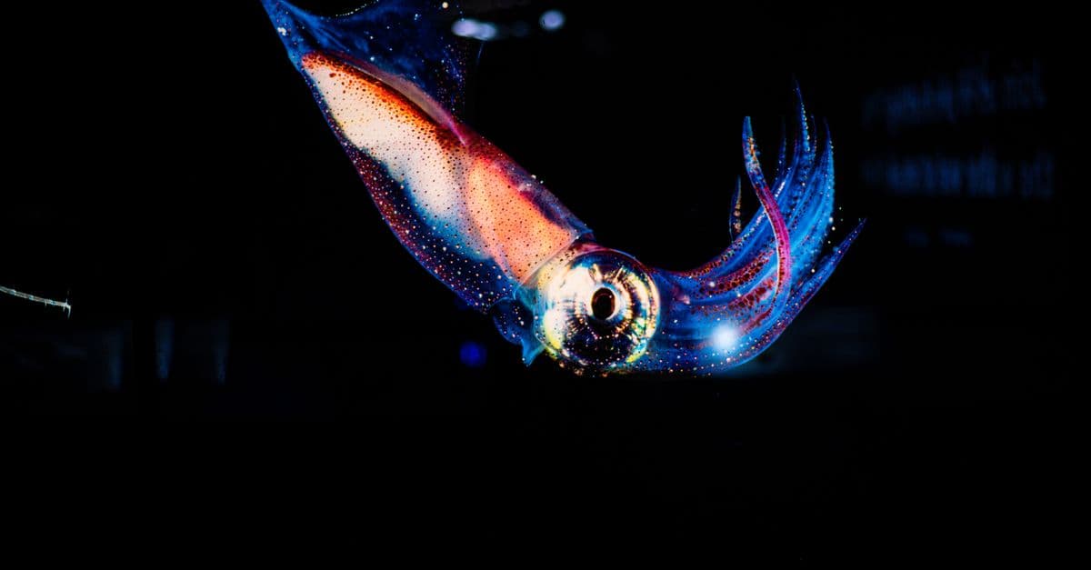
How Bioluminescence Works in Animals: The Chemistry of Living Light
More than 76% of deep-sea animals produce their own light. Fireflies flash in coordinated sequences. A jellyfish discovered off the coast of Friday Harbor, Washington, gave biologists a tool that transformed cell biology, earned three scientists a Nobel Prize, and now glows inside cancer cells in laboratories around the world. Bioluminescence — light produced by a living organism — is one of evolution's most useful accidents, and its chemistry is surprisingly simple.
The Most Extreme Organisms: Extremophiles and the Limits of Life
Tardigrades — eight-legged microscopic animals roughly half a millimeter long — have survived exposure to the vacuum of outer space, temperatures from -272°C to 150°C, pressures six times the deepest ocean trench, and radiation doses 1,000 times the lethal threshold for humans. They accomplish this not by being indestructible, but by entering a state of suspended animation called cryptobiosis that effectively stops time in their cells. The study of these organisms has redrawn the boundary of where life can exist — and raised serious questions about what might be alive elsewhere in the solar system.