Countries With the Most Islands (2025)
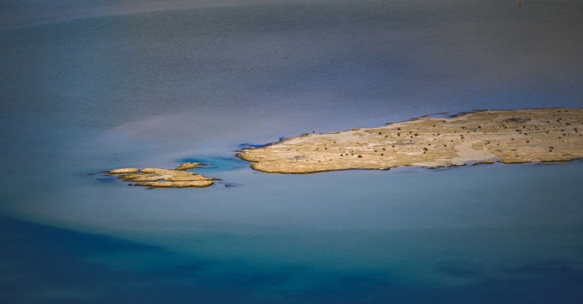
Photo: Francesco Ungaro / Pexels
The country with the most islands is not a tropical paradise. By official count it is Sweden, with 267,570 islands recorded by Statistics Sweden, followed by Norway with about 239,000 and Finland with about 198,000, according to compilations of national figures. Indonesia, the country most people guess first, has roughly 17,500, and the Philippines has 7,641.
This article ranks the countries with the most islands, explains why cold, glaciated coasts beat the tropics by a factor of ten or more, and shows why every island count comes with an asterisk. In 2023, Japan more than doubled its own total overnight without gaining an inch of land.
Key takeaways
- Sweden (267,570 islands in 2013), Norway (about 239,000), and Finland (about 198,000) hold the top three places, in large part because ice sheets scoured their bedrock into thousands of fragments and because their counts include very small features.
- Counts depend on the smallest feature that qualifies. Sweden's count includes islands as small as 9 square meters, and Japan's counts only land with a circumference of at least 100 meters.
- Japan's official total rose from 6,852 (1987 survey) to 14,125 (2023 recount) because of better maps, not new land.
- Indonesia's government agencies disagree among themselves, with totals from 17,499 to 17,508, and only 13,466 islands had names in the national gazetteer as of a 2017 paper.
- Islands are not permanent. Surtsey, off Iceland, appeared in 1963, and most of Hunga Tonga-Hunga Ha'apai was destroyed in January 2022.
Which countries have the most islands?
The ranking below uses the highest reliably sourced figure for each country and notes how it was counted. Treat the numbers as orders of magnitude rather than exact tallies, for reasons the next section explains. Where I could trace a figure to a national agency or a peer-reviewed paper, the source is named. Where a figure appears in compilations without a primary source, the table says so.
| Rank | Country | Islands | Source and year | How it was counted |
|---|---|---|---|---|
| 1 | Sweden | 267,570 | Statistics Sweden, 31 December 2013 | Land fully enclosed by water on a 1:10,000 national water map; smallest island 9 m² |
| 2 | Norway | about 239,000 | Kartverket (Norwegian Mapping Authority), as reported in secondary sources | Islands larger than 10 m² |
| 3 | Finland | 198,146 | Wikipedia compilation; primary Finnish source not located | About 81% (161,241) are smaller than 0.5 hectares |
| 4 | Canada | 52,455 | Widely cited total; primary source not located | No threshold stated |
| 5 | Chile | 43,471 | Instituto Geográfico Militar (1998) and Bienes Nacionales (2019), via a Wikipedia compilation | Thresholds of 3,000 m² and 9,000 m² are cited for different size classes |
| 6 | Indonesia | 17,499 to 17,508 | Four national agencies, per a 2017 paper | Disagree on tidal features and reefs |
| 7 | Japan | 14,125 | Geospatial Information Authority of Japan, 2023 | Circumference of at least 100 m |
| 8 | Australia | 8,222 | Wikipedia compilation | No threshold stated |
| 9 | Philippines | 7,641 | NAMRIA, via compilations | Some sources call it provisional |
| 10 | China | 7,226 | Kong (2016), via a Wikipedia compilation | Only features over 500 m² |
Sources: Statistics Sweden, "Number of islands in Sweden by region and size class, 2013"; Wikipedia, List of countries by number of islands, which marks itself incomplete as of June 2025; Sukendra-Martha 2017, Indonesian Journal of Geography; Explorersweb on Japan's 2023 recount.
The United States, the United Kingdom (6,346 by one Ordnance Survey-based count), and Greece (between 1,200 and 6,000, depending on criteria) follow in most compilations. The Greek spread alone, a factor of five between the low and high estimates, shows how much definitions matter.
The number worth remembering: Japan's government counted 6,852 islands in 1987 and 14,125 in 2023, using the same 100-meter circumference rule both times. The difference came entirely from using digital maps and aerial photographs instead of paper maps.
How do you count an island?
You need three decisions before you can count anything, and countries make them differently. The first is a legal definition. The United Nations Convention on the Law of the Sea, Article 121, says an island is "a naturally formed area of land, surrounded by water, which is above water at high tide." That excludes artificial land and features that are submerged at high tide. It also leaves the size question open.
The second decision is a minimum size. Sweden's count includes islands as small as 9 square meters, according to Statistics Sweden. Norway's mapping authority treats features larger than 10 square meters as islands, according to secondary reporting. Japan requires a circumference of at least 100 meters. China's counts include only features over 500 square meters. A country that counts a boulder-sized rock and one that ignores anything smaller than a tennis court will not produce comparable totals.
The third decision is the map. Counting islands from a map is like counting pebbles on a beach from a photograph: the answer depends on the resolution of the photo. Japan's 1987 survey relied on people examining paper maps, an approach that reports of the 2023 recount describe as prone to significant error. The Geospatial Information Authority of Japan (GSI) redid the count with digital mapping cross-checked against aerial photographs and arrived at 14,125, which is 7,273 more than before.
Why does the same problem affect coastlines?
Island counts share a problem with coastline lengths, a puzzle known as the coastline paradox. The measured length of a ragged coast grows as the measuring stick shrinks, because a shorter ruler follows more bays and headlands. Islands behave the same way: lower the size threshold and the number explodes, because small features vastly outnumber large ones. For a ranking of coastline length that wrestles with the same issue, see Countries With the Longest Coastlines, Ranked and Explained.
Why do Indonesia's agencies disagree?
A 2017 paper in the Indonesian Journal of Geography by Sukendra-Martha, writing from the national Geospatial Information Agency, laid out the problem. The Armed Forces survey center reported 17,508 islands, the Geospatial Information Agency 17,506 (after Sipadan and Ligitan left Indonesian control), the Ministry of Internal Affairs 17,504 (a figure the paper says was widely cited but not backed by documents), and the Navy's hydrographic office 17,499. Only 13,466 islands appeared with names in the national gazetteer. The author recommended high-resolution satellite imagery as the most reliable way to settle the question.
None of those figures is wrong in the sense of being careless. They reflect different treatment of tidal features, reefs that surface only at low tide, and features that merge or split with the tide.
Does a rock count as an island?
Legally it does, but the consequences differ. Article 121 of the UN Convention on the Law of the Sea says that "rocks which cannot sustain human habitation or economic life of their own shall have no exclusive economic zone or continental shelf." That clause matters because an island that qualifies for a full maritime zone can anchor claims to a large area of sea. Disputes over whether specific features are islands or rocks have been a recurring problem in maritime law.
Why do cold countries have the most islands?
The most island-rich coasts on Earth were all buried under ice sheets during the last glacial period. Ice up to about 3,000 meters thick sat on Scandinavia, according to NASA's Earth Observatory, and pressed the crust down by more than 500 meters. Flowing ice scraped, plucked, and scoured the bedrock, carving valleys that later filled with seawater and leaving the high ground between them as islands.
Think of pressing a thumb into a block of clay and then pulling it away. The clay slowly rebounds, and anything poking through the surface of a surrounding puddle of water becomes a new island. Geologists call this rebound glacial isostatic adjustment, and it is still going on. A skerry (from Old Norse sker, a small rocky island) is typically a bare rock, too small for houses. According to Wikipedia's summary of the geology, skerries are common along glaciated coastlines, including those of Norway, Sweden, Finland, the Scottish Hebrides, and the US Inside Passage.
How fast is the land still rising?
In the Gulf of Bothnia, between Sweden and Finland, the land rises roughly 8 to 9 millimeters per year. The Kvarken Archipelago and High Coast World Heritage site describes the figure as about 9 millimeters per year of levelled land uplift, measured against the zero level of the national height systems. Because sea level is rising at the same time, the change a person standing on the shore would notice is closer to 6 millimeters per year.
NASA reports that roughly 700 hectares of new land emerge from the sea along the Gulf of Bothnia each year, and that the Kvarken Archipelago holds approximately 5,600 islands and about 2,400 kilometers of shoreline. The land there has risen at least 286 meters since the ice left, and the crust still has about 100 meters of rebound to go, which will take several thousand years.
| Rebound fact | Value | Source |
|---|---|---|
| Ice thickness over Scandinavia at maximum | up to about 3,000 m | NASA Earth Observatory |
| Crust depression under the ice | more than 500 m | NASA Earth Observatory |
| Present uplift in the Kvarken area | about 8 to 9 mm per year | Kvarken Archipelago World Heritage site |
| New land along the Gulf of Bothnia | about 700 hectares per year | NASA Earth Observatory |
| Uplift still to come | about 100 m | NASA Earth Observatory |
Sources: NASA Earth Observatory, Uplift Underway in Finland's Kvarken Archipelago (page updated January 31, 2026); High Coast / Kvarken Archipelago, Land uplift and the sea.
When the ice began to melt about 10,500 years ago, according to the High Coast site, uplift ran at more than 10 centimeters per year. The slowdown to today's 9 millimeters per year is the signature of a recovery that began fast and is trailing off. The result is a coastline that changes on human timescales: shallow bays turn into meadows, and rocks that were underwater in a grandparent's lifetime now break the surface.
What does Sweden's archipelago look like?
Sweden's 267,570 islands are a count of every piece of land fully enclosed by water on the national 1:10,000 water map, down to 9 square meters. That inclusive rule is the main reason Sweden tops the list. Statistics Sweden notes that the count is only as detailed as the map, and that artificial islands, such as those in ponds or moat-enclosed castles, are included. The definition covers land surrounded by water, including lakes and large watercourses.
That last point matters. The Swedish total is not a count of coastal skerries alone: it includes islands in lakes and rivers, so people who imagine a quarter-million rocks in the Baltic are picturing only part of the geography.
Finland's situation is similar and more uncertain. Compilations list 198,146 islands, and a reported breakdown says that 161,241 of them, about 81%, are under half a hectare. I could not trace the figure to a Finnish government publication, so treat it as approximate. The Åland archipelago, an autonomous region between Finland and Sweden, is usually described as having about 6,500 islands and skerries, a figure that itself has been questioned, a reminder of how much a definition can shift a count.
Why are Canada's islands so different?
Canada ranks fourth by count, but its islands are on a different scale from the Scandinavian skerries. The Canadian Arctic Archipelago holds tens of thousands of islands, most of them small. Three of Canada's islands rank among the ten largest in the world: Baffin Island, Victoria Island, and Ellesmere Island.
| Rank among islands | Island | Area (km²) | Country |
|---|---|---|---|
| 1 | Greenland | about 2,108,000 | Denmark (Danish Realm) |
| 2 | New Guinea | about 774,000 | Indonesia and Papua New Guinea |
| 3 | Borneo | about 723,000 | Brunei, Indonesia, and Malaysia |
| 4 | Madagascar | about 593,000 | Madagascar |
| 5 | Baffin Island | about 507,000 | Canada |
| 6 | Sumatra | about 428,000 | Indonesia |
| 7 | Honshu | about 228,000 | Japan |
| 8 | Victoria Island | about 219,000 | Canada |
| 9 | Great Britain | about 219,000 | United Kingdom |
| 10 | Ellesmere Island | about 198,000 | Canada |
Source: Wikipedia, List of islands by area, rounded to the nearest thousand square kilometers. Other references give slightly different areas, for example about 743,000 km² for Borneo, because of different measurement methods and coastline definitions.
Mainland Australia, at about 7.6 million square kilometers, is usually classed as a continent rather than an island, which is why it does not appear in this table. If it were counted, it would top the list by a wide margin.
Most of these Arctic islands have few or no permanent residents, and many were never mapped in detail until aerial surveys and satellites made it routine. For other measures of how Canada's geography compares, see Countries That Border the Most Other Countries and Countries With the Most Time Zones.
Why is Indonesia the island nation everyone pictures?
Indonesia's roughly 17,500 islands are about one-fifteenth of Sweden's count, but they matter more in human terms. The country spans a huge stretch of equatorial ocean, and its islands include some of the largest on Earth: Sumatra, Borneo (shared with Brunei and Malaysia), New Guinea (shared with Papua New Guinea), and Sulawesi.
The tropical islands came about differently from the Scandinavian ones. Indonesia sits where several tectonic plates collide, and volcanic arcs and uplifted reefs built many of its islands. During the ice ages, falling sea levels exposed the Sunda Shelf, which joins Borneo, Java, Sumatra, and Bali to mainland Southeast Asia, while the Sahul Shelf joined Australia to New Guinea. Deep water between the two shelves stayed deep, so land animals on either side were separated.
What is the Wallace Line?
The Wallace Line is a biogeographic boundary first drawn by Alfred Russel Wallace in 1859 and later named by Thomas Henry Huxley in 1868. It runs through the Lombok Strait between Bali and Lombok and through the Makassar Strait between Borneo and Sulawesi. Bali and Lombok are only about 35 kilometers apart, yet the animals differ: Asian placental mammals such as elephants, rhinoceroses, and apes lie to the west, while marsupials and monotremes dominate to the east.
The idea that species 50 kilometers apart can be more different than species across an ocean is a useful exaggeration, but the pattern is real. A 2021 review by Ali and Heaney, summarized in Wikipedia, found that the distributions of land mammals, birds, and amphibians still support Wallace's boundaries. Between the lines lies Wallacea, a transitional zone that includes Sulawesi, the Lesser Sundas, and the Moluccas. For the evolutionary logic behind such patterns, see Evolution and Natural Selection: How Life Changes.
What is distinctive about the Philippines and Japan?
The Philippines lists 7,641 islands, a total that rose from the long-used figure of 7,107 after NAMRIA, the national mapping agency, revised the survey, a difference of 534 islands. Estimates of how many are inhabited range from about 1,000 to 2,000, and thousands are tiny and unnamed. Some sources describe the 7,641 figure as provisional, which is a polite way of saying the next survey may change it.
Japan's story is the cleanest example of how method moves the number. The 1987 Japan Coast Guard survey counted 6,852 islands. In February 2023, the GSI announced a recount of 14,125, a rise of 7,273 islands, using the same 100-meter circumference threshold. Officials stressed that Japan's territory had not changed; the new figure reflected better surveying technology and more detailed maps, not new land.
Can islands appear and disappear?
They can, quickly. On November 14, 1963, a volcanic eruption off Iceland broke the sea surface and created Surtsey. The eruption ended on June 5, 1967, by which time the island measured 2.7 square kilometers. Wave erosion had cut it to 1.3 square kilometers by 2012, and it loses roughly one hectare a year. UNESCO inscribed Surtsey as a World Heritage Site in 2008 because it offers a clean case of ecological colonization: the first vascular plant, Cakile arctica, appeared in the spring of 1965, mosses followed in 1967, and lichens in 1970. Access is restricted to a few scientists, and visitors check their belongings for seeds.
At the opposite end, the Hunga Tonga-Hunga Ha'apai volcano in the South Pacific was largely destroyed in its January 2022 eruption, with a satellite radar survey on January 15, 2022, finding that most of the island had been destroyed.
Low-lying coral atolls face a slower threat. In atoll nations such as Kiribati, the Maldives, the Marshall Islands, and Tuvalu, most land lies only a few meters above sea level. Countries in this position are the subject of long-running climate negotiations, and for a related explainer on reef ecosystems, see Coral Reefs Explained.
What do island counts tell you, and what do they not?
A big island count says something real about geology and little about economics, population, or geopolitical weight. Three misunderstandings recur.
- "More islands means more island people." Sweden has hundreds of thousands of islands but only 984 are listed as inhabited in one compilation. The Philippines has roughly 1,000 to 2,000 inhabited islands out of 7,641, depending on the source.
- "The count is a fact about the land." It is a fact about the map and the minimum size. Japan's land did not change in 2023; the count did.
- "Tropical archipelagos have the most islands." They have the most famous ones. By raw count, glaciated coasts and lake districts dominate.
For rankings built on other measures of national geography and scale, see Most Densely Populated Countries in the World, Countries with the Most Tourists Per Capita, and Countries With the Most UNESCO World Heritage Sites.
Frequently asked questions
Q: Which country has the most islands in the world? A: By official count, Sweden, with 267,570 islands recorded by Statistics Sweden in 2013. Norway (about 239,000, per its mapping authority as reported in secondary sources) and Finland (about 198,000) follow. Rankings depend on minimum size and method, so close calls between countries are not meaningful.
Q: Why does Sweden have more islands than Indonesia? A: Two reasons. Glaciers scoured Scandinavian bedrock into countless fragments, and Sweden's count includes lake and river islands down to 9 square meters. Indonesia's islands are far larger on average, but many tiny rocks fall below the thresholds that agencies apply.
Q: What is the largest island in the world? A: Greenland, at about 2.1 million square kilometers, according to Wikipedia's list of islands by area. Mainland Australia is about 7.6 million square kilometers but is classed as a continent rather than an island.
Q: Why did Japan's number of islands double in 2023? A: Japan's Geospatial Information Authority recounted using digital maps and aerial photographs, finding 14,125 islands against 6,852 in a 1987 paper-map survey. The 100-meter circumference rule was unchanged, so the increase reflects better measurement, not new land.
Q: Are new islands still forming? A: Yes. Surtsey emerged off Iceland in 1963, and along the Gulf of Bothnia the land rises about 8 to 9 millimeters a year, adding roughly 700 hectares of new land annually. Islands also disappear: most of Hunga Tonga-Hunga Ha'apai was destroyed in January 2022.
Q: What is the difference between an island and a rock? A: Under Article 121 of the UN Convention on the Law of the Sea, both are naturally formed, above water at high tide. Rocks that cannot sustain human habitation or an economic life of their own receive no exclusive economic zone or continental shelf, which makes the distinction legally consequential.
The takeaway
The most island-rich countries are the ones where ice did the carving: Sweden, Norway, and Finland. Their totals run into the hundreds of thousands because the coastal bedrock was ground into fragments and because counts include lake islands and very small features. The tropics hold fewer islands but more famous ones, and their numbers shift with survey methods.
Every ranking of this kind is partly a ranking of cartography. Japan's recount, Indonesia's four official totals, and the Philippines' provisional figure all show that the map is a model of the land, not the land itself. When you see an island count, ask three questions: how small is the smallest island included, what map was used, and in what year.
Sources
- Statistics Sweden, "Coast, shores and islands in Sweden 2013" (statistical news) and its island size-class table.
- Sukendra-Martha, The Analysis of Geospatial Information for Validating Some Numbers of Islands in Indonesia, Indonesian Journal of Geography, 2017.
- Explorersweb, Japanese Government Recounts Islands, Finds 7,000 More, February 2023.
- NASA Earth Observatory, Uplift Underway in Finland's Kvarken Archipelago.
- High Coast / Kvarken Archipelago, Land uplift and the sea.
- United Nations, Convention on the Law of the Sea, Part VIII, Article 121.
- Wikipedia, List of countries by number of islands, List of islands by area, Surtsey, Skerry, and Wallace Line, used for compiled figures and attributed to the primary sources they cite.
Related Reading
Follow new articles
Add SciHub101 to your feed reader to see new science and technology stories.
About the Author
SciHub101 is an independent science and technology publication founded and edited by Buğra Sözeri, a software engineer and app developer based in Türkiye. AI tools assist with drafting and research. Source documentation in the existing archive is uneven, and articles are being reviewed and corrected. The Editorial Team byline identifies editorial responsibility; it does not certify specialist or independent human review. Where we compare products, anything built by our own team is labelled as such — see the editorial guidelines and About page for how corrections and disclosures work.
Related Articles
Countries Most Contaminated by Landmines (2025)
Which countries are most contaminated by landmines depends on the yardstick. This ranking uses recorded contaminated area from Landmine Monitor 2025, then explains why Ukraine, Egypt, and Syria cannot be ranked on the same scale, and what casualties, clearance, and funding data show.
Countries With the Most Immigrants (2025)
The UAE has the highest immigrant share of any country in the world — 88% of its population was born abroad. From Gulf states built on migrant labour to traditional immigration nations like Australia and Canada, this ranking reveals where immigrants are most concentrated and why.
Countries With the Longest Coastlines, Ranked and Explained
Coastline length is one of geography's most measurement-dependent numbers. This ranking shows which countries have the longest coastlines, why Canada leads by a wide margin, and why different datasets disagree.
Countries That Border the Most Other Countries (2025)
China and Russia each share land borders with 14 other countries — more than any other nations on Earth. Brazil borders 10. This ranking examines how shared borders shape geopolitics, trade, conflict, and diplomacy — and what it means to be the world's most neighbour-rich countries.
Countries With the Most Time Zones (2025)
France has 12 time zones — more than any other country — thanks to its scattered overseas territories from French Polynesia to the Caribbean. Russia and the USA follow with 11 each. This ranking explains how countries accumulate time zones, why China uses just one, and the surprising geography of global timekeeping.
The Largest Islands in the World: Why Greenland Wins and Australia Doesn't Count
Greenland is the largest island on Earth at about 2.16 million square kilometres — but Australia, which is more than three times bigger, isn't on the list at all. The reason isn't size; it's a definition. Australia is classified as a continent, and the moment a landmass becomes a continent, it stops being an island. That single rule explains the entire ranking, and a famous map projection explains why Greenland looks even bigger than it is.