The Largest Islands in the World: Why Greenland Wins and Australia Doesn't Count
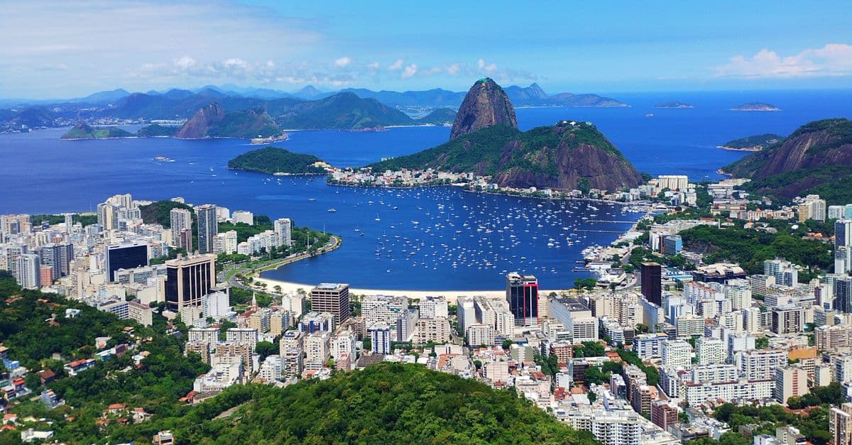
Photo: Douglas Moura / Pexels
The largest island in the world is Greenland, at about 2.16 million square kilometres (836,000 square miles). Australia is more than three times larger — but it doesn't appear on any list of largest islands, and the reason is a definition, not a measurement error. Understanding why Australia is excluded explains the entire ranking below, and it turns out geographers have argued about the line between "island" and "continent" for longer than most people realize.
The Short Answer: Largest Islands (by Area)
Table: The 10 largest islands in the world by area.
| Rank | Island | Area (approx.) | Region | Belongs to |
|---|---|---|---|---|
| 1 | Greenland | 2,166,086 km² | North Atlantic / Arctic | Denmark (autonomous territory) |
| 2 | New Guinea | 786,000–821,400 km² | Pacific | Indonesia & Papua New Guinea |
| 3 | Borneo | 743,000–748,000 km² | Southeast Asia | Indonesia, Malaysia, Brunei |
| 4 | Madagascar | 587,295 km² | Indian Ocean | Madagascar |
| 5 | Baffin Island | 507,451 km² | Arctic | Canada |
| 6 | Sumatra | 443,066 km² | Southeast Asia | Indonesia |
| 7 | Honshu | 227,898 km² | East Asia | Japan |
| 8 | Victoria Island | 217,291 km² | Arctic | Canada |
| 9 | Great Britain | 209,331 km² | North Atlantic | United Kingdom |
| 10 | Ellesmere Island | 196,236 km² | Arctic | Canada |
Greenland is in a class of its own — larger than the next two islands on the list combined. The size gap between rank one and rank two is bigger than the entire area of Texas.
Note that published figures for New Guinea and Borneo vary by a few percent between sources, because both islands have irregular, glacier-carved and river-delta coastlines that are genuinely hard to measure precisely, and because political boundaries within the islands (Indonesian versus Papua New Guinean territory, for instance) get surveyed with different methods. The ranking order, however, is not in dispute.
Why Australia Isn't an Island
By area, Australia (about 7.7 million km²) would crush Greenland — it's roughly three and a half times bigger. But geographers classify Australia as a continent, and "island" and "continent" are mutually exclusive categories in standard geographic convention. The largest island is, by definition, the largest landmass that is not a continent. That's why Greenland, the biggest non-continental land on Earth, takes the title instead of the true biggest landmass.
This isn't an arbitrary line drawn by a committee with nothing better to do. What makes Australia a continent rather than a giant island comes down to three things: it sits on its own distinct tectonic plate (the Indo-Australian Plate), it carries a deep and largely self-contained geological history stretching back over 3 billion years, and it hosts an evolutionary lineage of plants and animals — marsupials, eucalypts, monotremes like the platypus — that developed in near-total isolation once the landmass broke away from the other pieces of the ancient supercontinent Gondwana.
Greenland, by contrast, sits on the North American Plate. Structurally, it's an enormous chunk of the same continental crust that underlies Canada, not a separate tectonic entity. Its bedrock geology connects directly to the Canadian Shield across the Nares Strait. So while Greenland dwarfs most countries in size, plate tectonics treats it as an extension of North America rather than a landmass in its own right — which is exactly the kind of distinction that keeps it eligible for the "island" category.
Is there an official definition of "island" versus "continent"?
There is no single international governing body that legally defines the cutoff. Geographers and geologists generally agree that continents are large, tectonically distinct landmasses with continuous continental crust and long independent geological histories, while islands are smaller landmasses entirely surrounded by water, regardless of origin. The line is a convention reinforced by centuries of usage in cartography, geology, and geography textbooks — not a law of physics.
This kind of category argument matters more than it seems. It's the same reason Pluto stopped being called a planet in 2006 — not because it changed, but because the definition of "planet" was tightened around it. Size alone rarely settles a scientific classification; the underlying structure does.
The Greenland Map Illusion
Many people believe Greenland is roughly the size of Africa, because that's how it looks on the standard world map hanging in classrooms and printed in atlases. It's an illusion created by the Mercator projection — the most common way of flattening the spherical Earth onto a flat rectangle, first published by cartographer Gerardus Mercator in 1569.
The Mercator projection preserves shapes and angles, which made it enormously useful for sea navigation because a straight line on the map corresponds to a constant compass bearing. But that convenience comes at a cost: the projection badly distorts area near the poles, stretching landmasses that are far from the equator to look far larger than they actually are. The mathematics behind the stretching is unavoidable — it's a direct consequence of trying to represent a curved, three-dimensional surface on a flat, two-dimensional page, a problem cartographers call the "no free lunch" theorem of map projections. Every flat map trades one kind of accuracy (area, shape, distance, or direction) for another; none can preserve all four at once.
The result on a standard Mercator map: Greenland appears roughly comparable in size to Africa, when Africa is actually around 14 times bigger. Greenland, at 2.16 million km², is smaller than the Democratic Republic of the Congo alone (about 2.34 million km²), which is just one of Africa's 54 countries. Put another way, you could fit Greenland inside Africa fourteen times over and still have room left.
Why does this distortion matter beyond trivia?
Mercator's projection quietly shapes how people intuitively judge the relative importance and scale of countries near the poles versus the equator, which is one reason some educators and organizations have pushed alternative projections (like the Gall-Peters or the Robinson projection) for classroom maps. It's a reminder that even "obvious" geographic facts depend heavily on how the information is presented visually — the same lesson that applies to why the largest deserts on Earth surprise people once you look past assumptions built on casual map-reading.
Islands of Ice vs. Islands of Life
The largest islands on Earth split into two strikingly different worlds, and the split tracks almost perfectly with latitude.
Greenland and Baffin Island are mostly frozen. About 79 to 80% of Greenland's surface is buried under an ice sheet that in places is nearly 3 kilometers (1.9 miles) thick, according to glaciology surveys compiled by organizations like the National Snow and Ice Data Center. It is the second-largest body of ice on Earth after the Antarctic ice sheet, and it holds an estimated 2.9 million cubic kilometers of ice. If that entire sheet melted, sea levels worldwide would rise by roughly 7.4 meters (about 24 feet) — enough to redraw the coastline of every continent on the planet. Beneath all that ice, Greenland's bedrock is actually shaped like a deep bowl, pressed down by the weight of ice accumulated over hundreds of thousands of years; if the ice vanished, the land underneath would slowly rebound upward over millennia. Greenland's ice sheet is currently losing mass roughly seven times faster than it was 30 years ago, and it now accounts for about 20% of the sea-level rise the world is currently experiencing.
New Guinea, Borneo, and Madagascar are tropical biodiversity treasure houses. Long geographic isolation turned each into a kind of evolutionary laboratory, and recent botanical surveys have quantified just how extreme that richness is. A 2020 study published in Nature catalogued 13,634 plant species across New Guinea, making it the single richest island flora on Earth — ahead of Madagascar's 11,832 species and Borneo's 11,165. More than two-thirds of New Guinea's plants exist nowhere else. The island also hosts more than 800 bird species, including the famously ornate birds-of-paradise, plus hundreds of thousands of insect species.
Madagascar tells an even more extreme isolation story. It broke away from the African mainland roughly 135 million years ago as part of the breakup of the ancient supercontinent Gondwana, then separated from India about 88 million years ago and drifted alone into the Indian Ocean. Lemurs, the island's signature mammals, appear to have arrived by rafting across open ocean on floating vegetation around 54 million years ago and then diversified in isolation into more than 100 species found nowhere else on Earth. Roughly 90% of Madagascar's plant and animal species are endemic, including about 92% of its mammals and 95% of its reptiles.
Borneo, the third-largest island, splits its 743,000-plus square kilometers among Indonesia (about 73% of the island, called Kalimantan), Malaysia (about 26%, split into the states of Sabah and Sarawak), and Brunei (roughly 1%). It's the only place on Earth where wild Bornean orangutans live, and their numbers have fallen by more than half since 1999 to an estimated 104,700 individuals, driven largely by palm oil plantation expansion and logging. The island has lost more than half its original forest cover since the 1970s.
Island isolation drives this kind of runaway, unique evolution the same way deep, ancient, stable environments do elsewhere — see the longest-living animals on Earth for a parallel case where isolation and stability, rather than tropical heat, produced record-breaking biology.
Why do tropical islands have so much more biodiversity than similarly sized land areas elsewhere?
Warm, stable climates support faster reproduction and more ecological niches than cold or seasonal ones, and long isolation from mainland competitors lets species diversify into forms — very large, very small, oddly specialized — that would be outcompeted on a connected continent. New Guinea, Madagascar, and Borneo combine both factors: tropical warmth plus millions of years of separation from other landmasses.
How Islands Actually Form
The world's largest islands don't share a single origin story. Geologists generally sort them into three broad categories, and knowing which category an island belongs to explains a lot about its shape, its wildlife, and its geological future.
Continental fragments — Greenland, Madagascar, and Baffin Island fall into this group. These are pieces of continental crust that were separated from a larger landmass, either by rifting (the crust physically tearing apart, as happened when Gondwana broke up) or by rising sea levels drowning a land bridge. Madagascar's split from Africa and later from India is a textbook example: the island carries genuinely ancient continental rock, not oceanic crust, which is part of why its geology and wildlife diverged so completely from the African mainland just across the Mozambique Channel.
Volcanic islands — Iceland, the Hawaiian island chain, and many smaller Pacific islands were built from the seafloor up by repeated volcanic eruptions, either at a mid-ocean ridge (Iceland sits directly on the Mid-Atlantic Ridge) or over a stationary hot spot in the mantle that the tectonic plate above it slowly drifts across (the mechanism behind the Hawaiian chain). These tend to be smaller and geologically younger than continental fragments, though Iceland at about 103,000 km² is still a substantial landmass by this method alone.
Continental-shelf islands — Borneo, New Guinea, Sumatra, and Great Britain formed differently again. These sit on shallow continental shelves that were exposed as dry land during past ice ages, when so much of Earth's water was locked up in polar ice sheets that global sea levels sat over 100 meters lower than today. As the ice age ended and sea levels rose, the low-lying land bridges connecting these landmasses to the mainland flooded, cutting them off as islands. Borneo, New Guinea, and Sumatra were all part of a single connected landmass called Sundaland as recently as roughly 18,000 years ago — a geological eyeblink. Great Britain was connected to continental Europe by a similarly exposed plain, now called Doggerland, until roughly 8,200 years ago.
How do scientists know an island used to be connected to the mainland?
The clearest evidence comes from bathymetry — mapping the depth of the surrounding seafloor. A shallow, gently sloping continental shelf between an island and the nearest mainland (typically under 200 meters deep) indicates the two were dry land at points when sea levels were lower during past glacial periods. Matching fossil and genetic evidence between the island's and mainland's animal populations backs this up further.
Islands That Almost Made the List
The top five gets most of the attention, but the islands ranked six through ten reveal just as much about how geography, politics, and geology intersect.
Sumatra, at roughly 443,000 km², is entirely Indonesian territory and sits along the same tectonic boundary that produced the catastrophic 2004 Indian Ocean earthquake and tsunami — a reminder that the same subduction zone forces that build mountains and islands over geological time can also release enormous energy in seconds.
Honshu, Japan's main island at about 228,000 km², is the most densely populated large island on this list by a wide margin, home to Tokyo, Osaka, and roughly 80% of Japan's entire population packed into a landmass smaller than Sumatra.
Victoria Island and Ellesmere Island, both in the Canadian Arctic, are cold, sparsely populated, continental-fragment islands with tiny human populations relative to their size — Ellesmere Island, at over 196,000 km², has a permanent population of only a few hundred people.
Great Britain, at just over 209,000 km², is proof that island size and global influence don't have to correlate. It's smaller than Victoria Island, yet it anchored an empire that once controlled roughly a quarter of the planet's land area.
Does Antarctica count as an island?
No, Antarctica is classified as its own continent, not an island — for the same reason Australia isn't counted as an island, despite Antarctica also being entirely surrounded by ocean. It sits on its own tectonic plate (the Antarctic Plate) with a distinct, ancient geological history, which places it in the continent category regardless of the fact that water surrounds it on all sides.
What's the difference between an island and an archipelago?
An archipelago is a group or chain of islands clustered together, usually formed by the same underlying geological process, such as a volcanic hot spot or a shared continental shelf. Indonesia, made up of more than 17,000 individual islands, is the world's largest archipelago; individual islands within it, like Sumatra and the Indonesian portion of Borneo, are ranked separately on lists like this one.
Frequently Asked Questions
Q: What is the largest island in the world? A: Greenland, at about 2.16 million km². It's the largest landmass classified as an island rather than a continent. Australia is larger but is considered a continent, so it's excluded by definition. After Greenland come New Guinea, Borneo, and Madagascar.
Q: Why isn't Australia the largest island? A: Because Australia is classified as a continent, and a landmass can't be both a continent and an island under standard geographic convention. The distinction is geological — Australia sits on its own tectonic plate with distinct ancient geology and wildlife lineages. The "largest island" title therefore goes to the biggest non-continental landmass, Greenland.
Q: Is Greenland really as big as Africa? A: No — that's an illusion of the Mercator map projection, which stretches landmasses near the poles. Africa is actually about 14 times larger than Greenland. Greenland is even smaller than the Democratic Republic of the Congo, one of Africa's 54 countries. No flat map can show a curved planet without distorting either size or shape somewhere.
Q: What is the largest island belonging entirely to one country? A: Madagascar, the fourth-largest island in the world at about 587,295 km², is a single sovereign nation covering its whole landmass. New Guinea and Borneo, the second- and third-largest islands, are both split between multiple countries.
Q: Why do islands have unique animals? A: Long isolation lets species evolve separately from mainland relatives, often producing creatures found nowhere else — Madagascar's lemurs, New Guinea's birds-of-paradise, Borneo's orangutans. With fewer competitors and predators, island species can also evolve unusual sizes and traits, making large tropical islands some of the planet's richest evolutionary laboratories.
Q: How much would sea levels rise if Greenland's ice sheet melted completely? A: Scientists estimate roughly 7.4 meters (about 24 feet) of global sea-level rise if the entire Greenland ice sheet melted, based on its estimated 2.9 million cubic kilometers of ice volume. Greenland currently contributes about 20% of the sea-level rise happening today, and its ice loss rate has accelerated roughly sevenfold over the past 30 years.
Q: Was Borneo ever connected to the Asian mainland? A: Yes. Borneo, along with Sumatra and much of the Malay Peninsula, was part of a single exposed landmass called Sundaland during the last ice age, when lower sea levels left the shallow continental shelf between them as dry land. Rising seas after the ice age flooded those connections roughly 18,000 years ago, isolating the islands.
Q: Why is New Guinea considered more biodiverse than Madagascar even though it's smaller? A: A 2020 survey published in Nature catalogued 13,634 plant species on New Guinea versus 11,832 on Madagascar, despite New Guinea being roughly 786,000–821,000 km² compared to Madagascar's 587,295 km². The difference is attributed to New Guinea's more varied terrain, from coastal mangroves to tropical alpine grasslands, packed into a smaller footprint, plus its position within the broader biodiversity-rich Coral Triangle region.
Q: Is Iceland one of the largest islands in the world? A: Iceland, at roughly 103,000 km², is a substantial volcanic island but falls well outside the top ten largest islands globally, behind continental-fragment and continental-shelf islands like Ellesmere Island and Great Britain. It remains notable for a different reason: it's one of the few large islands built almost entirely by ongoing volcanic activity, sitting directly on the Mid-Atlantic Ridge.
Q: Could an island the size of Greenland ever become a continent? A: Not under current geological classification, because continent status depends on sitting atop an independent tectonic plate with its own long-term geological history, not on surface area. Greenland's bedrock is structurally part of the North American Plate, so no amount of ice loss or landmass exposure would change its classification without a fundamental shift in the underlying tectonics — something that unfolds over tens of millions of years, if it happens at all.
The takeaway
Greenland tops the list of the world's largest islands not because it's uniquely massive in absolute terms, but because Australia and Antarctica were reclassified out of the competition on tectonic grounds long before area comparisons ever came into it. The real story in this ranking isn't the numbers in the table, it's the two very different forces shaping the entries in it: ancient continental rifting versus rising post-ice-age seas, and the way both processes left behind landmasses now diverging wildly, from Greenland's shrinking ice sheet to New Guinea's still-expanding catalog of newly described species. The next time a map makes Greenland look the size of Africa, remember that's a 16th-century navigation trick, not a fact of geography.
Read next:
Sources
- NSIDC — Why Ice Sheets Matter
- NASA Sea Level Change Portal — Greenland Vital Signs
- NOAA Arctic Report Card 2024 — Greenland Ice Sheet
- Nature (2020) — New Guinea has the world's richest island flora
- Kew Gardens — New Guinea: One of the World's Biodiversity Hotspots
- Mongabay — Deforestation in Borneo threatens one in four orangutans
- UC Berkeley Understanding Evolution — Where did all of Madagascar's species come from?
- Encyclopædia Britannica — list of islands by area; Greenland, Australia, and Antarctica classification entries
Bottom line: Greenland is the largest island only because Australia and Antarctica "graduated" to continent status on tectonic grounds — and Greenland looks even bigger than it is on paper thanks to a centuries-old map projection trick. The ranking is as much about definitions as it is about dimensions.
Last verified: July 2026
Follow new articles
Add SciHub101 to your feed reader to see new science and technology stories.
About the Author
SciHub101 is an independent science and technology publication founded and edited by Buğra Sözeri, a software engineer and app developer based in Türkiye. AI tools assist with drafting and research. Source documentation in the existing archive is uneven, and articles are being reviewed and corrected. The Editorial Team byline identifies editorial responsibility; it does not certify specialist or independent human review. Where we compare products, anything built by our own team is labelled as such — see the editorial guidelines and About page for how corrections and disclosures work.
Related Articles
The Longest Bridges in the World: The 164-Kilometre Crossing
The longest bridge on Earth runs for 164 kilometres — roughly the distance from London to Birmingham — carrying high-speed trains across the rice paddies and rivers of eastern China. The Danyang–Kunshan Grand Bridge is so long that calling it a 'bridge' almost understates it; it is an elevated railway the length of a small country. But the real engineering drama lies elsewhere: in the bridges that span the widest single gaps without touching the ground.
The Strongest Earthquakes Ever Recorded: The Day Chile Shortened the Day
On 22 May 1960, the ground beneath southern Chile ruptured along a 1,000-kilometre fault, releasing a magnitude 9.5 earthquake — the most powerful ever recorded by instruments. It was so violent it shifted Earth's mass enough to measurably change the length of a day and set the entire planet ringing like a bell for weeks. Because the magnitude scale is logarithmic, this single quake released more energy than every other recorded earthquake of the 20th century combined.
The Longest Mountain Ranges in the World: The 65,000-Kilometre Range You'll Never See
The Andes stretch 7,000 kilometres down the spine of South America — the longest mountain range on land, and a wall so high it creates deserts on one side and rainforests on the other. But it's not even close to the longest range on the planet. That title belongs to a mountain chain ten times longer, winding 65,000 kilometres around the globe entirely beneath the oceans, where most of Earth's volcanic activity quietly happens.

Biggest Cities in the World by Population: City, Metro, and Urban Area
Jakarta leads the UN's 2025 city ranking, yet Chongqing has more people inside its borders. See the biggest cities by city, urban area, and metro definition.
The Largest Countries in the World: Russia Spans Eleven Time Zones
Russia is so large that when the sun rises over its Pacific coast, much of the country is still in the previous day. At about 17 million square kilometres it covers more than an eighth of all the land on Earth — bigger than the surface of Pluto — and stretches across eleven time zones. The ranking of the world's biggest countries is a story of empires, frozen frontiers, and a map projection that quietly lies about who's really biggest.