The Longest Mountain Ranges in the World: The 65,000-Kilometre Range You'll Never See
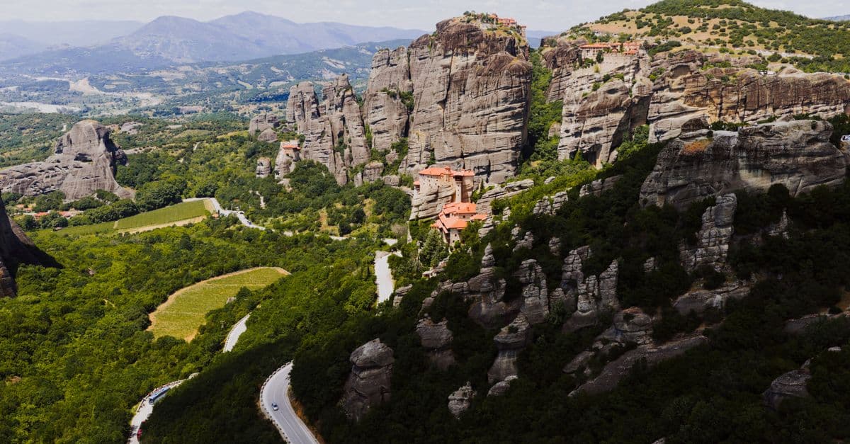
Photo: K / Pexels
The longest mountain range on land is the Andes, stretching about 7,000 kilometres (4,300 miles) down the western side of South America. But it is dwarfed by a range almost no one has seen: the Mid-Ocean Ridge, a continuous volcanic mountain chain roughly 65,000 kilometres (40,400 miles) long, hidden beneath every one of the world's major oceans. More than 90% of it lies in the deep sea, out of sight of satellites, sailors, and cartographers who spent centuries mapping every mountain they could see and missed the biggest one entirely. Understanding why reveals something most people never learn in school: mountains aren't just piles of rock pushed up by pressure. They're a byproduct of a much larger machine — plate tectonics — and the machine's biggest product is underwater.
The Short Answer: Longest Mountain Ranges
| Rank | Range | Length (approx.) | Location | Type |
|---|---|---|---|---|
| 1 | Mid-Ocean Ridge | 65,000 km (40,400 mi) | All oceans | Underwater (volcanic, divergent boundary) |
| 2 | Andes | 7,000 km (4,300 mi) | South America | Longest on land (subduction) |
| 3 | Rocky Mountains | 4,800 km (3,000 mi) | North America | Continental (subduction/collision, uplifted) |
| 4 | Great Dividing Range | 3,500 km (2,175 mi) | Australia | Continental (ancient, heavily eroded) |
| 5 | Transantarctic Mountains | ~3,500 km (2,175 mi) | Antarctica | Continental (rift-flank uplift) |
Table: Earth's longest mountain ranges by continuous length, land and undersea. Source: NOAA Ocean Exploration; Wikipedia — List of longest mountain chains on Earth, cross-referenced against Britannica.
The underwater ridge is in a category of its own — about ten times longer than the longest range on land, and by far the largest single geological feature on the planet. If you laid it out flat, it would circle the Earth at the equator roughly one and a half times.
The Andes: The Longest Wall on Land
The Andes run unbroken for roughly 7,000 km along the Pacific edge of South America, crossing seven countries: Venezuela, Colombia, Ecuador, Peru, Bolivia, Chile, and Argentina. They are the longest continental mountain range on Earth, and they are still growing.
They formed — and continue to form — where the oceanic Nazca Plate dives beneath the continental South American Plate in a process called subduction. Picture two conveyor belts running toward each other: the denser oceanic plate slides underneath the lighter continental one and sinks into the mantle, while the edge of the continental plate gets scraped, folded, and pushed skyward like the leading edge of a rug bunching against a wall. That same subduction zone makes the region one of the most earthquake- and volcano-prone stretches of crust on the planet, part of the Pacific "Ring of Fire" that also produced the strongest earthquakes ever recorded.
The Andes are so tall and so long that they don't just sit on the landscape — they reshape an entire continent's climate. Moist air rolling in off the Pacific hits the western slopes and dumps its rain there; by the time the air crosses the peaks, it has almost nothing left to give. That rain-shadow effect helps create the Atacama Desert on the leeward side, one of the driest places on Earth and a close relative of the polar deserts discussed in the largest deserts in the world. On the other side of the range, moisture funnels east and feeds the headwaters of the Amazon basin. A single mountain range, in other words, is directly responsible for both one of the driest deserts on the planet and the wettest, most biodiverse rainforest.
The Andes also hold elevation records worth knowing alongside their length record. Aconcagua, in Argentina, is the tallest peak outside Asia at 6,961 metres (22,838 ft), and it's often used as a training benchmark for climbers preparing for the Himalayas — a range that wins on height rather than length, as covered in the tallest mountains on Earth.
How long have the Andes been rising?
Uplift began roughly 45 million years ago and accelerated significantly starting about 10 million years ago, according to geological surveys of the central Andean plateau. The range is not a finished structure — GPS measurements show parts of it are still rising by a few millimetres a year as the Nazca Plate continues its slow dive beneath the continent.
Why Mountain Ranges Form Where They Do
Almost every great mountain range on Earth marks a plate boundary — a seam where two of Earth's tectonic plates meet, collide, or pull apart. Geologists sort the mountain-building process into three broad recipes, and knowing them explains why some ranges are jagged and young while others are worn-down and ancient.
- Continental collision (the Himalayas): two continental plates crash together, and because neither can sink beneath the other — both are too buoyant — the crust has nowhere to go but up and sideways. The Himalayas are the tallest range on Earth because the Indian Plate is still ramming into the Eurasian Plate at roughly 5 cm (2 in) a year, a collision that has been ongoing for about 50 million years. See the tallest mountains on Earth for how that collision produced all 14 of Earth's peaks above 8,000 metres.
- Subduction (the Andes, parts of the Rockies, the Cascades): a denser oceanic plate dives beneath a lighter continental one, buckling the overriding plate's edge upward and fueling volcanic activity as melted material rises through the crust above the subducting slab.
- Continental rifting and divergence (the Mid-Ocean Ridge, the East African Rift, the Transantarctic Mountains' flank): plates pull apart instead of colliding. Where this happens on the ocean floor, magma rises to fill the gap and freezes into new crust, building a ridge. Where it happens on land, the crust thins and stretches, and mountains can rise along the rift's shoulders even though the center of the rift is sinking.
Length, though, comes down to a simple geometric fact: mountain ranges trace plate boundaries, and boundaries can be short or extraordinarily long depending on how the plates are arranged. The longest boundary on Earth by a wide margin happens to run along the ocean floor, which is exactly why the longest mountain range does too.
Why don't collision ranges get as long as rift ranges?
Continental collision zones are limited by the size of the colliding landmasses — the Himalayas can only be as long as the India–Eurasia contact zone, a few thousand kilometres. Divergent boundaries, by contrast, can wrap continuously around entire ocean basins because there's no landmass edge to stop them, which is why the Mid-Ocean Ridge threads through the Atlantic, Pacific, Indian, and Arctic Oceans as one linked system.
The Real Champion: The Mid-Ocean Ridge
The Mid-Ocean Ridge is a continuous volcanic mountain range about 65,000 km (40,400 mi) long, snaking through the Atlantic, Pacific, Indian, and Arctic Oceans like the seam on a baseball, according to NOAA Ocean Exploration. Unlike the Andes or the Himalayas, it does not form where plates crash together. It forms where they pull apart: magma rises up through the gap between two diverging plates, cools on contact with seawater, and hardens into brand-new ocean floor. Repeat that process for tens of millions of years and you get a mountain chain running down the middle of nearly every ocean basin on the planet — the engine of what geologists call seafloor spreading.
This makes the ridge system the single most volcanically active feature on Earth, even though almost all of it is hidden under kilometres of water and was completely unmapped until the mid-20th century. According to the Woods Hole Oceanographic Institution, the rate at which the crust spreads varies dramatically by location: the Mid-Atlantic Ridge spreads slowly, at about 2 to 5 cm (0.8 to 2 in) per year, producing a steep, rugged, canyon-cut profile, while the East Pacific Rise spreads three to six times faster, at 6 to 16 cm (2.4 to 6.3 in) per year, producing a much wider, gentler-sloped ridge. Slow spreading looks like the Grand Canyon turned upside down and stretched into a mountain; fast spreading looks more like a broad, low dome.
In only a handful of places does the ridge break the ocean's surface entirely. The most famous is Iceland, which sits directly on top of the Mid-Atlantic Ridge and is, geologically speaking, being torn in two. The rift running through Iceland's Þingvellir National Park is a visible crack between the North American and Eurasian plates — you can stand with one foot on each. The island's frequent volcanic eruptions, including the 2010 Eyjafjallajökull eruption that grounded European air travel for days, are direct expressions of the same magma-rising process that builds the invisible 65,000-km ridge everywhere else.
The ridge is a close geological cousin of the rift zones that create some of Earth's other extreme features. The deepest lakes in the world, including Lake Baikal in Siberia, sit in continental rift valleys — places where the crust is pulling apart on land the same way the Mid-Ocean Ridge pulls apart underwater, just without enough spreading yet to fill the gap with ocean.
How was the Mid-Ocean Ridge discovered?
Its existence wasn't confirmed until systematic sonar mapping of the seafloor in the 1950s, led largely by geologists Marie Tharp and Bruce Heezen at Columbia University's Lamont Geological Observatory. Tharp's hand-drawn maps of ocean-floor topography revealed a continuous rift valley running down the center of the ridge system, a discovery that provided crucial physical evidence for the then-controversial theory of plate tectonics.
Is the Mid-Ocean Ridge a single connected range?
Yes. Although it has regional names — the Mid-Atlantic Ridge, the East Pacific Rise, the Southwest Indian Ridge, the Gakkel Ridge in the Arctic — these segments are physically connected, forming one continuous underwater mountain system that threads through every major ocean basin on Earth.
The Rocky Mountains: North America's Backbone
The Rocky Mountains stretch about 4,800 km (3,000 mi) from northern British Columbia in Canada down to New Mexico in the southwestern United States, making them the second-longest continental range after the Andes. Their formation is more complicated than a textbook subduction diagram: the main uplift, called the Laramide Orogeny, occurred between roughly 80 and 55 million years ago, when a subducting oceanic plate flattened out and slid nearly horizontally beneath the continent instead of plunging steeply into the mantle.
That shallow-angle subduction pushed mountain-building forces far inland, which is why the Rockies rise hundreds of kilometres from the Pacific coast rather than hugging it the way the Andes hug South America's western edge. It's a useful reminder that "subduction zone" doesn't automatically mean "mountains right at the coastline" — the angle and speed of the diving plate change where and how the crust buckles.
The Great Dividing Range: A Mountain Range Older Than the Dinosaurs' Extinction
Australia's Great Dividing Range runs more than 3,500 km along the entire eastern side of the continent, from the Torres Strait near Cape York in the north down through Queensland, New South Wales, and Victoria, according to the New World Encyclopedia and cross-referenced geological surveys. Unlike the Andes or the Rockies, it isn't a single clean ridge — it's a broad, complex system of ranges, plateaus, and escarpments, varying in width from about 160 to over 300 km.
What makes the Great Dividing Range geologically unusual is its age. Formation began through tectonic and volcanic activity between roughly 30 and 100 million years ago, but some of the range's oldest rock is Carboniferous in age, meaning parts of the system are hundreds of millions of years old. Because Australia has sat on a relatively stable, non-active plate interior for so long, with no active subduction or collision at its eastern margin today, the range has spent tens of millions of years simply eroding rather than being actively rebuilt. That's why its highest point, Mount Kosciuszko, tops out at just 2,228 metres (7,310 ft) — modest compared to the Andes or Rockies, because time and weather have worn it down rather than tectonic forces pushing it back up.
The Transantarctic Mountains: A Range Built by Rifting, Not Collision
The Transantarctic Mountains stretch roughly 3,500 km across Antarctica, dividing the continent into East and West Antarctica. Unlike most of the other ranges on this list, they didn't form primarily from a continental collision or classic ocean-plate subduction. According to research published on formation mechanisms and summarized by geological surveys, their uplift is linked to extension of the West Antarctic Rift System roughly 55 to 65 million years ago — crust stretching and thinning on one side created a rift, and the flank of that rift rose as a mountain-building "shoulder" effect, a process geologists call rift-flank uplift.
The range's geological record is exceptional even by mountain-range standards: it preserves rock spanning more than three billion years, including ancient crystalline basement, structures from the Ross Orogeny (a continental-collision mountain-building event roughly 550 to 480 million years ago), and sedimentary and volcanic layers tied to the breakup of the ancient supercontinent Gondwana. Few mountain ranges on Earth let geologists read that much of the planet's history in one place.
Length vs. Height: Two Completely Different Records
It's worth being explicit about something the ranking table glosses over: "longest" and "tallest" are unrelated records, because they're produced by different tectonic processes. The Andes win on length because a subduction boundary happens to run 7,000 km down one continental edge. The Himalayas win on height because a head-on continental collision, still actively happening, has nowhere to release its compressive force except straight up.
You can see this mismatch clearly in the numbers. The Himalayas run about 2,400 km — barely a third the length of the Andes — yet they contain every peak on Earth above 8,000 metres, including Everest at 8,848.86 metres (29,031.7 ft), as detailed in the tallest mountains on Earth. The Andes, despite being nearly three times longer, top out with Aconcagua at 6,961 metres. Longer doesn't mean taller, because the two properties are set by different variables: length is set by the geometry of the plate boundary, height is set by how much force the boundary generates and how long that force has had to act.
What Happens to Old Mountain Ranges
Mountain ranges are not permanent monuments. From the moment uplift slows, weathering and erosion begin wearing them back down, and given enough time — tens to hundreds of millions of years — even the tallest range on Earth would eventually be reduced to rolling hills.
The Appalachian Mountains in eastern North America are the textbook example. When they formed during the assembly of the supercontinent Pangaea roughly 480 million years ago, geologists estimate they may have rivaled or exceeded the Himalayas in height. Today, after hundreds of millions of years without active tectonic uplift, their highest point, Mount Mitchell, reaches only 2,037 metres (6,684 ft). The Great Dividing Range in Australia is following the same trajectory, just less far along it — actively eroding with nothing pushing back from below to replace the lost material.
This is also why a range's age tells you something about its shape before you even see a map. Young, actively uplifting ranges like the Andes or Himalayas tend to have sharp, jagged peaks because erosion hasn't had time to round them off. Old, inactive ranges like the Appalachians or the Great Dividing Range tend to be smoother and lower, because millions of years of rain, ice, and rivers have had free rein to sand them down.
Frequently Asked Questions
Q: What is the longest mountain range in the world? A: The Mid-Ocean Ridge, an underwater volcanic chain about 65,000 km long that winds through every ocean. On land, the longest is the Andes in South America, at about 7,000 km. The ocean ridge is roughly ten times longer than any range on land, but almost all of it is hidden beneath the sea.
Q: What is the longest mountain range on land? A: The Andes, stretching about 7,000 km along the western edge of South America through seven countries. It formed where the Nazca oceanic plate subducts beneath the continent, and it's still rising. The Rocky Mountains (~4,800 km) are the second-longest continental range, followed by the Great Dividing Range and Transantarctic Mountains (both roughly 3,500 km).
Q: Why is the longest mountain range underwater? A: Because the longest tectonic plate boundary on Earth runs along the seafloor. The Mid-Ocean Ridge marks where plates pull apart and magma rises to form new crust, building a continuous volcanic range through all the oceans. Divergent boundaries like this can wrap around entire ocean basins uninterrupted, while land-based collision ranges are limited by the size of the continents involved.
Q: Are the Andes or the Himalayas longer? A: The Andes are far longer (~7,000 km) than the Himalayas (~2,400 km). But the Himalayas are taller, containing all of Earth's highest peaks, including Everest. Length and height are different records produced by different processes: the Andes formed through subduction along a long coastline, while the Himalayas formed through a head-on continental collision that concentrates force upward rather than spreading it along a long boundary.
Q: Is Iceland part of a mountain range? A: Yes — Iceland sits directly on the Mid-Atlantic Ridge, the segment of the Mid-Ocean Ridge running through the Atlantic. It's one of the few places the underwater range rises above sea level, which is why Iceland is so volcanically active and is slowly being pulled apart as the North American and Eurasian plates beneath it diverge.
Q: How fast do mountain ranges grow? A: Actively uplifting ranges typically rise a few millimetres per year — the Andes and Himalayas both fall in roughly this range according to GPS surveys. That sounds slow, but sustained over millions of years it adds up to thousands of metres of elevation, offset by ongoing erosion that removes some of the gain.
Q: What is the oldest mountain range on Earth? A: Among well-studied ranges, the Appalachian Mountains in eastern North America and parts of the Great Dividing Range in Australia rank among the oldest, with formation beginning several hundred million years ago. Because active uplift stopped long ago in both, they've eroded down to a fraction of their original height.
Q: Does every mountain range form at a plate boundary? A: Almost every major range does, but there are exceptions. Some isolated volcanic mountain chains, like the Hawaiian Islands, form over stationary "hotspots" in the mantle rather than at a plate edge, with the moving plate creating a trail of volcanoes rather than a boundary-driven range.
Q: Can a mountain range span more than one continent? A: Not in the way the Mid-Ocean Ridge does, since it's undersea and not bound by continental edges. On land, ranges are generally confined to a single continental plate system, though some, like the Alpine-Himalayan belt, form a loosely connected chain of separate ranges stretching from Europe through the Middle East into South Asia, all produced by the same broad collision zone between Africa, Arabia, India, and Eurasia.
Q: Why does the Mid-Ocean Ridge produce so many earthquakes if it isn't a subduction zone? A: Divergent boundaries generate earthquakes as crust fractures and shifts while plates pull apart, but these quakes are typically much shallower and less powerful than the massive subduction-zone earthquakes seen at places like the 1960 Chile quake, because there's less friction and stored strain energy at a spreading boundary than at one plate forcing itself beneath another.
The takeaway
Every mountain range on this list, from the visible 7,000-km wall of the Andes to the invisible 65,000-km seam of the Mid-Ocean Ridge, traces the edge of a moving tectonic plate. The ranges you can see and climb are almost all products of plates colliding or one sliding beneath another; the range you'll never see with your own eyes is the product of plates pulling apart and constantly manufacturing new ocean floor. Length turns out to be less about how much rock got pushed up and more about how long the underlying boundary happens to be, which is why a rift system with no continental edge to stop it can run three times around the length of South America. The Andes are the longest mountains anyone will ever hike. The real backbone of the planet is somewhere you'd need a submersible to reach.
Read next:
- The Tallest Mountains on Earth
- The Strongest Earthquakes Ever Recorded
- The Deepest Places in the Ocean
- The Largest Deserts in the World
- The Deepest Lakes in the World
Sources
- NOAA Ocean Exploration — What is a mid-ocean ridge?
- Woods Hole Oceanographic Institution — Mid-ocean ridges
- Wikipedia — List of longest mountain chains on Earth (cross-referenced against Britannica and NOAA figures)
- Britannica — Great Dividing Range
- New World Encyclopedia — Great Dividing Range
- Wikipedia — Transantarctic Mountains
- USGS — plate tectonics and mountain-building references
Bottom line: The Andes are the longest mountains you can climb, but the planet's true backbone is the 65,000-km volcanic ridge threading the ocean floor — the longest mountain range on Earth, and the one constantly building new world.
Last verified: July 2026
Follow new articles
Add SciHub101 to your feed reader to see new science and technology stories.
About the Author
SciHub101 is an independent science and technology publication founded and edited by Buğra Sözeri, a software engineer and app developer based in Türkiye. AI tools assist with drafting and research. Source documentation in the existing archive is uneven, and articles are being reviewed and corrected. The Editorial Team byline identifies editorial responsibility; it does not certify specialist or independent human review. Where we compare products, anything built by our own team is labelled as such — see the editorial guidelines and About page for how corrections and disclosures work.
Related Articles
The Tallest Waterfalls in the World: Angel Falls and the Hidden Giants
Venezuela's Angel Falls drops 979 meters — so far that much of the water turns to mist before it ever reaches the ground, especially in the dry season. It is the tallest waterfall on land, plunging off a flat-topped mountain built from some of the oldest rock on Earth. But the single tallest waterfall on the planet is not on land at all: it is underwater, a cataract beneath the ocean that dwarfs every waterfall you can see.
The Longest Tunnels in the World: 57 Kilometres Under the Alps
To send high-speed trains through the heart of the Alps, engineers didn't go over the mountains — they went straight through, boring the Gotthard Base Tunnel 57 kilometres beneath rock up to 2.3 kilometres thick. It's the longest railway tunnel on Earth, and at its deepest the rock above presses down so hard the temperature reaches 46°C. But the single longest tunnel of any kind carries no trains at all — it carries water to a thirsty city.

The Tallest Mountains on Earth: Everest, Mauna Kea, and Chimborazo Compared
Mount Everest is not the tallest mountain on Earth — and it is not the closest point on Earth's surface to outer space. Both claims belong to other peaks depending on how you define 'tallest.' At 8,848.86 meters (29,031.7 feet) above sea level, Everest wins the elevation contest. But Mauna Kea in Hawaii stands 10,210 meters (33,500 feet) from seafloor base to summit. And Chimborazo in Ecuador, a relatively modest 6,263 meters above sea level, sits 6,384.4 km from Earth's center — 2.1 km farther than Everest's summit.
The Largest Islands in the World: Why Greenland Wins and Australia Doesn't Count
Greenland is the largest island on Earth at about 2.16 million square kilometres — but Australia, which is more than three times bigger, isn't on the list at all. The reason isn't size; it's a definition. Australia is classified as a continent, and the moment a landmass becomes a continent, it stops being an island. That single rule explains the entire ranking, and a famous map projection explains why Greenland looks even bigger than it is.
The Largest Lakes in the World: The Caspian Paradox and the Inland Seas
The largest lake on Earth is called a sea. The Caspian Sea covers about 371,000 to 374,000 square kilometres — larger than Germany — and is bordered by five countries that argued for over two decades about whether it's legally a lake or a sea, because the answer decides who owns its oil. Behind it stretch the true freshwater giants, including a single North American lake big enough to cover the entire United Kingdom.
The Deepest Lakes in the World: Lake Baikal and the Crack in a Continent
Lake Baikal in Siberia plunges to 1,642 metres — deep enough to swallow the world's tallest building twice over with room to spare. It is not just the deepest lake on Earth; it holds about a fifth of all the planet's unfrozen fresh water and has existed for 25 million years, longer than any other lake. The deepest lakes share a common origin: they sit in places where the Earth's crust is literally being pulled apart.