The Deepest Lakes in the World: Lake Baikal and the Crack in a Continent
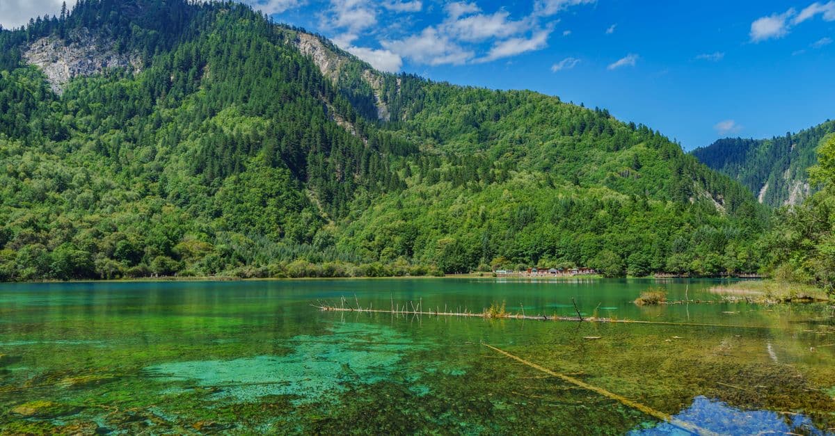
Photo: David Tran / Pexels
The deepest lake in the world is Lake Baikal in southern Siberia, reaching a maximum depth of 1,642 metres (5,387 feet). No other lake comes close to Baikal's combination of depth, volume, and age, and the reason traces back to a slow-motion geological event: a continent tearing itself apart. Understanding why Baikal is so deep also explains why almost every other lake on this list, from Tanganyika to Malawi, shares the same violent origin story.
The Short Answer: Deepest Lakes (by Maximum Depth)
Table 1. The world's deepest lakes ranked by maximum depth, with location and geological origin.
| Rank | Lake | Max Depth | Location | Origin |
|---|---|---|---|---|
| 1 | Baikal | 1,642 m (5,387 ft) | Russia (Siberia) | Continental rift |
| 2 | Tanganyika | 1,470 m (4,823 ft) | East Africa | Continental rift |
| 3 | Caspian Sea | 1,025 m (3,363 ft) | Central Asia | Tectonic remnant |
| 4 | Vostok (subglacial) | ~900 m | Antarctica | Subglacial basin |
| 5 | O'Higgins–San Martín | 836 m (2,743 ft) | Chile / Argentina | Glacial-tectonic |
| 6 | Malawi (Nyasa) | 706 m (2,316 ft) | Malawi / Mozambique / Tanzania | Continental rift |
| 7 | Issyk-Kul | 668 m (2,192 ft) | Kyrgyzstan | Tectonic (endorheic) |
| 8 | Great Slave Lake | 614 m (2,014 ft) | Canada | Glacial-tectonic |
| 9 | Crater Lake | 594 m (1,949 ft) | Oregon, USA | Volcanic caldera |
| 10 | Matano | 590 m (1,936 ft) | Sulawesi, Indonesia | Continental rift |
Sources: WorldAtlas — Deepest Lakes in the World; Britannica — 9 of the World's Deepest Lakes; USGS — Eruption History of Mount Mazama and Crater Lake Caldera.
The Caspian is also the world's largest lake by surface area; it is usually counted as a lake despite its name, a question we unpack later. Lake Vostok is buried under roughly 4 kilometres of Antarctic ice and has never been directly sampled with a submersible, so its reported depth carries more uncertainty than the others on this list.
Why the Deepest Lakes Sit in Rifts
Look at the top of the list and a pattern jumps out immediately: the two deepest lakes on Earth, Baikal and Tanganyika, both formed in continental rift zones, places where tectonic forces are stretching and tearing the crust apart. So did Malawi, and so did Matano in Sulawesi. This is not a coincidence. It is close to the only way a lake basin can get that deep.
When a continent begins to split, the land between two diverging faults drops, forming a long, narrow trough called a graben (German for "ditch" or "trench," and the geological term for a down-dropped block of crust bounded by parallel faults). Fill that trough with water and you get a lake that is deep out of all proportion to its width. Think of it the way you'd think of a knife slowly pulling apart a slab of dough: the dough thins and sags in the middle long before it tears completely, and that sagging middle is where the water collects.
This is fundamentally different from how most of the world's lakes form. The majority were scooped out by glaciers during the last ice age, roughly 20,000 to 12,000 years ago, and glacial lakes are typically broad and shallow, rarely exceeding a few hundred metres in depth. A glacier is a bulldozer: it grinds and gouges but does not tear the crust itself. A rift is closer to a wound that keeps reopening. That structural difference is why nine of the ten deepest lakes on the planet are either rift lakes, remnants of ancient tectonic basins, or, in Crater Lake's single case, the collapsed throat of a volcano.
Rift lakes keep getting deeper over geological time, too, which is part of why they dominate the depth rankings and the largest-lakes-by-volume rankings simultaneously. As a rift slowly widens (Baikal's basin spreads about 2 centimetres a year according to GPS-based tectonic surveys, roughly the rate your fingernails grow), the crustal floor continues to subside, and sediment from surrounding rivers and erosion piles up beneath the water. Baikal's water column is 1,642 metres deep, but the total basin, water plus sediment fill, is closer to 8 or 9 kilometres from the crystalline bedrock floor to the surface. The lake has simply been sinking and filling for longer than any other lake basin has stayed intact.
This same rifting process, magnified over tens of millions of years and eventually flooded by an ocean rather than a lake, is what builds and eventually destroys entire ocean basins. The most extreme expression of that process on Earth today is not a rift at all but a subduction trench, the deep end of which you can explore in the deepest places in the ocean, where the crust is being consumed rather than pulled apart. For another kind of record-sized hole in the ground, this one dug by people, see the biggest mines in the world.
How is lake depth actually measured?
Modern lake depth is measured with multibeam sonar, a technique in which a ship-mounted array fires sound pulses across a fan-shaped swath of the lake floor and times their echoes to build a three-dimensional depth map, the same core technology oceanographers use to chart the seafloor. Baikal's 1,642-metre figure comes from Russian and international bathymetric surveys conducted through the 1990s and 2000s, refined with GPS-corrected sonar passes that reduced the older, ship-based single-beam estimates by tens of metres in either direction.
Lake Baikal: The Record-Breaker on Every Axis
Baikal is not just the deepest lake. It is arguably the single most extraordinary body of fresh water on the planet, holding a cluster of world records that reinforce and explain one another.
- Oldest lake in the world: roughly 25 to 30 million years old, based on sediment cores and the age of the rift itself. Most lakes fill with sediment and vanish within tens of thousands of years; Baikal's active, still-widening rift keeps generating new basin space faster than sediment can fill it.
- Largest freshwater lake by volume: it holds about 20% of all the planet's unfrozen fresh water, roughly 23,600 cubic kilometres, more than all five North American Great Lakes combined despite having a much smaller surface area.
- Astonishing clarity: in winter and spring, before algae blooms cloud the upper layers, a white disc lowered into the water can remain visible to around 40 metres down, a transparency rivaled by very few lakes on Earth.
- A world of its own: because it has been isolated and stable for so long, roughly 80% of Baikal's roughly 2,600 documented animal species are endemic, meaning they exist nowhere else on Earth, including the Baikal seal or nerpa, one of only two entirely freshwater seal populations on the planet (the other being the much smaller Saimaa ringed seal population in Finland).
That deep isolation makes Baikal a natural laboratory for evolution, in the same way the planet's harshest habitats produce the most extreme organisms (extremophiles): both are cases where a population gets cut off long enough that entirely new lineages emerge to fill niches no other lake or ocean offers. Its multi-million-year run also earns it a place among the oldest things on Earth, alongside far older geological features like billion-year-old zircon crystals, though Baikal is a young feature by comparison to those.
Why doesn't Baikal freeze solid in Siberian winters?
Baikal freezes over on the surface, typically from January through May or June, with ice up to 2 metres thick in places, but the sheer volume of water beneath means the lake never freezes to the bottom. Water's thermal properties help too: fresh water is densest at about 4°C, so the coldest surface water floats above slightly warmer, denser water at depth, insulating the lake's interior and keeping most of its volume liquid year-round even as the air above drops below -30°C (-22°F).
Lake Tanganyika: Africa's Deep Twin
Lake Tanganyika, at 1,470 metres, sits in the western branch of the East African Rift, the same tectonic system along which the African continent is slowly splitting in two, a process that will, over tens of millions of years, eventually open a new ocean basin between the Somali and Nubian plates. Like Baikal, Tanganyika is ancient (estimated at roughly 9 to 12 million years old), enormously voluminous (the second-largest freshwater lake by volume on Earth, after Baikal), and packed with species found nowhere else, most famously its cichlid fish.
Tanganyika's cichlids are one of the best-documented examples of rapid evolutionary radiation known to biology: a relatively small number of ancestral species colonized the lake and, isolated by depth, water chemistry, and habitat structure, split into hundreds of distinct species over a few million years, each specialized for a different diet, depth, or breeding behavior. Researchers studying evolution by natural selection routinely point to African rift lakes as some of the clearest real-world laboratories for watching speciation happen on a geologically short timescale.
Tanganyika is also long and thin, about 673 kilometres from end to end but rarely more than 50 kilometres wide, exactly the shape a rift basin produces, since the lake is constrained by the same parallel faults that define the graben itself. Its deep water below roughly 200 metres is permanently anoxic (without oxygen), a condition caused by the lake's extreme depth combined with weak vertical mixing in the tropics, so almost all fish and animal life clings to the sunlit, oxygenated upper few hundred metres, leaving the deeper 80% of the lake's volume essentially lifeless except for anaerobic microbes.
Source: Britannica — Lake Tanganyika; WorldAtlas — Deepest Lakes.
Lake Malawi and the Rest of the East African Rift Lakes
Lake Malawi (also called Lake Nyasa), at 706 metres deep, is the third African rift lake to appear on the global depth rankings, sitting in the same rift system as Tanganyika but along a different branch. It shares Tanganyika's basic recipe: a narrow, elongated graben, extreme age relative to glacial lakes, and a spectacular burst of cichlid speciation, with estimates of 700 to 1,000 endemic cichlid species, making it one of the most species-rich freshwater ecosystems on the planet relative to its size.
What differentiates Malawi from Tanganyika is oxygen. Because Malawi is shallower and its climate produces stronger seasonal mixing, oxygenated water reaches somewhat further down than in Tanganyika, though the deepest layers are still anoxic. This small difference in mixing has outsized consequences for where and how fish populations diversify, and it is a textbook case researchers use to explain why depth alone does not determine an ecosystem's productivity; oxygen penetration and nutrient cycling matter just as much.
The East African Rift as a whole hosts dozens of lakes at varying stages of formation, some narrow and deep like Tanganyika and Malawi, others shallow and saline like Lake Natron, which sits in a portion of the rift where evaporation outpaces inflow. Geologists studying the rift use this range of lake types as a kind of time-lapse: shallow, young rift basins like Natron show what Tanganyika and Malawi may have looked like millions of years ago, before enough time passed for the graben to deepen and stabilize.
The Caspian Question
The Caspian Sea, at 1,025 metres deep in its southern basin, is the world's largest enclosed body of water by area, and whether it counts as a "lake" or a "sea" is a genuine legal and scientific debate with real financial consequences for the five countries around it: Russia, Kazakhstan, Turkmenistan, Iran, and Azerbaijan. Geologically it is the salty remnant of an ancient ocean, the Paratethys Sea, that was gradually cut off from the global ocean by tectonic uplift roughly 5 to 11 million years ago and has been shrinking and separating into isolated basins (including the modern Black Sea and Aral Sea) ever since.
The Caspian's classification matters enormously because international maritime law treats "seas" and "lakes" under entirely different legal frameworks. Under the United Nations Convention on the Law of the Sea, a genuine sea allows countries to claim exclusive economic zones extending 200 nautical miles from their coastline, covering fishing, mineral, and oil rights. A lake, by contrast, is typically divided by agreement among the bordering states, often along a median line or by direct negotiation, with no automatic 200-mile zones. Because the Caspian floor holds an estimated tens of billions of barrels of oil and vast natural gas reserves, the five bordering nations spent over two decades negotiating a resolution, culminating in the 2018 Convention on the Legal Status of the Caspian Sea, which created a hybrid legal status: neither a full "sea" under maritime law nor a simple shared "lake," but a body of water with its own bespoke rules for territorial waters, fishing zones, and a shared central zone for resource extraction.
By the plain geographic definition, a body of water entirely surrounded by land, the Caspian is unambiguously the largest lake on Earth, at roughly 371,000 square kilometres, an area larger than Germany. Its depth, at just over 1,000 metres in the southern basin (the northern basin, by contrast, averages only about 5 to 6 metres deep), reflects its origin as a fragment of a deep ocean floor rather than a freshly rifted basin, which is why it does not fit neatly into either the "rift lake" or "glacial lake" categories that describe most of the rest of this list. It sits closer in geological character to the deep basins found within the Mediterranean or Black Sea than to Baikal or Tanganyika.
Source: Britannica — Caspian Sea; details on the 2018 Convention are widely documented in international law and geopolitical coverage of the agreement.
Lake Vostok: The Deepest Lake You Cannot See
Buried under approximately 4 kilometres of Antarctic ice, Lake Vostok is the largest of more than 400 subglacial lakes discovered beneath the Antarctic ice sheet, and estimates put its maximum depth at roughly 900 metres, placing it near the top of the global depth rankings even though almost nothing about it has been directly observed. The lake was identified in the 1990s through a combination of airborne radar surveys, which can detect the sharp reflective boundary between ice and liquid water, and seismic data collected near Russia's Vostok Station.
Vostok's water has been sealed beneath the ice sheet for an estimated 15 million years or more, kept liquid not by warmth (surface temperatures above the lake are among the coldest recorded on Earth) but by geothermal heat rising from below and the immense insulating pressure of the ice sheet itself, which lowers water's freezing point. In 2012, Russian scientists drilled through to the lake's surface for the first time, retrieving frozen accretion ice samples that had refrozen onto the base of the ice sheet, though the subglacial water itself remains one of the least explored bodies of liquid water on the planet, arguably closer in accessibility to an ocean on one of Jupiter's icy moons than to any other lake on Earth's own surface.
Because Vostok has never been fully surveyed with the same bathymetric precision as Baikal or Tanganyika, its depth figure carries wider error bars than the other lakes in this ranking, and some scientific summaries list it anywhere from 400 to 1,000 metres depending on the survey method cited.
Issyk-Kul, Great Slave Lake, and Crater Lake: Three Different Recipes for Depth
Not every deep lake owes its depth to an active continental rift. The remaining entries in the global top ten show that geology has more than one way to carve a deep basin.
Issyk-Kul, in the Tien Shan mountains of Kyrgyzstan, reaches about 668 metres and is an endorheic lake, meaning it has no outlet to the ocean; water leaves only through evaporation. It sits in a tectonic depression associated with the same mountain-building collision between the Indian and Eurasian plates that raised the Himalayas, making it a tectonic basin rather than a classic rift, shaped by compression rather than extension. Despite its high mountain setting and cold winters, Issyk-Kul rarely freezes, a fact reflected in its name, which translates roughly to "warm lake" in the local Kyrgyz language, thanks to its depth, its slight salinity, and geothermal input from below.
Great Slave Lake, in Canada's Northwest Territories, reaches 614 metres and combines two processes: it sits along an ancient, deeply eroded fault system in the Canadian Shield, one of the oldest and most stable pieces of continental crust on Earth, and it was subsequently scoured and deepened by the massive ice sheets of the last glacial period. Its depth is a case where a pre-existing tectonic weakness gave glaciers a head start, letting them carve dramatically deeper than they typically manage in flatter terrain.
Crater Lake, in Oregon, is the outlier on this list: the only top-ten deepest lake formed by volcanism rather than tectonics or glaciers. It fills the caldera left after Mount Mazama, a stratovolcano in the Cascade Range, underwent a catastrophic eruption roughly 7,700 years ago that emptied its magma chamber and caused the mountain's summit to collapse inward, according to the U.S. Geological Survey's eruption history of Mount Mazama. That collapse released an estimated 50 cubic kilometres of magma and ash, among the largest eruptions in North America in the last 10,000 years, and left behind an 8-by-10-kilometre caldera basin more than a kilometre deep that has since filled with rain and snowmelt to a depth of 594 metres, making it both the deepest lake in the United States and one of the clearest, since it has no significant rivers feeding in sediment or pollutants.
Source: USGS — Eruption History for Mount Mazama and Crater Lake Caldera.
What Depth Does to a Lake's Ecology
Depth is not just a number on a bathymetric chart; it reshapes how an entire lake functions biologically, and the deepest lakes behave more like miniature oceans than like typical ponds or reservoirs.
Shallow lakes mix easily. Wind and seasonal temperature swings churn the whole water column, carrying oxygen down and nutrients up, so most of the lake's volume can support life. Deep rift lakes like Baikal, Tanganyika, and Malawi behave very differently. Below a certain depth, roughly 200 to 300 metres in Tanganyika's case, the water becomes stratified into distinct layers that rarely mix, and the deep layers lose their oxygen entirely, a condition called meromixis (from Greek roots meaning "partial mixing"). The result is that a lake can be enormous in volume, yet the vast majority of that volume is biologically closer to a lifeless void than a habitat.
This is part of why Baikal is such a scientific outlier: despite its extreme depth, its high-latitude climate and unusually vigorous seasonal mixing (driven by winter cooling and strong currents) manage to oxygenate water down to nearly its full depth, a rare trait among lakes this deep. That oxygenation is a major reason Baikal supports such a rich endemic ecosystem throughout its water column rather than only in a thin surface layer, unlike Tanganyika and Malawi, where deep water is essentially uninhabitable.
Deep lakes also act as long-term climate and sediment archives in a way shallow lakes cannot. Because their bottom waters are undisturbed by mixing or bottom-dwelling organisms that would otherwise churn the mud, sediment settles in extremely fine, undisturbed annual layers called varves. Scientists extract sediment cores from Baikal, Tanganyika, and Malawi to reconstruct tens of thousands to millions of years of past climate, vegetation, and even volcanic eruption history, layer by layer, the same way tree rings or ice cores are read, making these lakes some of the most valuable paleoclimate archives on the continents.
Common Misconceptions About the Deepest Lakes
"The deepest lake must also be the biggest lake." This is one of the most persistent mix-ups in casual geography discussions, and it is wrong on both counts depending on which "biggest" you mean. Baikal is the deepest lake and the largest by water volume, but it is not the largest by surface area; the Caspian Sea, at roughly 371,000 square kilometres, dwarfs Baikal's surface area of about 31,700 square kilometres, even though the Caspian holds less water overall because it is comparatively shallow across most of its northern basin. Depth, area, and volume are three separate records, and a lake can dominate one without leading the others, a distinction covered in detail in the largest lakes in the world.
"Rift lakes are unstable and dangerous because the crust is actively tearing." The rifting itself is exceptionally slow, on the order of centimetres per year, comparable to the rate continents drift apart everywhere on Earth, and poses no direct hazard to people living near these lakes on human timescales. The more immediate hazards near African rift lakes are volcanic and seismic activity associated with the same tectonic system, and, in a small number of documented cases, sudden releases of dissolved carbon dioxide or methane gas from deep, stagnant water layers, a phenomenon called a limnic eruption. The best-documented example is Lake Nyos in Cameroon, a much smaller crater lake unrelated to the deep rift lakes on this list, where a 1986 gas release killed nearly 1,800 people; Baikal, Tanganyika, and Malawi have no comparable documented history of limnic eruptions given their different chemistry and much larger scale.
"The Caspian Sea is not really a lake because it's called a sea and it's salty." Salinity does not determine whether a body of water is legally or scientifically classified as a lake. The Great Salt Lake in Utah, the Dead Sea, and the Caspian are all salty and all classified as lakes by the standard geographic definition (a body of water surrounded by land with no direct connection to the ocean). The Caspian's "sea" label is a historical holdover from a time before its landlocked status was fully understood, reinforced by its sheer size and its geological origin as a fragment of an actual ancient ocean.
"Deeper always means older." Depth and age often correlate among rift lakes, because rifts deepen over time, but they are not the same measurement, and the correlation breaks down entirely outside the rift-lake category. Crater Lake, at 594 metres, is barely 7,700 years old, one of the youngest lakes on Earth by geological standards, while some much shallower glacial lakes in the same region can be tens of thousands of years old, dating to the retreat of the last ice sheets. Age is a function of how long a basin has existed without filling in or draining, not a direct function of how deep it currently is.
Frequently Asked Questions
Q: What is the deepest lake in the world? A: Lake Baikal in Siberia, Russia, at a maximum depth of 1,642 metres (5,387 feet). It is far deeper than any other lake; the second-deepest, Lake Tanganyika in Africa, reaches about 1,470 metres. Baikal is also the world's oldest lake and holds the most fresh water by volume.
Q: Why is Lake Baikal so deep? A: It sits in a continental rift, a zone where tectonic forces are slowly tearing the crust apart, dropping the land between fault lines into a deep trough called a graben. The rift is still active and widening about 2 centimetres a year, so the basin continues to deepen, and it has had roughly 25 to 30 million years to do so. Most other lakes were carved by glaciers roughly 20,000 to 12,000 years ago and are far shallower and far younger.
Q: How much water does Lake Baikal hold? A: About 20% of all the unfrozen fresh water on Earth, roughly 23,600 cubic kilometres. That is more than all five of North America's Great Lakes put together, despite Baikal having a much smaller surface area, because it is so extraordinarily deep relative to its width.
Q: Is the Caspian Sea a lake? A: By the standard geographic definition, a body of water entirely surrounded by land, yes, the Caspian is the world's largest lake. The "sea" label is historical, reflecting its size and salty water, since it is a remnant of an ancient ocean called the Paratethys. Its legal status was formally disputed for over two decades because it affects how the five surrounding countries share access to its oil and gas reserves, resolved by a 2018 international convention that created a unique hybrid legal status.
Q: What is the deepest lake in the United States? A: Crater Lake in Oregon, at about 594 metres (1,949 feet). It formed in the collapsed caldera of a volcano, Mount Mazama, that erupted catastrophically around 7,700 years ago, and it is renowned for exceptional water clarity and a vivid blue colour, since it has no major rivers feeding sediment into it.
Q: What is the second-deepest lake in the world? A: Lake Tanganyika in East Africa, at approximately 1,470 metres deep. Like Baikal, it formed in an active continental rift, the East African Rift, and it is famous for its extraordinarily diverse cichlid fish population, with hundreds of species found nowhere else.
Q: Why do rift lakes tend to be so deep compared to other lakes? A: Rift lakes form in grabens, long narrow troughs created when the crust stretches and the land between two parallel faults drops. Unlike glacial lakes, which are gouged out by moving ice and tend to be broad and shallow, rift basins keep subsiding over millions of years as the rift widens, so the deepest rift lakes have had far more time and geological mechanism to accumulate depth than almost any other lake type.
Q: Does Lake Baikal ever run out of oxygen at depth, like Lake Tanganyika does? A: No. Unlike Tanganyika and Malawi, whose deep water below roughly 200 metres is permanently without oxygen, Baikal's high-latitude climate produces unusually strong seasonal mixing that carries oxygen down to nearly its full 1,642-metre depth. This is a major reason Baikal supports rich, diverse life throughout its water column rather than only near the surface.
Q: How was Lake Baikal's depth actually measured? A: Modern figures come from multibeam sonar surveys, in which a ship-mounted sonar array sends out a fan of sound pulses across the lake floor and times the echoes to build a precise three-dimensional depth map. Russian and international bathymetric surveys through the 1990s and 2000s, cross-checked with GPS positioning, established the current 1,642-metre figure, refining earlier single-beam sonar estimates.
Q: Is Lake Vostok in Antarctica really deeper than most surface lakes? A: Estimates place Lake Vostok's maximum depth at roughly 900 metres, which would rank it among the world's ten deepest lakes, but because it sits beneath about 4 kilometres of Antarctic ice and has never been fully surveyed with the same bathymetric precision as surface lakes, its exact depth carries wider uncertainty, with some estimates ranging from 400 to 1,000 metres.
The Takeaway
The deepest lakes on Earth are not deep by accident. Almost every one of them, from Baikal to Tanganyika to Malawi to Matano, sits in a place where the crust itself is being pulled apart, and the handful of exceptions, a volcanic caldera in Oregon, a glacier-scoured fault basin in Canada, an ice-sealed cavity in Antarctica, each still trace back to a specific, identifiable geological mechanism rather than random chance. Depth, in other words, is a readable signature of how a landscape was built. Baikal's particular combination of extreme depth, extreme age, and full-depth oxygenation makes it not just a record holder but a genuinely unusual planetary feature, a lake old enough and stable enough to have become one of the best natural climate archives and evolutionary laboratories on Earth's surface.
Read next:
- The Largest Lakes in the World
- The Deepest Places in the Ocean
- The Oldest Things on Earth
- The Most Extreme Organisms (Extremophiles)
Sources
- WorldAtlas — The Deepest Lakes in the World
- Britannica — 9 of the World's Deepest Lakes
- Britannica — Lake Baikal
- Britannica — Lake Tanganyika
- Britannica — Caspian Sea
- USGS — Eruption History for Mount Mazama and Crater Lake Caldera
Bottom line: The deepest lakes on Earth are scars where continents are pulling apart. Lake Baikal, deepest, oldest, and most voluminous, is the masterpiece of that slow, planetary tearing.
Last verified: July 2026
Follow new articles
Add SciHub101 to your feed reader to see new science and technology stories.
About the Author
SciHub101 is an independent science and technology publication founded and edited by Buğra Sözeri, a software engineer and app developer based in Türkiye. AI tools assist with drafting and research. Source documentation in the existing archive is uneven, and articles are being reviewed and corrected. The Editorial Team byline identifies editorial responsibility; it does not certify specialist or independent human review. Where we compare products, anything built by our own team is labelled as such — see the editorial guidelines and About page for how corrections and disclosures work.
Related Articles
The Largest Deserts in the World: Why Antarctica Beats the Sahara
Ask most people to name the world's largest desert and they'll say the Sahara. They're wrong — and the reason why reveals what a desert actually is. A desert is defined by how little water falls from the sky, not by sand or heat. By that definition the single largest desert on Earth is Antarctica: a 14-million-square-kilometre sheet of ice that receives less precipitation than parts of the Sahara. The biggest deserts on Earth are frozen.
The Longest-Living Animals on Earth: From 500-Year Clams to the Immortal Jellyfish
In 2006, researchers dredged a clam from the seabed off Iceland and counted the rings on its shell. The number stopped them cold: 507 years. The animal, later nicknamed Ming, had been alive since before Columbus sailed. It is the oldest individual animal ever reliably aged — but it isn't even the strangest entry on this list. One creature appears to cheat death entirely, reversing its own aging on demand.
The Largest Lakes in the World: The Caspian Paradox and the Inland Seas
The largest lake on Earth is called a sea. The Caspian Sea covers about 371,000 to 374,000 square kilometres — larger than Germany — and is bordered by five countries that argued for over two decades about whether it's legally a lake or a sea, because the answer decides who owns its oil. Behind it stretch the true freshwater giants, including a single North American lake big enough to cover the entire United Kingdom.
The Longest Mountain Ranges in the World: The 65,000-Kilometre Range You'll Never See
The Andes stretch 7,000 kilometres down the spine of South America — the longest mountain range on land, and a wall so high it creates deserts on one side and rainforests on the other. But it's not even close to the longest range on the planet. That title belongs to a mountain chain ten times longer, winding 65,000 kilometres around the globe entirely beneath the oceans, where most of Earth's volcanic activity quietly happens.
The Tallest Waterfalls in the World: Angel Falls and the Hidden Giants
Venezuela's Angel Falls drops 979 meters — so far that much of the water turns to mist before it ever reaches the ground, especially in the dry season. It is the tallest waterfall on land, plunging off a flat-topped mountain built from some of the oldest rock on Earth. But the single tallest waterfall on the planet is not on land at all: it is underwater, a cataract beneath the ocean that dwarfs every waterfall you can see.

The Tallest Mountains on Earth: Everest, Mauna Kea, and Chimborazo Compared
Mount Everest is not the tallest mountain on Earth — and it is not the closest point on Earth's surface to outer space. Both claims belong to other peaks depending on how you define 'tallest.' At 8,848.86 meters (29,031.7 feet) above sea level, Everest wins the elevation contest. But Mauna Kea in Hawaii stands 10,210 meters (33,500 feet) from seafloor base to summit. And Chimborazo in Ecuador, a relatively modest 6,263 meters above sea level, sits 6,384.4 km from Earth's center — 2.1 km farther than Everest's summit.