The Largest Deserts in the World: Why Antarctica Beats the Sahara
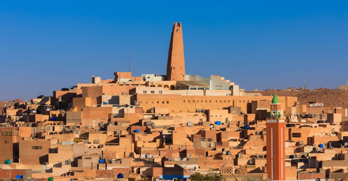
Photo: Djamel Ramdani / Pexels
The largest desert in the world is not the Sahara — it's Antarctica. The Antarctic Polar Desert covers about 14 million square kilometers, making it the single biggest desert on Earth. The Sahara, the answer most people give, is only the third-largest. The reason for the surprise is a definition almost everyone gets wrong: deserts are ranked by dryness, not heat, and the driest large landmasses on the planet are the two ice sheets sitting on top of it.
The Short Answer: Largest Deserts (by Area)
Table 1. The world's largest deserts by area, type, and location.
| Rank | Desert | Type | Area (approx.) | Location |
|---|---|---|---|---|
| 1 | Antarctic | Polar (cold) | 14.2 million km² | Antarctica |
| 2 | Arctic | Polar (cold) | 13.9 million km² | Arctic region |
| 3 | Sahara | Subtropical (hot) | 9 million km² | North Africa |
| 4 | Arabian | Subtropical (hot) | 2.3 million km² | Arabian Peninsula |
| 5 | Gobi | Cold winter | 1.3 million km² | China & Mongolia |
| 6 | Kalahari | Semi-arid subtropical | 900,000 km² | Southern Africa |
| 7 | Patagonian | Cold, rain-shadow | 670,000 km² | Argentina |
| 8 | Great Victoria | Subtropical (hot) | 647,000 km² | Australia |
| 9 | Syrian | Subtropical (hot) | 500,000 km² | Middle East |
| 10 | Great Basin | Cold, rain-shadow | 492,000 km² | United States |
The top two entries are frozen. The Sahara is the largest hot desert, which is a narrower, different record from largest desert overall — a distinction most rankings you'll find online quietly skip.
What a Desert Actually Is
A desert is defined by aridity, not temperature. Climatologists commonly use a threshold of about 250 millimeters (10 inches) of precipitation per year as the boundary between "arid" and everything wetter, though some classifications use an aridity index that also accounts for evaporation and temperature rather than rainfall alone. Sand, dunes, and scorching heat are common features of some deserts, but none of them are part of the technical definition.
This is the key that unlocks the whole ranking. The interior of Antarctica receives only a few centimeters of snow water equivalent a year, drier than many parts of the Sahara. Almost no liquid water exists there. It is, by the precise meteorological definition, one of the most extreme deserts on the planet. It just happens to be covered in ice that accumulated over hundreds of thousands of years, because what little falls almost never melts and instead compacts into the ice sheet layer by layer.
So deserts come in two broad families, and understanding both is the fastest way to make sense of the ranking above.
- Hot (subtropical) deserts — the Sahara, Arabian, Kalahari, Great Victoria — formed where descending dry air suppresses rainfall near 30 degrees latitude, north and south of the equator.
- Cold (polar) deserts — the Antarctic and Arctic — formed because frigid air holds almost no moisture, so almost no precipitation falls in the first place.
A third, smaller category, rain-shadow deserts like the Gobi, Patagonian, and Great Basin, forms downwind of major mountain ranges that wring the moisture out of passing air before it ever arrives. All three mechanisms are explained below, because none of them have anything to do with heat.
How a Desert Forms: Three Different Machines, One Result
"Desert" describes an outcome — persistent low precipitation — not a single cause. Three distinct atmospheric mechanisms produce that outcome, and each explains a different chunk of the top-10 list above.
The Hadley cell: why hot deserts cluster near 30° latitude
Air near the equator absorbs intense solar heating, rises, and dumps its moisture as tropical rain — this is why the Amazon and Congo basins are so wet. That same air, now dry, spreads north and south at high altitude and sinks back down around 30° latitude, both north and south of the equator. Sinking air compresses and warms, which lowers its relative humidity even further and suppresses cloud formation almost entirely. This descending branch of what meteorologists call the Hadley cell is why a band of deserts circles the globe at roughly 15° to 35° latitude in both hemispheres — the Sahara, the Arabian Desert, the Kalahari, the Sonoran, and the Great Victoria Desert all sit inside this belt.
The rain shadow: why some deserts sit next to tall mountains
Moist air forced to rise over a mountain range cools as it climbs, and cool air holds less water vapor than warm air, so the moisture condenses and falls as rain or snow on the windward slope. By the time that same air crosses the peak and descends the other side, it has lost most of its water and warms again as it sinks — arriving bone-dry. This rain shadow effect is the primary reason the Gobi Desert exists on the leeward side of the Himalayas and Tibetan Plateau, why Argentina's Patagonian Desert sits east of the Andes, and why the Great Basin Desert in the western United States lies east of the Sierra Nevada and Cascade ranges.
Cold, dry air: why the poles are deserts despite having almost no heat
Cold air simply cannot hold much water vapor — a physical relationship known as the Clausius-Clapeyron relation, which roughly means the amount of moisture air can carry drops as temperature falls. At the poles, where average air temperatures sit tens of degrees below freezing for most of the year, the atmosphere is intrinsically starved of moisture no matter what else is happening. Combine that with the fact that both poles sit under persistent high-pressure systems that further discourage storm formation, and you get the driest large regions on the planet, even though neither one feels remotely "desert-like" to a visitor bundled in thermal gear.
H3: What defines a desert if not sand or heat?
A desert is any region that receives roughly 250 mm (10 in) or less of precipitation annually, evaluated against evaporation rates rather than temperature. Sand deserts like the Sahara's ergs get the cultural attention, but rocky, icy, and gravel-covered regions meet the same scientific definition and, in the case of the poles, dwarf them in size.
The Antarctic: The Biggest, Driest, Highest Desert
Antarctica is a desert of superlatives. Beyond being the largest, its interior holds some of the driest spots on Earth — the McMurdo Dry Valleys, the largest ice-free region on the continent at roughly 4,800 km² (1,850 sq mi), receive only about 50 mm of snow water equivalent a year, and some sections are thought to have gone without any significant precipitation for as long as two million years. What little snow does fall is often stripped away again by fierce, dry katabatic winds that sweep down from the polar plateau and cause the snow to sublimate — turn directly from ice into water vapor — before it can accumulate.
Antarctica is also the coldest and, on average, the highest continent, home to the lowest natural air temperature ever recorded on Earth's surface: -89.2°C (-128.6°F) at Vostok Station on July 21, 1983. These extremes link directly to other records covered in the hottest and coldest places on Earth and connect to the broader physics of aridity discussed in the driest and wettest places on Earth.
Despite being almost waterless in liquid form, Antarctica holds about 70% of the world's fresh water, locked in ice that averages roughly 2.16 km (1.3 mi) thick and reaches over 4.7 km (2.9 mi) at its deepest point. A desert that contains most of the planet's fresh water is exactly the kind of paradox the aridity-based definition produces — and it's a paradox that trips up nearly everyone encountering this ranking for the first time.
Life in the Dry Valleys is a case study in minimalism. Rather than plants or animals, the ecosystem is dominated by microbial mats living inside porous rocks (a strategy called endolithic colonization) and communities of microscopic organisms clinging on in the thin films of liquid water that briefly appear where ice meets sun-warmed rock in the short austral summer. Researchers studying these communities have used the Dry Valleys as a proxy environment for studying how life might persist on Mars, precisely because the combination of cold, dryness, and radiation exposure has few equivalents anywhere else on Earth.
The Arctic: The Second-Largest Desert, and the Least Recognized
The Arctic Polar Desert, covering roughly 13.9 million km² across the Arctic Ocean basin and its surrounding tundra fringe, is almost never included in casual "biggest desert" conversations, yet it misses first place by only a slim margin. Like Antarctica, its size comes from the same cause: intensely cold air holds almost no moisture, so annual precipitation across much of the high Arctic totals well under 250 mm, qualifying it as arid by the same standard used for the Sahara.
The Arctic differs from Antarctica in one structural way that matters for the ranking: much of it is sea ice floating on ocean rather than a continental ice sheet sitting on bedrock, so its extent fluctuates more with the seasons and with long-term climate trends than Antarctica's does. That variability is also why area estimates for the Arctic desert differ more between sources than estimates for the Antarctic desert, which sits on a fixed landmass.
The Sahara: Largest Hot Desert
The Sahara spans roughly 9 million km² across North Africa — an area comparable to the entire United States or China — making it the largest hot desert and the popular mental image of "desert," even though it ranks only third overall. Only about a quarter of the Sahara is covered by sand dunes (ergs); the rest is gravel plains (reg), rocky plateaus (hamada), and mountain ranges, including peaks in the Ahaggar and Tibesti massifs that rise above 3,000 meters (9,800 ft).
The Sahara is also a functioning climate machine, not just a static landscape. Satellite data from NASA's CALIPSO mission tracked an average of about 27.7 million tons of Saharan dust crossing the Atlantic Ocean every year between 2007 and 2013, carrying with it an estimated 22,000 tons of phosphorus, an amount roughly matching what the Amazon rainforest loses annually to rainfall runoff and flooding. In effect, dust blown off the world's largest hot desert helps replenish the nutrient budget of the world's largest rainforest, thousands of kilometers away.
The Sahara's boundaries have also shifted dramatically over geological time. As recently as 6,000 to 11,000 years ago, during a period paleoclimatologists call the African Humid Period, much of what is now desert was wooded savanna threaded with rivers and lakes — including a "mega-Lake Chad" thought to have covered roughly 360,000 km², comparable in size to the modern Caspian Sea. Rock art at sites like Tassili n'Ajjer in Algeria still shows the hippos, giraffes, and cattle that lived there. Research on sediment cores suggests the transition back to desert conditions happened abruptly, over as little as one to two centuries, driven by a slow shift in Earth's orbital tilt that weakened the West African monsoon. It connects to the planet's rainfall extremes covered in the driest and wettest places on Earth.
H3: Is the Sahara growing?
Long-term studies of rainfall records suggest the Sahara's boundary has expanded modestly over the past century, particularly along its southern Sahel fringe, though the desert has also been dramatically smaller in the past — a reminder that desert edges are dynamic zones driven by shifting rainfall patterns rather than fixed lines on a map.
Beyond the Top Three: How the Rest of the List Compares
Once you get past the two polar deserts and the Sahara, the list splits cleanly along the three formation mechanisms described earlier. The table below groups the next tier of major deserts by how they actually formed, which is a more useful way to understand them than area alone.
Table 2. Major deserts grouped by formation mechanism.
| Desert | Mechanism | Approx. area | Notable feature |
|---|---|---|---|
| Arabian | Hadley cell (subtropical high) | 2.3 million km² | Contains the Rub' al Khali (Empty Quarter), the largest contiguous sand sea on Earth |
| Gobi | Rain shadow (Himalaya/Tibetan Plateau) | 1.3 million km² | Winter temperatures below -20°C, summer above 33°C |
| Kalahari | Hadley cell + interior continentality | 900,000 km² | Semi-arid; supports more vegetation than most true deserts |
| Patagonian | Rain shadow (Andes) | 670,000 km² | Cold desert with persistent, powerful westerly winds |
| Great Victoria | Hadley cell (Southern Hemisphere) | 647,000 km² | Australia's largest desert, mostly sand ridges and scrub |
| Syrian | Hadley cell + continental interior | 500,000 km² | Basalt and gravel plains across Syria, Jordan, and Iraq |
| Great Basin | Rain shadow (Sierra Nevada/Cascades) | 492,000 km² | Cold desert; home to Death Valley, the hottest air temperature ever officially recorded |
| Atacama | Rain shadow (Andes) + cold ocean current | 105,000 km² | Driest non-polar desert; core areas average roughly 15 mm of rain a year |
The Atacama is worth singling out even at just 105,000 km², a fraction of the Sahara's footprint, because it demonstrates a fourth reinforcing factor beyond the three main mechanisms: a cold ocean current running along the coast (the Humboldt Current) chills the air above it, and chilled air holds less moisture, which suppresses rainfall on top of the rain-shadow effect already produced by the Andes. Some Atacama weather stations recorded essentially no measurable rain from 1964 to 2001, and parts of the desert are estimated to have gone over 400 years without significant rainfall — a dryness record that rivals the Dry Valleys of Antarctica despite sitting near the equator rather than the pole.
Life in the Driest Places on Earth
It would be reasonable to assume nothing lives in the driest deserts, but both the hyper-arid core of the Atacama and the ice-free valleys of Antarctica host organisms, just not the kind most people picture. In the Atacama, researchers have found bacterial communities that appear to survive largely on fog moisture and rare rain pulses that occur perhaps once a decade, with some microbial populations effectively dormant between events — closer to biological suspended animation than to conventional plant or animal life. Scientists studying the region have described it as a useful analog for the kind of environment a Mars rover might encounter, since both settings combine extreme dryness with high radiation exposure and large daily temperature swings.
The same logic applies to the McMurdo Dry Valleys, where the entire visible ecosystem is often reduced to endolithic microbes (organisms living just beneath the surface of translucent rocks, where enough sunlight penetrates for photosynthesis while the rock itself buffers against wind and extreme cold) and a handful of specialized soil microorganisms clustered in transient patches of meltwater. Neither environment supports anything resembling the plants and large animals people associate with "desert" wildlife in the Sahara or the American Southwest — a further sign of how differently the word "desert" plays out depending on which formation mechanism produced it.
Why Deserts Matter Beyond the Ranking
Deserts and the broader category of drylands are not a marginal slice of the planet. According to the UN Convention to Combat Desertification's 2024 Global Land Outlook, drylands now cover about 40.6% of Earth's land surface excluding Antarctica, having expanded by roughly 4.3 million km² over the past three decades as previously humid regions became permanently drier. Up to 40% of all land globally is considered degraded, a condition that directly affects an estimated three billion people and, by UN estimates, threatens close to half of global GDP.
That matters for the desert ranking in a subtle way: it means the boundary between "desert" and "not yet desert" is not fixed. The Sahara's slow southern creep into the Sahel, the documented spread of drylands worldwide, and the sensitivity of even the polar deserts to changing precipitation patterns all mean that a ranking like the one at the top of this article is a snapshot, not a permanent scoreboard. Numbers a few decades from now, particularly for the Sahara and the Arctic, are likely to look different from the ones cited here.
Why the Ranking Surprises People
The confusion is cultural, not scientific. "Desert" entered everyday language as shorthand for sandy and hot, while climatology uses it to mean dry, full stop. Both usages are valid within their own contexts, but the record for "largest desert" follows the scientific definition, which is why the icy poles take first and second place while the Sahara, despite being nine times the size of Texas, still finishes third.
It's a useful reminder that world records depend entirely on how a category is defined. Change the question from "which region receives the least precipitation" to "which sandy, hot region is largest," and the Sahara instantly reclaims the crown — it just isn't the question this particular ranking is answering.
H3: Why don't polar deserts feel like the Sahara if they're both technically deserts?
Because temperature and precipitation are independent variables. A region can be extremely dry and extremely cold at the same time — Antarctica proves this at continental scale. The two properties happen to overlap in places like the Sahara, which is both hot and dry, but nothing about the definition of "desert" requires heat; it only requires a persistent shortage of water.
Common Confusions About "The Largest Desert"
A few misconceptions recur often enough to address directly.
"Deserts are all sand." Sand dunes cover only a minority of most deserts by area. In the Sahara it's roughly a quarter; in Antarctica, essentially none of the surface is sand at all, since it's covered by ice and exposed rock instead.
"Cold and desert are contradictory terms." They aren't, because "desert" is a precipitation classification, not a temperature classification. A region can be arctic-cold and still qualify as one of the driest places on the planet, which is exactly the case for both poles.
"The Sahara is the biggest desert because it's the biggest sand region people picture." It's the biggest hot desert, a real and meaningful record, but not the biggest desert overall. Conflating the two is the single most common error in casual discussions of this topic, and it's an easy one to make since almost no popular media distinguishes the two categories.
"Desert size never changes." It does, on both geological and human timescales. The Sahara was green savanna within the last 10,000 years, and today's drylands are expanding due to a mix of natural climate variability and human land-use change, according to the UNCCD's most recent assessment.
Frequently Asked Questions
Q: What is the largest desert in the world? A: The Antarctic Polar Desert, at about 14.2 million km². It's the largest because a desert is defined by low precipitation, not heat, and Antarctica's interior receives less precipitation than parts of the Sahara. The Arctic is second, and the Sahara is third.
Q: Why is Antarctica considered a desert? A: Because a desert is any region receiving very little precipitation, typically under 250 mm a year, regardless of temperature. Antarctica's interior gets only a few centimeters of snow water equivalent annually, making it extremely arid. The ice exists because the small amount that falls almost never melts and has built up over hundreds of thousands of years.
Q: What is the largest hot desert? A: The Sahara in North Africa, at roughly 9 million km², an area comparable to the entire United States. It's the third-largest desert overall, behind the two polar deserts, but the largest of the hot, subtropical deserts that most people picture when they hear the word "desert."
Q: What is the largest sand desert specifically? A: The Rub' al Khali, or Empty Quarter, within the Arabian Desert, is the largest contiguous sand sea on Earth. It's a subset of the broader Arabian Desert rather than a separate entry on the overall largest-deserts list.
Q: Is the Sahara getting bigger? A: The Sahara's edges fluctuate with climate over long periods. Studies of rainfall trends suggest it has expanded modestly over the last century, particularly along its southern Sahel border, but the desert has also been far smaller in the past — around 6,000 to 11,000 years ago much of it was green savanna. Its boundary is dynamic, driven by shifts in monsoon rainfall patterns.
Q: How much of the Sahara is actually sand? A: Only about a quarter. Most of the Sahara is gravel plains (reg), rocky plateaus (hamada), and mountain ranges. The vast sand-dune seas (ergs) that define the popular image cover a minority of its total area.
Q: What is the driest desert on Earth? A: The Atacama Desert in Chile, not the Sahara or Antarctica. Its hyper-arid core averages roughly 15 mm of rain a year, and some stations have gone decades or even centuries with essentially no measurable rainfall, driven by a combination of the Andes rain shadow and the cold Humboldt Current offshore.
Q: Does anything live in the world's driest deserts? A: Yes, but rarely plants or large animals. In the Atacama's core and Antarctica's McMurdo Dry Valleys, life is largely limited to specialized bacteria and microbial communities living inside porous rock or in brief pockets of meltwater, ecosystems researchers use as analogs for studying how life might survive on Mars.
Q: Why do deserts cluster around 30 degrees latitude? A: Because of the Hadley cell, a global atmospheric circulation pattern. Air that rises and loses its moisture as rain near the equator descends again around 30° north and south, arriving dry and warming further as it sinks, which suppresses cloud formation and rainfall across that latitude band worldwide.
Q: Is desert area increasing worldwide? A: Global drylands, the broader category that includes deserts, have expanded by roughly 4.3 million km² over the last three decades and now cover about 40.6% of Earth's land surface excluding Antarctica, according to the UN Convention to Combat Desertification's 2024 Global Land Outlook.
The takeaway
The word "desert" carries two different meanings that people use interchangeably without noticing, and only one of them is scientifically precise. Once you rank landmasses by actual precipitation rather than by how sandy or hot they look, the ice sheets at both poles dwarf even the Sahara, because cold air is simply incapable of holding much water vapor in the first place. The Sahara's record as the largest hot desert is real and impressive, but it's a narrower title than most people assume they're citing when they call it the world's biggest desert. The next time the topic comes up, the useful question isn't "which desert is biggest," it's "biggest by which definition" — and that single follow-up question resolves nearly every disagreement the topic tends to produce.
Read next:
- The Largest Islands in the World
- The Driest and Wettest Places on Earth
- The Hottest and Coldest Places on Earth
Sources
- NASA — Satellite Reveals How Much Saharan Dust Feeds Amazon's Plants
- Nature Scitable — Green Sahara: African Humid Periods Paced by Earth's Orbital Changes
- UN Convention to Combat Desertification — Global Land Outlook 2 (2024)
- Wikipedia / peer-sourced overview — McMurdo Dry Valleys precipitation and sublimation
- World Meteorological Organization — official global temperature and climate extremes archive
- ASU News — Tracking Water in the World's Driest Desert (Atacama)
- Gobi Desert climate and rain-shadow formation overview
Bottom line: The biggest deserts on Earth are frozen, not sandy. Once you define a desert by dryness instead of heat, Antarctica wins, and the Sahara, impressive as it is, comes third.
Last verified: July 2026
Follow new articles
Add SciHub101 to your feed reader to see new science and technology stories.
About the Author
SciHub101 is an independent science and technology publication founded and edited by Buğra Sözeri, a software engineer and app developer based in Türkiye. AI tools assist with drafting and research. Source documentation in the existing archive is uneven, and articles are being reviewed and corrected. The Editorial Team byline identifies editorial responsibility; it does not certify specialist or independent human review. Where we compare products, anything built by our own team is labelled as such — see the editorial guidelines and About page for how corrections and disclosures work.
Related Articles
The Longest Rivers in the World: The Nile, the Amazon, and a Measurement Fight
For over a century, the Nile has been called the longest river on Earth at about 6,650 kilometres. But a stubborn group of scientists argues the Amazon is actually longer — and the disagreement isn't sloppiness. It comes down to a genuinely hard question: where does a river begin, and where does it end? The answer changes the ranking, and reveals why even something as basic as 'how long is this river' has no single correct number.
The Deepest Lakes in the World: Lake Baikal and the Crack in a Continent
Lake Baikal in Siberia plunges to 1,642 metres — deep enough to swallow the world's tallest building twice over with room to spare. It is not just the deepest lake on Earth; it holds about a fifth of all the planet's unfrozen fresh water and has existed for 25 million years, longer than any other lake. The deepest lakes share a common origin: they sit in places where the Earth's crust is literally being pulled apart.

The Driest and Wettest Places on Earth: Extreme Precipitation Records
Some corners of the Atacama Desert have received no measurable rainfall since weather records began. Others, 400 meters above sea level in northeast India, average nearly 12,000 mm of rain every year — enough to submerge a four-story building. The gap between Earth's driest and wettest places is not just meteorological curiosity. It is a product of ocean currents, mountain geometry, and atmospheric circulation that shapes everything from agriculture to geology to the evolution of life itself.
The Highest and Lowest Points on Earth: Everest, Challenger Deep, and the Full Vertical Range
Mount Everest's summit reaches 8,848.86 meters above sea level, measured in a joint 2020 China-Nepal survey using GPS and gravity data — 86 centimeters higher than the figure used for most of the 20th century. The floor of Challenger Deep in the Mariana Trench sits 10,935 meters below sea level. The total measured vertical range of Earth's surface is therefore approximately 19,784 meters — about 19.8 kilometers from the lowest ocean floor to the highest mountain peak. Buried under 2.7 kilometers of Antarctic ice, the Denman Glacier trough reaches 3,500 meters below sea level: the deepest point on continental land, and the place where the next large ice loss could have catastrophic consequences.
Biggest Cities in the World by Population: City, Metro, and Urban Area
Jakarta leads the UN's 2025 city ranking, yet Chongqing has more people inside its borders. See the biggest cities by city, urban area, and metro definition.