The Largest Countries in the World: Russia Spans Eleven Time Zones
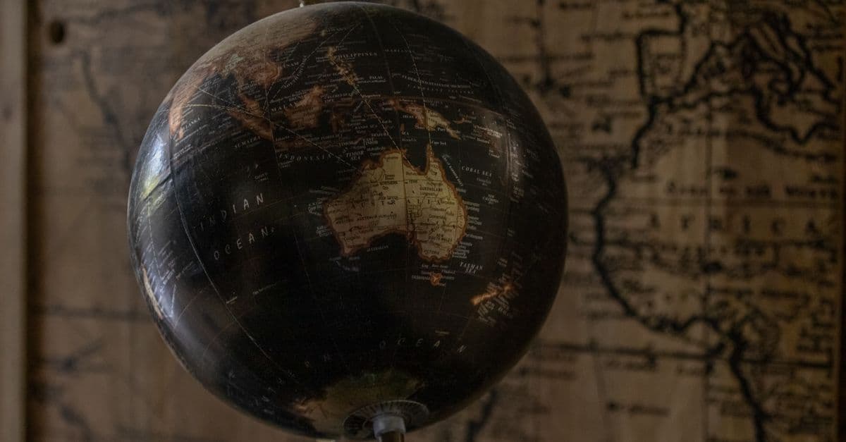
Photo: Mirko Fabian / Pexels
The largest country in the world by area is Russia, at roughly 17.1 million square kilometres (6.6 million square miles) — more than an eighth of all the land on Earth and nearly twice the size of the second-place country. It spans eleven time zones, so the country is never entirely inside the same calendar day: workers are clocking off in Kaliningrad on the Baltic coast while their compatriots on the Pacific coast are already asleep tomorrow. Behind Russia comes a tight cluster of continental giants — Canada, China, the United States, and Brazil — whose exact order depends on which government agency you ask and how it counts water. This is the full ranking, the history that built it, and the reason your mental map of the world is quietly wrong.
The Short Answer: Largest Countries (by Area)
| Rank | Country | Area (approx.) | Continent | Note |
|---|---|---|---|---|
| 1 | Russia | 17.1 million km² | Europe/Asia | Largest; spans 11 time zones |
| 2 | Canada | 9.98 million km² | North America | More lakes than the rest of the world combined |
| 3 | China | 9.6–9.7 million km² | Asia | Most land borders of any country (14) |
| 4 | United States | 9.4–9.8 million km² | North America | Ranking vs. China is genuinely contested |
| 5 | Brazil | 8.5 million km² | South America | Largest country entirely in the Southern Hemisphere |
| 6 | Australia | 7.7 million km² | Oceania | Largest country that is also a continent |
| 7 | India | 3.3 million km² | Asia | Most populous country, far smaller by land |
| 8 | Argentina | 2.8 million km² | South America | Largest Spanish-speaking country by area |
| 9 | Kazakhstan | 2.7 million km² | Asia | Largest landlocked country in the world |
| 10 | Algeria | 2.4 million km² | Africa | Largest country in Africa |
Table: The ten largest countries in the world by total land area, based on figures compiled from national statistical agencies and the CIA World Factbook. The US–China order varies by source depending on whether disputed territories and coastal waters are counted — even country sizes carry an asterisk.
Russia: A Country the Size of a Planet's Face
Russia is so vast it resists intuition. At 17.1 million km² it is larger than the entire surface area of Pluto, bigger than the combined area of the next two countries on this list, and it crosses eleven time zones — more than any other nation on Earth. Stretch a straight line from Russia's Baltic exclave of Kaliningrad to its Pacific coast near Vladivostok and you cover roughly 9,000 kilometres (5,600 miles), almost a quarter of the planet's circumference, without ever leaving Russian territory.
Much of that immensity is Siberia: taiga forest, permafrost, and tundra that stays frozen for eight or nine months of the year. It's a landscape so extreme that Oymyakon, a village in the Sakha Republic, holds the record for the coldest permanently inhabited settlement on Earth, with temperatures that have dropped below −67°C (−89°F). Despite covering more than an eighth of the planet's land, Russia is home to fewer than 150 million people — a population density of roughly nine people per square kilometre, one of the lowest of any major country, because so much of that land is simply too cold or too remote to settle.
Russia's size is not an accident of geology; it's a legacy of roughly four centuries of imperial expansion, beginning with the conquest of the Khanate of Sibir in the late 1500s and continuing eastward across Siberia to the Pacific by the mid-1600s. That same empire-building dynamic — grabbing thinly defended land faster than anyone could stop you — is the subject of the largest empires in history, where the 13th-century Mongol Empire conquered more contiguous land in a single lifetime than any state before or since.
How Do You Actually Measure a Country's Size?
Before ranking anything, it helps to know what "area" even means here, because the answer is less settled than it sounds. National statistics agencies, the United Nations, and the CIA World Factbook don't always draw a country's boundary the same way, and that produces genuinely different numbers for the same nation.
The differences come from a handful of specific choices:
- Land only, or land plus inland water? Lakes, rivers, and reservoirs are sometimes counted as part of a country's territory and sometimes excluded. Canada's enormous freshwater surface area — it holds roughly 60% of the world's lakes by number — shifts its total meaningfully depending on which rule is used.
- Disputed and claimed territory. China's figure changes depending on whether Taiwan and contested Himalayan borderlands are included. Argentina's official area includes its claim to part of Antarctica and the Falkland Islands, which most other countries don't recognise in that total.
- Overseas territories. France's mainland ("Metropolitan France") is under 550,000 km², but France including all its overseas departments and territories is far larger. Most rankings, including this one, use figures that reflect a country's contiguous or generally recognised sovereign territory rather than every scattered island possession.
- Exclusive Economic Zones (EEZ) are not land area. A country's EEZ — the ocean territory where it controls fishing and resource rights, typically extending 200 nautical miles from shore under the UN Convention on the Law of the Sea — is sometimes confused with land area in casual rankings. France actually has the largest EEZ in the world thanks to its scattered island territories, despite ranking nowhere near the top of this list, because EEZ measures ocean, not land.
That's why you'll see Russia's area quoted anywhere from about 17.0 to 17.1 million km² depending on the source, and why the US and China genuinely swap third and fourth place depending on which agency's numbers you trust. None of these are errors; they're different, defensible definitions of the same question.
Why do the United States and China trade places in the rankings?
The US and China are close enough in size — both around 9.4 to 9.8 million km² — that small measurement choices flip their order. The CIA World Factbook has historically ranked the US third and China fourth by total area including water, while UN-based figures using land area alone sometimes reverse it. Both are correct under their own definitions.
Why the Map Makes Northern Countries Look Even Bigger
Russia and Canada look enormous on a standard classroom world map — and they genuinely are huge — but the most common map projection exaggerates them even further. The Mercator projection, created by Flemish cartographer Gerardus Mercator in 1569 for ocean navigation, preserves straight-line compass directions, which sailors needed. To do that, it has to stretch land as it approaches the poles, so anything far from the equator balloons in apparent size while anything near the equator shrinks.
The classic demonstration: on a Mercator map, Greenland looks roughly the same size as the entire continent of Africa. In reality, Africa is about 14 times larger than Greenland — a discrepancy explored in detail in the largest islands in the world, where Greenland's status as the biggest island (rather than a small continent) is its own quirk of definition. The same distortion inflates Russia's and Canada's apparent size relative to tropical countries like Brazil and the Democratic Republic of the Congo, which sit much closer to the equator and are rendered comparatively small even though their true areas are substantial.
Think of it like photographing a globe with a fisheye lens pointed at the equator: everything in the centre of the frame looks roughly true to scale, but everything near the top and bottom edges stretches outward. That's essentially what Mercator does mathematically. It's not that Russia and Canada are fake giants — they are real giants — it's that the map you grew up with adds a thumb on the scale that most people never learn to correct for.
Alternative projections exist specifically to fix this. The Gall–Peters projection, popularised in the 1970s as a corrective, preserves relative area at the cost of distorting shape, making equatorial countries look stretched vertically but restoring their true size relative to the poles. Neither projection is "right" in an absolute sense — you cannot flatten a sphere onto a rectangle without distorting something, whether that's shape, area, distance, or direction. Cartographers call this the fundamental trade-off of map projection, and it's why no single world map can ever be fully accurate on every dimension at once.
The Rest of the Top Ten, Country by Country
Canada: The Second-Biggest, and the Wettest
Canada covers about 9.98 million km², putting it a comfortable second overall, though it trails Russia by nearly 7 million km². What sets Canada apart isn't just its size but its water: the country contains more lakes than the rest of the world's countries combined, including Great Bear Lake and Great Slave Lake, both large enough to be visible from space as distinct bodies of water. Roughly 9% of Canada's total area is fresh water.
Despite its size, Canada's population is concentrated in a narrow band close to the US border — about 90% of Canadians live within 160 kilometres (100 miles) of it — leaving the vast northern territories of Yukon, Nunavut, and the Northwest Territories almost empty by comparison. It's a pattern that echoes Russia's: enormous territory, but climate and geography herd the population into a fraction of it.
China: Fourteen Neighbors, One Enormous Interior
China's area is generally put at around 9.6 to 9.7 million km², making it the third or fourth largest country depending on the source. What's undisputed is that China shares land borders with 14 countries, more than any other nation on Earth — a diplomatic and defensive challenge that comes bundled with sheer size. Its territory ranges from the Gobi Desert and Tibetan Plateau in the west to dense, subtropical river deltas in the southeast, giving it more climate diversity within one country's borders than almost anywhere else on the list.
The United States: Third or Fourth, Depending Who You Ask
The United States sits at roughly 9.4 to 9.8 million km², and as covered above, its precise rank against China shifts depending on the measurement standard used. What's stable is the geography: 50 states spanning tropical Hawaii, arctic Alaska, temperate mainland, and everything between, plus a network of territories in the Pacific and Caribbean that aren't typically folded into the headline figure.
Brazil: The Southern Hemisphere's Biggest Country
Brazil, at about 8.5 million km², is the largest country entirely within the Southern Hemisphere and the largest in South America, covering nearly half the continent's total land area. Most of that territory sits within the Amazon basin, home to the largest rainforest on Earth, which alone spans roughly 5.5 million km² across Brazil and eight neighbouring countries.
Australia: A Country That's Also a Continent
Australia, at about 7.7 million km², is the only country on this list that is also, by itself, an entire continent — a status Greenland notably does not share, which is precisely why Greenland counts as the world's largest island while Australia doesn't count as an island at all. Australia is also one of the driest inhabited continents, with roughly 70% of its land classified as arid or semi-arid, which is why its population of about 26 million clusters almost entirely along the eastern and southern coastlines.
India: Proof That Size and Population Don't Move Together
India covers about 3.3 million km², a fraction of Russia's footprint, yet it is either the most or second-most populous country on Earth, with well over 1.4 billion people. That combination gives India one of the highest population densities among large countries — several hundred people per square kilometre on average, compared to roughly nine per square kilometre in Russia. Nowhere on this list is the gap between "biggest by area" and "biggest by people" more dramatic.
Argentina, Kazakhstan, and Algeria: The Regional Giants
Argentina (about 2.8 million km²) is the largest Spanish-speaking country in the world and the second-largest in South America after Brazil. Kazakhstan (about 2.7 million km²) holds a distinction none of the others do: it is the largest landlocked country on Earth, with no direct access to open ocean, bordered instead by Russia, China, and the other Central Asian republics. Algeria (about 2.4 million km²) rounds out the top ten as the largest country in Africa, most of it Saharan desert.
Area vs. Population: Different Giants Entirely
As with most "biggest" questions, the answer splits depending on what you're actually measuring.
- By area: Russia leads by a wide margin, followed by Canada, China, and the United States — much of that territory cold, arid, or otherwise sparsely populated.
- By population: India and China lead, each home to well over a billion people, despite China ranking third or fourth by area and India ranking only seventh.
A country can be enormous and nearly empty, or modest in size and densely packed. Canada spreads roughly 40 million people across the world's second-largest territory, giving it one of the lowest population densities of any major nation. Bangladesh, by contrast, packs around 170 million people into an area smaller than the US state of Iowa, making it one of the most densely populated large countries on Earth. Area measures land. Population measures people. The world's "biggest" country depends entirely on which one you're asking about, and conflating the two produces some of the most common misconceptions about global geography.
What Historically Makes a Country This Big
The countries at the top of this ranking got there through a small, repeating set of historical forces rather than pure geographic luck alone.
Imperial expansion across thinly-populated land. Russia's growth across Siberia, and the United States' and Canada's growth across North America, followed a similar pattern: a state with organised military and administrative capacity expanding into territory held by populations without the same technology or unified political structure to resist for long. This is the same expansion dynamic that built the largest empires in history, from Rome to the Mongols to the British Empire, which at its early-20th-century peak governed roughly a quarter of the planet's land.
Geographic inheritance. Some countries simply inherited a large, contiguous continental interior with few competing regional powers nearby to contest it — Australia's interior, much of it desert unsuitable for dense settlement by any competing group, is a clear example.
Federation and unification. Several of the largest states on this list — the US, Brazil, Australia, and to some extent modern China — reached their current size by binding many previously separate regions, colonies, or kingdoms into a single political entity rather than through continuous frontier expansion alone.
Size brings its own costs. Defending long borders is harder: China's 14 neighbours mean 14 separate border relationships to manage. Governing remote regions is harder: Russia's Far East is closer to Tokyo than to Moscow. And holding together many different peoples, languages, and climates within one government is a persistent source of political strain — the same overextension pressure that eventually fractured every empire on record, including the largest ones in history.
Common Misconceptions About Country Size
"The biggest country must have the most people." It doesn't, and it's rarely close. Russia, the largest country by far, ranks ninth in the world by population. Meanwhile India, seventh on the area list, is either the first- or second-most populous country on Earth. Area and population are unrelated measures that happen to get conflated in casual conversation.
"Greenland is nearly the size of Africa." It isn't — that's a Mercator projection artifact, and Africa is roughly 14 times larger in reality. The confusion is common enough that it's one of the most-cited examples in cartography education for why projection choice matters.
"Bigger EEZ means bigger country." They're different measurements entirely. A country's Exclusive Economic Zone extends into the ocean and depends heavily on how many scattered islands a country controls — which is why France, a modestly sized country by land, has one of the largest EEZs on Earth thanks to its island territories in the Pacific, Indian Ocean, and Caribbean.
"Australia is an island, so Greenland shouldn't count as one either." The dividing line is conventional rather than physical: any landmass large enough and geologically distinct enough to be classified as a continent stops being counted as an island by definition, and Australia crossed that threshold while Greenland didn't. It's an arbitrary but consistently applied rule, covered in more depth in the islands ranking linked above.
Frequently Asked Questions
Q: What is the largest country in the world? A: Russia, at roughly 17.1 million km² — more than an eighth of all land on Earth and nearly twice the size of second-place Canada. It spans eleven time zones, so the country is never entirely within the same calendar day. Much of it is sparsely populated Siberian forest, tundra, and permafrost.
Q: Is Canada bigger than the United States? A: Yes, by total area. Canada is about 9.98 million km², larger than the United States, which sits at roughly 9.4 to 9.8 million km² depending on the source. The US and China are close enough in size that their own third-versus-fourth ranking shifts depending on how disputed territories and inland water are counted.
Q: Why do Russia and Canada look so big on maps? A: They are genuinely huge, but the common Mercator map projection, designed in 1569 for ocean navigation, exaggerates landmasses near the poles while shrinking those near the equator. The same effect makes Greenland look roughly as large as Africa, when Africa is actually about 14 times bigger. So Russia and Canada appear even larger relative to tropical countries than their true area justifies.
Q: What is the largest country by population instead of area? A: India and China, each home to well over 1.4 billion people, far more than any other country — even though both rank lower than Russia, Canada, and the US by land area. Area and population are separate measures entirely: Russia is the biggest by land, but has one of the lowest population densities of any major country.
Q: How many time zones does Russia have? A: Eleven. Because Russia stretches roughly 9,000 km from its Baltic exclave of Kaliningrad in the west to its Pacific coast in the east, the sun rises on its far-eastern regions while its western regions are still hours behind, meaning parts of the country are always in a different time and sometimes a different calendar day.
Q: What is the largest landlocked country in the world? A: Kazakhstan, at roughly 2.7 million km², making it the ninth-largest country overall and by far the biggest with no direct coastline on the open ocean. It borders Russia, China, and several other Central Asian nations, and its geography ranges from steppe grassland to desert.
Q: What is the largest country in Africa? A: Algeria, at roughly 2.4 million km², is Africa's largest country by area, most of it Saharan desert. It ranks tenth in the global ranking. Algeria took the title after South Sudan's 2011 independence redrew regional borders and after Sudan itself lost territory in that split.
Q: Why does China's area figure change depending on the source? A: Different agencies handle disputed territory differently. Some figures for China include Taiwan and contested Himalayan border regions, while others exclude them, and inland water is sometimes counted and sometimes not. That produces a range of roughly 9.6 to 9.7 million km² across otherwise reputable sources, which is normal for large countries with unresolved border disputes.
Q: Is a country's Exclusive Economic Zone (EEZ) the same as its land area? A: No. An EEZ is ocean territory, typically extending 200 nautical miles from a country's coastline under international maritime law, where it controls fishing and resource rights. It has nothing to do with land area — France, which ranks far outside the top ten by land, has one of the world's largest EEZs because of its scattered overseas island territories.
Q: Which is bigger, Russia or Pluto? A: Russia, at about 17.1 million km², is very close in size to Pluto's total surface area of roughly 17.6 million km², making Russia one of the very few objects on Earth whose scale is genuinely comparable to a dwarf planet's entire surface, land and ice caps included.
The takeaway
Russia's size isn't a rounding error or a map trick, it's real: eleven time zones and more than an eighth of the planet's land, built up over four centuries of eastward expansion into some of the coldest inhabited territory on Earth. But "largest" is never a single, settled fact once you look closely. Canada, China, and the United States crowd together at the top depending on how you count disputed borders and inland water, Australia is the only country that doubles as its own continent, and the map most people grew up trusting quietly inflates the far north at the expense of the tropics. The real lesson of this ranking isn't which country wins, it's how many different, defensible ways there are to measure "biggest" before you even get an answer.
Read next:
Sources
- CIA World Factbook — country area entries and comparative country rankings
- World Population Review — largest countries in the world by area, 2026 compilation
- United Nations Statistics Division — country and territory land area data
- UN Convention on the Law of the Sea — Exclusive Economic Zone definitions
- Encyclopædia Britannica — Russia, Canada, Mercator projection, and country area entries
Bottom line: Russia is the undisputed giant by land, eleven time zones of it, but the map flatters the frozen north, the US–China order genuinely depends on who's counting, and "largest" flips entirely to India and China the moment you measure people instead of square kilometres.
Last verified: July 2026
Follow new articles
Add SciHub101 to your feed reader to see new science and technology stories.
About the Author
SciHub101 is an independent science and technology publication founded and edited by Buğra Sözeri, a software engineer and app developer based in Türkiye. AI tools assist with drafting and research. Source documentation in the existing archive is uneven, and articles are being reviewed and corrected. The Editorial Team byline identifies editorial responsibility; it does not certify specialist or independent human review. Where we compare products, anything built by our own team is labelled as such — see the editorial guidelines and About page for how corrections and disclosures work.
Related Articles
The Longest Tunnels in the World: 57 Kilometres Under the Alps
To send high-speed trains through the heart of the Alps, engineers didn't go over the mountains — they went straight through, boring the Gotthard Base Tunnel 57 kilometres beneath rock up to 2.3 kilometres thick. It's the longest railway tunnel on Earth, and at its deepest the rock above presses down so hard the temperature reaches 46°C. But the single longest tunnel of any kind carries no trains at all — it carries water to a thirsty city.
The Tallest Trees in the World: Hyperion and the Limits of Living Tall
Hidden in a Californian valley, its exact location kept secret to protect it, stands Hyperion — a coast redwood roughly 116 metres tall, the tallest living thing on Earth. It is taller than the Statue of Liberty, older than most nations, and growing near a hard ceiling that physics imposes on every tree: a height beyond which water simply cannot be lifted. The tallest trees aren't just big; they're pushing against the laws of nature.
What Is Geopolitics? How Geography Shapes the Fate of Nations
Why does Russia keep fighting over access to the sea? Why does the United States have so much room to maneuver? Why has Poland been invaded from both sides? Geopolitics argues that mountains, rivers, coastlines, and resources shape political choices more than most people expect. Here is how the idea works, and where it breaks down.


Biggest Cities in the World by Population: City, Metro, and Urban Area
Jakarta leads the UN's 2025 city ranking, yet Chongqing has more people inside its borders. See the biggest cities by city, urban area, and metro definition.