Countries with the Longest Rivers in the World (Ranked)
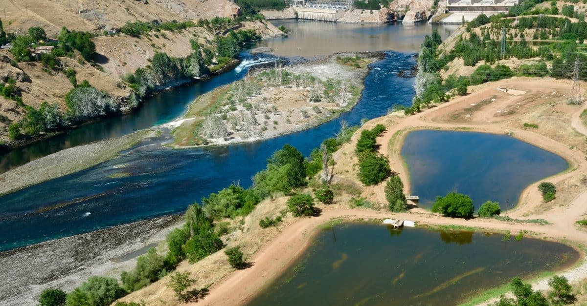
Photo: Ahsen / Pexels
Rivers are the circulatory system of continents — distributing freshwater from highlands to oceans, shaping civilisations, defining national boundaries, and driving ecosystems. The world's great rivers — the Nile, Amazon, Yangtze, Mississippi, Congo — are not merely geographic features but foundational facts of human history.
No country owns a river alone: the world's longest rivers typically cross multiple nations. But each is most associated with the country where it reaches its greatest power or where its civilisational role has been most profound.
Key takeaways
- The Nile (6,650 km) and Amazon (6,400 km) dispute the title of world's longest river — measurement methodology determines the winner.
- The Amazon carries approximately 20% of all the freshwater that flows into the world's oceans — far more than any other river, making it the world's most powerful by discharge.
- Russia hosts 4 of the world's 10 longest rivers (Ob, Yenisei, Lena, Amur), all draining Siberia into the Arctic Ocean.
- The Congo is the world's deepest river (up to 220m) and second-largest by discharge — it drains the world's second-largest tropical rainforest.
- Many of the world's great rivers are under severe threat from climate change, dams, and water abstraction.
The world's longest rivers
| Rank | River | Length (km) | Countries | Discharge (m³/s) |
|---|---|---|---|---|
| 1 | Nile | 6,650 | Uganda, Sudan, Egypt (+ others) | 2,830 |
| 2 | Amazon | 6,400 | Brazil, Peru, Colombia | 209,000 |
| 3 | Yangtze | 6,300 | China | 30,000 |
| 4 | Mississippi-Missouri | 6,275 | United States | 16,800 |
| 5 | Yenisei-Angara | 5,539 | Russia, Mongolia | 19,600 |
| 6 | Yellow (Huang He) | 5,464 | China | 2,110 |
| 7 | Ob-Irtysh | 5,410 | Russia, Kazakhstan, China | 12,475 |
| 8 | Congo | 4,700 | DRC, Congo, + others | 41,000 |
| 9 | Amur-Argun | 4,444 | Russia, China | 11,400 |
| 10 | Lena | 4,400 | Russia | 17,100 |
| 11 | Mekong | 4,350 | China, Laos, Thailand, Cambodia, Vietnam | 16,000 |
| 12 | Niger | 4,180 | Guinea, Mali, Niger, Benin, Nigeria | 5,589 |
| 13 | Brahmaputra | 3,848 | China, India, Bangladesh | 19,800 |
| 14 | Volga | 3,692 | Russia | 8,080 |
| 15 | Indus | 3,610 | China, India, Pakistan | 7,160 |
| 16 | Danube | 2,860 | Germany, Austria, Slovakia, Hungary, + 6 more | 6,500 |
| 17 | Zambezi | 2,693 | Zambia, Zimbabwe, + 4 | 3,400 |
| 18 | Rhine | 1,230 | Switzerland, Germany, Netherlands | 2,200 |
| 19 | Thames | 346 | United Kingdom | 65 |
| 20 | Seine | 775 | France | 480 |
Source: USGS Water Resources Data, International Commission on Large Dams (ICOLD) (2024), World's Major River Systems database — river lengths and discharge data from satellite monitoring and streamflow gauges.
Where This Data Comes From
River length and discharge data derive from the USGS (US Geological Survey) global river database, supplemented by national hydrological services in each country and the International Commission on Large Dams. Length is measured from the remotest headwater stream to the river mouth; this can be contentious when multiple tributaries compete for "true source" status (as with the Nile, Amazon, and Mississippi-Missouri). Discharge is measured at downstream gauging stations, typically as a long-term average during normal flow conditions (extreme floods or droughts create anomalous readings). For transnational rivers, discharge figures often represent the combined outflow of all tributaries and the main stem. Countries are listed in order of their role in each river's course (source to mouth), though many large rivers have genuinely shared significance across multiple nations. Data is current to 2024, though many gauging stations in developing nations are sparse or unreliable, making some discharge figures estimates.
What River Distribution Reveals About Continental Geography and Human Settlement
Rivers are not randomly distributed — their geography reflects continental hydrology and fundamentally shapes human development. The Amazon's extraordinary discharge (209,000 m³/s — nearly 10× the Congo, 70× the Nile) results from the Andes catching massive moisture-laden Atlantic Trade Wind flows that converge over the Amazon Basin. Russia's massive Siberian rivers flow northward into the Arctic, making them historically less useful for human commerce than the Nile, Yangtze, or Mississippi-Missouri, which flow through populated regions. The Nile's unusual importance despite moderate discharge reflects the accidental geography that makes it flow through one of Earth's driest regions, making it literally the life supply for Egypt. This geographic variation explains why "longest" and "most important" rivers differ: the Nile is longest (or tied) but sedentary; the Amazon is shorter but hydrologically dominant. Human civilisation has consistently settled along rivers regardless of length — the Tigris-Euphrates, Indus, Yangtze, Mississippi, and Danube each built empires not because they were longest but because they provided predictable water and transportation through densely settable land.
The Nile vs. Amazon debate
The Nile is officially the longest river at 6,650 km — but this is contested. The Amazon's length depends on which of its headwater tributaries you count as its true source. If the most remote headwater (the Apurímac-Ucayali system in Peru) is counted, the Amazon reaches approximately 6,992 km — longer than the Nile.
The dispute matters more for national pride than practical geography. What is not disputed: the Amazon wins every other meaningful measure. It carries approximately 20% of all freshwater flowing into Earth's oceans — more than the next seven largest rivers combined. It drains the world's largest tropical rainforest (5.5 million km²). It contains more species of fish than the entire Atlantic Ocean.
Russia: the river continent
Russia's river network is extraordinary. The major Siberian rivers — Ob, Yenisei, Lena, Amur — collectively drain approximately 12 million km² of territory (roughly the size of the contiguous United States) into the Arctic Ocean. These rivers are among the world's largest by volume and length, yet flow into the sparsely inhabited Arctic, making them largely irrelevant to human commerce compared to their scale.
The Volga (3,692 km), by contrast, drains European Russia and has been central to Russian civilisation — the spine of the medieval Rus trade routes, the site of the decisive Battle of Stalingrad, and still carrying approximately 40% of Russia's internal freight traffic.
The Yangtze: China's great river
The Yangtze (6,300 km) has been central to Chinese civilisation for thousands of years. It divides China into north (wheat-growing) and south (rice-growing) — a fundamental agricultural geography. The Yangtze Delta around Shanghai is one of the world's most economically productive regions.
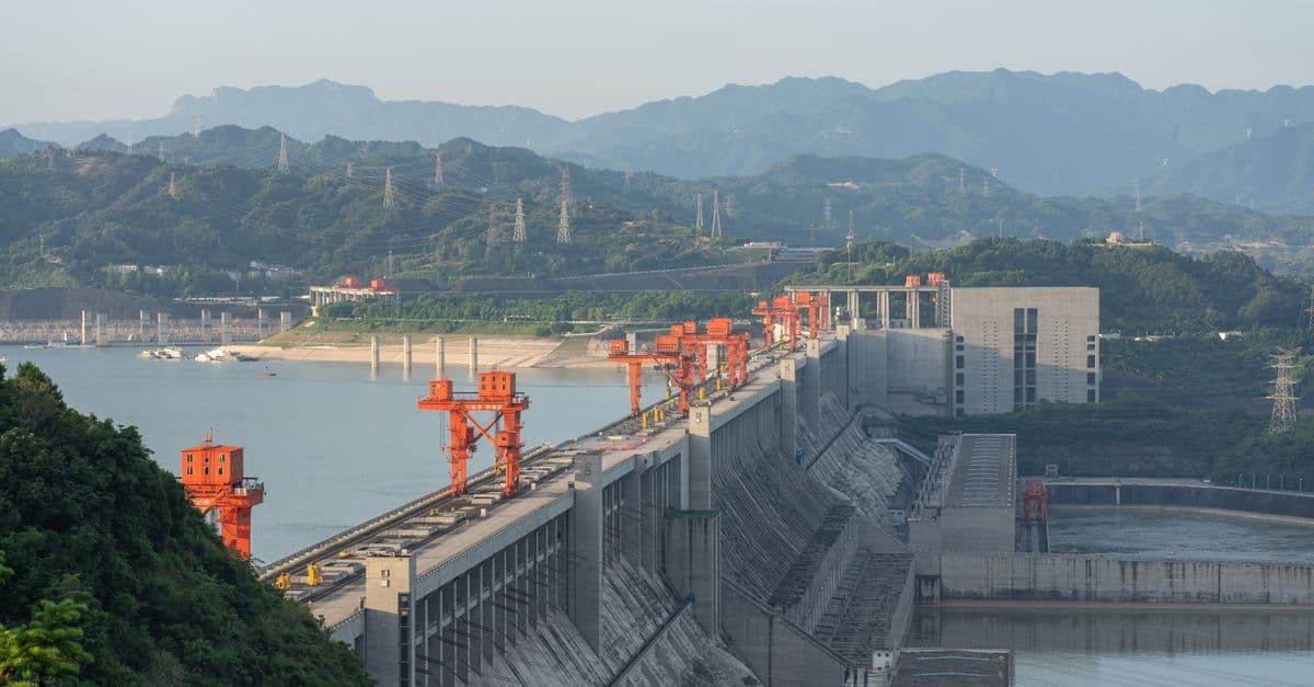
The Three Gorges Dam on the Yangtze — the world's largest power station by installed capacity (22,500 MW) — altered the river's hydrology permanently, displacing 1.3 million people and creating a 600 km reservoir. It provides approximately 10% of China's electricity from renewable hydro.
The Yangtze is one of the world's most threatened rivers. The Yangtze River dolphin (baiji) was declared functionally extinct in 2007 — the first large aquatic mammal driven to extinction in modern times. The river faces extreme sediment trapping behind Three Gorges, water pollution from industrial discharge, and overfishing.
The Congo: the deepest river
The Congo River (4,700 km) is the world's deepest river — reaching 220m in places — and the second largest by water discharge. It drains the Congo Basin rainforest, the second-largest tropical forest on Earth (3.4 million km²), which stores a disproportionate share of global carbon.
The Congo's potential for hydroelectric power is extraordinary. A proposed Grand Inga Dam complex on the Congo could generate 40,000 MW — nearly twice the Three Gorges Dam — enough to provide electricity for much of sub-Saharan Africa. It has been planned for decades but not yet built, due to financing, governance, and logistical challenges.
Most threatened rivers (2025)
Many of the world's great rivers are in crisis:
Colorado River (USA): Supplies water to 40 million Americans and massive irrigated agriculture. Has reached the Gulf of California only intermittently since the 1960s due to abstraction. Lake Mead (its largest reservoir) hit record-low levels in 2022 — at 26% capacity.
Mekong (Southeast Asia): China has built 11 large dams on the upper Mekong; downstream countries (Laos, Thailand, Cambodia, Vietnam) face reduced flows, altered flood cycles, and collapsed fisheries. The Mekong feeds 60 million people's diet primarily through its fish.
Indus (Pakistan/India): Feeds Pakistan's agriculture, which supports 220 million people. Heavily over-abstracted; glacial melt from the Himalayas (which feeds it) is accelerating due to climate change — short-term increase followed by long-term decline.
Ganges (India): Sacred to 1 billion Hindus; one of the world's most polluted rivers due to industrial discharge, untreated sewage, and solid waste. India's "Clean Ganga" programme has spent billions with limited visible improvement.
Frequently asked questions
What is the difference between length and discharge?
Length measures the distance from source to mouth. Discharge measures volume of water passing per unit time. A river can be very long (Nile) but low-discharge if it flows through desert (the Nile loses significant volume to evaporation crossing the Sahara). The Amazon is shorter than the Nile but carries ~70× more water because it flows through the world's most rainfall-intense tropical zone.
What is the most important river for human civilisation?
Historically, the Nile — which made Egypt possible (the entire fertile civilisation exists in the Nile Valley within desert). The Tigris-Euphrates (Iraq) was the cradle of Mesopotamia and the first cities. The Yangtze and Yellow Rivers built Chinese civilisation. The Indus hosted one of the earliest urban civilisations (Harappan). The Rhine-Danube shaped European commerce and borders. No single answer, but rivers were existential to all early civilisations.
Can rivers run dry?
Yes — increasingly so. The Colorado, Yellow (Huang He), Amu Darya (Aral Sea feeder), and others have all run dry at their mouths in recent decades due to over-abstraction. Climate change is intensifying both droughts (reducing flow) and floods (increasing damaging peak flows).
The bottom line
The world's great rivers are more than geographic features — they are the foundations of civilisations and ecosystems that have shaped human history. Russia's vast Siberian rivers drain an uninhabited interior into the Arctic; the Amazon carries a fifth of all freshwater flowing to the ocean; the Nile made Egypt possible across 5,000 years of history. But these extraordinary systems are under unprecedented pressure: dams, abstraction, pollution, and climate change are threatening rivers that billions of people depend on. The next century of water politics will be shaped less by which countries have the longest rivers than by which can manage them sustainably under accelerating stress.
Related Reading
Follow new articles
Add SciHub101 to your feed reader to see new science and technology stories.
About the Author
SciHub101 is an independent science and technology publication founded and edited by Buğra Sözeri, a software engineer and app developer based in Türkiye. AI tools assist with drafting and research. Source documentation in the existing archive is uneven, and articles are being reviewed and corrected. The Editorial Team byline identifies editorial responsibility; it does not certify specialist or independent human review. Where we compare products, anything built by our own team is labelled as such — see the editorial guidelines and About page for how corrections and disclosures work.
Related Articles
The Longest Rivers in the World: The Nile, the Amazon, and a Measurement Fight
For over a century, the Nile has been called the longest river on Earth at about 6,650 kilometres. But a stubborn group of scientists argues the Amazon is actually longer — and the disagreement isn't sloppiness. It comes down to a genuinely hard question: where does a river begin, and where does it end? The answer changes the ranking, and reveals why even something as basic as 'how long is this river' has no single correct number.
Countries with the Most Freshwater Lakes in the World
No single list ranks countries by lake count, because the answer depends on how small a pond you are willing to call a lake. Here is what the national surveys and satellite inventories actually say, and which lakes hold the most water.
Countries with the Most Freshwater Resources (Ranked)
Brazil has the world's largest total renewable freshwater resources — approximately 8,647 cubic kilometers per year, more than any other country and roughly 20 percent of the global total. Russia is second at 4,525 km³/year, Canada third at 2,860 km³/year. But total volume is only part of the story: Canada's per-capita freshwater availability is 36 times higher than China's. And water stress — not total availability — is the defining water challenge of the twenty-first century. This ranking covers the top 20 countries by total renewable freshwater resources, sourced from FAO AQUASTAT, with per-capita comparison and analysis of global water scarcity.
The Amazon Rainforest: Earth's Lungs Explained by Science
The Amazon is not Earth's oxygen factory, but it stores vast carbon and recycles rain across a continent. Here is what the evidence says about deforestation, drought, and tipping points.
Countries Facing the Worst Freshwater Stress (WRI Ranked)
WRI's 2023 Aqueduct update puts 25 countries, home to about a quarter of humanity, in the extremely high water stress category. Here is who ranks worst, why the rankings disagree, and what Cape Town, Chennai, the Aral Sea, and Israel show about causes and fixes.
Best Free Hydroponic Calculators and References 2026
Best free hydroponic calculators and references in 2026: Rootless Farm for crop profiles and 18 tools, plus five university and open tools, with limits.