How Tornadoes Form — Tornado Science Explained
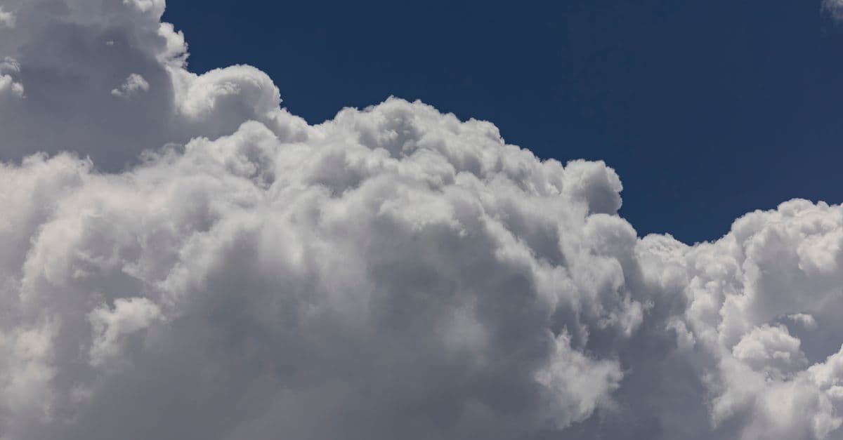
Photo: Stephen Leonardi / Pexels
A tornado is a violently rotating column of air that extends from a thunderstorm down to the ground. The United States gets roughly 1,200 tornadoes a year — more than the rest of the world combined — and they remain one of the most studied and least predictable weather phenomena on Earth.
This article explains the meteorology of how tornadoes form, why the central US is so prone to them, how the Enhanced Fujita scale rates them, and how modern radar and warning systems give people minutes — sometimes the difference between life and death — to take shelter.
The Four Ingredients
For a tornado to form, the atmosphere needs four things at the same time:
- A supercell thunderstorm — a rare type of storm with a deep, persistent rotating updraft called a mesocyclone.
- Warm, moist air at low levels — usually from the Gulf of Mexico in the US.
- Cold, dry air above — providing instability so the warm air rushes upward.
- Wind shear — winds changing speed and/or direction with altitude, creating horizontal rotation that the updraft can tilt vertical.
Of these four, wind shear is the key. Without it, you get a thunderstorm. With it, you get a rotating thunderstorm — a supercell — which is the parent of nearly every strong tornado.
Step by Step: From Sky to Ground
- A dryline or cold front acts as a trigger, lifting moist air upward.
- Strong vertical wind shear creates a horizontal tube of rotating air at low levels.
- The thunderstorm updraft tilts that tube vertical — birth of the mesocyclone.
- Lowered cloud base under the rotation forms a wall cloud.
- A funnel cloud descends from the wall cloud.
- When the funnel touches the ground, it is officially a tornado.
The whole sequence can unfold in 10–30 minutes, which is why even good warnings provide so little reaction time.
Why Tornado Alley Exists
The central US Plains are uniquely suited for tornadoes because three air masses regularly meet there:
- Cold, dry continental air from the Rocky Mountains.
- Warm, moist tropical air from the Gulf of Mexico.
- Hot, dry desert air from the Southwest, often forming a "cap" and a dryline.
The flat terrain lets these masses collide undisturbed. Peak season is April–June, when the temperature gradient is strongest.
Important update: Since around 2010, tornado activity has been shifting east. Mississippi, Alabama, Tennessee, and Kentucky — sometimes called the new "Dixie Alley" — now see more deadly tornadoes than the traditional Plains, partly because tornadoes there happen at night and inside hilly, wooded terrain that hides them until they strike.
The Enhanced Fujita (EF) Scale
The original Fujita scale was introduced by Tetsuya "Ted" Fujita in 1971. The Enhanced Fujita (EF) scale replaced it in 2007, using damage indicators to estimate wind speed more accurately.
| Rating | Wind Speed (mph) | Damage | Frequency |
|---|---|---|---|
| EF0 | 65–85 | Light — gutters, tree branches | Most common |
| EF1 | 86–110 | Moderate — roof surface peeled | Common |
| EF2 | 111–135 | Considerable — roofs torn off | Less common |
| EF3 | 136–165 | Severe — well-built homes destroyed | Rare |
| EF4 | 166–200 | Devastating — homes leveled | Very rare |
| EF5 | >200 | Incredible — homes swept away | Extraordinarily rare (~60 in US history) |
For reference, the British TORRO scale runs from T0–T11 and uses finer gradations.
The Deadliest Tornadoes in US History
- 1925 Tri-State Tornado — 695 deaths. Stayed on the ground for 3.5 hours and 219 miles across Missouri, Illinois, and Indiana — the longest single tornado path ever recorded.
- 2011 Joplin, Missouri (EF5) — 161 deaths. Cut a 6-mile scar through the city.
- 2013 Moore, Oklahoma (EF5) — 24 deaths. Hit two elementary schools.
- 2011 Super Outbreak — 360 tornadoes in 4 days, 324 deaths.
- April 2024 Midwest Outbreak — An unusually intense late-April outbreak, with hundreds of tornadoes in 48 hours across Iowa, Nebraska, and Oklahoma.
The fastest wind speed ever directly measured in a tornado was 318 mph in the 1999 Bridge Creek–Moore tornado, captured by a Doppler on Wheels mobile radar.
How We Detect and Warn for Tornadoes
- NEXRAD Doppler radar sees wind motion inside storms. A "rotation signature" can indicate a developing mesocyclone 15–30 minutes before tornado touchdown.
- Dual-polarization radar (deployed nationwide 2011–2013) can detect a tornado debris signature (TDS) — confirmation that debris is being lofted, i.e. a tornado is on the ground.
- NWS tornado warnings are issued by local forecast offices and pushed via Wireless Emergency Alerts to phones.
- Average lead time is roughly 13 minutes and has improved over the past decade thanks to better radar and machine-learning-augmented forecasting.
Other Tornado-Like Phenomena
- Waterspouts — Tornadoes over water; usually weaker, formed from cumulus clouds without supercells.
- Landspouts — Weak, non-supercell tornadoes that form from the ground up, similar to dust devils on steroids.
- Gustnadoes — Brief swirls along thunderstorm gust fronts; not true tornadoes.
- Squall-line tornadoes — Often quick, hard to warn for, and common in the Southeast at night.
Climate Change and Tornadoes
The relationship is complex. Climate models suggest:
- Total tornado count may not change much.
- Outbreaks may become more clustered — many tornadoes in a single day, fewer "average" days.
- Geographic shift eastward and earlier-season activity are already observed.
Attribution to climate change is difficult because tornadoes are small, brief, and pre-1990 records are inconsistent.
What to Do During a Tornado
- Best: A basement or storm cellar.
- Next best: An interior room on the lowest floor, away from windows. A bathroom or closet works.
- Cover: Helmets save lives. Mattresses, blankets — anything to block flying debris.
- Mobile homes are the worst place to be — leave for sturdy shelter before the storm arrives.
- In a car: Do NOT try to outrun a tornado on city streets. If a tornado is close, abandon the car and lie in a ditch lower than the roadway, away from trees. Highway overpasses are dangerous — wind accelerates underneath them.
Comparison Table: Tornado Scales
| Scale | Range | Basis | Used By |
|---|---|---|---|
| Fujita (original, 1971) | F0–F5 | Damage → wind estimate | US (retired 2007) |
| Enhanced Fujita | EF0–EF5 | 28 damage indicators | US, Canada |
| TORRO | T0–T11 | Wind speed (peak gust) | UK, Europe |
| IF Scale | IF0–IF5 | International Fujita | Europe (proposed) |
The Physics of Rotation: Wind Shear and Mesocyclones
Understanding wind shear is key to understanding why tornadoes form where they do. Wind shear — the change in wind speed and direction with altitude — creates horizontal vorticity (rotation) in the atmosphere. A supercell's powerful updraft tilts this horizontal rotation into a vertical column, creating the mesocyclone.
This process is called tilting. Imagine a rolling log floating in a river (horizontal rotation). If you grab it with a crane and pull it upward at an angle, it tilts vertical. That vertical rotation is the mesocyclone. Once established, the mesocyclone can tighten and extend downward, eventually forming a tornado circulation near the ground.
The rotation rate in strong mesocyclones can exceed 2 rotations per second — extraordinary angular velocity in a circulation sometimes 10+ kilometers in diameter. This is captured in radar as a "velocity couplet" — simultaneous wind velocities toward and away from the radar site, indicating rotation.
Supercells: The Tornado Factory
Not all thunderstorms produce tornadoes; supercells are the type most likely to. A supercell has:
- A persistent, rotating updraft (mesocyclone) that can last 1–2 hours
- A deep rain-free base where you can see the rotation visually
- Organized outflow boundaries that feed new, warm air into the circulation
- A distinctive "striated" or "sculpted" appearance on radar
Two types of supercells exist:
Right-moving (classic) — The storm moves to the right of the mean wind direction, with the precipitation core on the south side and the main rotation (mesocyclone) on the north. Most EF4–EF5 tornadoes come from right-moving supercells.
Left-moving — Rarer, moves to the left of mean wind, typically weaker tornadoes.
Supercells are rare — only 1–2% of thunderstorms are supercells — but they produce about 80% of violent (EF3–EF5) tornadoes in the US.
Radar Signatures and Detection
Doppler radar revolutionized tornado warnings by allowing meteorologists to "see" wind motion inside clouds, not just precipitation:
Velocity couplet: A rapid change from inbound to outbound velocities indicates rotation. A small, intense couplet often precedes tornado touchdown by 10–30 minutes.
Delta velocity: The absolute value of the velocity difference between adjacent pixels. Very high delta velocity (>100 knots) indicates severe rotation and high tornado probability.
Tornado debris signature (TDS): Introduced with dual-polarization radar, this is a backscattering signature from debris being lofted by the tornado. Once a TDS appears, a tornado is almost certainly on the ground.
Mesocyclone: A broader, larger circulation signature that can precede tornadoes by 15+ minutes. Not all mesocyclones produce tornadoes — "mesocyclone without tornado" is a false alarm.
Machine learning is now improving detection. Neural networks trained on thousands of radar volume scans can identify high-probability tornado signatures faster than human forecasters, improving lead time from ~13 minutes to sometimes 20+ minutes.
Supercells and the Squall Line
While supercells are the classic tornado producers, squall lines (organised clusters of storms moving along a gust front) also produce tornadoes, particularly in the Southeast. Squall-line tornadoes are different:
- Form from leading-edge boundaries (the gust front)
- Often produce weaker (EF0–EF1) tornadoes, but can be devastating
- Occur frequently at night, making them hard to see and warn for
- Kill a disproportionate number of people because warnings often come with little lead time
The Derecho of 2020 is a famous example — a fast-moving squall line that spawned over 50 tornadoes as it swept from Nebraska to Delaware.
International Tornadoes and Why the US Dominates
Tornadoes do occur worldwide. Argentina, South Africa, India, Japan, and Europe all experience them. But the US gets ~80% of the world's violent tornadoes, a fact rooted in geography:
Flat terrain: The Great Plains have no mountains to disrupt approaching air masses. In Europe or South Asia, mountains block or weaken approaching systems.
Colliding air masses: Polar air, tropical air, and dry subtropical air meet routinely in spring over the central US, creating ideal vertical wind shear. Most other regions don't have this combination.
Supercell frequency: The geography and seasonal patterns favor supercells specifically. Europe gets more tornadoes from squall lines (weaker average).
Data bias: The US has better records and detection networks, so historical counts are more reliable. Many tornadoes in developing countries go unreported.
That said, India and Argentina have produced EF5-equivalent tornadoes. A 1888 supercell in Kansas produced an EF5 with wind speeds estimated at 230+ mph (before the Fujita scale even existed). So the US dominance is real but partly an artifact of detection and recording infrastructure.
Tornado Climatology and Seasonal Patterns
Peak tornado season in the US is May, followed by April and June. However, seasonality varies by region:
- Southern Plains (Oklahoma, Kansas, northern Texas): April–May
- Northern Plains (Nebraska, South Dakota): May–June
- Southeast (Mississippi, Alabama, Tennessee): April–May, with secondary peak in November
- Winter tornadoes: December–February, typically weaker but sometimes deadly (occur in warm sector of strong winter storms)
Since the early 2000s, tornado activity has shifted eastward and northward. This may reflect climate change, but the data is complicated by changes in radar coverage and reporting practices.
Nocturnal tornadoes (those occurring after dark) have increased as a proportion of total tornadoes in the Southeast. This is particularly dangerous because warning systems rely partly on visual confirmation, and people are more likely to be indoors and asleep.
Tornado Research Methods and Field Work
Understanding tornadoes requires both radar analysis and ground-based mobile units:
Doppler on Wheels (DoW): Mobile radar trucks deployed by researchers and the National Center for Atmospheric Research (NCAR) near supercells to collect high-resolution wind data inside tornadic circulation.
Probe deployment: Researchers drive instrumented vehicles into tornado paths (in front of the funnel) to measure surface winds, pressure, and other parameters. This is extraordinarily dangerous and rare.
Aerial reconnaissance: Specialized aircraft flying into supercells to collect atmospheric data and take photographs of cloud structure.
Post-event surveys: The National Weather Service and university teams conduct damage surveys to estimate EF scale ratings and map tornado tracks precisely.
The VORTEX projects (Verification of the Origins of Rotation in Tornadoes Experiment, conducted in 1994–1995 and 2009–2012) were landmark field campaign efforts that collected thousands of data points and fundamentally improved understanding of storm dynamics.
Machine Learning and the Future of Tornado Forecasting
Neural networks are beginning to revolutionize tornado prediction by recognizing radar patterns faster and more accurately than trained meteorologists. Convolutional neural networks (CNNs) trained on thousands of radar volume scans from tornadic and non-tornadic supercells can identify key features — velocity couplets, delta velocity, mesocyclone structure — in seconds, faster than a human scanning the raw data.
The advantage is both speed and consistency. A human meteorologist might be fatigued after 6 hours of scanning radar. A trained neural network performs identically on the 1,000th scan as the first. Research at the University of Oklahoma and the National Severe Storms Laboratory has shown that neural network-augmented warnings can improve lead time from 13–14 minutes to sometimes 18–22 minutes, particularly for supercell tornadoes where the radar signature is unambiguous.
However, ML faces challenges that human forecasters handle intuitively:
Ambiguous signatures: A radar pattern that looks like tornado rotation might just be strong wind shear without rotation. Humans use contextual clues (other storms nearby, atmospheric sounding data, radar trends over minutes) to disambiguate. Neural networks require that context to be explicitly fed to them as additional data.
Rare-event bias: Tornadoes are rare. Of 10,000 supercells that form each year, only a few hundred produce tornadoes. A neural network trained on raw radar data sees 99% non-tornadic examples, which can bias it toward false negatives (missing actual tornadoes). Rebalancing training data to oversample tornadic cases helps, but creates its own bias.
Transferability: A neural network trained on Oklahoma radar (a specific radar type, specific terrain, specific storm climatology) may perform poorly if deployed in Mississippi, which has different radar systems, different terrain, and different storm morphology.
Source: Lagerquist, R., et al. (2021). "Deep learning on three-dimensional radarscans to predict large hail, wind, and tornado." Monthly Weather Review, 149(8): 2391–2411. — Benchmark study showing CNN performance on severe weather prediction using NEXRAD data.
Despite these challenges, ML is being operationalized. The National Weather Service is piloting neural network-assisted warning systems in select offices. If successful, lead times could improve to 20+ minutes regularly, potentially saving hundreds of lives annually. The bottleneck is not the science — it's regulatory approval and training meteorologists to trust and work alongside algorithms that can't easily explain their reasoning.
Modern Warning Infrastructure and Lead Times
The average lead time for tornado warnings in 2024 is roughly 13–14 minutes, up from 5–6 minutes in the 1980s. This improvement comes from:
- Improved radar: Dual-polarization and higher temporal resolution
- Machine learning: Neural networks identifying key signatures faster than humans
- More meteorologists: Larger forecast offices with more staff
- Better training: Standardized warning criteria and decision-making frameworks
However, lead times vary by tornado type:
- Supercell tornadoes: 15–25 minute lead time (form in radar-visible mesocyclones)
- Squall-line tornadoes: 5–10 minute lead time (form suddenly along gust fronts)
- Landspouts: Often 0–2 minute lead time (form from visual clouds, hard to detect on radar)
For a person in a mobile home or outdoors when a tornado forms, even a 13-minute warning is tight. This is why the National Weather Service emphasizes having a shelter plan before severe weather season.
Frequently Asked Questions
Q: How fast do tornadoes move across the ground?
A: Most travel at 20–40 mph forward, but some race at 70+ mph. Outrunning a fast-moving tornado in a car on city streets is nearly impossible; rural highways are slightly better if visibility is good.
Q: How long do tornadoes typically last?
A: Average lifespan is under 10 minutes. The longest documented tornado (1925 Tri-State) lasted about 3.5 hours, but this is extraordinarily rare. Most are 5–15 minutes.
Q: Why does the sky turn green before a tornado?
A: The greenish tint comes from a tall thunderstorm with water and hail at high altitudes, scattering light. It indicates severe weather conditions often associated with tornadoes, though green sky alone doesn't guarantee one.
Q: Can tornadoes form in all US states?
A: Yes. Every US state has recorded at least one tornado. Even Alaska and Hawaii have observed them, though violently rotating supercell tornadoes are concentrated in the central and southern US.
Q: What's the difference between a tornado watch and a tornado warning?
A: A watch (issued by the Storm Prediction Center) means conditions favor tornado formation — stay alert and monitor weather. A warning (issued by local NWS offices) means a tornado has been sighted or radar-indicated — seek shelter immediately.
Q: Can you predict whether a specific storm will produce a tornado?
A: Not with certainty more than 30 minutes in advance. Meteorologists can identify supercells likely to produce tornadoes, but individual storm behavior is chaotic. Warnings typically have 13–15 minute lead times, not hours in advance.
The takeaway
Tornadoes form through a precise sequence of atmospheric conditions: warm moist air, cold dry air above, strong wind shear, and a supercell thunderstorm to organize it all. The central US experiences more tornadoes than the rest of the world combined because its geography — flat terrain and colliding air masses — perfectly favors this sequence each spring. Modern radar and machine learning have lengthened warning times, now averaging 13–14 minutes. While this has saved lives, it remains a narrow window. The best defense remains preparation: knowing your shelter options before severe weather arrives and heeding watches and warnings when they're issued.
Read next:
Follow new articles
Add SciHub101 to your feed reader to see new science and technology stories.
About the Author
SciHub101 is an independent science and technology publication founded and edited by Buğra Sözeri, a software engineer and app developer based in Türkiye. AI tools assist with drafting and research. Source documentation in the existing archive is uneven, and articles are being reviewed and corrected. The Editorial Team byline identifies editorial responsibility; it does not certify specialist or independent human review. Where we compare products, anything built by our own team is labelled as such — see the editorial guidelines and About page for how corrections and disclosures work.
Related Articles
What's Inside Earth? Layers Explained
What's inside Earth: crust, mantle, outer core, inner core. How we know via seismology, recent discoveries, magnetic field origin, and why it matters.

What Is Gravity? From Newton to Einstein
Gravity explained: Newton's universal law, Einstein's curved spacetime, gravitational waves, and why GPS satellites must correct for it.
The Most Extreme Weather Records: Wind, Hail, Rain, and Lightning
On April 10, 1996, an automated anemometer on Barrow Island off the northwest coast of Australia measured a three-second wind gust of 408 km/h (253.5 mph) during Tropical Cyclone Olivia — the highest surface wind speed ever officially recorded on Earth. Tornadoes have exceeded even that. A hailstone in South Dakota weighed 878 g (1.94 lb). A Venezuelan lake generates up to 1,600 lightning bolts per hour, every night, for 300 nights per year. These records are not flukes. Each one follows from specific, explainable atmospheric physics.

Why Do We See Our Breath When It's Cold? The Science
Exhaled air is warm and close to saturated with water vapor. When it mixes into cold air, the mixture cannot hold all of that vapor, and a small cloud of liquid droplets appears.
The Strongest Winds Ever Recorded on Earth
The strongest surface wind gust ever officially recorded was 408 km/h on Barrow Island, Australia, during Tropical Cyclone Olivia in 1996. But the answer changes if you mean one-minute sustained tropical cyclone winds, tornado winds, jet stream winds, or winds measured away from Earth's surface. This guide explains the real records, why they differ, and how meteorologists verify wind extremes.
What If HAARP Could Really Control the Weather? What Atmospheric Physics Says
HAARP is a real research facility studying the upper atmosphere. Conspiracy theorists claim it can control hurricanes, cause earthquakes, and modify weather. Here's why physics says no.