How Drones Actually Work and Where They Are Going
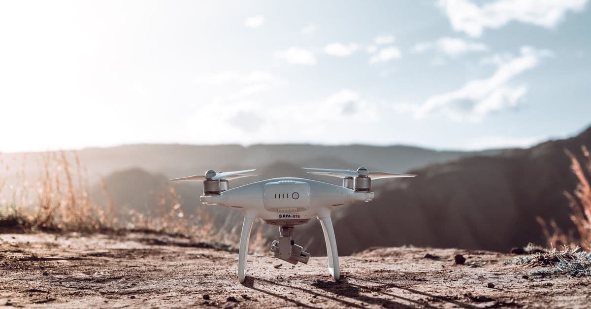
Photo: Luis Quintero / Pexels
How drones work comes down to one unstable machine and a great deal of correction. A typical quadcopter cannot hold itself level for even a second without a computer adjusting four motors, so the "drone" is really a flying feedback loop. That loop is the same whether the aircraft is a 249-gram camera drone or a military aircraft that can stay aloft for more than 27 hours. This article covers how drones fly, what is inside them, what they are used for, how the rules work, and which promises have and have not come true.
Key takeaways
- A drone (also called a UAV, for uncrewed aerial vehicle, or a UAS, for uncrewed aircraft system) is an aircraft with no human aboard. Sizes run from palm-sized to airliner-sized.
- Multirotor designs such as quadcopters dominate consumer use because they hover and take off vertically. Fixed-wing designs fly farther on the same energy.
- Stability comes from software. A flight controller reads motion sensors and adjusts rotor speeds in nested feedback loops.
- Battery energy is the main limit. One popular 249-gram drone carries a pack of 18.96 watt-hours and is rated for 34 minutes of flight.
- Regulation, airspace integration, and noise, not the flight technology itself, are the main barriers to broad delivery and air taxi service.
What counts as a drone, and why one word covers so much
The legal definition is broad. U.S. federal rules define an unmanned aircraft as an aircraft operated without the possibility of direct human intervention from within or on the aircraft, and define a "small" unmanned aircraft as one weighing less than 55 pounds (about 25 kilograms) at takeoff, including everything attached (14 CFR 107.3). That one definition covers a toy and a cargo aircraft.
The practical categories are better described by what the machine is for. The table uses specific, published examples so the scale is clear.
| Category | Example | Published figure | What it shows |
|---|---|---|---|
| Consumer camera drone | DJI Mini 4 Pro | Under 249 g with the standard battery; 34 minutes rated flight time, 45 with the larger battery | Light enough to fall under the lowest regulatory weight tiers |
| Industrial and delivery | Zipline Platform 2 | Hybrid vertical-takeoff and fixed-wing aircraft | Wings for range, rotors for takeoff and landing |
| Military, long endurance | General Atomics MQ-9A Reaper | Over 27 hours endurance, 50,000 ft ceiling, 3,850 lb payload capacity | Airplane-scale, long-range, remotely piloted |
| Loitering munition | Various | Small, expendable aircraft carrying a warhead | Blurs the line between drone and missile |
Sources: DJI Mini 4 Pro specifications; General Atomics MQ-9A page.
Two other labels matter. A "drone" can be remotely piloted, meaning a person flies it from the ground, or autonomous, meaning software handles navigation and the person supervises. Most consumer drones sit in between: the human sets the goal, and the aircraft handles stabilization and obstacle avoidance on its own. For how the same layered idea works in cars, see how self-driving cars actually work.
How a quadcopter hovers, climbs, and turns
A quadcopter has four rotors. Two spin clockwise and two counterclockwise, arranged so each rotor's reaction torque (the twisting force it exerts back on the airframe) is cancelled by a rotor spinning the opposite way. At a steady hover, the combined thrust of the four rotors equals the weight, and the torques cancel.
Thrust grows quickly with rotor speed, roughly with its square, which is why small speed changes produce large force changes. That single fact explains all the controls:
| Command | What the rotors do | Why it works |
|---|---|---|
| Climb or descend | All four speed up or slow down together | Total thrust rises above or falls below weight |
| Pitch forward | Rear rotors speed up, front rotors slow down | The airframe tilts nose-down; part of the thrust now points forward |
| Roll sideways | Rotors on one side speed up, the other side slows | The same idea on the other axis |
| Yaw (spin in place) | The two clockwise rotors speed up and the two counterclockwise slow (or the reverse) | The torques no longer cancel, so the airframe twists |
Notice that a quadcopter has no wings or tail surfaces that restore balance on their own. An airplane in steady flight tends to settle back toward level if gusts nudge it, because its wings and tail create restoring forces. A quadcopter has no such passive stability. The better comparison is balancing a broom on your palm. Someone can do it, but only by watching the top of the broom and moving a hand constantly. A flight controller plays the part of the hand, far faster than a person could.
Helicopter pilots solve a related problem with moving parts: a main rotor with adjustable blade pitch and a tail rotor. The multirotor replaced those mechanisms with four fixed-pitch propellers and electronics, which is a large part of why drones became cheap. For the older aircraft, see the helicopter.
Inside the flight controller: feedback loops stacked on feedback loops
The flight controller is a small computer running flight control software. Two open-source projects are widely used. PX4 is hosted by the Dronecode Foundation, a Linux Foundation project, supports multirotors, fixed-wing aircraft, and VTOLs, and is released under a BSD 3-Clause license (PX4 documentation).
PX4's documentation describes a standard cascaded control architecture for multicopters, which is the key to why it can fly stably (PX4 controller diagrams). From outermost to innermost:
- Position controller. A simple proportional controller that turns "I am 5 meters from the target" into a desired velocity.
- Velocity controller. A PID controller (proportional, integral, derivative, three ways of reacting to error) that turns a desired velocity into a desired acceleration.
- Attitude controller. Converts the acceleration request into a desired tilt and heading, and tracks it.
- Rate controller. The innermost loop, which compares the desired rotation rate with the measured one from the gyroscope and sets motor outputs.
Think of a company's management chain. The top level says "get to that hill." The next level says "go at this speed." The next says "lean this much." The bottom says "motor three, a little faster." Each level only deals with the level below, and the lowest loops must react quickest, because the airframe's rotation changes fastest. PX4's documentation also describes filtering of the gyroscope data, including a notch filter and low-pass filters, so that motor vibration is not read as motion. Noise handling is one of the quieter reasons a drone looks smooth in footage.
How the drone knows where it is
A flight controller cannot steer without knowing its state. Several sensors contribute, and none is trustworthy alone.
- IMU (inertial measurement unit). Gyroscopes measure rotation rate and accelerometers measure acceleration. They respond instantly but drift, so errors accumulate if used alone.
- Magnetometer. A compass for heading, vulnerable to nearby metal and electrical currents.
- Barometer. Air pressure gives altitude changes, but weather also changes pressure.
- GNSS (global navigation satellite system). GPS and its counterparts such as Galileo supply absolute position, but slowly and with errors, and not at all indoors. See how GPS works for the underlying system.
- Cameras and range sensors. The Mini 4 Pro, for example, lists omnidirectional binocular vision plus a downward 3D infrared sensor, with forward obstacle measurement ranging from 0.5 to 18 meters.
The fusion step is a filter. PX4 uses an estimator called EKF2 (an extended Kalman filter) that blends the fast-but-drifting inertial data with the slow-but-anchored GPS, barometer, and compass readings. A useful analogy is dead reckoning on a ship: you track speed and heading continuously, then correct your estimate whenever a landmark gives you a fix. When a landmark is wrong, for example a GPS fix distorted near tall buildings, a well-designed filter distrusts it, which is also why drones sometimes behave oddly beside steel structures.
Lidar-equipped drones add a laser distance sensor. How LiDAR works explains how a pulse of light becomes a 3D point cloud, which is how drone surveys build terrain maps.
Power: why flight time is the hard limit
Flying costs energy continuously. A rotor holds the aircraft up by pushing air down, and it must keep doing that every second, unlike a car that coasts. The result is that battery size dominates drone design.
The Mini 4 Pro makes a good worked example. Its standard battery stores 18.96 watt-hours (Wh), and DJI rates the drone for up to 34 minutes. If the pack were fully drained, that implies an average draw near 33 watts (18.96 Wh divided by 34/60 of an hour). Real flight leaves reserve in the pack, so the true average draw during flight is somewhat higher. The larger Plus battery stores 28.4 Wh and is rated for 45 minutes, but it pushes the aircraft over 249 grams, which matters for regulation, as the next sections show.
Why not simply add more battery? Because heavier batteries need more thrust, which needs more power, which drains the battery faster. Designers hit diminishing returns quickly. That tradeoff explains several design choices:
- Fixed-wing aircraft get lift from wings and not from rotors, so they fly longer on the same energy. A military airframe like the MQ-9A uses a fueled engine, which stores far more energy per kilogram than a battery.
- Hybrid VTOL designs use rotors to take off and land vertically, then fly forward on wings. Zipline's Platform 2 is one example.
- Tethered drones receive power through a cable, so their endurance is limited by the cable and the host, not the aircraft.
- Hydrogen fuel cells are being tested for industrial drones to extend endurance. For how that fuel is produced, see how green hydrogen is made.
For the battery chemistry itself, see how lithium-ion batteries work. One practical point: lithium-based packs can catch fire if damaged or overcharged, so manufacturers' charging and storage instructions matter.
Fixed-wing, multirotor, and hybrid: choosing the aircraft for the job
No single design wins everywhere, and the best choice follows the mission.
| Type | Strengths | Weaknesses | Typical uses |
|---|---|---|---|
| Multirotor | Hovers, takes off and lands anywhere, precise positioning | Short endurance, low speed | Photography, inspection, small-area mapping |
| Fixed-wing | Long range, high efficiency | Needs runway, catapult, or net; cannot hover | Large-area mapping, long-range surveillance |
| Hybrid VTOL | Vertical takeoff plus efficient cruise | Mechanically complex, heavier | Delivery, medium-range mapping |
| Single-rotor helicopter | Heavy payload for its size | Complex and costly to maintain | Specialized industrial lifting |
The radio link
The pilot's controller talks to the aircraft by radio, and video comes back the same way. Range depends heavily on terrain. DJI's Mini 4 Pro listing gives a maximum transmission range of 20 kilometers for the FCC (US) configuration and 10 kilometers for the CE (Europe) configuration under unobstructed, interference-free conditions. In real environments DJI lists roughly 1.5 to 4 kilometers in urban areas with interference, and 0 to 0.5 kilometers when buildings block the signal.
The gap between the lab number and the street number is the lesson. Radio links weaken with distance, and buildings and trees absorb and reflect them. For the wider physics of such links, see how WiFi works.
What happens when the link drops? Most drones have a "failsafe": they hover, land, or fly back to a recorded home point, depending on settings. That behavior is software policy, not an inherent property of drones, which is why failsafe configuration is a standard part of a pre-flight check.
A short history: from the Kettering Bug to a toy in your pocket
Uncrewed aircraft are older than most people expect. During World War I, Charles Kettering of Dayton, Ohio, designed an unmanned aerial torpedo that came to be called the Kettering Bug. The U.S. Air Force museum's fact sheet says it was designed in 1917, launched from a four-wheeled dolly on a portable track, guided by pre-set pneumatic and electrical controls, and carried 180 pounds of explosive. Dayton-Wright built fewer than 50 before the Armistice, and the Bug never saw combat (National Museum of the U.S. Air Force).
The Bug's guidance was set before launch, so it flew a planned course to a planned point. Modern consumer drones are defined less by their goals than by their feedback: sensors, filters, and controllers that continuously measure the aircraft and correct it, running on inexpensive electronics. The shrinking and cheapening of motion sensors, batteries, motors, and processors is what moved drones from specialist aircraft to consumer products.
What drones are actually used for
The list below sticks to uses that are well established. Each is a case where a small aircraft with a camera or sensor reaches a place or viewpoint that is awkward or costly to reach otherwise.
- Photography and filmmaking. The most visible use, in real estate, film, news, and events.
- Mapping and surveying. Overlapping photographs or lidar scans can be stitched into 3D models and terrain maps for construction, mining, and archaeology.
- Agriculture. Multispectral cameras reveal differences in plant condition that are hard to see from the ground, and some drones apply sprays to small areas.
- Infrastructure inspection. Wind turbine blades, power lines, bridges, and roofs can be photographed without sending a person up.
- Search and rescue. Thermal cameras detect body heat against cooler ground, which helps find missing people at night or in rough terrain.
- Public safety. Fire departments use thermal imaging to find hotspots, and police use drones for scene mapping and crowd monitoring.
- Disaster response. Rapid imagery after floods and earthquakes helps responders prioritize where to go first.
- Wildlife conservation. Aerial counts and monitoring, often with less disturbance than a helicopter.
- Racing and hobby flying. First-person-view (FPV) racing, in which the pilot flies by video goggles, is an organized sport.
A caution on claims. Vendors often say drones make inspection or surveying "faster, safer, and cheaper" than traditional methods. That is plausible for many tasks, but the size of the savings depends on the site, the regulations, and the data processing needed afterward, so treat any specific percentage with care unless it comes from a published comparison.
Delivery: what has worked, and what has not
Delivery drones have been "coming next year" for a decade, but the record now includes real numbers, and they show a pattern: success in specific settings first, followed by slow expansion.
| Date | Event | Source |
|---|---|---|
| October 2016 | Zipline begins deliveries from a distribution center in Muhanga, Rwanda, carrying blood and medical supplies to rural clinics | Wikipedia, Zipline |
| April 24, 2019 | Zipline launches in Ghana; first delivery carried yellow fever vaccines | Wikipedia, Zipline |
| June 21, 2022 | FAA grants Zipline a Part 135 air carrier certificate | Wikipedia, Zipline |
| September 18, 2023 | FAA authorizes Zipline beyond-visual-line-of-sight commercial deliveries | Wikipedia, Zipline |
| April 2024 | Zipline reports its millionth commercial delivery | Wikipedia, Zipline |
| April 2025 | Walmart deliveries begin in the Dallas-Fort Worth area using Platform 2 | Wikipedia, Zipline |
| January 2026 | Zipline reports its two millionth commercial delivery | Wikipedia, Zipline |
Source for the table: Wikipedia's Zipline entry, which cites company and trade press reports for the milestones.
Trade reporting in 2026 describes continued growth. DroneXL reported that Walmart passed one million drone deliveries in late May 2026, working with partners Wing and Zipline, and that Wing and Walmart announced plans in January 2026 to reach more than 270 store locations by 2027 (DroneXL). These are trade-press figures, not audited statistics.
Setbacks are part of the record too. Amazon Prime Air paused drone deliveries in Texas and Arizona in January 2025 to upgrade its drones' software, after MK30 crashes at its Oregon test site that regulators were investigating, according to reporting by FLYING Magazine.
Why mass urban delivery is still hard
Three obstacles recur. The first is regulation, covered below: flying beyond the pilot's visual line of sight (BVLOS) is the key to scaling and has required case-by-case approval. The second is economics: a delivery drone carries a small payload, so each trip has to be cheap and frequent to compete with a van on a route that already exists. The third is the neighborhood: noise and privacy concerns grow as flights become routine. Gradual expansion in suburban areas and healthcare logistics looks more realistic than pizza arriving over dense city blocks.
Military drones
Drones changed military practice in several ways, and ethical and legal debates about them are real and unresolved. The facts below are descriptive.
Surveillance and strike aircraft. The MQ-9A Reaper, according to its maker, can stay aloft for more than 27 hours (34 in an extended-range variant), reach 50,000 feet, and carry a payload of 3,850 pounds including 3,000 pounds of external stores. Flying for that long without a crew aboard is the point: operators on the ground can hand off shifts, which an aircraft with pilots cannot do.
Small attack drones. Cheap quadcopters and purpose-built one-way attack drones changed ground warfare in Ukraine. Public estimates of how much of the battlefield damage they cause vary widely, from roughly 70 to 85 percent in various reports, and most come from officials or secondhand accounts and attribute damage to all drone types together, so the figures should be read as a sign of scale, not as a measurement.
Counter-drone systems. Defending against drones uses jamming, radar and radio detection, kinetic interceptors, nets, and lasers, and it is a growing field. The economics are a widely discussed problem: using an expensive interceptor against a cheap drone is a poor trade.
For a comparison of national programs, see countries with the most advanced drone programs. For the radar side of detection, see the invention of radar.
The rules: what pilots must follow
The regulatory landscape differs by country, but common ideas recur: keep the aircraft within sight, stay below a set altitude, avoid crowds and airports, and be identifiable.
United States
- Part 107 (commercial and professional flying). The operating limits include a maximum groundspeed of 87 knots (100 mph), a maximum altitude of 400 feet above ground level (or within 400 feet of a structure), and minimum flight visibility of three statute miles, per 14 CFR 107.51. Aircraft must weigh under 55 pounds at takeoff.
- Registration. FAA guidance says drones that require registration cost $5 per drone for Part 107 operators, valid for three years. Recreational registration also costs $5 and covers all of an owner's drones. Recreational drones above 0.55 pounds (250 grams) require registration under the FAA's recreational rules (see FAA drone registration).
- Remote ID. The Remote ID rule (14 CFR Part 89) required drones that need FAA registration to broadcast identification information by September 16, 2023, either through built-in capability, a retrofit module, or by flying in an FAA-recognized identification area. Enforcement followed a grace period.
- Beyond visual line of sight. BVLOS operations have required case-by-case waivers. The FAA's proposed Part 108 would create a standard framework. As of reporting on September 8, 2026, the final rule had been sent for White House review on July 10, 2026 and had not been published (PickDrones summary). This status can change quickly, so check the Federal Register for the current position.
European Union
The EU divides drones into categories by risk. The "open" category for low-risk operations covers drones under 25 kilograms with a 120-meter altitude limit, and EASA's published table ties rules to drone classes.
| Class | Maximum mass | Subcategory | Key limit | Remote pilot requirement |
|---|---|---|---|---|
| C0 | Under 250 g | A1 (also A3) | No flying over assemblies of people | Read the user manual |
| C1 | Under 900 g | A1 (also A3) | Avoid flying over uninvolved people | Online training and exam |
| C2 | Under 4 kg | A2 (also A3) | 30 m horizontal distance from uninvolved people (5 m with low-speed mode) | A2 certificate |
| C3 / C4 | Under 25 kg | A3 | 150 m from uninvolved people and urban areas | Online training and exam |
Source: EASA open category page. The minimum remote pilot age is 16 for most rows, and open-category drones generally need a remote identification system, with limited exceptions.
Geofencing and why it exists
Many consumer drones include geofencing: software that knows the location of restricted areas, such as airports, and refuses to take off or fly in them without an unlock. It works only as well as the database behind it and the willingness of the manufacturer to maintain it. Apps from drone makers and national aviation authorities show airspace classifications before a flight.
Privacy, safety, and noise
Three concerns appear in nearly every local debate.
Privacy. A camera that can rise above a fence raises questions that existing laws handle unevenly. Rules on photographing people in private spaces and on surveillance vary by jurisdiction, and specific drone laws are still developing. The sensible default is to avoid recording people without their knowledge.
Safety. A falling drone can injure people, and damaged lithium packs can burn. Rules requiring distance from people and limits on weight are the regulators' answer, as the EU table above shows.
Noise. Drones are audible, and delivery operators have to plan routes with residents in mind, since the disturbance grows with the number of flights, not with any single flight.
What is coming next
eVTOL air taxis. Electric vertical-takeoff-and-landing aircraft such as those from Joby aim to carry passengers. Reporting in November 2025 said Joby had begun power-on testing of its first FAA-conforming aircraft, expected FAA pilots to take control for type-certification flight testing in 2026, and planned to start commercial service in Dubai in 2026. Type certification, the FAA's formal approval of the design, was still pending in that reporting (Gulf News, November 7, 2025). Check current status before relying on any launch date, because schedules in this sector have slipped repeatedly.
More autonomy. On-board vision and planning software increasingly handles obstacle avoidance and tracking. The same trend powers edge AI on your phone, and it connects to the broader question of embodied machines covered in humanoid robots explained.
Traffic management. Unmanned aircraft traffic management (UTM) systems aim to let many drones share airspace with crewed aircraft by exchanging positions and plans digitally. The unresolved question is right of way. The FAA reopened the comment period on the proposed Part 108 rule in January 2026 to address contested provisions on electronic conspicuity and right-of-way, according to the same PickDrones summary.
Counter-drone technology. Demand for detection and interception keeps growing, driven by conflicts and by airport and prison incidents.
Common misconceptions
"A drone flies itself." Stabilization is automatic, but flying safely still depends on a pilot or an approved autonomous operation. Even a drone that tracks a subject follows rules set by software and may fail in clutter, in glare, or in low light.
"Heavier drones are always more dangerous." Weight matters for impact energy, but small drones under 250 grams are still treated as aircraft with rules in many countries, and a light drone near an airport is a real hazard.
"GPS makes a drone precise." GPS gives an absolute position estimate with errors, and a drone fuses it with inertial and barometric data. Fine positioning, such as holding steady beside a wall, relies on cameras and range sensors.
"Delivery drones are about to replace vans." The best-documented deliveries are in healthcare and suburban retail, and the limit is regulation and economics as much as technology.
"The range on the box is the range you will get." Manufacturer range figures describe unobstructed conditions. Around buildings the usable range can be a small fraction of that number.
FAQ
Q: Can I shoot down a drone over my property? A: Generally no. In the United States, federal rules define an unmanned aircraft as an aircraft, and damaging aircraft can carry serious legal consequences. If a drone is a nuisance or a privacy problem, record its details and contact local police or the aviation authority.
Q: How do I know whether flying is legal where I am? A: Check the national aviation authority's rules and an airspace map before each flight. In the US, the FAA's tools and drone makers' apps show airspace classes, and in the EU the national authority publishes which category and class rules apply. Restrictions near airports and crowds are the most common reason a flight is not allowed.
Q: Do I need a license to fly a drone? A: It depends on the purpose and the aircraft. In the US, commercial flying under Part 107 requires a remote pilot certificate, while recreational flying has its own rules and registration threshold of 0.55 pounds. In the EU, rules depend on the drone's class and the subcategory of flight.
Q: How long can a drone stay in the air? A: Consumer camera drones are rated for roughly 30 to 45 minutes, as in the 34 and 45 minute ratings for the Mini 4 Pro's two batteries. Fixed-wing and fueled aircraft last much longer, and the MQ-9A is listed at over 27 hours. Tethered drones are limited by their tether and power source instead.
Q: Are drones safer than helicopters? A: For many inspection and survey tasks they remove a person from a dangerous position, which is a real safety benefit. They are not risk-free, since a drone can fall or collide, and a comparison depends on the specific task and operator.
Q: What does Remote ID do? A: It makes a drone broadcast identification and location information during flight so authorities and, in some cases, nearby people can identify it. In the US, drones that require registration must comply, through built-in capability, an add-on module, or flying in a designated area.
Q: When will air taxis carry passengers? A: Some operators plan limited commercial service first, for example in Dubai, while FAA type certification was still pending in late 2025 reporting. Widespread routine service depends on certification, vertiport infrastructure, and local approvals, so specific dates should be treated as targets.
The takeaway
Drones are best understood as feedback machines: sensors, filters, and cascaded controllers that make an unstable airframe behave. That explains both their strengths, such as hovering precisely and carrying cameras anywhere, and their limits, such as short battery life, vulnerability to radio and GPS problems, and dependence on rules written for crewed aircraft. The slowest-moving parts of the story are not the aircraft. They are the regulations that decide when a drone may fly beyond sight, over people, or alongside airliners, and the economics that decide whether a trip is worth making. Delivery and air taxis will arrive where those two gates open first.
Sources
- 14 CFR 107.3 (definitions), Legal Information Institute: https://www.law.cornell.edu/cfr/text/14/107.3
- 14 CFR 107.51 (operating limitations), Legal Information Institute: https://www.law.cornell.edu/cfr/text/14/107.51
- PX4 documentation, controller diagrams: https://docs.px4.io/main/en/flight_stack/controller_diagrams.html
- PX4 documentation, overview: https://docs.px4.io/main/en/
- DJI Mini 4 Pro specifications: https://www.dji.com/mini-4-pro/specs
- General Atomics, MQ-9A: https://www.ga-asi.com/remotely-piloted-aircraft/mq-9a
- EASA, open category: https://www.easa.europa.eu/en/domains/drones-air-mobility/operating-drone/open-category-low-risk-civil-drones
- National Museum of the U.S. Air Force, Kettering Aerial Torpedo "Bug": https://www.nationalmuseum.af.mil/Visit/Museum-Exhibits/Fact-Sheets/Display/Article/198095/kettering-aerial-torpedo-bug/
- Zipline (drone delivery company), Wikipedia: https://en.wikipedia.org/wiki/Zipline_(drone_delivery_company)
- FAA, drone registration: https://www.faa.gov/uas/getting_started/register_drone
Related Reading
Follow new articles
Add SciHub101 to your feed reader to see new science and technology stories.
About the Author
SciHub101 is an independent science and technology publication founded and edited by Buğra Sözeri, a software engineer and app developer based in Türkiye. AI tools assist with drafting and research. Source documentation in the existing archive is uneven, and articles are being reviewed and corrected. The Editorial Team byline identifies editorial responsibility; it does not certify specialist or independent human review. Where we compare products, anything built by our own team is labelled as such — see the editorial guidelines and About page for how corrections and disclosures work.
Related Articles

What Is Neuralink? How Brain-Computer Interfaces Actually Work
A device implanted in the brain that lets paralysed patients move computer cursors with their thoughts. Here's how Neuralink and other brain-computer interfaces actually work.

What Are VR and AR — and Where Is the Metaverse Actually Going?
Virtual and augmented reality have been "the next big thing" for a decade. Here's how each actually works, where they succeed, and what the realistic future looks like.
How Camera Sensors Work — CCD vs CMOS
How digital camera sensors turn photons into pixels: photodiodes, Bayer filters, CCD vs CMOS, pixel size, noise, dynamic range, and computational photography.
How Do Self-Driving Cars Actually Work?
Self-driving cars combine cameras, radar, lidar, and AI into one of the most complex robots ever built. Here's how the sensors, software, and decisions actually work.

How Photography Didn't Kill Painting — It Transformed Everything
When photography arrived in 1839, painters feared for their craft. Instead of ending painting, the camera changed what painting was for, and art has traded ideas with it ever since.
Countries With the Most Advanced Drone Programs (2025)
Drones have fundamentally changed warfare, surveillance, and geopolitics. This ranking of the top countries with the most advanced drone programmes in 2025 covers military UAV capabilities, commercial industries, and combat records — from the USA's Reaper to China's Wing Loong, Turkey's Bayraktar, and Iran's Shahed-136.